


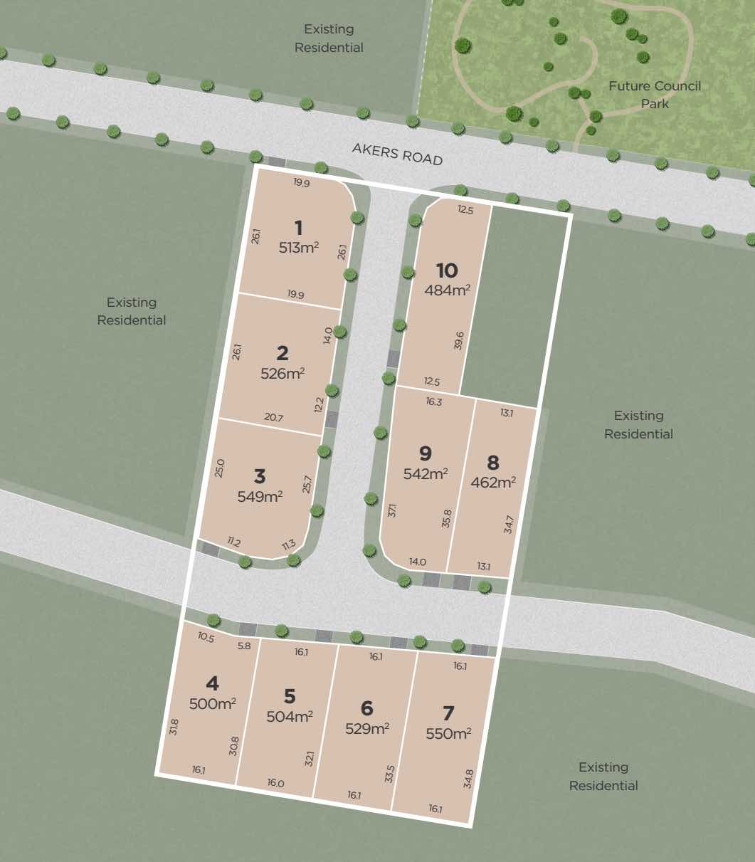
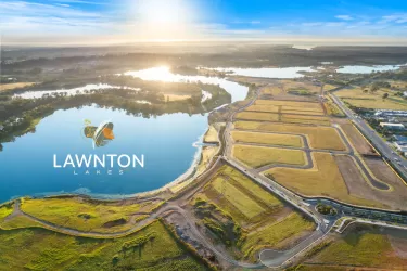
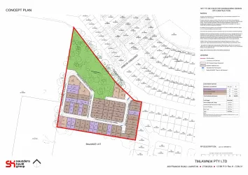
Parklane Estate - Lawnton


- Premium boutique 10 lot development
- Registration expected April 2023
- Large blocks in leafy location
Property types for sale
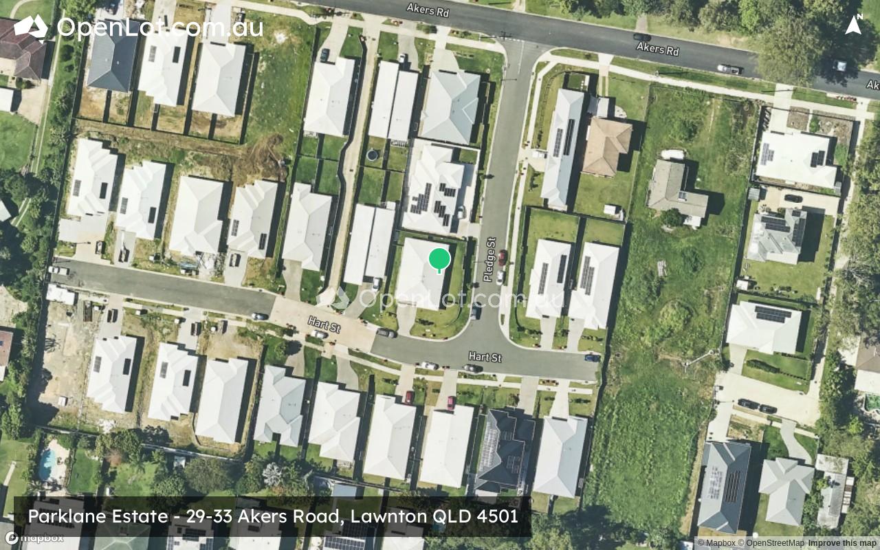
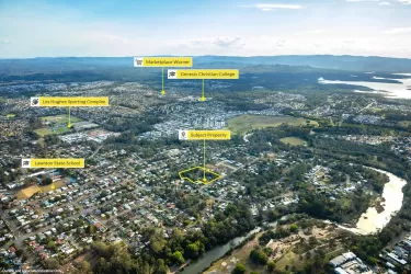
Location & Map for Parklane Estate - Lawnton
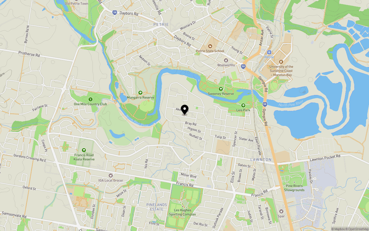
Schools near Parklane Estate - Lawnton
Overview
This information is estimated by the OpenLot research team. Let us know here to provide up-to-date information about this development.
| Total new homes | |
| Area Size | 0.73 hectares |
| Growth Region | Greater Brisbane Growth Areas |
| City Council | Moreton Bay Regional Council |
| Developer | Nolah Property Developments |
| Project Marketer | Colliers |
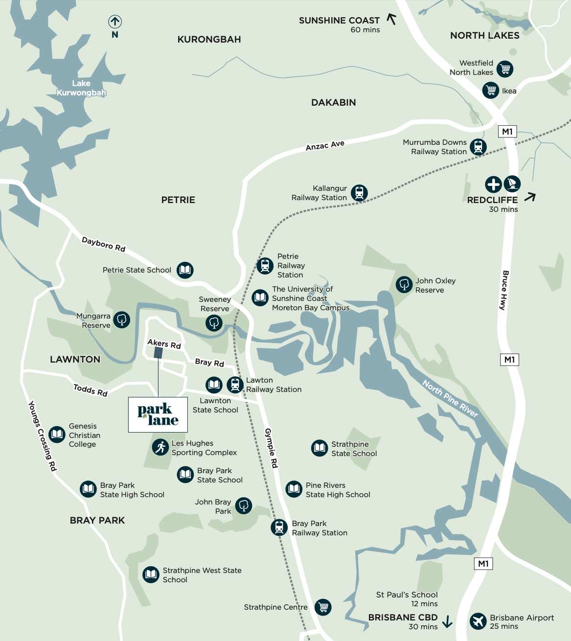
| Distance to |
Updates for Parklane Estate - Lawnton
Land Price Trend in Lawnton QLD 4501
Below shows the price trend from vacant land sales recorded in Lawnton QLD 4501.
The data and information provided by Terralytics (Aust) Pty Ltd (Terralytics Data) is general in nature and is not intended to constitute professional advice. Read more
It should not be relied upon as a substitute for legal, financial, valuation, or other specialist advice relevant to your specific circumstances.
Terralytics uses commercially reasonable endeavours to ensure the Terralytics Data is current and accurate. However, as the Terralytics Data incorporates information sourced from third parties, Terralytics makes no representation or warranty — express or implied — as to its accuracy, completeness, or currency. To the maximum extent permitted by applicable law, Terralytics excludes all liability for any loss or damage (including consequential loss) arising out of or in connection with reliance on the Terralytics Data, whether arising in contract, tort (including negligence), statute, or otherwise.
Popular Estates near Parklane Estate - Lawnton


Not exactly what you're looking for? Try surrounding suburbs
Strathpine QLD 4500
2 estates | Moreton Bay Regional Council
2.3km south
Murrumba Downs QLD 4503
4 estates | Moreton Bay Regional Council
3.0km north-east
Bald Hills QLD 4036
3 estates | Brisbane City Council
4.1km south-east
Kallangur QLD 4503
6 estates | Moreton Bay Regional Council
3.8km north
Petrie QLD 4502
1 estate | Moreton Bay Regional Council
1.9km north
Bray Park QLD 4500
1 estate | Moreton Bay Regional Council
1.2km south-west
Latest published articles


FAQs about Parklane Estate - Lawnton
Nolah Property Developments is the developer behind Parklane Estate - Lawnton.
Parklane Estate - Lawnton consists of 10 homes.
The total area for Parklane Estate - Lawnton is 0.73 hectares.
Parklane Estate - Lawnton falls under Moreton Bay Regional Council.
Parklane Estate - Lawnton is 22 km north of Brisbane CBD.
Colliers is the project marketer for Parklane Estate - Lawnton.
Nearby schools for Parklane Estate - Lawnton:
- Lawnton State School - 762m south-east
- Petrie State School - 1.0km north
- Our Lady of the Way School - 1.5km north-east
- Mt Maria College - Petrie - 1.5km north-east
- Pine Rivers Special School - 1.6km south-east
- YOS Lawnton - 1.8km south-east