SOLD OUT
Strathyre Drive, Prestons NSW 2170 SOLD OUT
This information is estimated by the OpenLot research team. Let us know here to provide up-to-date information about this development.
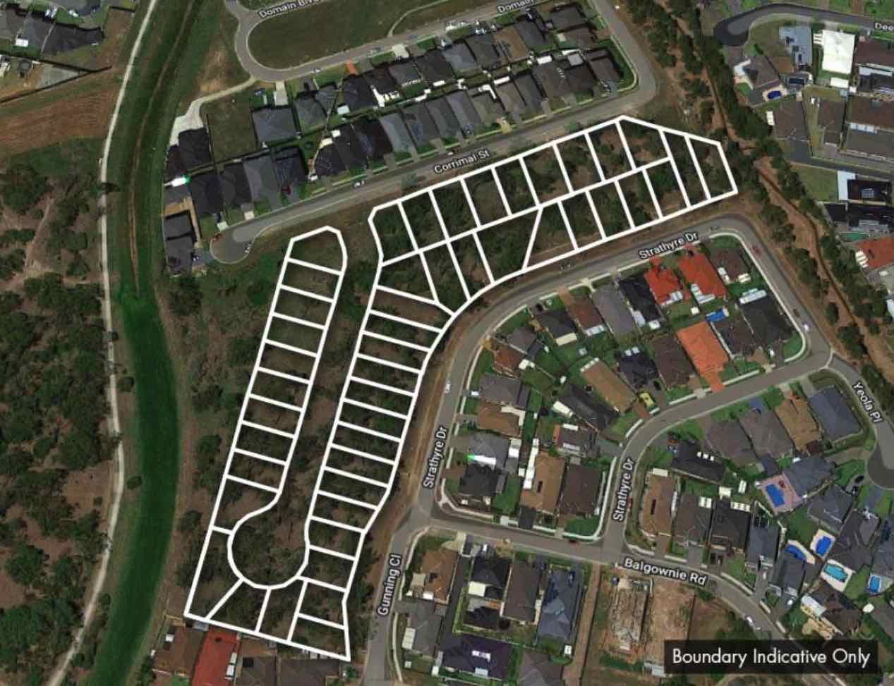
| Total new homes | N/A |
| Area size | 1.86 hectares |
| Growth Region | Sydney South West Growth Areas |
| City council | Liverpool City Council |
| Developer | N/A |
| Project marketer | Golden Land Property Group |
| Distance to | Sydney Airport - 29 km west Sydney CBD - 31 km west |
Land for Sale, House and Land Packages:
Popular Estates near Strathyre Drive, Prestons


Updates for Strathyre Drive, Prestons
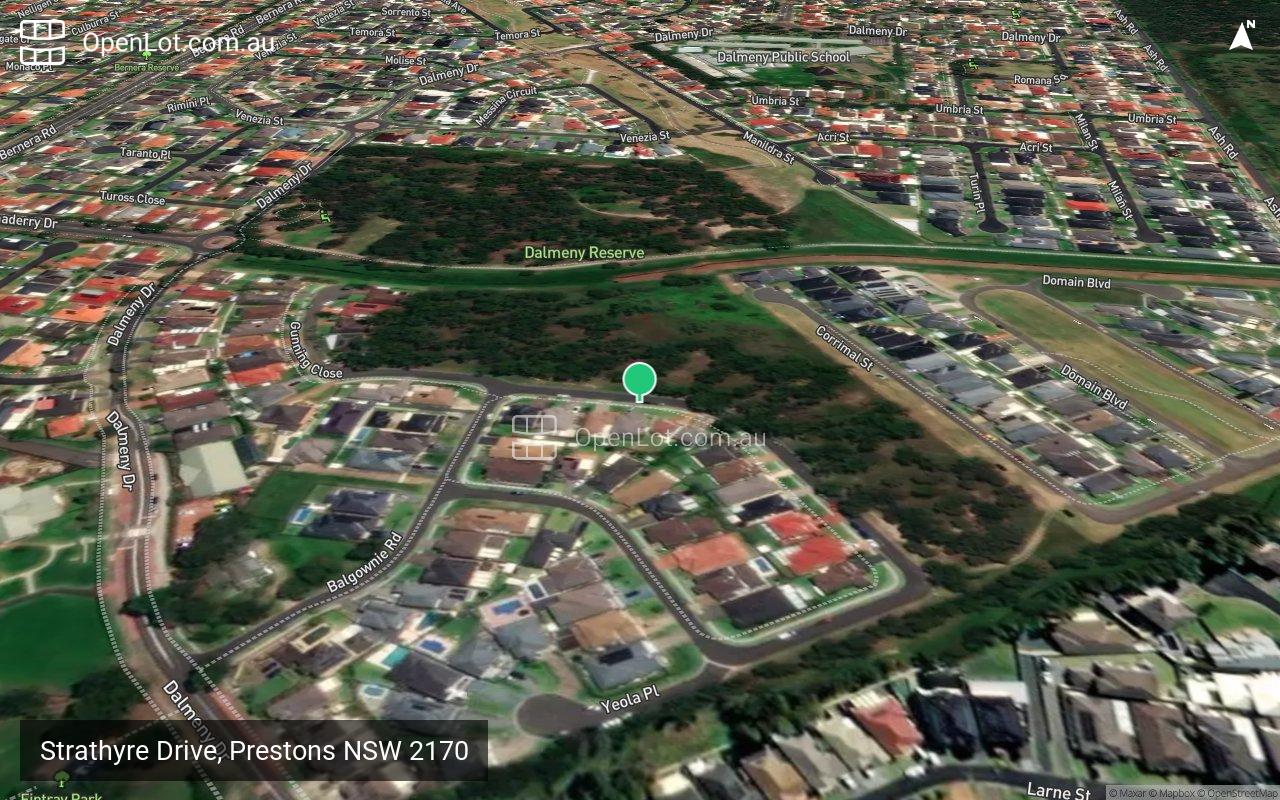
Location & Map for Strathyre Drive, Prestons
Loading...
Display Homes near Strathyre Drive, Prestons


Vacancy Rate in Prestons NSW 2170
View full vacancy rate history in Prestons NSW 2170 via SQM Research.
Schools near Strathyre Drive, Prestons
Here are 6 schools near Strathyre Drive, Prestons:
St Catherine of Siena Catholic Primary School - Prestons
K-6 Catholic Primary School
168m south-west
Dalmeny Public School - Prestons
K-6 Government Primary School
522m north
Amity College - Prestons
K-12 Independent Combined School - School Head Campus
1.2km north-east
William Carey Christian School - Prestons
K-12 Independent Combined School
1.8km west
Prestons Public School - Prestons
K-6 Government Primary School
1.9km east
Glenfield Park School - Glenfield
U Government Special School
1.9km south-east
Reviews & Comments on Strathyre Drive, Prestons
Loading comments...
Estate Brochure, Masterplan, Engineering Plan, Plan of Subdivision (POS), Design Guidelines
FAQs about Strathyre Drive, Prestons
What’s the total area size for Strathyre Drive, Prestons?
Strathyre Drive, Prestons has 1.86 hectares total area size.
Which city council does Strathyre Drive, Prestons fall under?
Liverpool City Council is the local government area for Strathyre Drive, Prestons.
Who is the project marketer for Strathyre Drive, Prestons?
Golden Land Property Group is the project marketer for Strathyre Drive, Prestons.
View all estates marketed by Golden Land Property Group
View all estates marketed by Golden Land Property Group
Which schools near Strathyre Drive, Prestons?
Below are the nearby schools for Strathyre Drive, Prestons:
- St Catherine of Siena Catholic Primary School - 168m south-west
- Dalmeny Public School - 522m north
- Amity College - 1.2km north-east
- William Carey Christian School - 1.8km west
- Prestons Public School - 1.9km east
- Glenfield Park School - 1.9km south-east
Popular Estates near Strathyre Drive, Prestons
Latest New Home Articles for You

10/May/2024
13
content here.
10/May/2024
14
Content here.
10/May/2024
15
Content here.
10/May/2024
16
Content here.
10/May/2024
17
Content here.
10/May/2024
18
Content here.
10/May/2024
19
Content here.

10/May/2024
20
Lorem ipsum dolor sit amet, consectetur adipiscing elit. Etiam turpis era...
10/May/2024
21
Content here.