
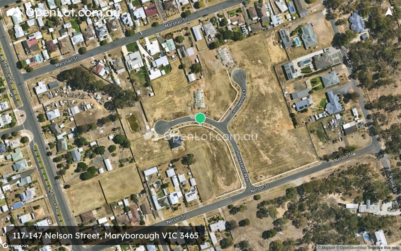
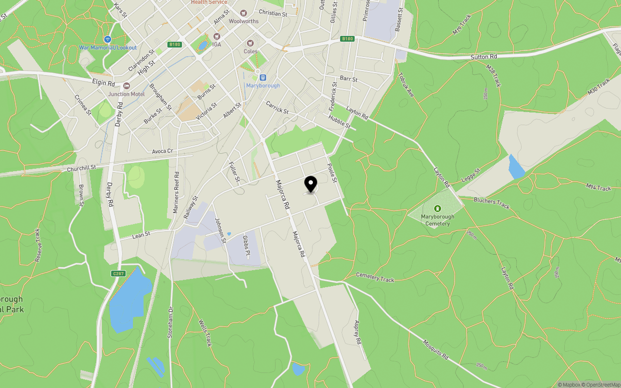
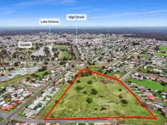
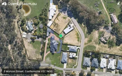
Location & Map for 117-147 Nelson Street, Maryborough VIC 3465
Schools near 117-147 Nelson Street, Maryborough VIC 3465
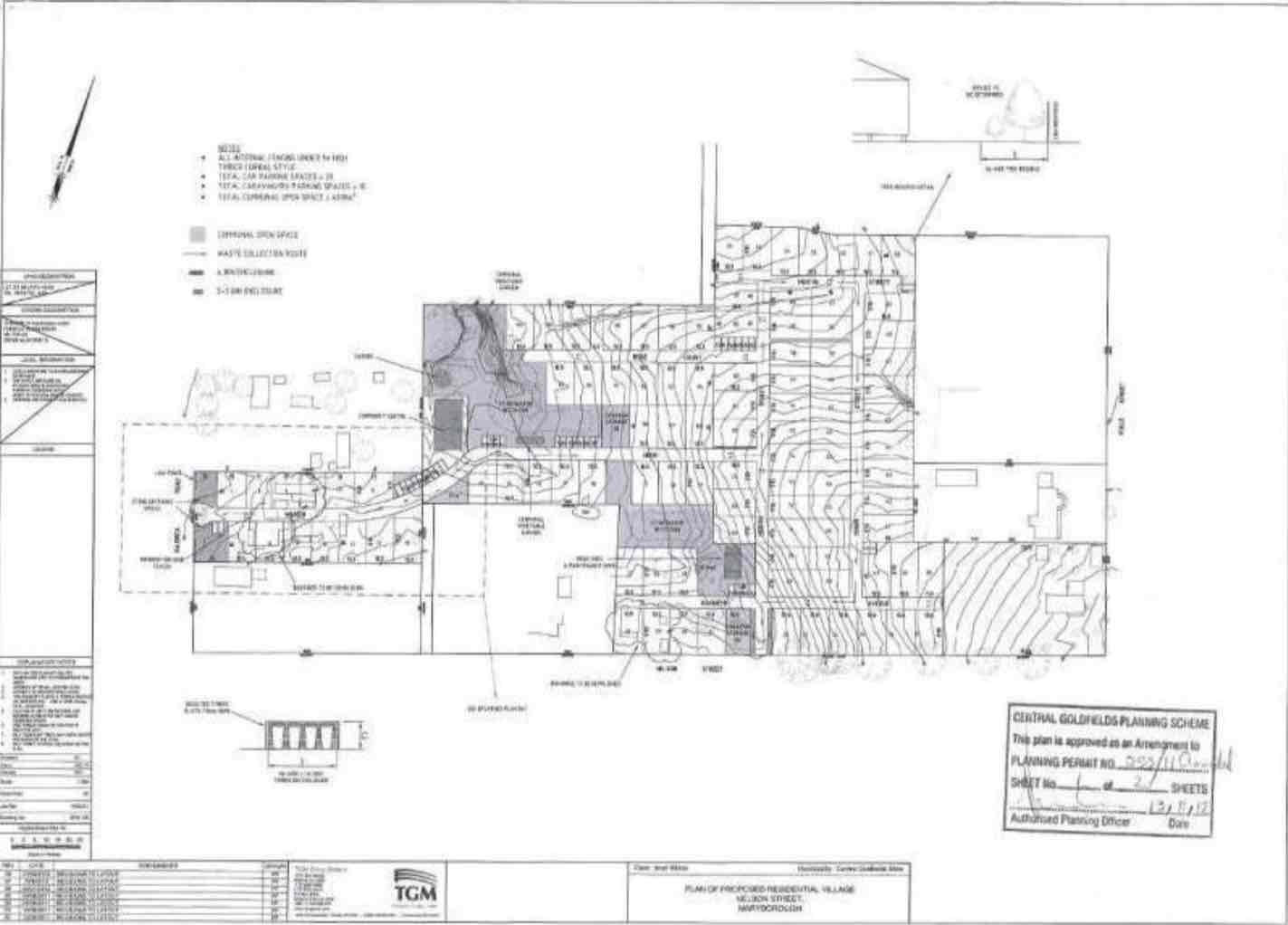
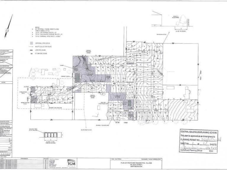
Overview
This information is estimated by the OpenLot research team. Let us know here to provide up-to-date information about this development.
| Total new homes | |
| Area Size | 3.60 hectares |
| City Council | Central Goldfields Shire Council |
| Developer | N/A |
Updates for 117-147 Nelson Street, Maryborough
Land Price Trend in Maryborough VIC 3465
Below shows the price trend from vacant land sales recorded in Maryborough VIC 3465.
The data and information provided by Terralytics (Aust) Pty Ltd (Terralytics Data) is general in nature and is not intended to constitute professional advice. Read more
It should not be relied upon as a substitute for legal, financial, valuation, or other specialist advice relevant to your specific circumstances.
Terralytics uses commercially reasonable endeavours to ensure the Terralytics Data is current and accurate. However, as the Terralytics Data incorporates information sourced from third parties, Terralytics makes no representation or warranty — express or implied — as to its accuracy, completeness, or currency. To the maximum extent permitted by applicable law, Terralytics excludes all liability for any loss or damage (including consequential loss) arising out of or in connection with reliance on the Terralytics Data, whether arising in contract, tort (including negligence), statute, or otherwise.
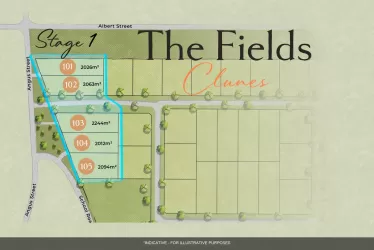
Popular Estates near 117-147 Nelson Street, Maryborough

Not exactly what you're looking for? Try surrounding suburbs
Mckenzie Hill VIC 3451
5 estates | Mount Alexander Shire Council
39.5km east
Campbells Creek VIC 3451
3 estates | Mount Alexander Shire Council
41.9km east
Castlemaine VIC 3450
2 estates | Mount Alexander Shire Council
41.5km east
Learmonth VIC 3352
1 estate | Ballarat City Council
41.4km south
Smeaton VIC 3364
1 estate | Hepburn Shire Council
34.4km south-east
Clunes VIC 3370
1 estate | Hepburn Shire Council
27.0km south
Latest published articles


FAQs about 117-147 Nelson Street, Maryborough VIC 3465
117-147 Nelson Street, Maryborough VIC 3465 consists of 26 homes.
The total area for 117-147 Nelson Street, Maryborough VIC 3465 is 3.60 hectares.
117-147 Nelson Street, Maryborough VIC 3465 falls under Central Goldfields Shire Council.
Nearby schools for 117-147 Nelson Street, Maryborough VIC 3465:
- Highview College - 1.1km north-west
- St Augustine's School - 1.2km north-west
- Maryborough Education Centre - 2.9km north-west
- Carisbrook Primary School - 5.9km east
- Timor Primary School - 8.9km north
- Talbot Primary School - 12.7km south