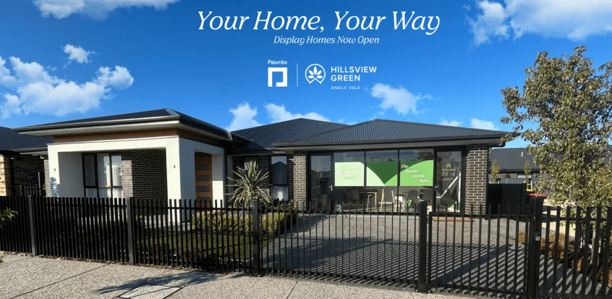


Hillsview Green Estate - Angle Vale
[NEW RELEASE] Complete Home Solution - House and Land packages are available now!


- Fifth Release selling now ! ONLY 15 allotments remaining
- 6th Release is now launched ! 23 allotments remaining
- Secure Your Allotment & Build with Award-Winning Builder, Palumbo.
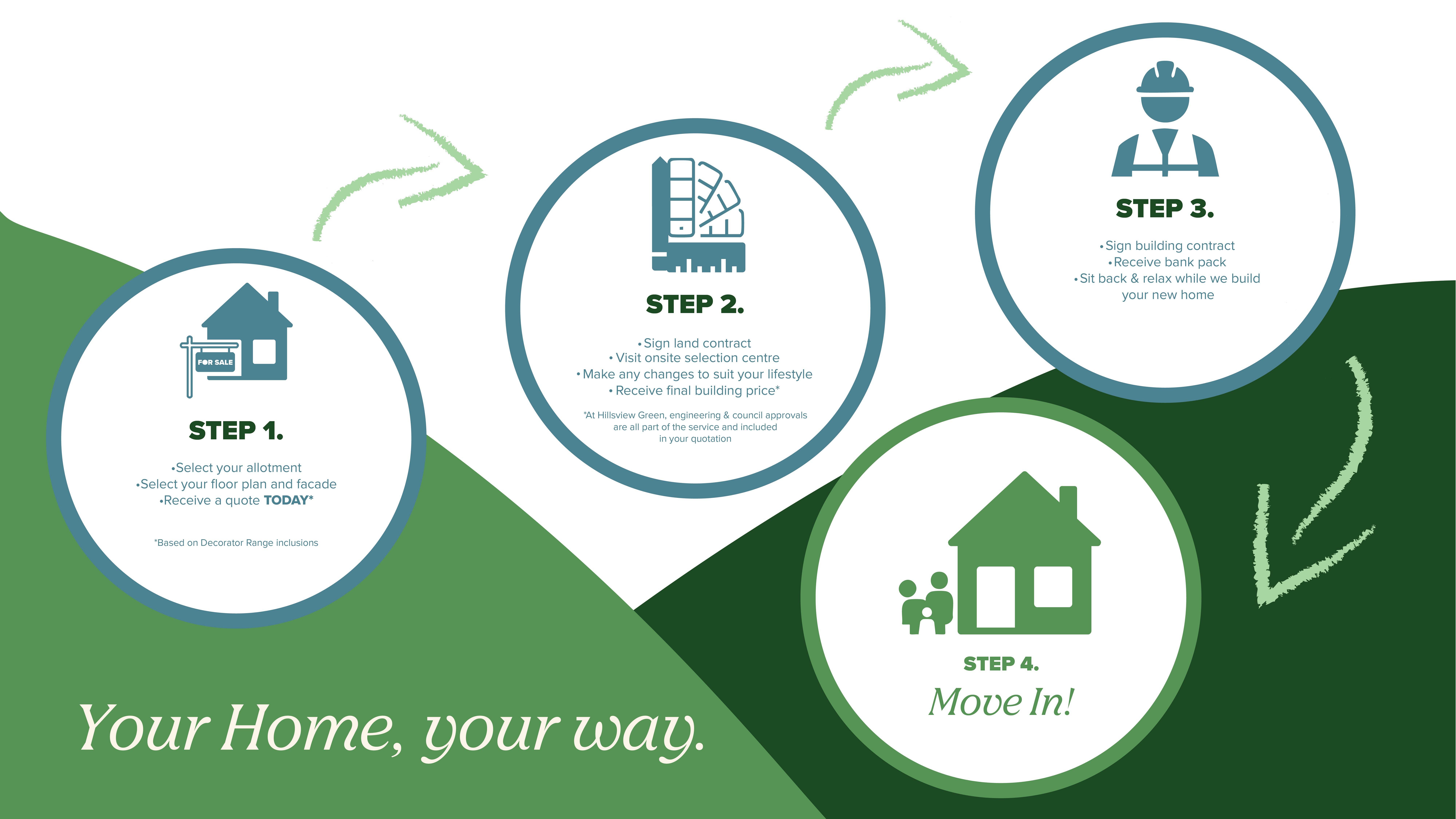
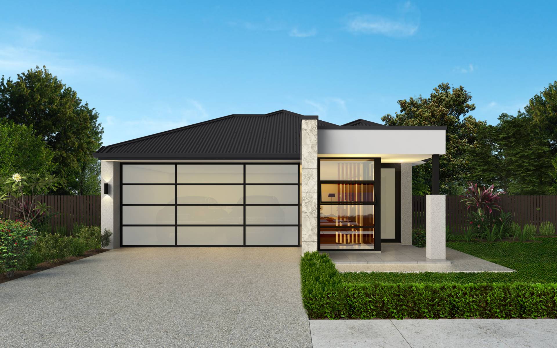
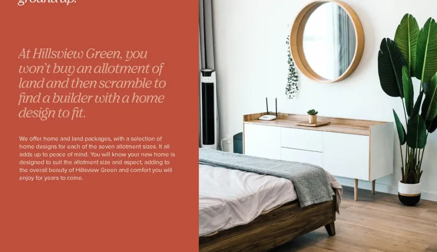
- Choose Your allotment, Build Your Future
- Whether you’re a first homebuyer, growing family, or looking to invest, Hillsview Green offers the flexibility of open lots, allowing you to choose the location and layout that suits your lifestyle.
- Local, Reliable, Proven – South Australian owned and operated
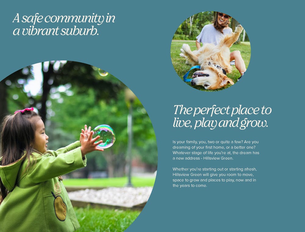
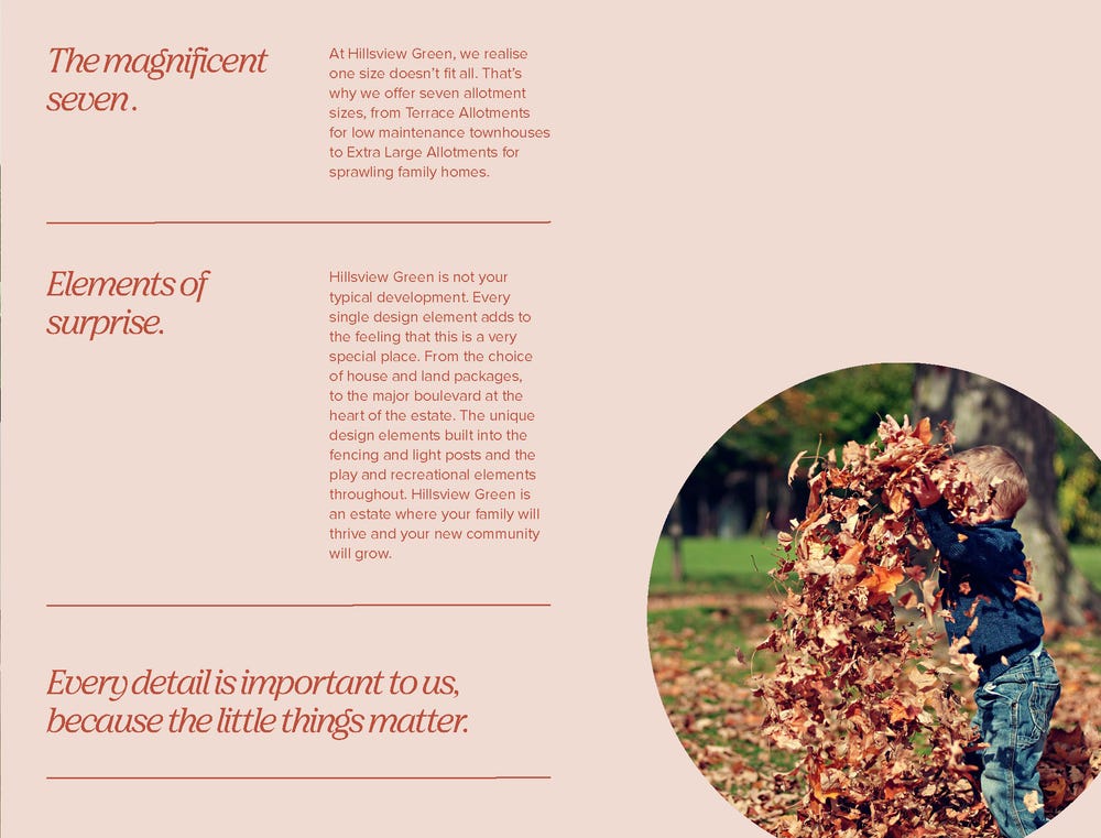
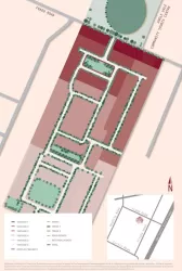
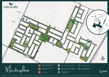
- Hillsview Green – A Community Designed for Living
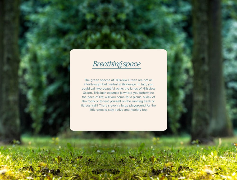
• Two landscaped parks
• Scenic walking trails & running tracks
• Huge family-friendly playground
• Close to schools, Bunnings, shops, sports & community facilities
• Master-planned for lifestyle, connection, and growth - 25 years structural guarantee* T&Cs apply
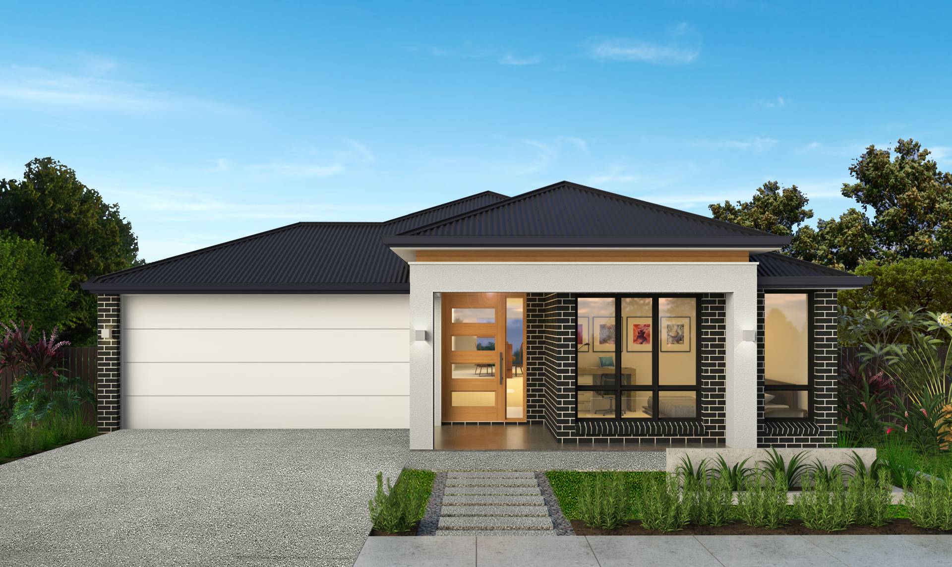
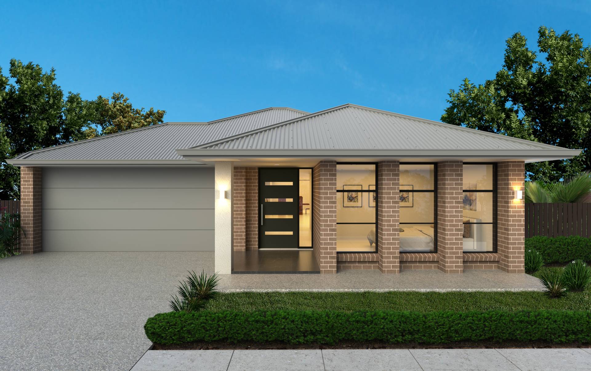
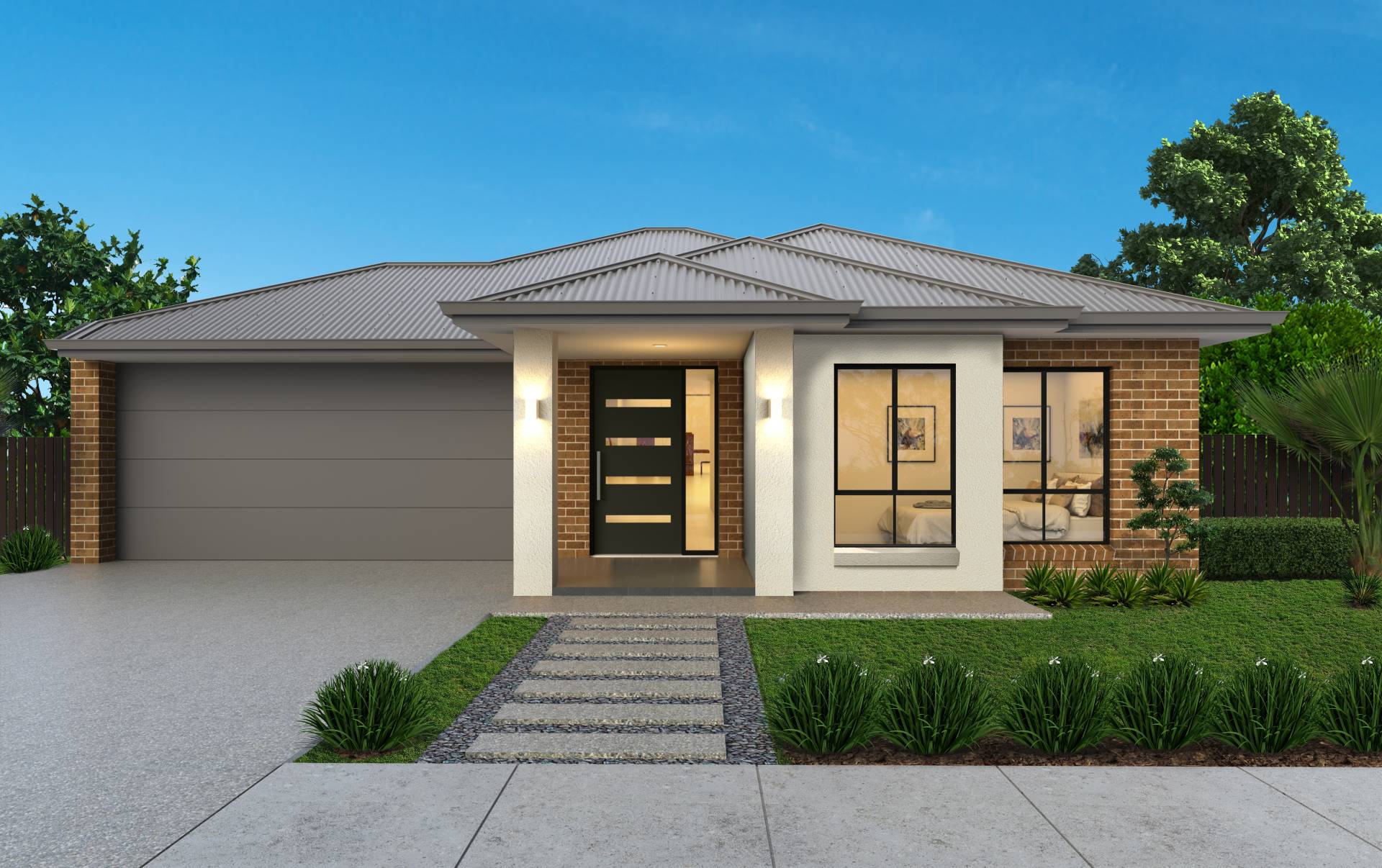
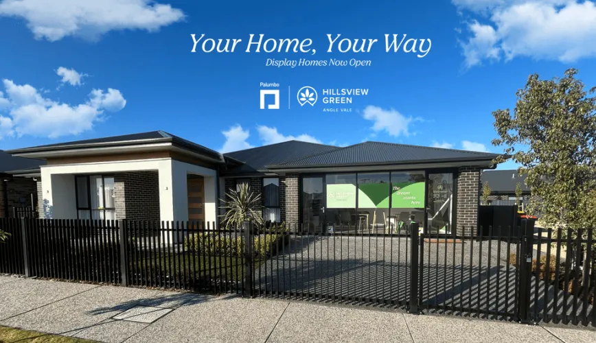
- Visit Our Display Village – See the Quality for yourself
- Walk through our stunning display homes and experience firsthand the exceptional quality and craftsmanship Palumbo is known for. Speak with our expert team about available lots and tailored home designs to suit your needs and budget.
- * Open Saturday to Wednesday, 10am–4pm
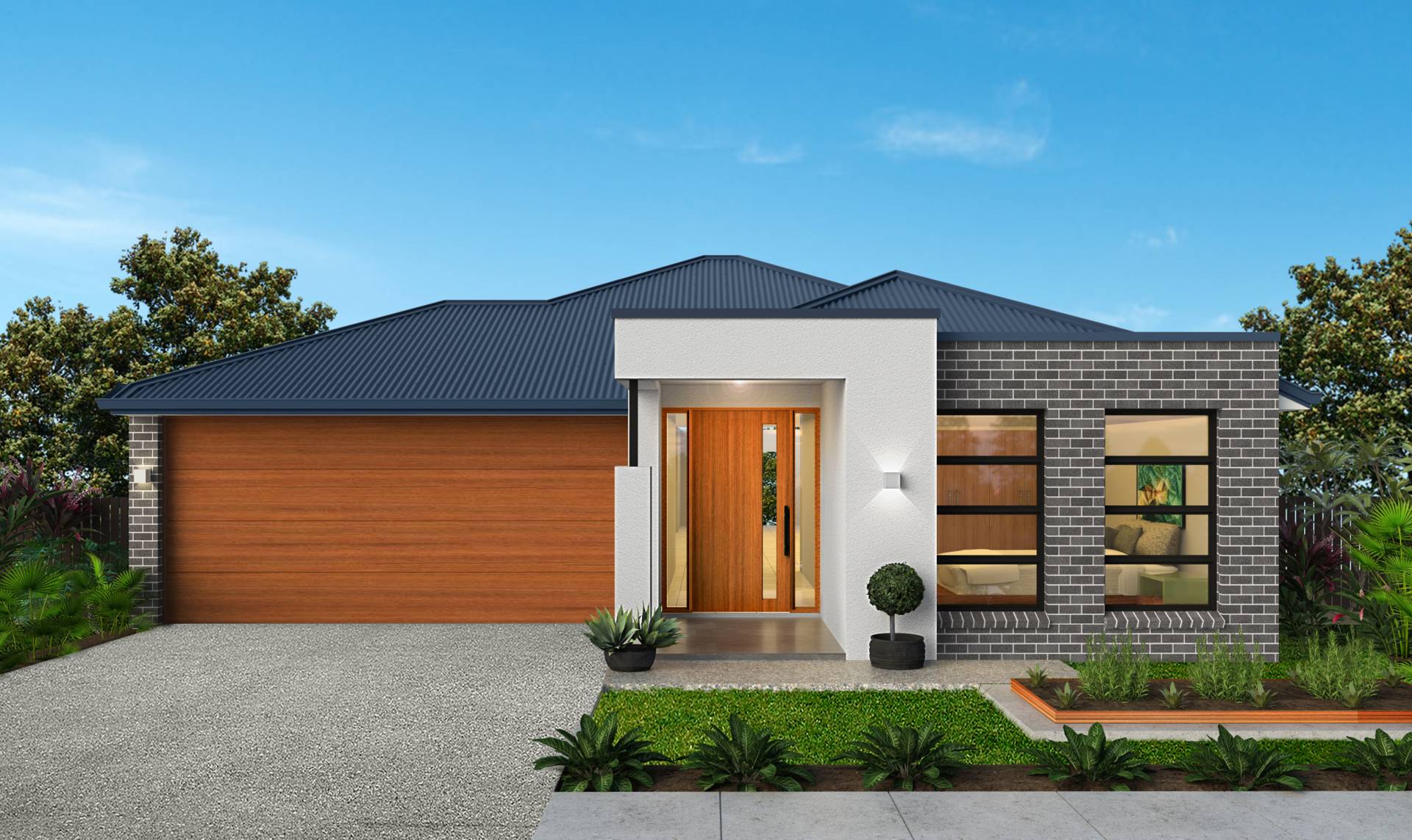
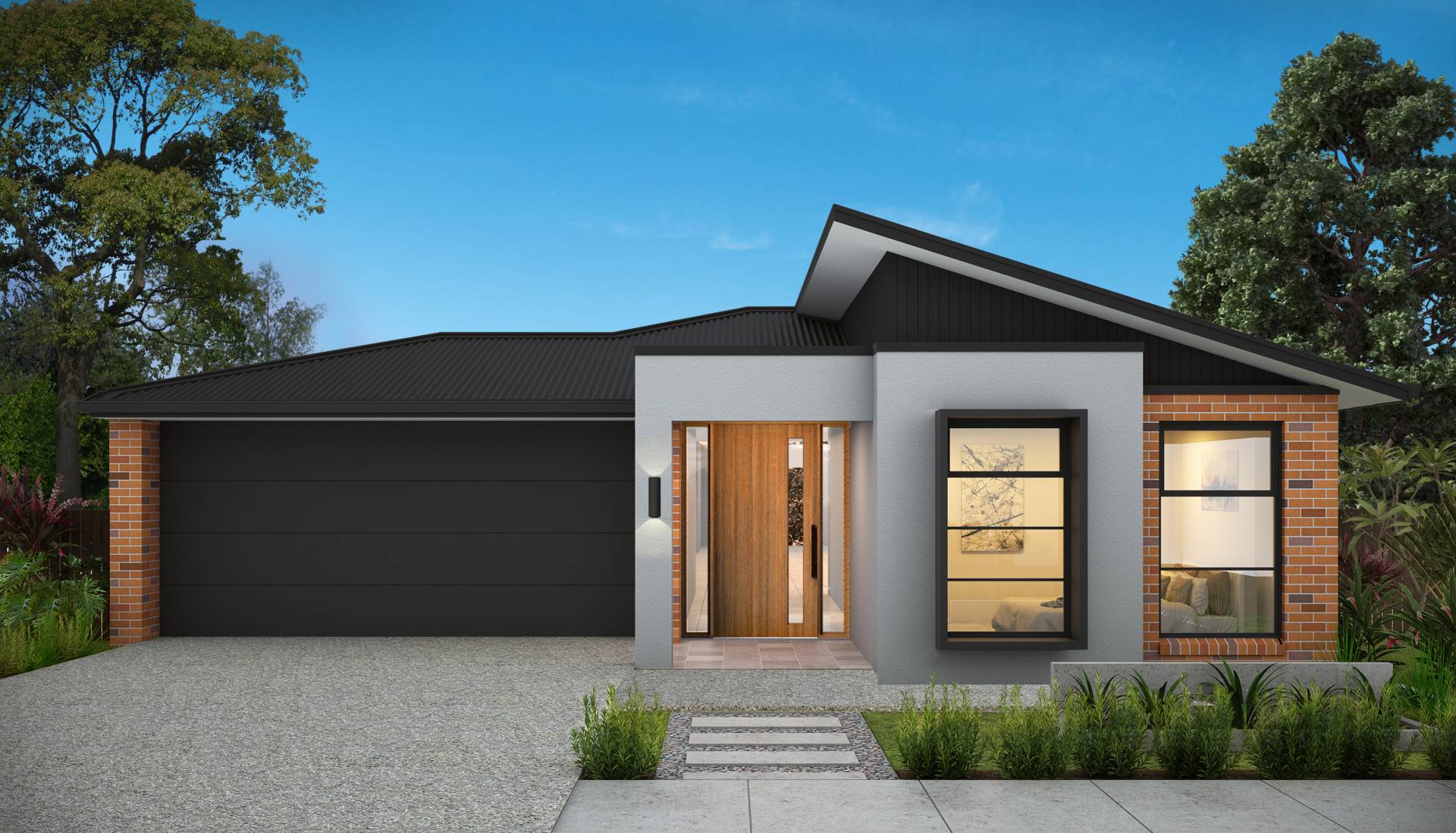
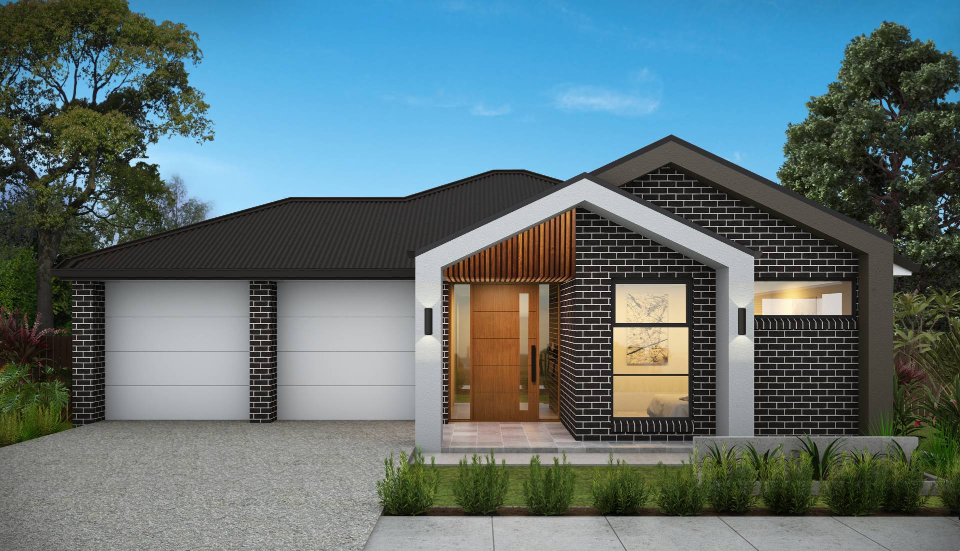
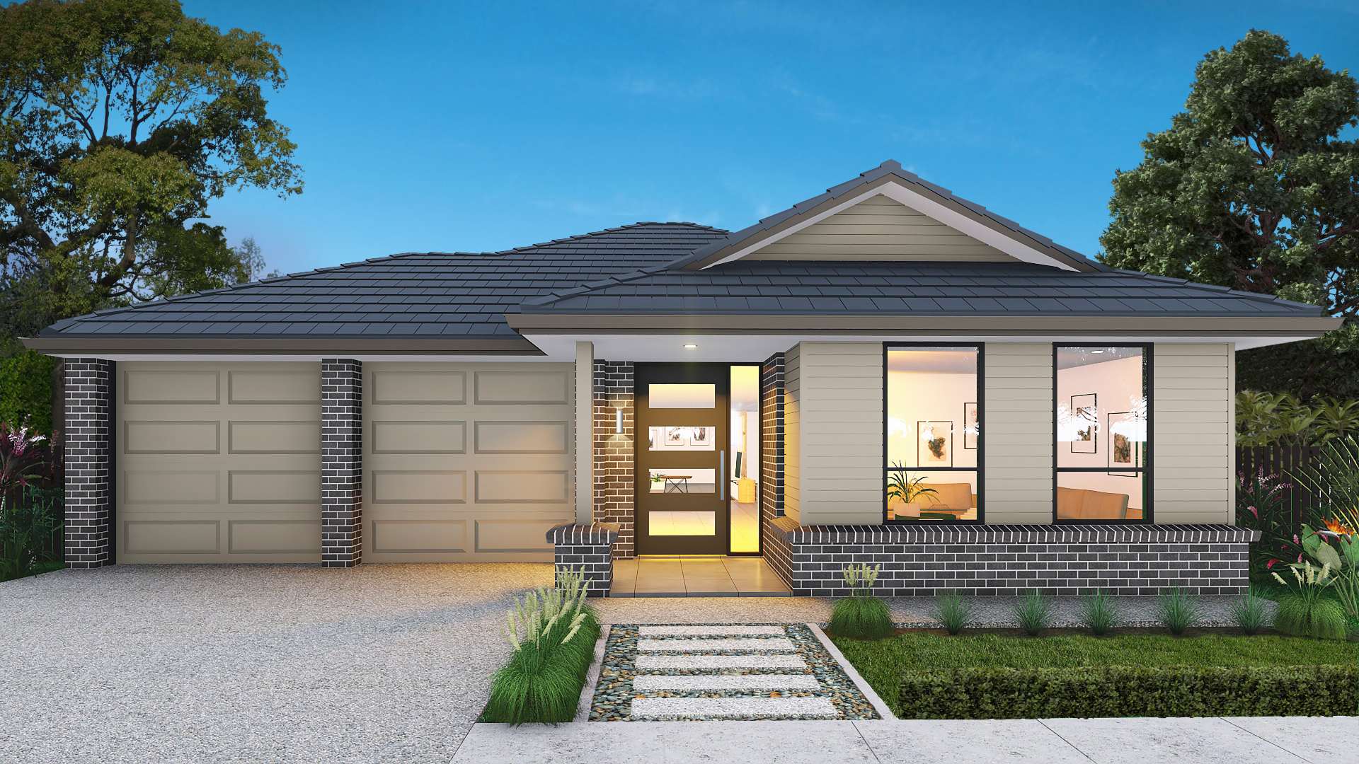
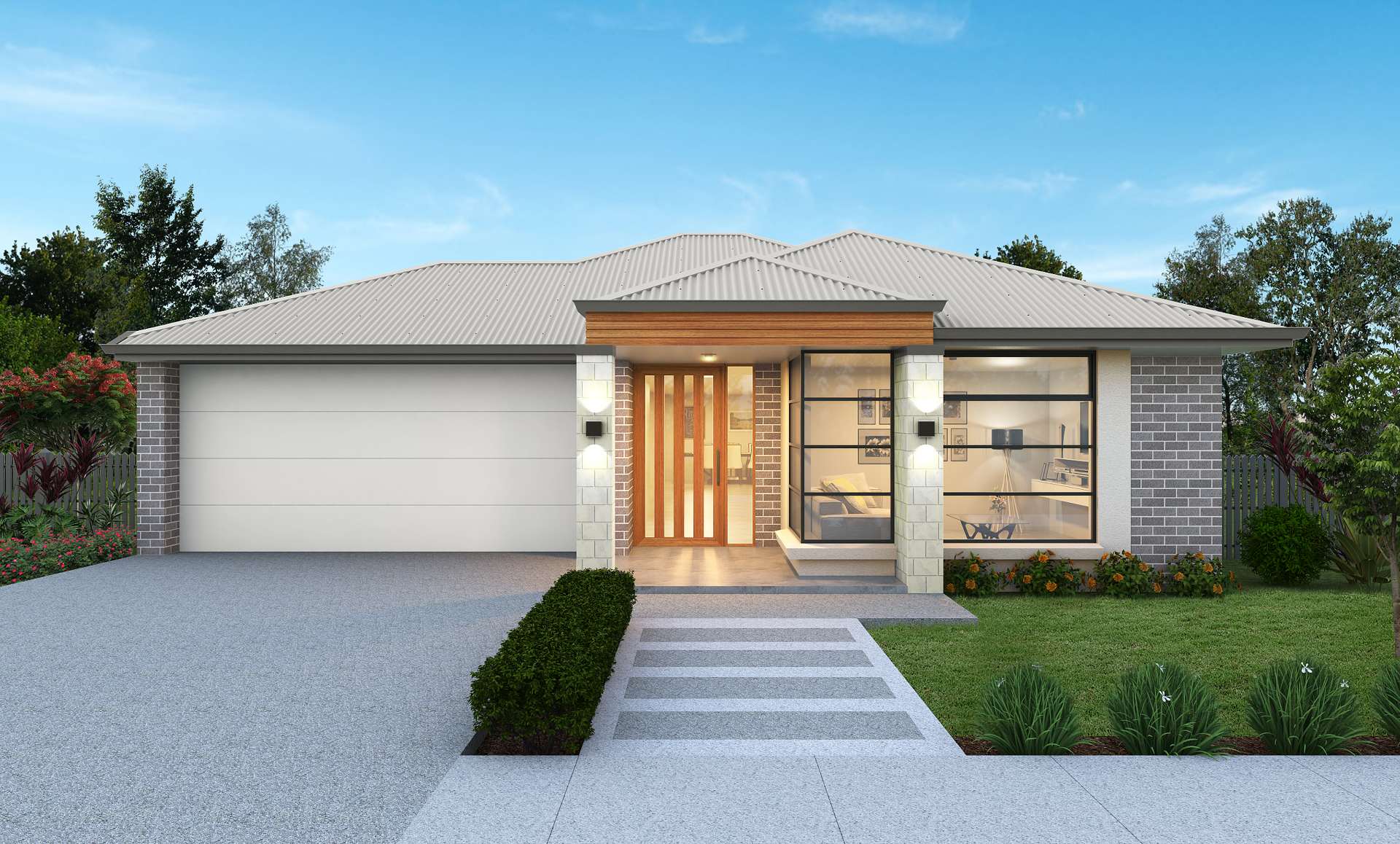
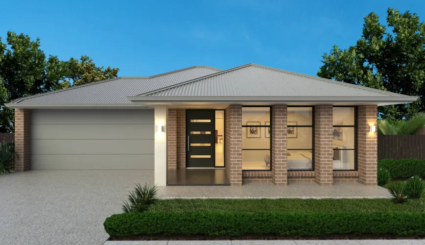
- Build with Palumbo, A Name You Can Trust
• Award-Winning Quality – Builder of the iconic Adelaide Sofitel • 2022 Design Inn Australasia - Pacific Hotel Design Award
• Fixed-Price Contracts – Know exactly what you're paying upfront - Partner with Palumbo, a trusted South Australian builder with over 35 years of experience, to create a fully finished, move-in ready home – no hidden costs, no surprises.
- Member of Master Builders SA, Housing Industry Association, Urban Development Institute Australia, and Property Council Australia.
Property types for sale
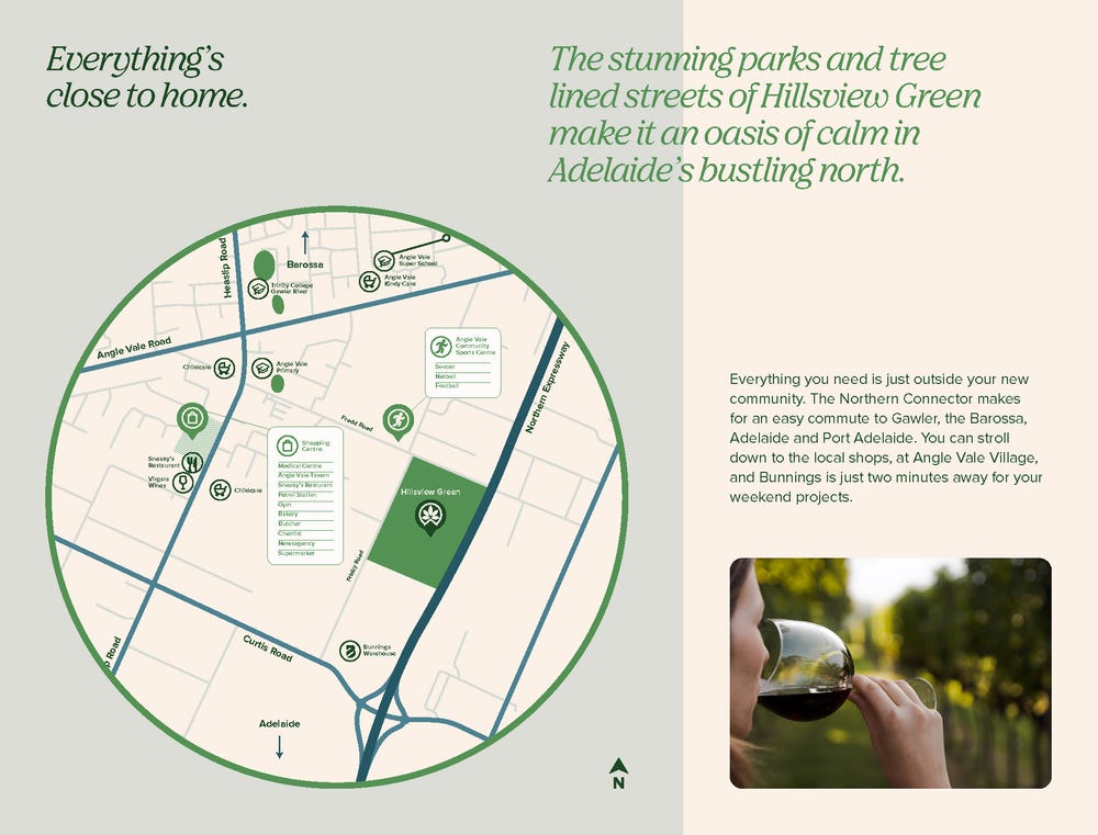
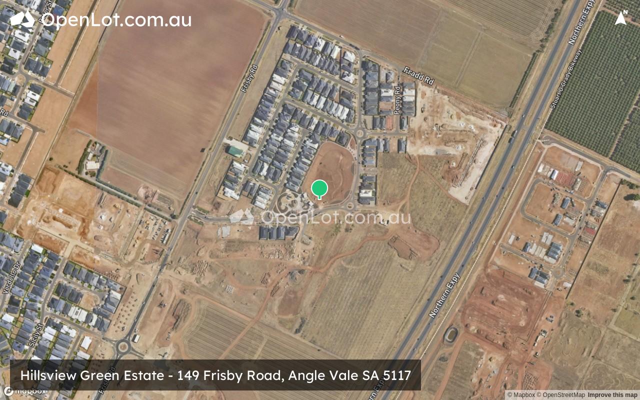
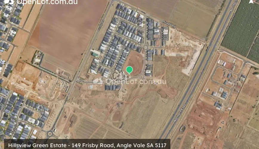
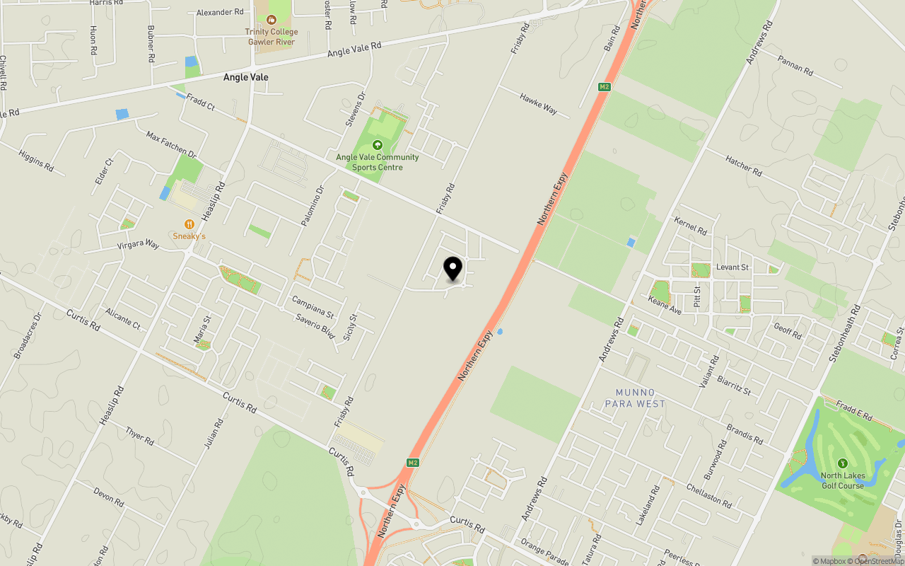
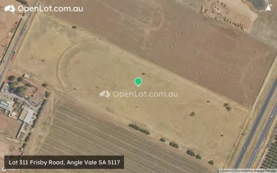
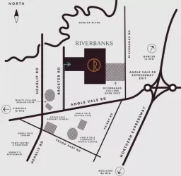
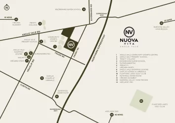
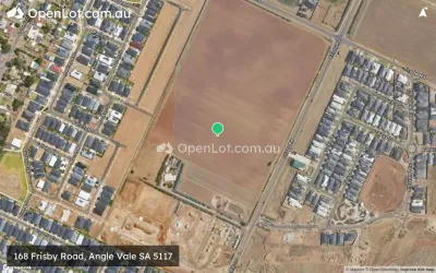
Location & Map for Hillsview Green Estate - Angle Vale
Schools near Hillsview Green Estate - Angle Vale
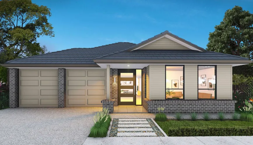
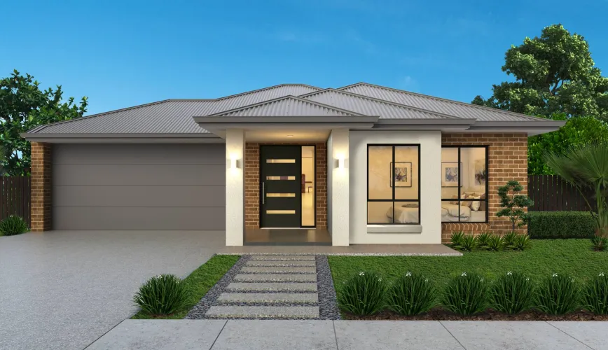
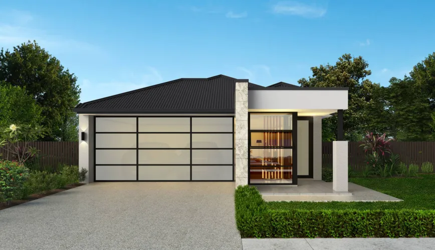
19 House and Land Packages in Hillsview Green Estate - Angle Vale
3D Tour of Hillsview Green Estate - Angle Vale
7 Display Homes in Hillsview Green Estate Display Village - Angle Vale
Hillsview Green Angle Vale Video
Overview
This information is estimated by the OpenLot research team. Let us know here to provide up-to-date information about this development.
| Total new homes | |
| Area Size | 28.00 hectares |
| Growth Region | Adelaide North Growth Areas |
| City Council | City of Playford |
| Developer | Palumbo |
| Creative Agency | Simple |
| Distance to | |
| OpenLot Offer | $200 Cashback |
Suburb Planning Review in Angle Vale SA 5117
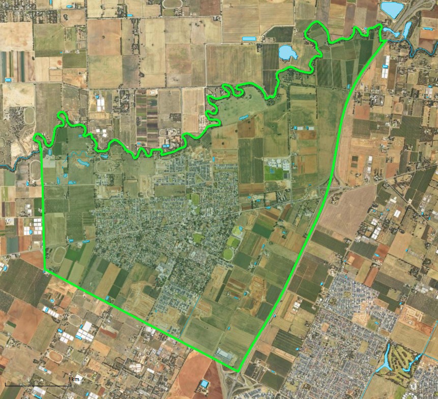
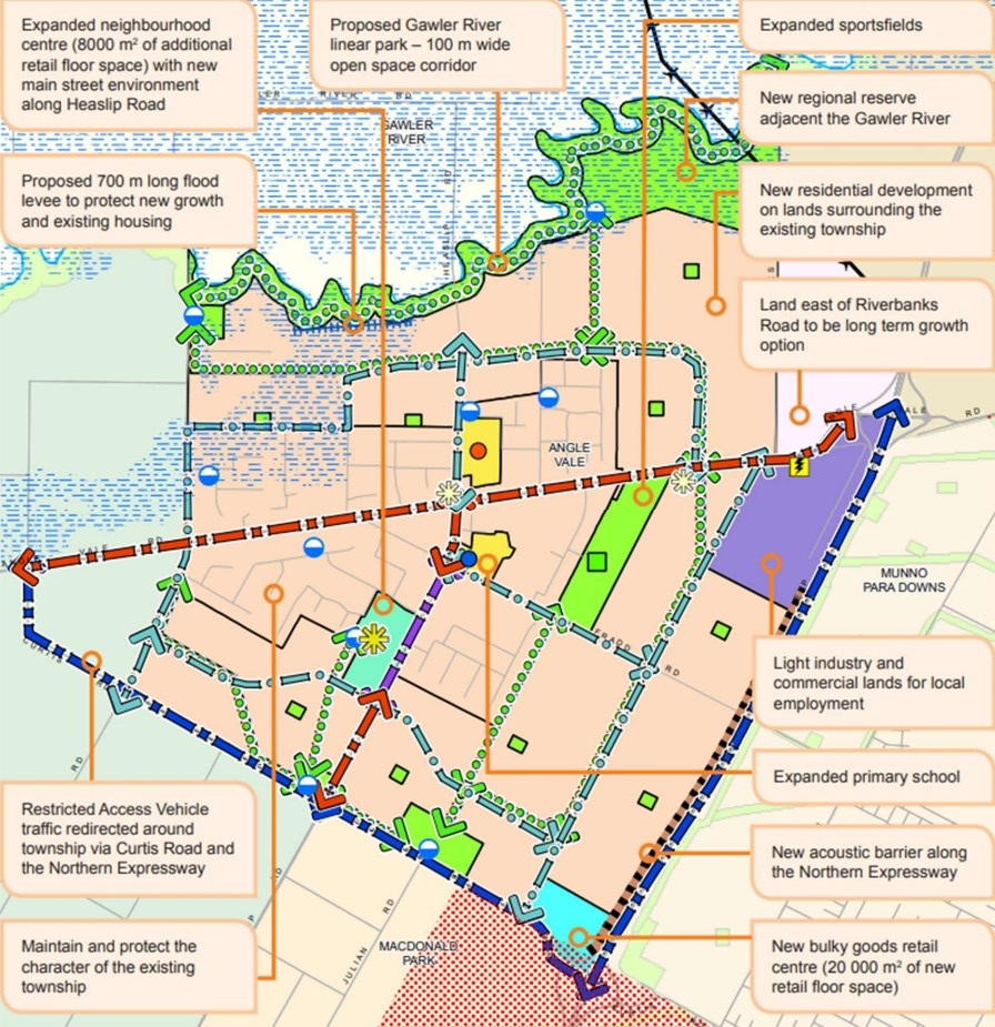
Angle Vale is approximately 14.1 square kilometres within the Playford City Council, located on the Adelaide Plains and forms part of the Greater Adelaide region in South Australia. Located 31 kilometres north of Adelaide CBD, the semi-rural township contains a central urbanised area, residential areas, parks, schools, shops and a local centre. The urbanised area is surrounded by rural land holdings and the agriculture industry.
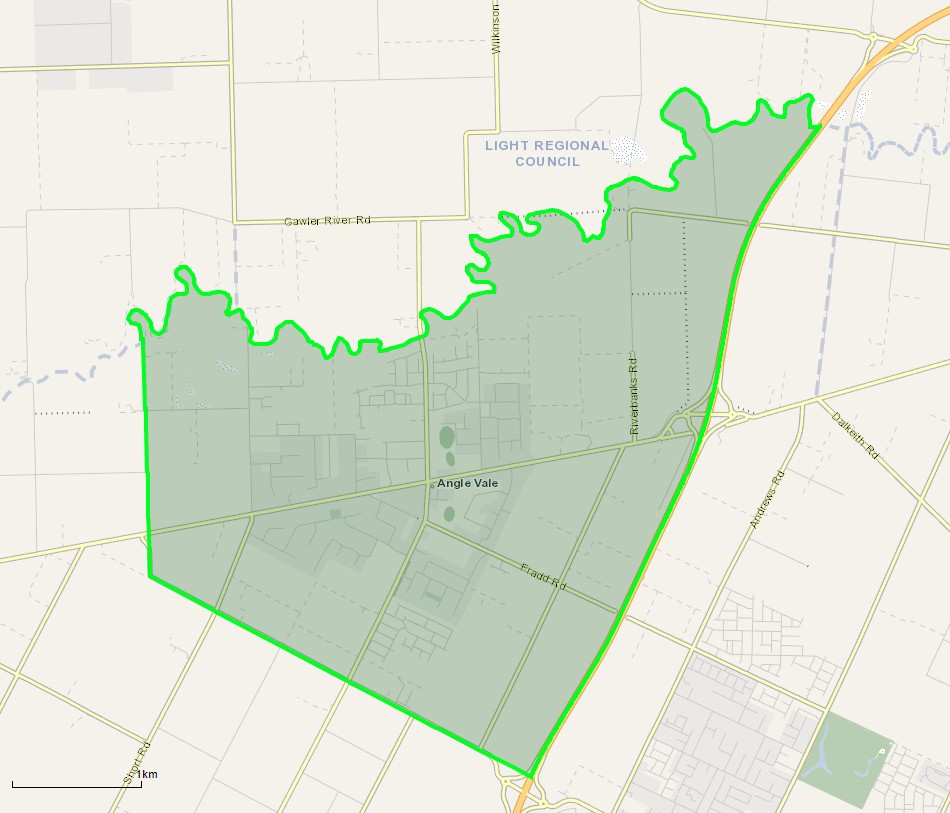
The suburb boundary is located along the Northern Expressway and Curtis Road to the south. The Gawler River is the entire northern boundary, McGee Road to the west and the Northern Expressway to the east.
A local road network is found throughout Angle Vale, providing access to the surrounding suburbs and the local network of roads. Heaslip Road provides north and south connections, while Angle Vale Road provides west and east connections through the centre of the suburb, linking to the major arterial road in proximity.
The urban area found in the centre of the suburb is zoned Master Planned Township zoning, with Rural Horticulture and Employment zones found to the east and west of the township.
The Master Planned Township zoning has been increased in size and renamed the Suburban Neighbourhood zoning under the Playford Urban Growth Areas Development Plan (amendment) declared by the Minister for Planning in January 2014.
The amendment provides limited areas for commercial, light industry and primary production zoning in Angle Vale, with most land dedicated to infill residential development. This is supported under the 30-Year Plan for Greater Adelaide prepared by the Department of Planning, Transport and Infrastructure for the South Australian State Government.
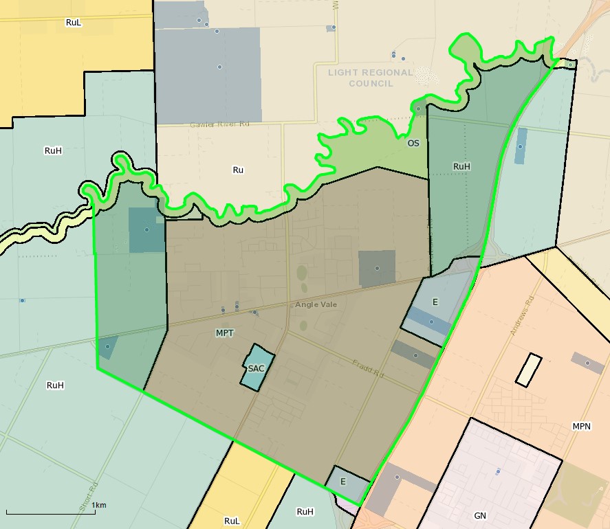
Development for urban purposes cannot proceed for land bounded by Heaslip Road, Chivell Road and the Harris Road alignment until a levee is installed to protect potential flooding from the Gawler River. Furthermore, noise attenuation walls are recommended to be provided adjacent to the Expressway before residential are developed to protect the amenity.
Angle Vale will be transformed into a low and medium density residential walkable neighbourhood that builds on the established neighbourhood activity centres. The growth areas will provide active public spaces and providing equitable access to public open spaces, shops, education facilities (new and existing) and provide a range of community services.
Further objectives include:
- Provision of medium density residential development adjacent to activity centres, public transport stops and public open space.
- Local and neighbourhood activity centres that provide a range of shopping, community, business and recreational facilities for the surrounding neighbourhood.
- The orderly expansion or intensification of urban areas to support the effective and economic provision of public infrastructure and community services.
- Sustainable development outcomes through innovation in stormwater management, waste minimisation, water conservation, energy efficiency and urban biodiversity.
Playford Urban Growth Area of Angle Vale
Angle Vale forms the outer northern area of Playford City Council Growth Area and is part of the region plan for the Greater Adelaide Region. The plan for the next 30 years is the revitalisation of existing neighbourhoods, concentrated new development around transit corridors, and proposed new mixed-use precincts to bring jobs, services and public transport closer to where people live. Changes are illustrated below in the growth structure plan.
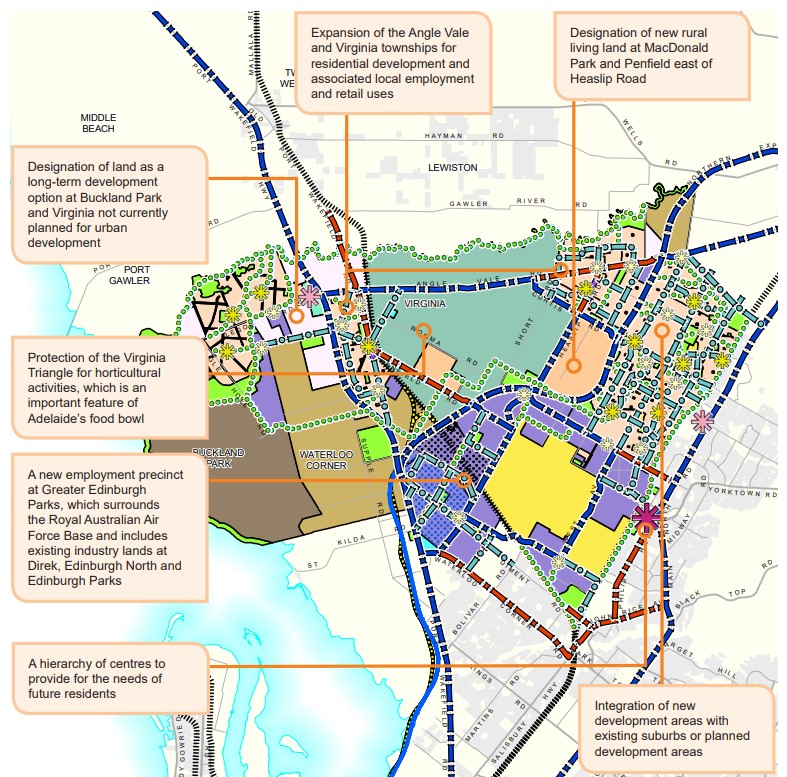
Greater Adelaide Region Growth Area
The population growth in the Greater Adelaide Region area will be 1.97 million people by 2045, which is expected to require a housing growth of 248,000 dwellings. The planning priorities and actions for improving the liveability of residents, a competitive and sustainable region are set down in the 30-Year Plan For Greater Adelaide, 2017 update.
The growth areas will create the opportunity to reduce urban sprawl to the north and south of the elongated metropolitan footprint and the use of urban renewal projects is encouraged to find new spaces and places to live. The City Shape 2043 provides a basis for ongoing discussion with the community about the changing shape of Playford as it grows.
Playford Vision
“Playford is the City of Opportunity, supporting the community’s hopes and aspirations to be vibrant, thriving and sustainable. It provides an enviable lifestyle that is connected, healthy, happy, ambitious and proud, where each individual can take advantage of the many opportunities offered, making the City prosperous, liveable and happy.”
Angle Vale Suburb Summary
References
- Angle Vale – SA State Government
- Playford Community Vision 2043
- Angle Vale – Development Control Plan - Amendment
- Playford Growth Area Structure Plan December 2013
- Google Streetview and Aerial
Updates for Hillsview Green Estate - Angle Vale


Land Price Trend in Angle Vale SA 5117
Below shows the price trend from vacant land sales recorded in Angle Vale SA 5117.
The data and information provided by Terralytics (Aust) Pty Ltd (Terralytics Data) is general in nature and is not intended to constitute professional advice. Read more
It should not be relied upon as a substitute for legal, financial, valuation, or other specialist advice relevant to your specific circumstances.
Terralytics uses commercially reasonable endeavours to ensure the Terralytics Data is current and accurate. However, as the Terralytics Data incorporates information sourced from third parties, Terralytics makes no representation or warranty — express or implied — as to its accuracy, completeness, or currency. To the maximum extent permitted by applicable law, Terralytics excludes all liability for any loss or damage (including consequential loss) arising out of or in connection with reliance on the Terralytics Data, whether arising in contract, tort (including negligence), statute, or otherwise.
Popular Estates near Hillsview Green Estate - Angle Vale


Not exactly what you're looking for? Try surrounding suburbs
Hillier SA 5116
1 estate | The Town of Gawler
5.1km east
Andrews Farm SA 5114
6 estates | City of Playford
4.3km south
Smithfield Plains SA 5114
2 estates | City of Playford
5.3km south-east
Munno Para West SA 5115
14 estates | City of Playford
3.1km south-east
Munno Para SA 5115
4 estates | City of Playford
5.1km south-east
Munno Para Downs SA 5115
16 estates | City of Playford
4.2km east
Latest published articles


FAQs about Hillsview Green Estate - Angle Vale
Palumbo is the developer behind Hillsview Green Estate - Angle Vale.
Hillsview Green Estate - Angle Vale consists of 406 homes.
The total area for Hillsview Green Estate - Angle Vale is 28.00 hectares.
Hillsview Green Estate - Angle Vale falls under City of Playford.
Hillsview Green Estate - Angle Vale is 31 km north of Adelaide CBD.
Nearby schools for Hillsview Green Estate - Angle Vale:
- Angle Vale Primary School - 1.4km north-west
- Trinity College Gawler River - 1.8km north-west
- Riverbanks College B-12 - 1.9km north
- St Columba College - 2.4km south
- Adelaide North Special School - 2.8km south-east
- Mark Oliphant College (B-12) - 2.8km south-east