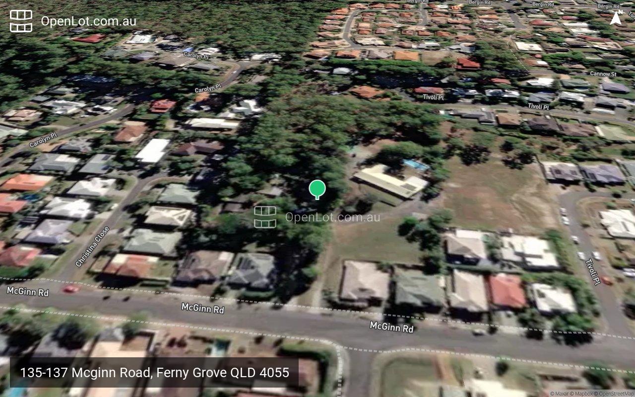
135-137 Mcginn Road, Ferny Grove QLD 4055
This information is estimated by the OpenLot research team. Let us know here to provide up-to-date information about this development.
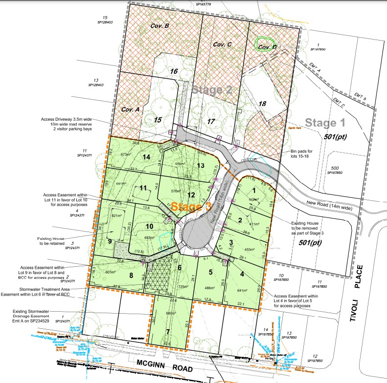
| Total new homes | 19 |
| Area size | 2.41 hectares |
| Growth Region | Greater Brisbane Growth Areas |
| City council | Brisbane City Council |
| Developer | N/A |
| Distance to | Brisbane CBD - 12 km north-west Brisbane Airport - 19 km west |
Land for Sale, House and Land Packages:
Popular Estates near 135-137 Mcginn Road, Ferny Grove


Updates for 135-137 Mcginn Road, Ferny Grove
Facebook updates:
Submit the Facebook page for 135-137 Mcginn Road, Ferny Grove.
Related news:
A subdivision development application has been lodged for subdivision, located at 135 & 137 McGinn Road and 12 Tivoli Place, Ferny Grove. Designed by Jense

Missing articles? Send us a link here.
Location & Map for 135-137 Mcginn Road, Ferny Grove
Vacancy Rate in Ferny Grove QLD 4055
View full vacancy rate history in Ferny Grove QLD 4055 via SQM Research.
Schools near 135-137 Mcginn Road, Ferny Grove
Here are 6 schools near 135-137 Mcginn Road, Ferny Grove:
Prep-6 Government Primary School
Prep-6 Catholic Primary School
7-12 Government Secondary School
Prep-6 Government Primary School
Prep-6 Government Primary School
Prep-6 Government Primary School
Reviews & Comments on 135-137 Mcginn Road, Ferny Grove
Estate Brochure, Masterplan, Engineering Plan, Plan of Subdivision (POS), Design Guidelines
FAQs about 135-137 Mcginn Road, Ferny Grove
- Ferny Grove State School - 550m east
- St Andrew's Catholic School - 686m south
- Ferny Grove State High School - 1.0km east
- Patricks Road State School - 1.6km north-east
- Ferny Hills State School - 1.9km east
- Grovely State School - 3.7km east
Popular Estates near 135-137 Mcginn Road, Ferny Grove
Latest New Home Articles for You

10/May/2024
13
content here.
10/May/2024
14
Content here.
10/May/2024
15
Content here.
10/May/2024
16
Content here.
10/May/2024
17
Content here.
10/May/2024
18
Content here.
10/May/2024
19
Content here.

10/May/2024
20
Lorem ipsum dolor sit amet, consectetur adipiscing elit. Etiam turpis era...
10/May/2024
21
Content here.