
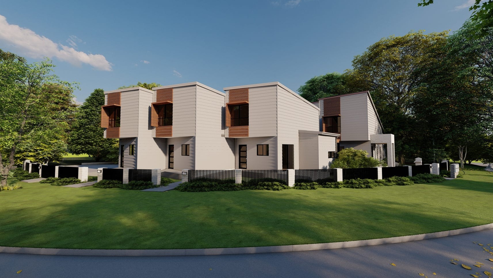
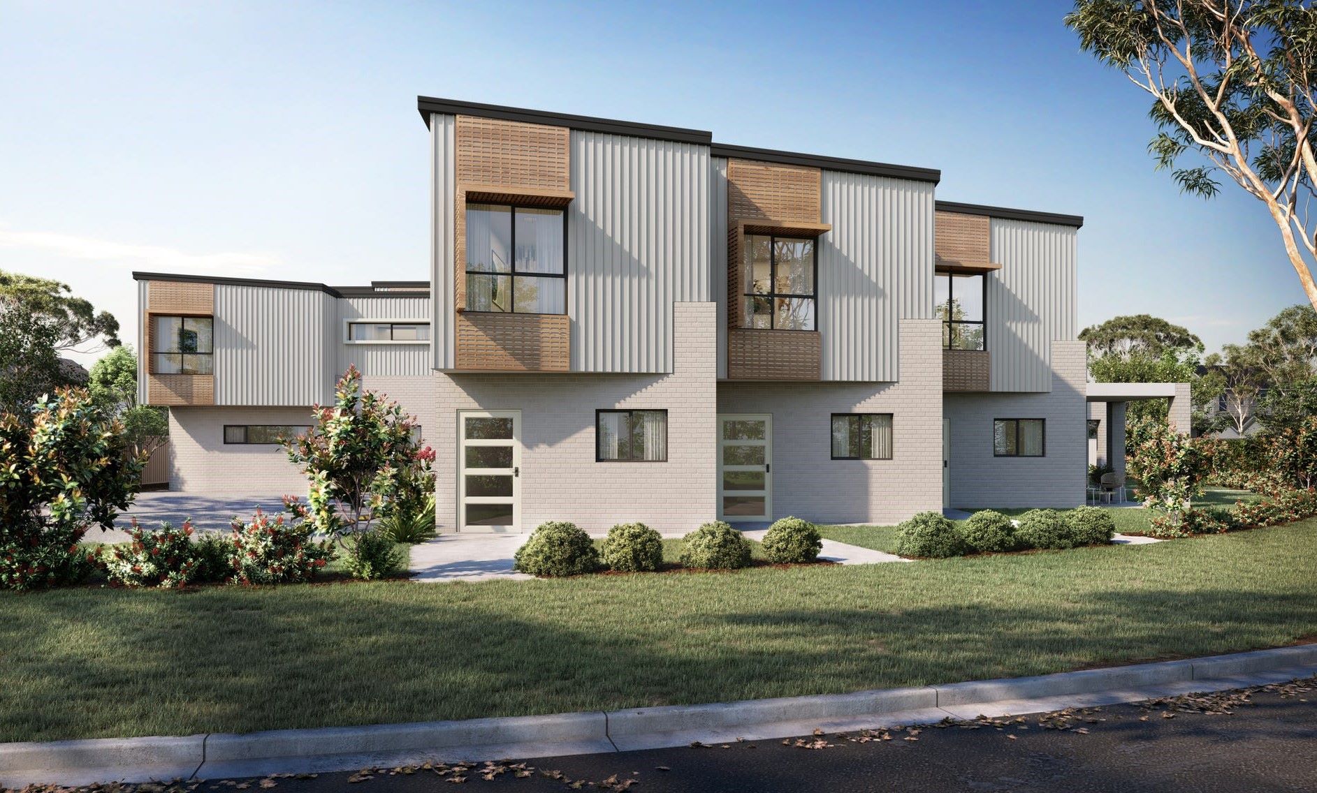
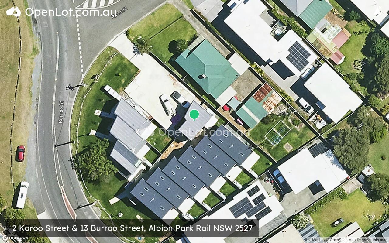
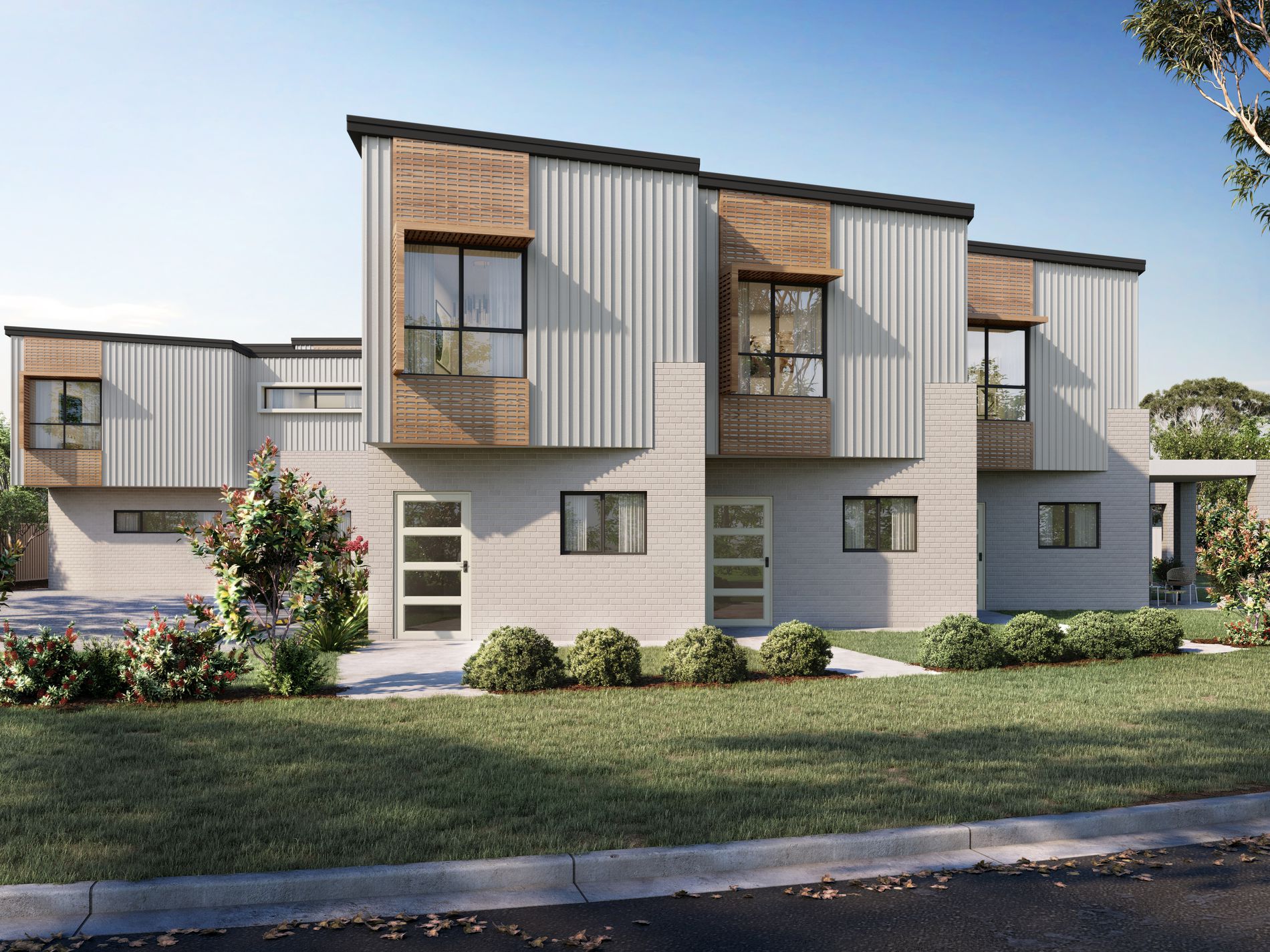
2 Karoo Street & 13 Burroo Street, Albion Park Rail NSW 2527
Property types for sale
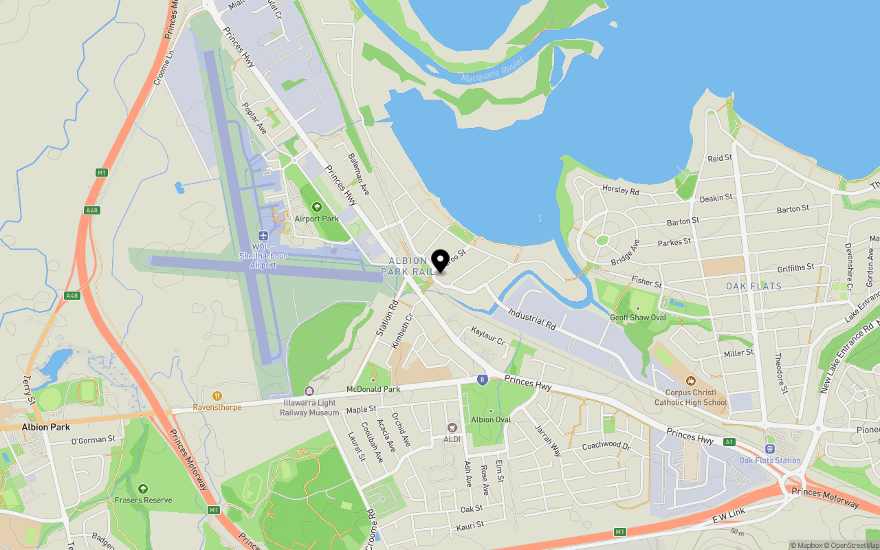
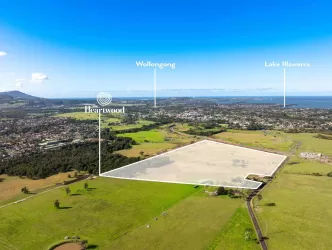
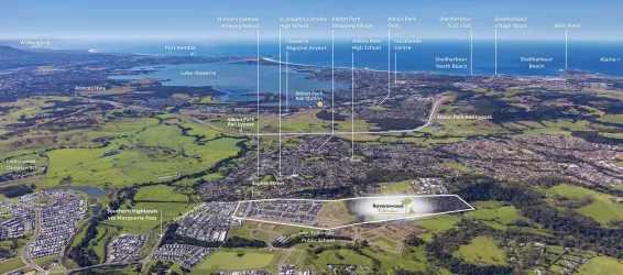
Location & Map for 2 Karoo Street & 13 Burroo Street, Albion Park Rail NSW 2527
Schools near 2 Karoo Street & 13 Burroo Street, Albion Park Rail NSW 2527
Overview
This information is estimated by the OpenLot research team. Let us know here to provide up-to-date information about this development.
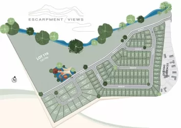
| Total new homes | |
| Area Size | 0.14 hectares |
| Growth Region | Wollongong (Illawarra-Shoalhaven Region) |
| City Council | Shellharbour City Council |
| Developer | N/A |
| Project Marketer | A-List Property Group |
| Distance to |
Updates for 2 Karoo Street & 13 Burroo Street, Albion Park Rail
Popular Estates near 2 Karoo Street & 13 Burroo Street, Albion Park Rail


Not exactly what you're looking for? Try surrounding suburbs
Albion Park NSW 2527
3 estates | Shellharbour City Council
3.4km south-west
Cleveland NSW 2530
1 estate | Wollongong City Council
6.8km north
Dunmore NSW 2529
1 estate | Shellharbour City Council
6.9km south-east
Yallah NSW 2530
1 estate | Wollongong City Council
3.1km north
Avondale NSW 2530
1 estate | Wollongong City Council
5.8km north-west
Tullimbar NSW 2527
5 estates | Shellharbour City Council
5.7km south-west
Latest published articles


FAQs about 2 Karoo Street & 13 Burroo Street, Albion Park Rail NSW 2527
2 Karoo Street & 13 Burroo Street, Albion Park Rail NSW 2527 consists of 10 homes.
The total area for 2 Karoo Street & 13 Burroo Street, Albion Park Rail NSW 2527 is 0.14 hectares.
2 Karoo Street & 13 Burroo Street, Albion Park Rail NSW 2527 falls under Shellharbour City Council.
2 Karoo Street & 13 Burroo Street, Albion Park Rail NSW 2527 is 17 km south-west of Wollongong CBD.
A-List Property Group is the project marketer for 2 Karoo Street & 13 Burroo Street, Albion Park Rail NSW 2527.
Nearby schools for 2 Karoo Street & 13 Burroo Street, Albion Park Rail NSW 2527:
- Albion Park Rail Public School - 514m south
- Oak Flats Public School - 1.6km east
- Corpus Christi Catholic High School - 1.7km south-east
- Albion Park Public School - 2.6km west
- Albion Park High School - 2.9km south-west
- Balarang Public School - 2.9km east