
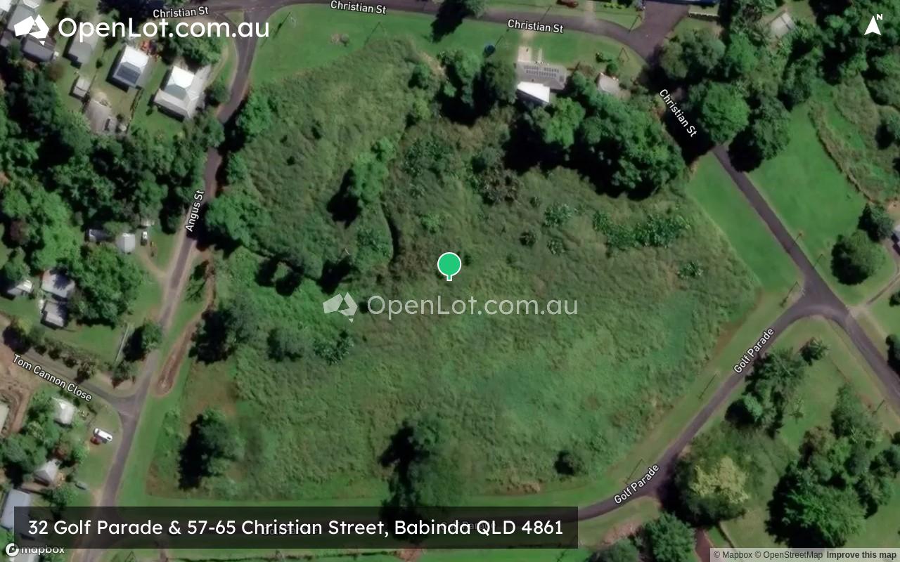
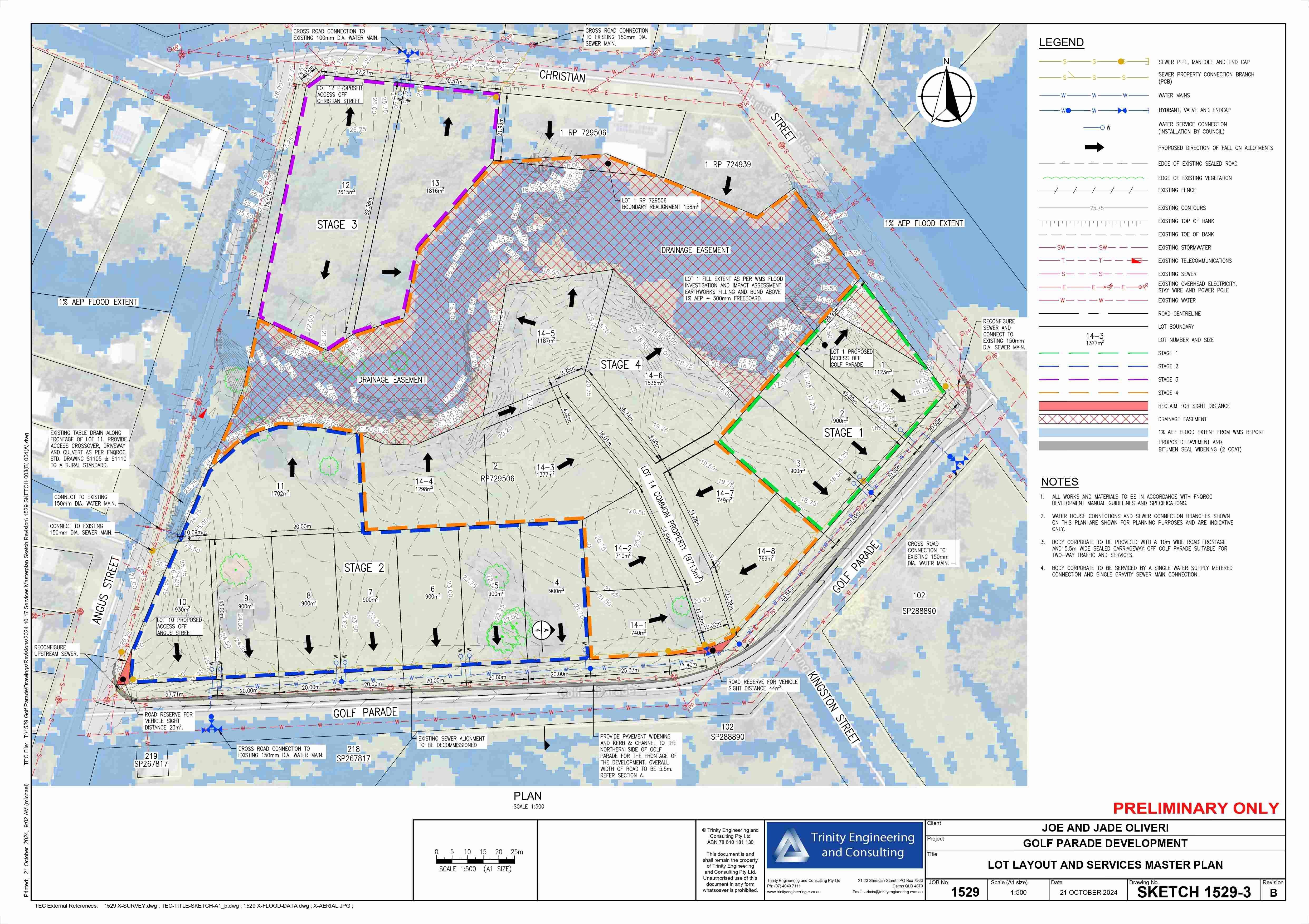
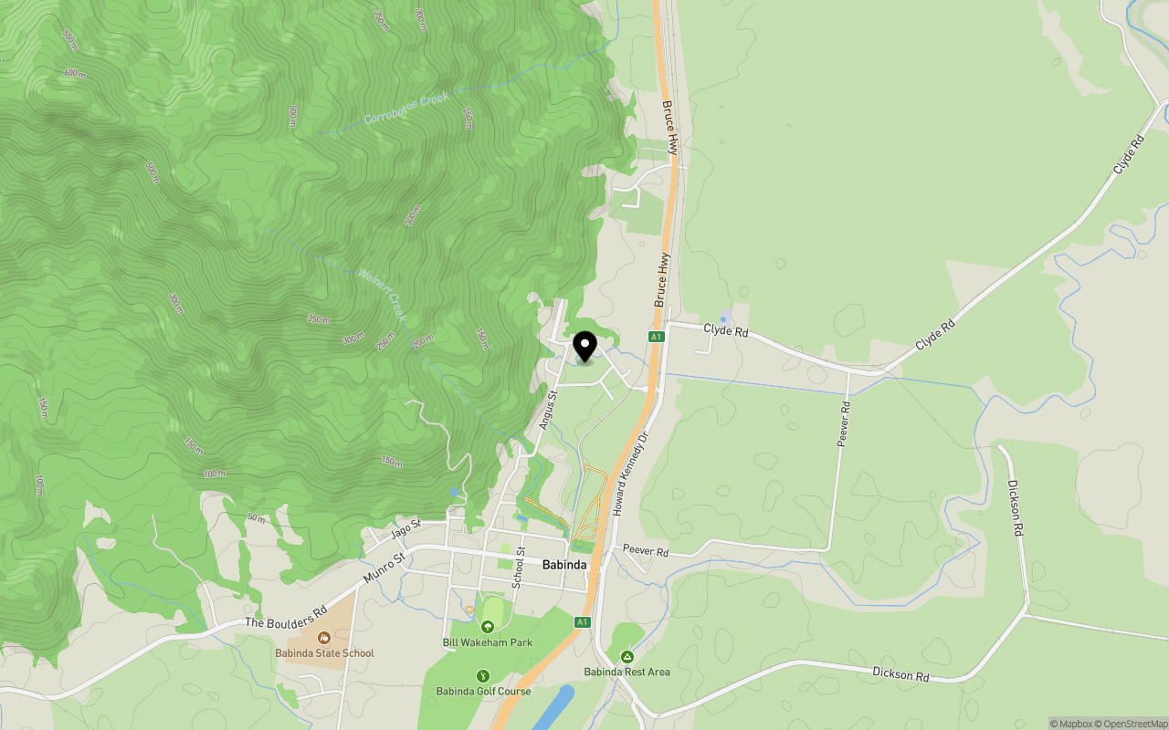
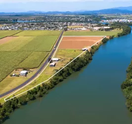
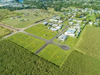
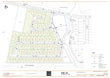
32 Golf Parade & 57-65 Christian Street, Babinda QLD 4861
Location & Map for 32 Golf Parade & 57-65 Christian Street, Babinda QLD 4861
Schools near 32 Golf Parade & 57-65 Christian Street, Babinda QLD 4861
Overview
This information is estimated by the OpenLot research team. Let us know here to provide up-to-date information about this development.
| Total new homes | |
| Area Size | 3.48 hectares |
| Growth Region | Cairns (Far North Queensland Region) |
| City Council | Cairns Regional Council |
| Developer | N/A |
| Distance to |
Updates for 32 Golf Parade & 57-65 Christian Street, Babinda
Popular Estates near 32 Golf Parade & 57-65 Christian Street, Babinda


Not exactly what you're looking for? Try surrounding suburbs
Eaton QLD 4860
1 estate | Cassowary Coast Regional Council
22.0km south-east
Mighell QLD 4860
1 estate | Cassowary Coast Regional Council
24.1km south-east
Gordonvale QLD 4865
4 estates | Cairns Regional Council
32.5km north-west
Webb QLD 4860
1 estate | Cassowary Coast Regional Council
24.9km south-east
Malanda QLD 4885
2 estates | Tablelands Regional Council
35.1km west
Goldsborough QLD 4865
2 estates | Cairns Regional Council
25.5km north-west
Latest published articles


FAQs about 32 Golf Parade & 57-65 Christian Street, Babinda QLD 4861
32 Golf Parade & 57-65 Christian Street, Babinda QLD 4861 consists of 21 homes.
The total area for 32 Golf Parade & 57-65 Christian Street, Babinda QLD 4861 is 3.48 hectares.
32 Golf Parade & 57-65 Christian Street, Babinda QLD 4861 falls under Cairns Regional Council.
32 Golf Parade & 57-65 Christian Street, Babinda QLD 4861 is 49 km south of Cairns CBD.
Nearby schools for 32 Golf Parade & 57-65 Christian Street, Babinda QLD 4861:
- St Rita's School - 902m south
- Babinda State School - 1.7km south-west
- Bellenden Ker State School - 7.6km north
- Mirriwinni State School - 7.6km south
- Bartle Frere State School - 12.9km south
- McDonnell Creek State School - 15.7km north