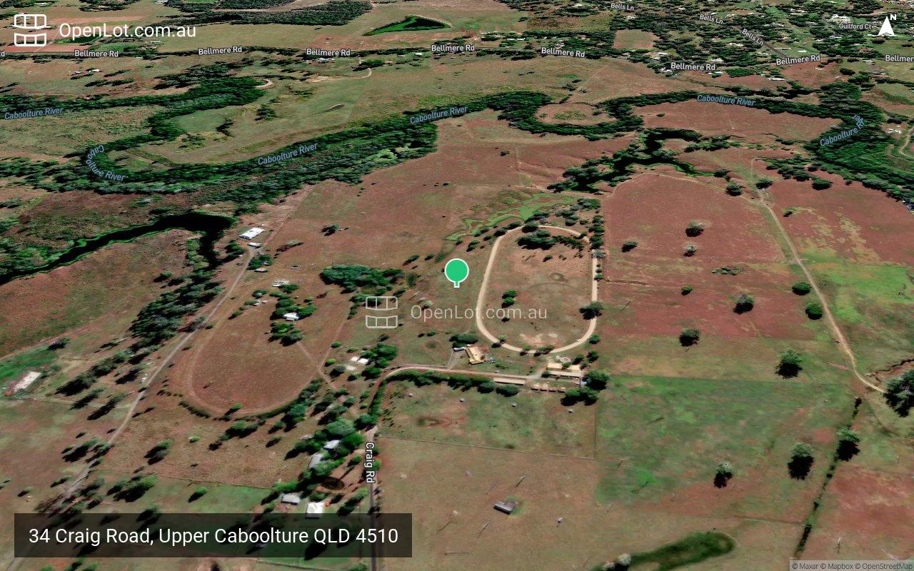
34 Craig Road, Upper Caboolture QLD 4510 COMING SOON
This information is estimated by the OpenLot research team. Let us know here to provide up-to-date information about this development.
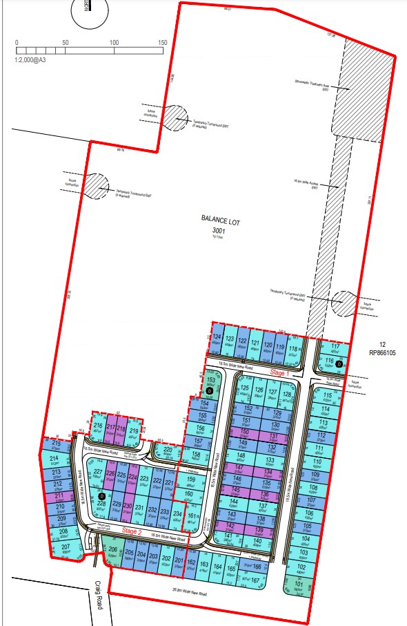
| Total new homes | 266 |
| Area size | 16.55 hectares |
| Growth Region | Greater Brisbane Growth Areas |
| City council | Moreton Bay Regional Council |
| Developer | Orchard Property Group |
| Distance to | Brisbane Airport - 39 km north-west Brisbane CBD - 43 km north |
Land for Sale, House and Land Packages:
Popular Estates near 34 Craig Road, Upper Caboolture


Updates for 34 Craig Road, Upper Caboolture
Facebook updates:
Submit the Facebook page for 34 Craig Road, Upper Caboolture.
Related news:
The perfect place to build your perfect home. Located between Brisbane and the Sunshine Coast, this estate is situated in the thriving area of Caboolture. Only minutes to schools, medical facilities, Morayfield Shopping Centre, dining precincts and an abundance of lifestyle opportunities. Your perfect lifestyle awaits…
Track the progress of development applications from lodgement through to decision.
Missing articles? Send us a link here.
Location & Map for 34 Craig Road, Upper Caboolture
Vacancy Rate in Upper Caboolture QLD 4510
View full vacancy rate history in Upper Caboolture QLD 4510 via SQM Research.
Schools near 34 Craig Road, Upper Caboolture
Here are 6 schools near 34 Craig Road, Upper Caboolture:
Prep-6 Government Primary School
Prep-6 Government Primary School
Prep-6 Government Special School
7-12 Government Secondary School
Prep-6 Independent Primary School
Prep-6 Government Primary School
Reviews & Comments on 34 Craig Road, Upper Caboolture
Estate Brochure, Masterplan, Engineering Plan, Plan of Subdivision (POS), Design Guidelines
FAQs about 34 Craig Road, Upper Caboolture
View all estates from Orchard Property Group
- Bellmere State School - 1.4km north-east
- Minimbah State School - 2.3km south-east
- Caboolture Special School - 4.0km east
- Tullawong State High School - 4.2km north-east
- St Paul's Lutheran Primary School - 4.3km north-east
- Morayfield State School - 4.3km east
Popular Estates near 34 Craig Road, Upper Caboolture
Latest New Home Articles for You

10/May/2024
13
content here.
10/May/2024
14
Content here.
10/May/2024
15
Content here.
10/May/2024
16
Content here.
10/May/2024
17
Content here.
10/May/2024
18
Content here.
10/May/2024
19
Content here.

10/May/2024
20
Lorem ipsum dolor sit amet, consectetur adipiscing elit. Etiam turpis era...
10/May/2024
21
Content here.