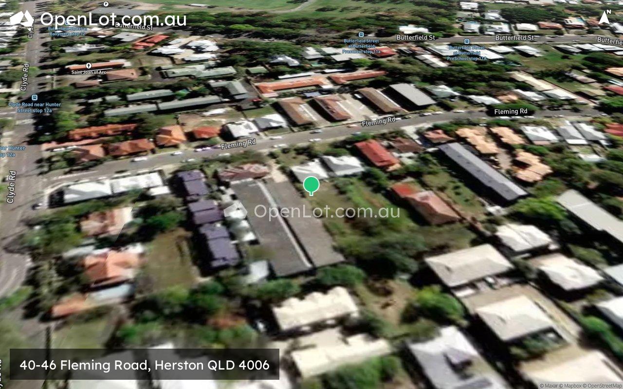
40-46 Fleming Road, Herston QLD 4006 IN PLANNING
This information is estimated by the OpenLot research team. Let us know here to provide up-to-date information about this development.
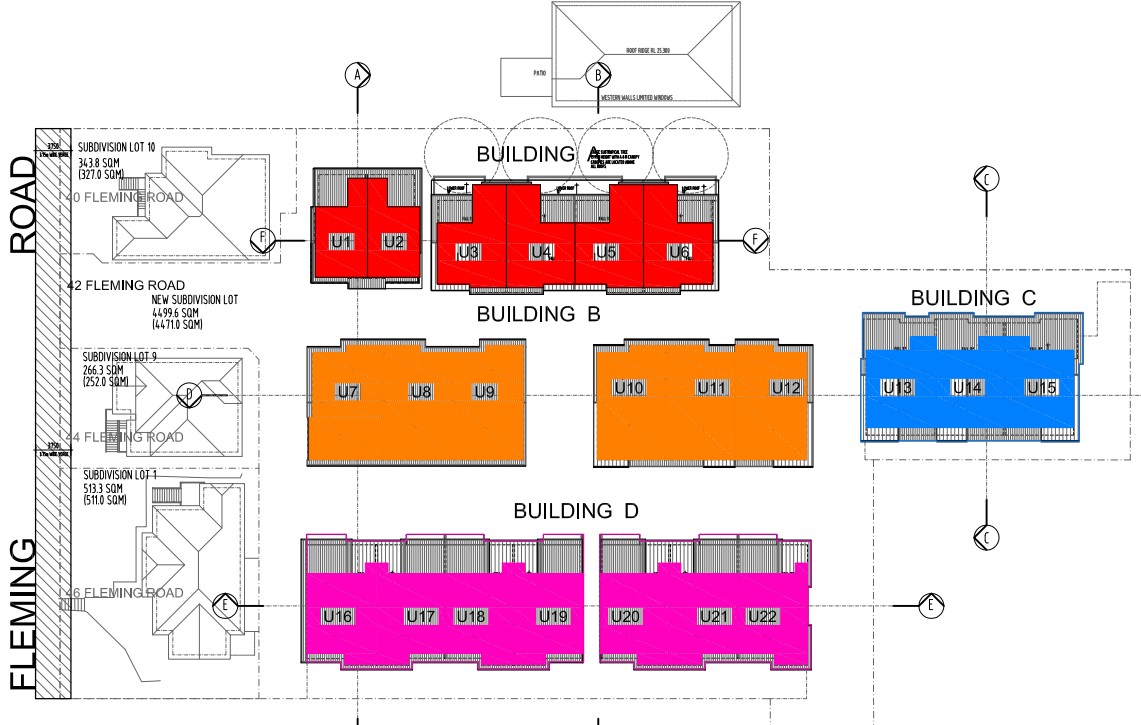
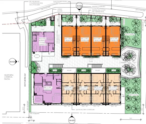
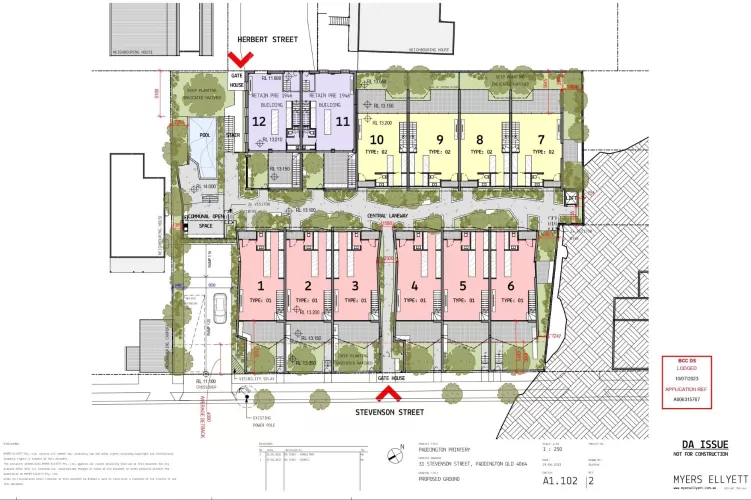
| Total new homes | 22 |
| Area size | 0.56 hectares |
| Growth Region | Greater Brisbane Growth Areas |
| City council | Brisbane City Council |
| Developer | Unison Projects |
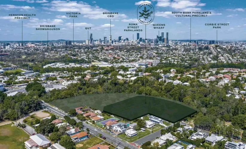
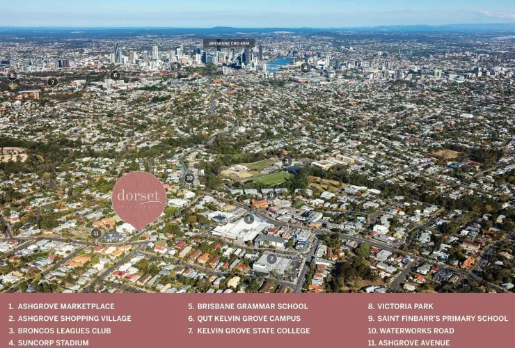
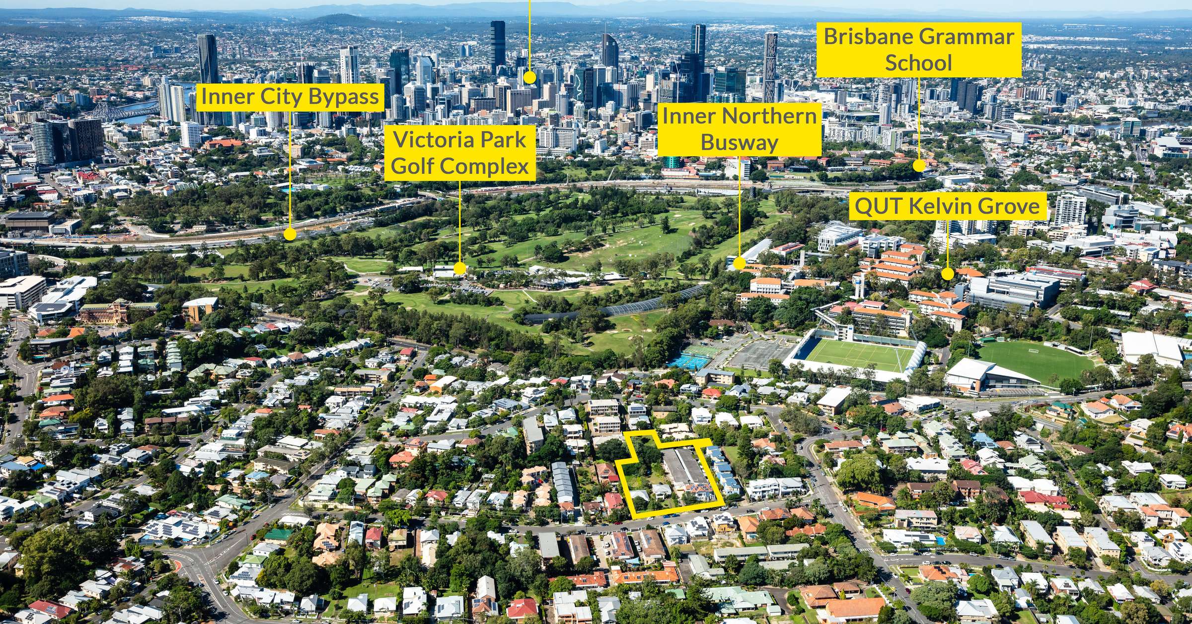
| Distance to | Brisbane CBD - 3 km north Brisbane Airport - 12 km south-west |
Popular Estates near 40-46 Fleming Road, Herston
Updates for 40-46 Fleming Road, Herston
Facebook updates:
Related news:
Coming soon to Unison Projects.

'Sold by Ray White Special Projects Qld | 5,623m²* Brisbane City In-Fill Approved Development Site' - Sold on 1 July 2021 by Ray White Special Projects…
Land & Development Property Sold at 40, 42 and 46 Fleming Road, Herston QLD 4006. Sold by Ray White Special Projects Qld | 5,623sqm* Brisbane City In-Fill Approved Development Site. See if it's right for you or find something similar at Commercial Real Estate.

Missing articles? Send us a link here.
Location & Map for 40-46 Fleming Road, Herston
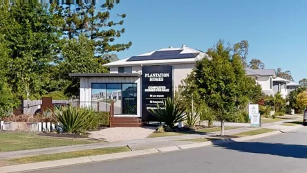
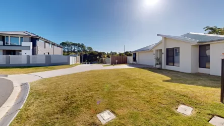
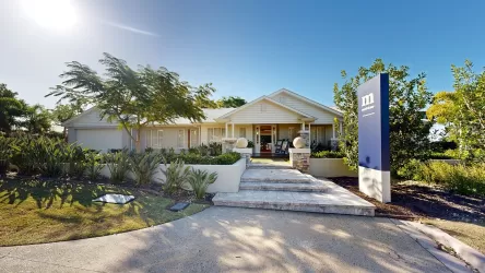
Visit Display Homes near 40-46 Fleming Road, Herston
Vacancy Rate in Herston QLD 4006
View full vacancy rate history in Herston QLD 4006 via SQM Research.
Schools near 40-46 Fleming Road, Herston
Here are 6 schools near 40-46 Fleming Road, Herston:
Prep-12 Government Combined School
10-12 Government Secondary School
Prep-7 Independent Combined School - School Head Campus
5-12 Catholic Combined School - School Head Campus
Prep-6 Catholic Primary School
7-12 Independent Secondary School - School Head Campus
Reviews & Comments on 40-46 Fleming Road, Herston
FAQs about 40-46 Fleming Road, Herston
View all estates from Unison Projects
- Kelvin Grove State College - 717m south-west
- Queensland Academy for Creative Industries - 825m south-west
- Compass Independent School - 1.1km south-west
- St Joseph's College - 1.3km south-east
- St Ambrose's Primary School - 1.4km north-west
- Brisbane Girls Grammar School - 1.4km south
Popular Estates near 40-46 Fleming Road, Herston
Latest New Home Articles for You

19/Aug/2025 | OpenLot.com.au
🏡 Suburb Profile: Beveridge
Beveridge is within the Mitchell Shire, located 42 kilometres north of Me...
19/Aug/2025 | OpenLot.com.au
test2
19/Aug/2025 | OpenLot.com.au
tests
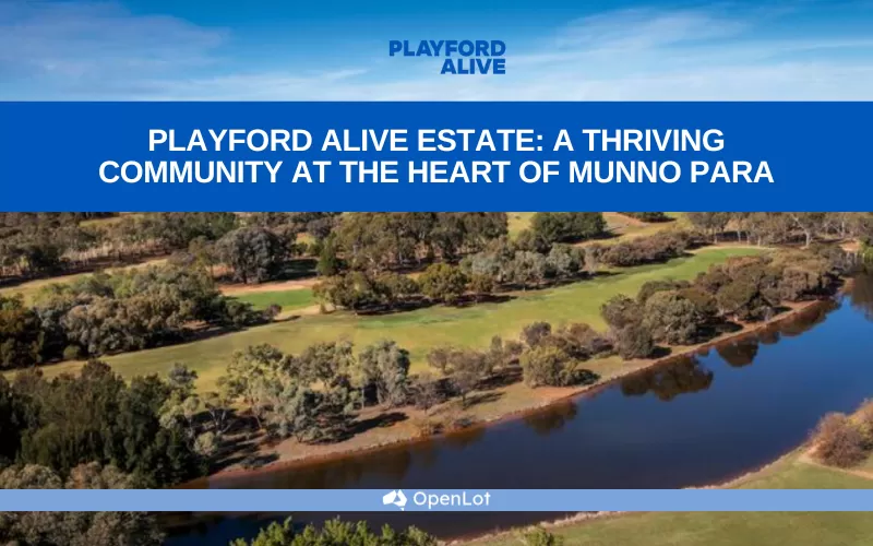
13/Jun/2025 | OpenLot.com.au
Display Homes at Playford Alive Estate: A Thriving Community at the Heart of Munno Para
Welcome to Playford Alive, a vibrant and dynamic masterplanned community ...
11/Jun/2025 | OpenLot.com.au
Display Homes at Ocean Hill Estate: A Thriving Community by the Coast
A short stroll from the white sands of Madora Beach and fringed by the co...
10/Jun/2025 | OpenLot.com.au
Display Homes at Bluestone Estate: An Established Community in the Mount Barker
Whether you’re a first home buyer, a growing family, or looking to downsi...

09/Jun/2025 | OpenLot.com.au
Queensland Leads, But NSW and VIC Fall Behind, in New Housing Buyer Demand Index
New data reveals that Australia’s new housing market remains resilient de...
06/Jun/2025 | OpenLot.com.au
Display Homes at Minters Fields Estate: A Scenic Hillside Community in Mount Barker
Nestled in the heart of Mount Barker, Minters Fields offers a truly remar...
03/Jun/2025 | OpenLot.com.au
🏡 Step Inside a Frenken Home at Smiths Lane
During a recent visit to the Smiths Lane display village, OpenLot.com.au ...