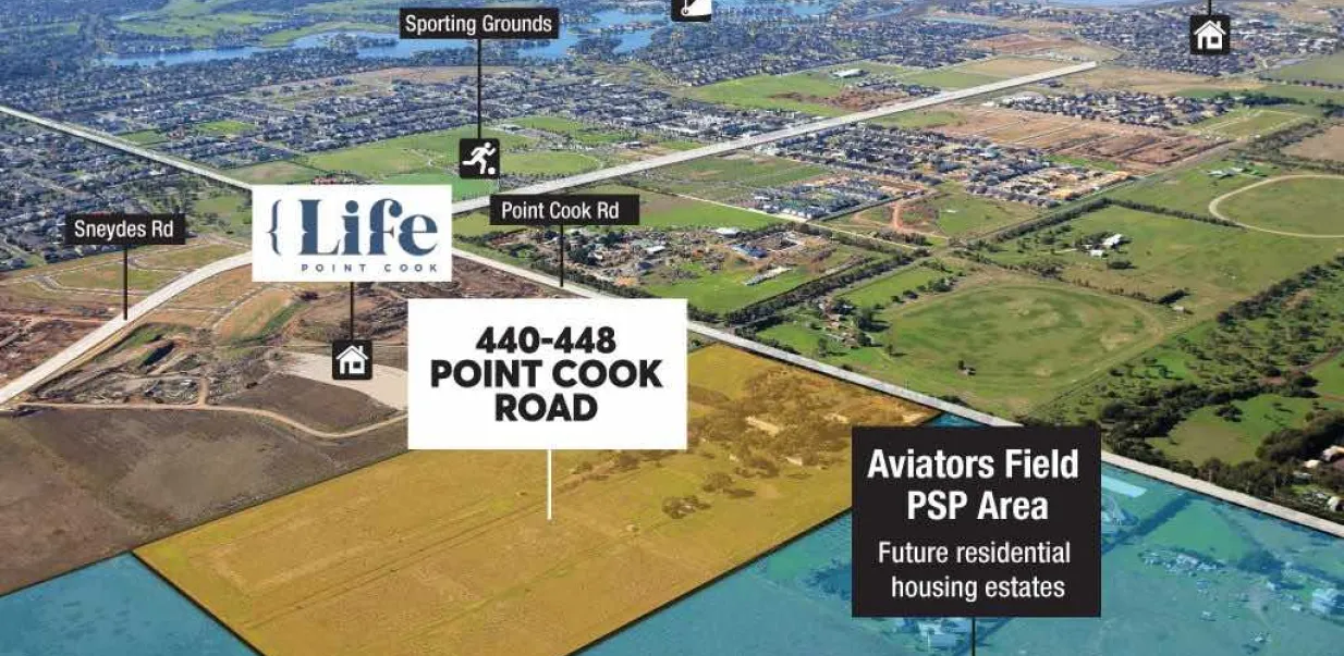
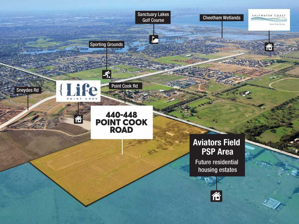
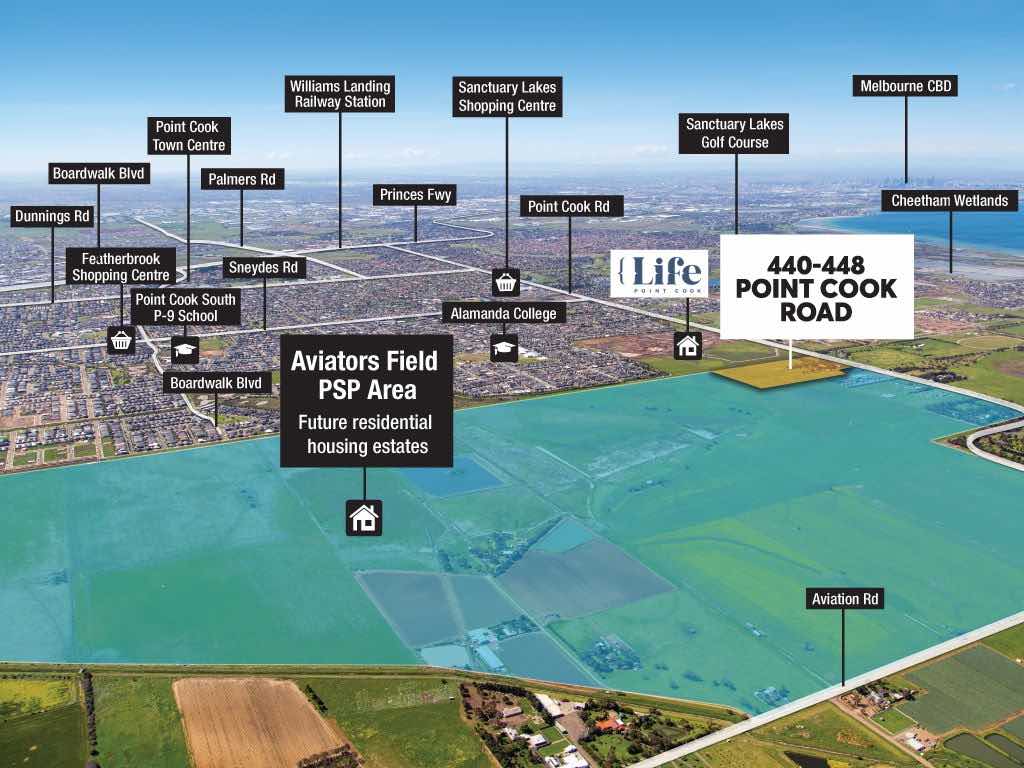
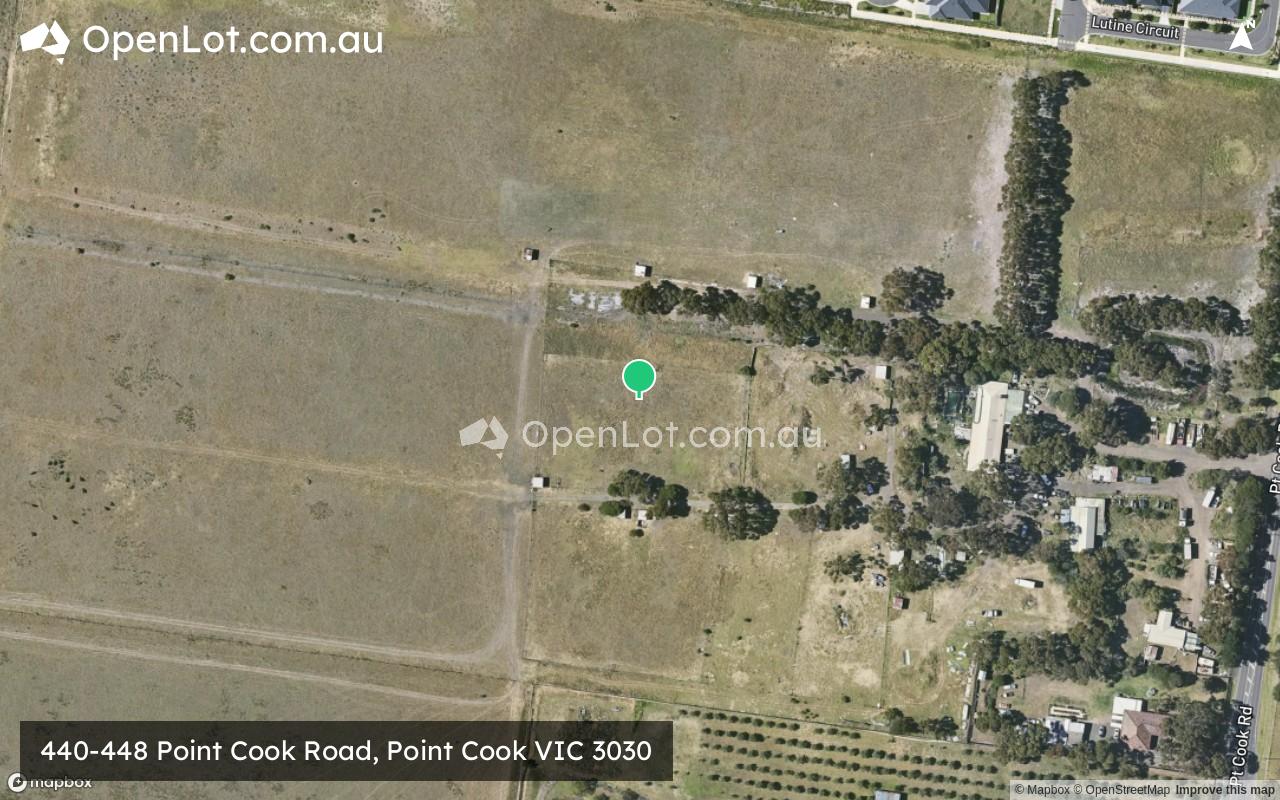
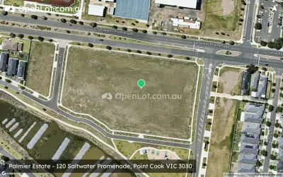
440-448 Point Cook Road, Point Cook VIC 3030
Location & Map for 440-448 Point Cook Road, Point Cook VIC 3030
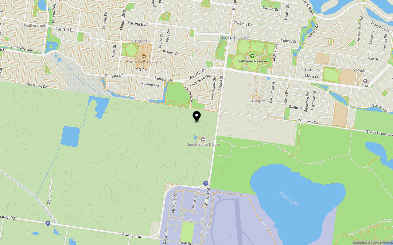
Schools near 440-448 Point Cook Road, Point Cook VIC 3030
Overview
This information is estimated by the OpenLot research team. Let us know here to provide up-to-date information about this development.
| Total new homes | |
| Area Size | 14.01 hectares |
| Growth Region | Melbourne West Growth Corridor |
| City Council | Wyndham City Council |
| Developer | SIG Group |
| Distance to |
Updates for 440-448 Point Cook Road, Point Cook


Land Price Trend in Point Cook VIC 3030
Below shows the price trend from vacant land sales recorded in Point Cook VIC 3030.
The data and information provided by Terralytics (Aust) Pty Ltd (Terralytics Data) is general in nature and is not intended to constitute professional advice. Read more
It should not be relied upon as a substitute for legal, financial, valuation, or other specialist advice relevant to your specific circumstances.
Terralytics uses commercially reasonable endeavours to ensure the Terralytics Data is current and accurate. However, as the Terralytics Data incorporates information sourced from third parties, Terralytics makes no representation or warranty — express or implied — as to its accuracy, completeness, or currency. To the maximum extent permitted by applicable law, Terralytics excludes all liability for any loss or damage (including consequential loss) arising out of or in connection with reliance on the Terralytics Data, whether arising in contract, tort (including negligence), statute, or otherwise.
Popular Estates near 440-448 Point Cook Road, Point Cook


Not exactly what you're looking for? Try surrounding suburbs
Werribee South VIC 3030
1 estate | Wyndham City Council
7.0km south-west
Williams Landing VIC 3027
2 estates | Wyndham City Council
4.6km north
Altona North VIC 3025
5 estates | Hobsons Bay City Council
7.6km north-east
Hoppers Crossing VIC 3029
2 estates | Wyndham City Council
7.1km north-west
Laverton VIC 3028
1 estate | Hobsons Bay City Council
4.8km north
Altona VIC 3018
2 estates | Hobsons Bay City Council
6.1km north-east
Latest published articles


FAQs about 440-448 Point Cook Road, Point Cook VIC 3030
SIG Group is the developer behind 440-448 Point Cook Road, Point Cook VIC 3030.
440-448 Point Cook Road, Point Cook VIC 3030 consists of 200 homes.
The total area for 440-448 Point Cook Road, Point Cook VIC 3030 is 14.01 hectares.
440-448 Point Cook Road, Point Cook VIC 3030 falls under Wyndham City Council.
440-448 Point Cook Road, Point Cook VIC 3030 is 22 km south-west of Melbourne CBD.
Nearby schools for 440-448 Point Cook Road, Point Cook VIC 3030:
- Alamanda K-9 College - 1.0km north-west
- St Mary of the Cross Catholic Primary School - 1.7km north-east
- Homestead Senior Secondary College - 1.7km east
- Saltwater P-9 College - 1.9km east
- Featherbrook P-9 College - 2.4km north-west
- Lumen Christi School - 2.6km north