
Property types for sale
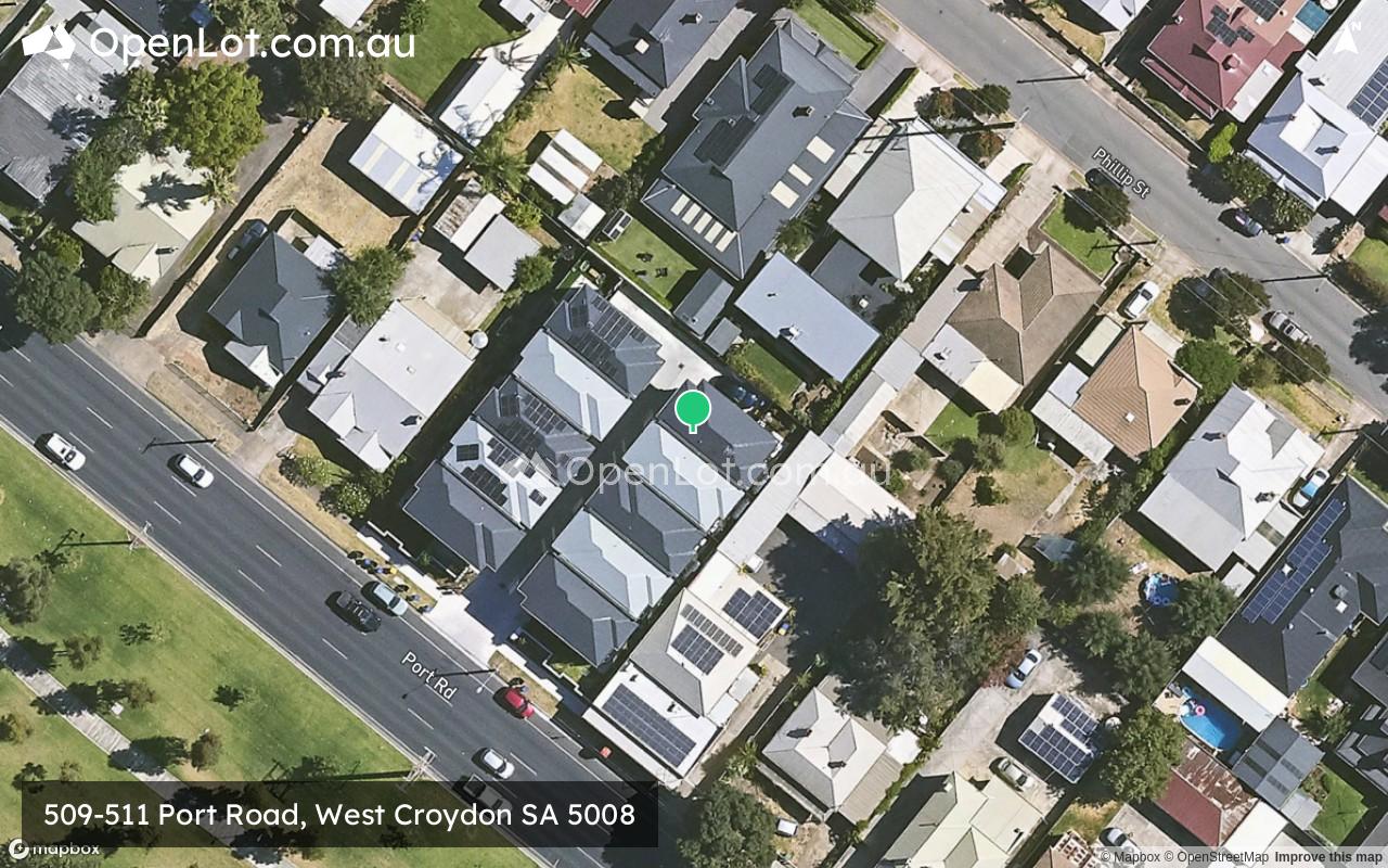
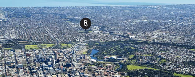
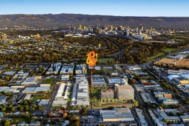
Location & Map for 509-511 Port Road, West Croydon SA 5008
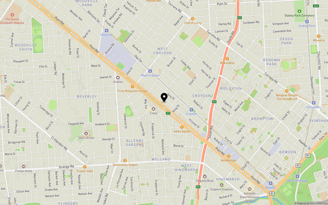
Schools near 509-511 Port Road, West Croydon SA 5008
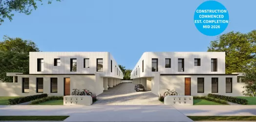
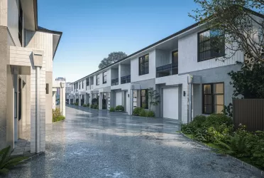
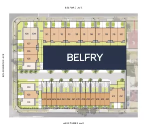
Overview
This information is estimated by the OpenLot research team. Let us know here to provide up-to-date information about this development.
| Total new homes | |
| Area Size | 0.12 hectares |
| Growth Region | Adelaide North Growth Areas |
| City Council | City of Charles Sturt |
| Developer | N/A |
| Distance to |
Land Price Trend in West Croydon SA 5008
Below shows the price trend from vacant land sales recorded in West Croydon SA 5008.
The data and information provided by Terralytics (Aust) Pty Ltd (Terralytics Data) is general in nature and is not intended to constitute professional advice. Read more
It should not be relied upon as a substitute for legal, financial, valuation, or other specialist advice relevant to your specific circumstances.
Terralytics uses commercially reasonable endeavours to ensure the Terralytics Data is current and accurate. However, as the Terralytics Data incorporates information sourced from third parties, Terralytics makes no representation or warranty — express or implied — as to its accuracy, completeness, or currency. To the maximum extent permitted by applicable law, Terralytics excludes all liability for any loss or damage (including consequential loss) arising out of or in connection with reliance on the Terralytics Data, whether arising in contract, tort (including negligence), statute, or otherwise.
Popular Estates near 509-511 Port Road, West Croydon

Not exactly what you're looking for? Try surrounding suburbs
Bowden SA 5007
4 estates | City of Charles Sturt
2.3km south-east
Allenby Gardens SA 5009
2 estates | City of Charles Sturt
1.6km south-west
Brompton SA 5007
1 estate | City of Charles Sturt
1.8km south-east
Devon Park SA 5008
1 estate | City of Port Adelaide Enfield
1.9km east
Woodville Park SA 5011
1 estate | City of Charles Sturt
1.3km north-west
Welland SA 5007
1 estate | City of Charles Sturt
1.7km south
Latest published articles


FAQs about 509-511 Port Road, West Croydon SA 5008
509-511 Port Road, West Croydon SA 5008 consists of 10 homes.
The total area for 509-511 Port Road, West Croydon SA 5008 is 0.12 hectares.
509-511 Port Road, West Croydon SA 5008 falls under City of Charles Sturt.
509-511 Port Road, West Croydon SA 5008 is 4 km north-west of Adelaide CBD.
Nearby schools for 509-511 Port Road, West Croydon SA 5008:
- Australian Islamic College Adelaide - 617m north-east
- Allenby Gardens Primary School - 794m south-west
- Kilkenny Primary School - 819m north-west
- St Joseph's School - 949m south-east
- Adelaide Secondary School of English - 1.3km north-east
- St Margaret Mary's School - 1.5km north