
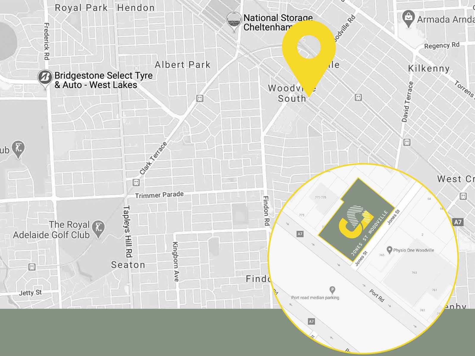
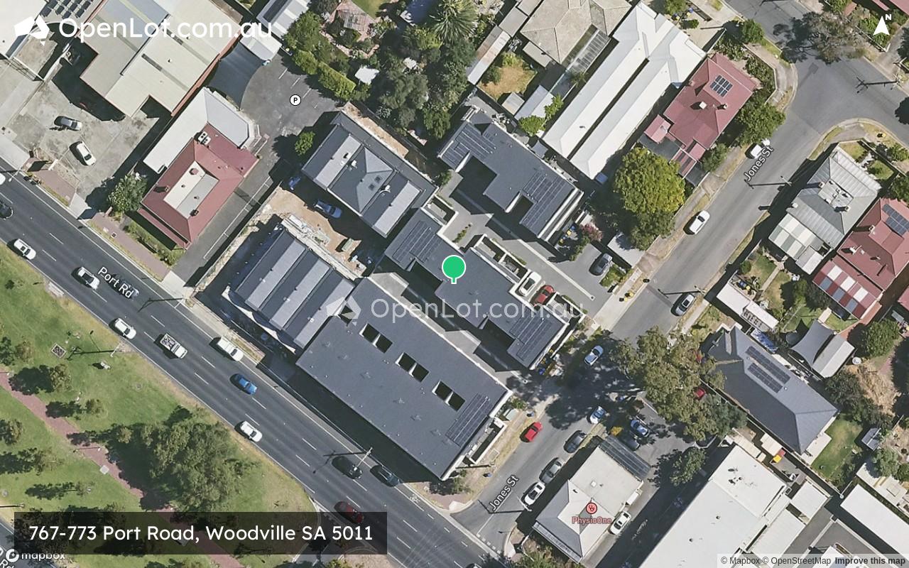
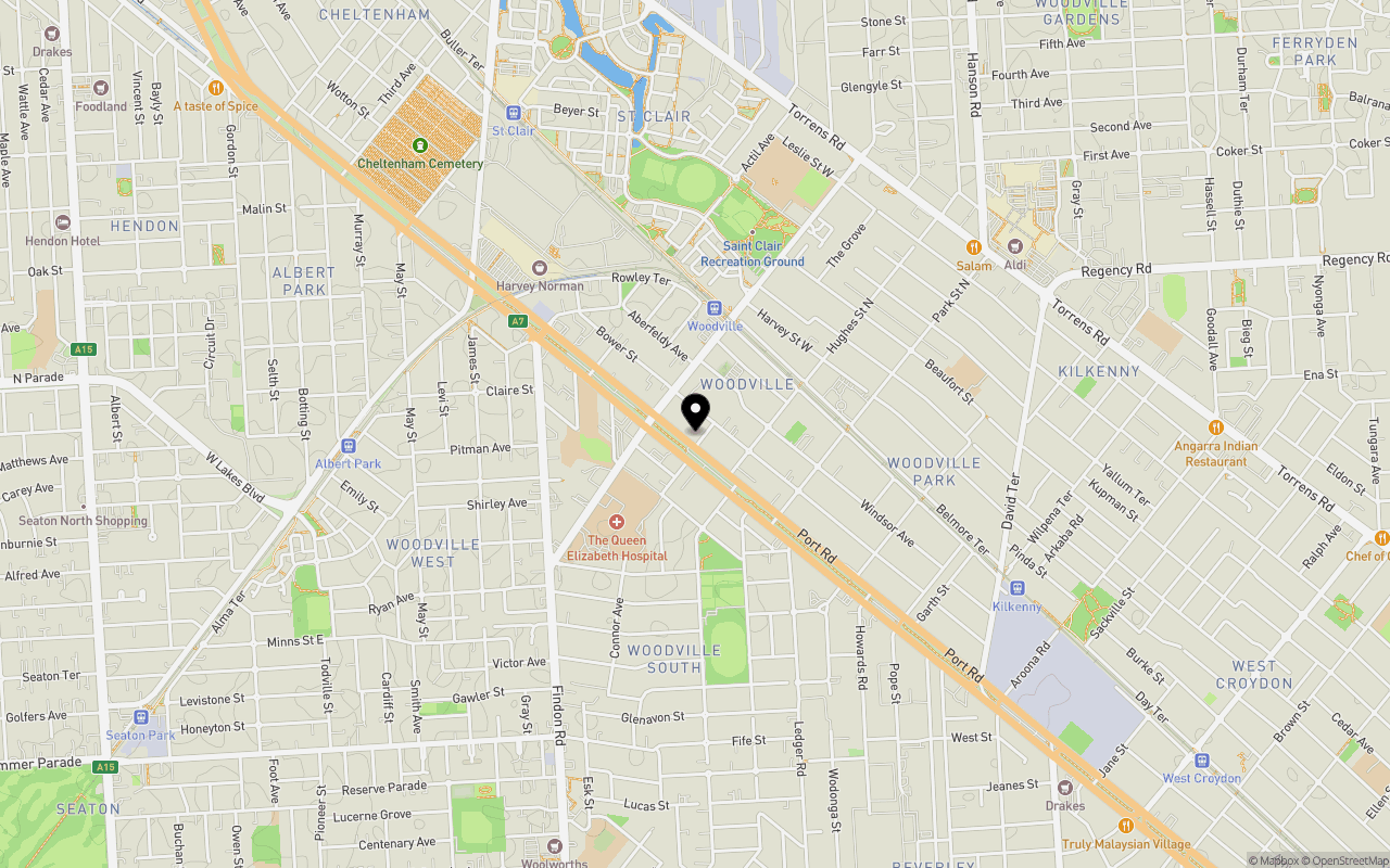
Location & Map for 767-773 Port Road, Woodville SA 5011
Schools near 767-773 Port Road, Woodville SA 5011
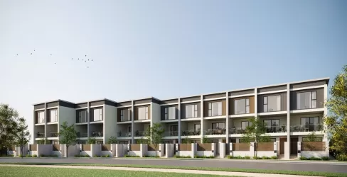
Overview
This information is estimated by the OpenLot research team. Let us know here to provide up-to-date information about this development.
| Total new homes | |
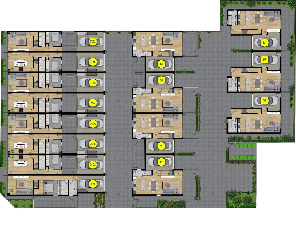
| Area Size | 0.22 hectares |
| Growth Region | Adelaide North Growth Areas |
| City Council | City of Charles Sturt |
| Developer | N/A |
| Distance to |
Popular Estates near 767-773 Port Road, Woodville


Not exactly what you're looking for? Try surrounding suburbs
St Clair SA 5011
6 estates | City of Charles Sturt
821m north-west
Woodville West SA 5011
1 estate | City of Charles Sturt
1.4km south-west
Findon SA 5023
1 estate | City of Charles Sturt
2.4km south
West Croydon SA 5008
1 estate | City of Charles Sturt
2.4km south-east
Woodville Gardens SA 5012
2 estates | City of Port Adelaide Enfield
1.8km north-east
Woodville Park SA 5011
1 estate | City of Charles Sturt
1.1km south-east
Latest published articles


FAQs about 767-773 Port Road, Woodville SA 5011
767-773 Port Road, Woodville SA 5011 consists of 15 homes.
The total area for 767-773 Port Road, Woodville SA 5011 is 0.22 hectares.
767-773 Port Road, Woodville SA 5011 falls under City of Charles Sturt.
767-773 Port Road, Woodville SA 5011 is 7 km north-west of Adelaide CBD.
Nearby schools for 767-773 Port Road, Woodville SA 5011:
- Woodville Primary School - 392m west
- Whitefriars School - 979m east
- Woodville High School - 982m north
- The Grove Education Centre - 1.1km north-east
- Our Lady Queen of Peace School - 1.4km west