
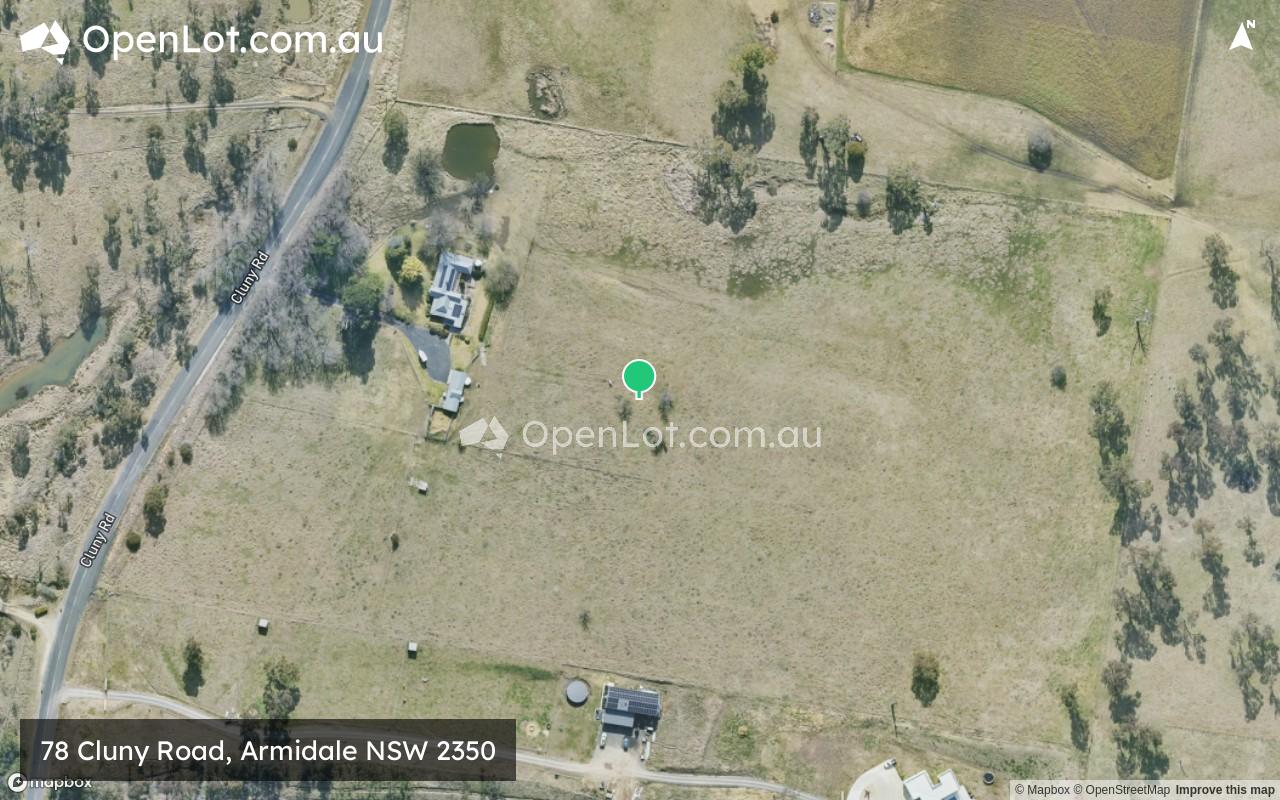
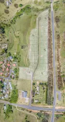
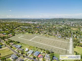
Location & Map for 78 Cluny Road, Armidale NSW 2350
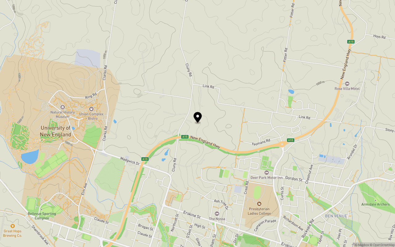
Schools near 78 Cluny Road, Armidale NSW 2350
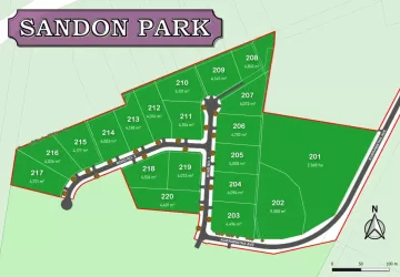
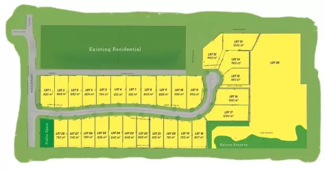
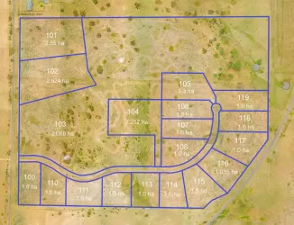
Overview
This information is estimated by the OpenLot research team. Let us know here to provide up-to-date information about this development.
| Total new homes | |
| Area Size | 8.55 hectares |
| City Council | Armidale Regional Council |
| Developer | N/A |
Updates for 78 Cluny Road, Armidale
Land Price Trend in Armidale NSW 2350
Below shows the price trend from vacant land sales recorded in Armidale NSW 2350.
The data and information provided by Terralytics (Aust) Pty Ltd (Terralytics Data) is general in nature and is not intended to constitute professional advice. Read more
It should not be relied upon as a substitute for legal, financial, valuation, or other specialist advice relevant to your specific circumstances.
Terralytics uses commercially reasonable endeavours to ensure the Terralytics Data is current and accurate. However, as the Terralytics Data incorporates information sourced from third parties, Terralytics makes no representation or warranty — express or implied — as to its accuracy, completeness, or currency. To the maximum extent permitted by applicable law, Terralytics excludes all liability for any loss or damage (including consequential loss) arising out of or in connection with reliance on the Terralytics Data, whether arising in contract, tort (including negligence), statute, or otherwise.
Popular Estates near 78 Cluny Road, Armidale

Not exactly what you're looking for? Try surrounding suburbs
North Tamworth NSW 2340
5 estates | Tamworth Regional Council
92.6km south-west
Nemingha NSW 2340
1 estate | Tamworth Regional Council
92.3km south-west
East Tamworth NSW 2340
2 estates | Tamworth Regional Council
94.1km south-west
Moore Creek NSW 2340
5 estates | Tamworth Regional Council
86.2km south-west
Oxley Vale NSW 2340
1 estate | Tamworth Regional Council
93.8km south-west
Kootingal NSW 2352
1 estate | Tamworth Regional Council
83.2km south-west
Latest published articles


FAQs about 78 Cluny Road, Armidale NSW 2350
78 Cluny Road, Armidale NSW 2350 consists of 92 homes.
The total area for 78 Cluny Road, Armidale NSW 2350 is 8.55 hectares.
78 Cluny Road, Armidale NSW 2350 falls under Armidale Regional Council.
Nearby schools for 78 Cluny Road, Armidale NSW 2350:
- Sandon Public School - 1.1km south
- PLC Armidale - 1.3km south-east
- OneSchool Global NSW - Armidale - 1.8km south
- Ben Venue Public School - 2.2km south-east
- Drummond Memorial Public School - 2.7km south
- St Mary's Primary School - 3.2km south