
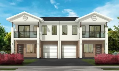
Property types for sale
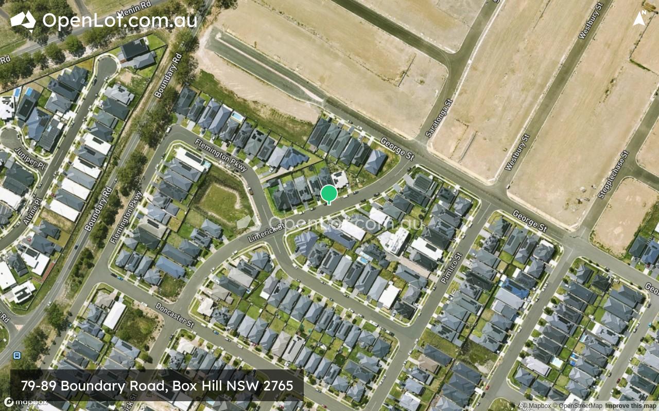
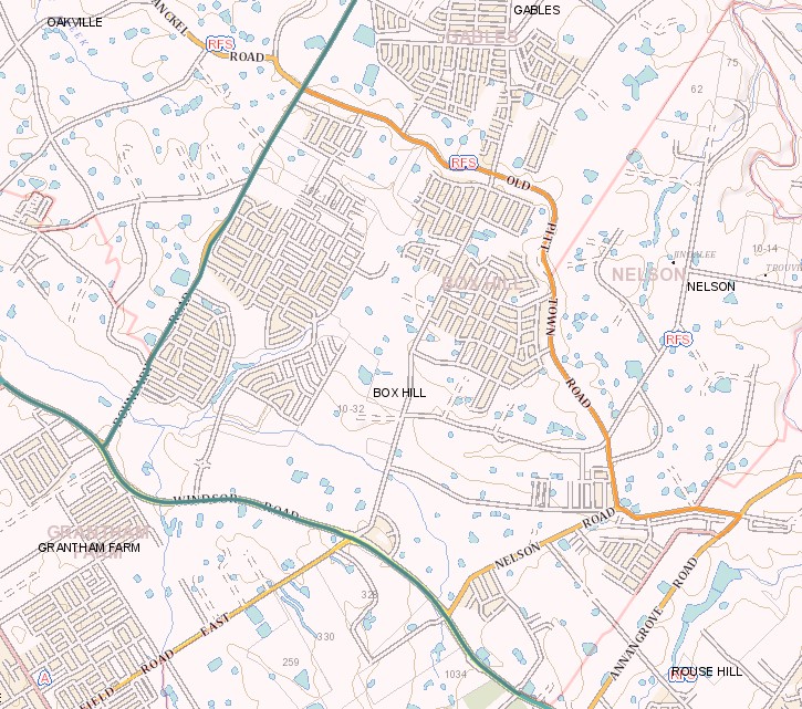
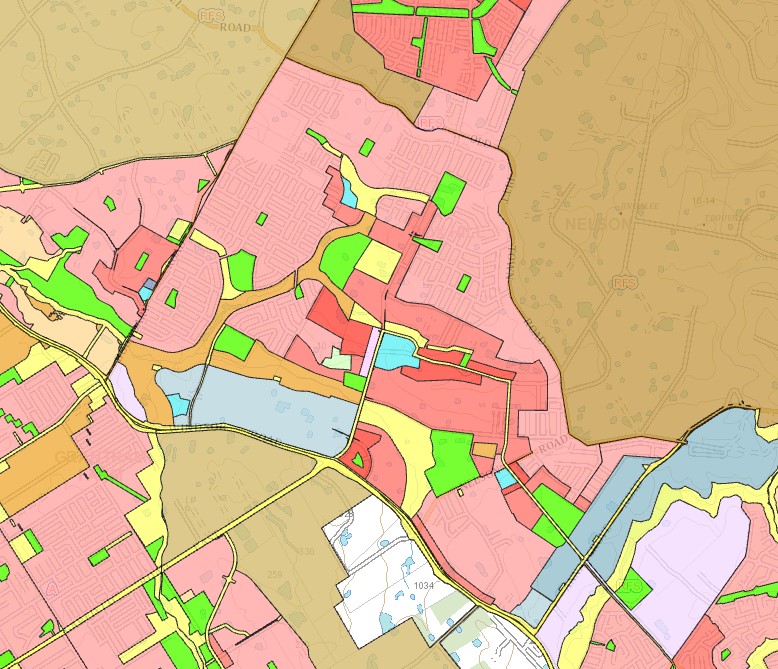
Location & Map for 79-89 Boundary Road, Box Hill NSW 2765
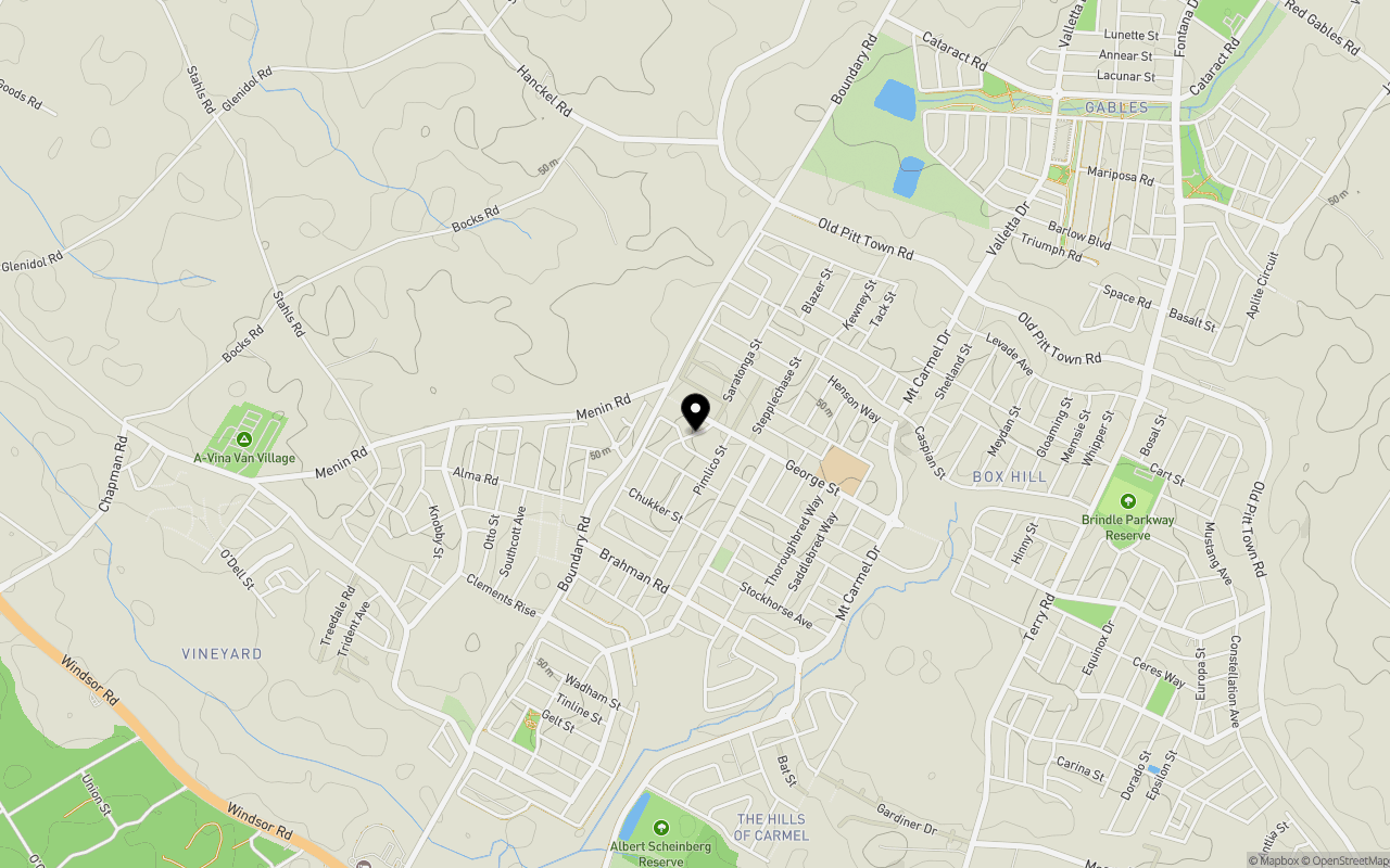
Schools near 79-89 Boundary Road, Box Hill NSW 2765
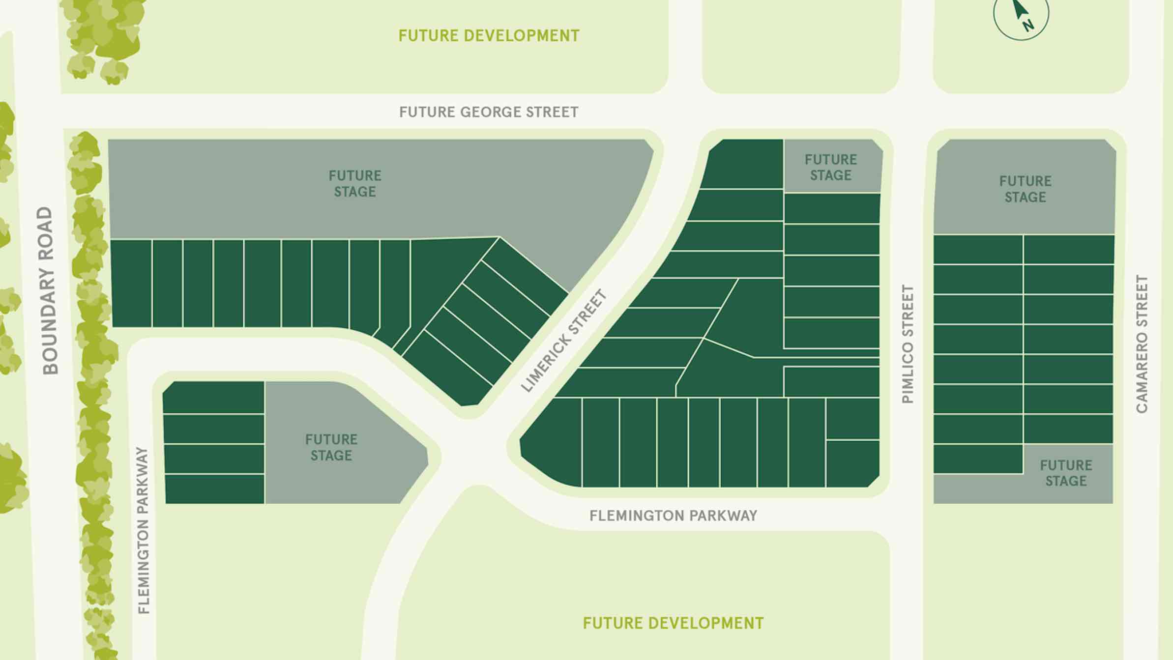
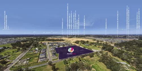
Overview
This information is estimated by the OpenLot research team. Let us know here to provide up-to-date information about this development.
| Total new homes | |
| Area Size | 4.30 hectares |
| Growth Region | Sydney North West Growth Areas |
| City Council | The Hills Shire Council |
| Developer | Rawson Homes |
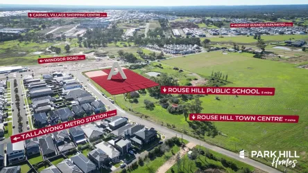
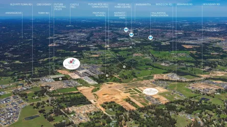
| Distance to |
Suburb Planning Review in Box Hill NSW 2765
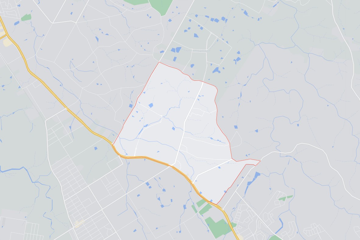
Box Hill is approximately 9.4 square kilometres within the Hills Shire Council, forming part of the Greater Western Sydney region in New South Wales, located 42 kilometres north west of Sydney. A northern part of the suburb was reallocated in 2020 to a newly formed suburb of Gables and at the same time acquired a small area of Rouse Hill to the south east.
The suburb does not have a business district and is primarily made up of large rural residential properties, patches of urbanised residential areas and industrial pockets. An increase in residential density is being established in the north and west of the suburb.
The suburb boundary is located along Boundary Road to the west and Annangrove Road to the east. The suburb boundaries are along Old Pitt Town Road to the north and Windsor Road to the south. Terry Road, Mount Carmel Drive and Nelson Road run through Box Hill, providing access to the surrounding suburbs and the local network of roads. Killarney Chain of Ponds continues from the adjoining suburb of Vineyard and splits into other smaller creek corridors connected by a series of water holes.
North West Priority Growth Area in Box Hill
Sydney’s North West forms part of the new approach to planning in NSW, with the Department of Planning and Environment working closely with The Hills Shire Council, stakeholders and the community to produce a rezoning plan for new homes and essential infrastructure, to help meet local community needs.
Box Hill forms part of the North West Growth Area and a Development Control Plan (DCP) was prepared to embed density controls in precinct plans to ensure that infrastructure planning aligns with growth. This Plan is known as the associated Box Hill and Box Hill Industrial Development Control Plan (DCP) was adopted and came into force on 23 April 2013 and was recently amended in 2018. The amendment included the relocation of Mt Carmel Road and changes to employment land in Box Hill and Box Hill Industrial precincts along Terry and Annangrove Road.
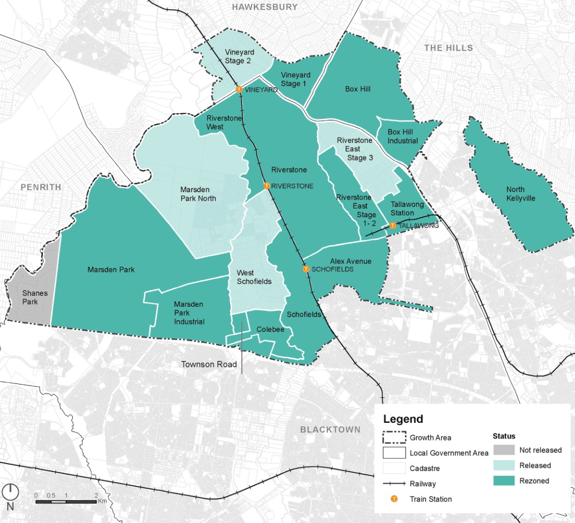
The Hills Shire Council prepared the Growth Centres Precinct Development Control Plan (DCP) that was adopted by the Department of Planning and Environment on June 2021 and came into force on 6 July 2021.
The DCP was prepared to provide additional guidance to developers, simplify the planning and ensure the orderly, efficient and environmentally sensitive development within the Precinct. The Box Hill Growth Centre Precinct is to be envisaged by the North West Sector Structure Plan and refined by the Box Hill Growth Centre Precincts Indicative Layout Plan.
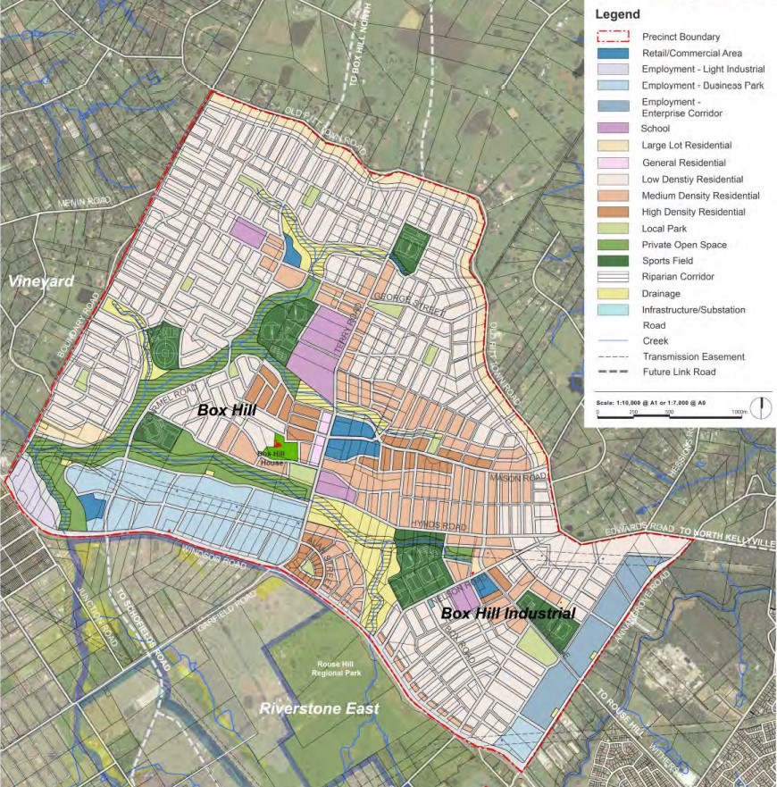
Box Hill Precinct
The Box Hill Growth Centre Precinct provides the planning so new development provides residential and employment areas that respond to the Precincts’ natural environment. A mix of recreation, employment and residential will be designed to address public transport use, walking and cycling.
The New South Wales State Government aimed to provide a new precinct that was an attractive and well-connected community, in proximity to public transport, community facilities, open space and retail.
It is noted that the Precinct of Gable will use parts of the former Box Hill suburb for redevelopment growth.
The Vision of Box Hill
“The planning for the Box Hill Growth Centre Precincts promotes the development of a vibrant residential and employment urban area that responds to the Precincts’ natural environment, represented in its streams, landform, heritage, environmental characteristics and landscape setting”.
“The planning of the Precincts seeks to promote a community that is less dependent on private vehicle use thereby contributes to a reduced carbon footprint”.
“A balanced mix and distribution of recreation, employment and residential uses encourage public transport, walking and cycling. A safe and permeable street network promotes accessibility, connectivity and social interaction”.
“Direct connections to nearby regional transport hubs, including the Rouse Hill, Riverstone, Area 20 and Schofields Road Transit Boulevard ensure regional public transport accessibility”.
“Retail and commercial areas complement and support surrounding centres. The centrally located Box Hill Town Centre provides the retail, commercial and community services that promote a community hub. Three villages and two neighbourhood centres service all local residential and employment areas”.
“A business park, an enterprise corridor and a light industrial area provide a mix of local and regional employment opportunities that meet the regional demand for jobs”.
Precinct Zoning in Box Hill
The existing zoning will be amended to provide for future infrastructures to facilitate future development within the Box Hill Growth Centre Precincts. A new village centre including a supermarket and some community facilities is planned to meet the local shopping needs of future residents.
A new road network has been designed to help provide safe streets for residents, cycling and walking paths, and provide direct access to the village centre. The new roads will enable bus services to connect people to surrounding suburbs and areas for schools, employment, retail, open spaces and services.
Pedestrian and cyclist facilities will be constructed along open space and creek corridors that will access the new residential areas.
The rezoning of Box Hill will create a new community with shops, cafes and substantial green open space in Sydney's North West. Green spaces will be integrated with new homes with landscaping and tree planting along streets and in public domain areas, and with protected remnant stands of vegetation, for local residents to enjoy.
Box Hill Suburb Summary
| Suburb | Box Hill |
| City / State | The Hills Shire Council, New South Wales |
| Suburb Area | 9.4 square kilometres |
| Boundary |
|
| Box Hill and Box Hill Industrial Precinct Inclusions | |
| Suburb inclusions |
|
| Community Amenity |
|
| Location | Box Hill, 42 kilometres northwest of Sydney |
| Education | new primary and high schools |
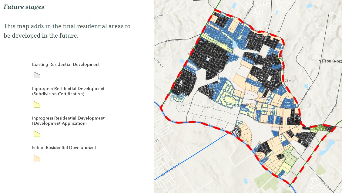
| Types of Residential | Housing choice and diversity to meet the needs of the community, through a mix of housing styles including stand-alone, R2 low-density dwellings, terraces on land rezoned for R3 medium-density development and R4 high-density development |
| Employment Areas | Local business and village centre, school and services |
| Infrastructure | Roads |
| Transportation | Local road network |
| Recreation Areas | 4 sports fields, 7 local parks and an open space watercourse corridor |
| Environment | Creek corridor |
| Settlement Pattern | Informal grid with separated land uses (Residential and Industrial) |
References
Updates for 79-89 Boundary Road, Box Hill
Land Price Trend in Box Hill NSW 2765
Below shows the price trend from vacant land sales recorded in Box Hill NSW 2765.
The data and information provided by Terralytics (Aust) Pty Ltd (Terralytics Data) is general in nature and is not intended to constitute professional advice. Read more
It should not be relied upon as a substitute for legal, financial, valuation, or other specialist advice relevant to your specific circumstances.
Terralytics uses commercially reasonable endeavours to ensure the Terralytics Data is current and accurate. However, as the Terralytics Data incorporates information sourced from third parties, Terralytics makes no representation or warranty — express or implied — as to its accuracy, completeness, or currency. To the maximum extent permitted by applicable law, Terralytics excludes all liability for any loss or damage (including consequential loss) arising out of or in connection with reliance on the Terralytics Data, whether arising in contract, tort (including negligence), statute, or otherwise.
Popular Estates near 79-89 Boundary Road, Box Hill


Not exactly what you're looking for? Try surrounding suburbs
Grantham Farm NSW 2765
12 estates | Blacktown City Council
2.0km south
Riverstone NSW 2765
17 estates | Blacktown City Council
4.0km south
Gables NSW 2765
10 estates | The Hills Shire Council
3.4km east
Rouse Hill NSW 2155
28 estates | Blacktown City Council, The Hills Shire Council
4.7km south-east
Oakville NSW 2765
9 estates | Hawkesbury City Council
2.2km north
Vineyard NSW 2765
9 estates | Blacktown City Council, Hawkesbury City Council
1.9km west
Latest published articles


FAQs about 79-89 Boundary Road, Box Hill NSW 2765
Rawson Homes is the developer behind 79-89 Boundary Road, Box Hill NSW 2765.
The total area for 79-89 Boundary Road, Box Hill NSW 2765 is 4.30 hectares.
79-89 Boundary Road, Box Hill NSW 2765 falls under The Hills Shire Council.
79-89 Boundary Road, Box Hill NSW 2765 is 38 km north-west of Sydney CBD.
Nearby schools for 79-89 Boundary Road, Box Hill NSW 2765:
- Santa Sophia Catholic College (Secondary) - 2.7km north-east
- Santa Sophia Catholic College (Primary) - 2.7km north-east
- Oakville Public School - 2.7km north-west
- Vineyard Public School - 2.7km west
- St John's Primary School - 4.0km south
- Arndell Anglican College - 4.1km north-west