
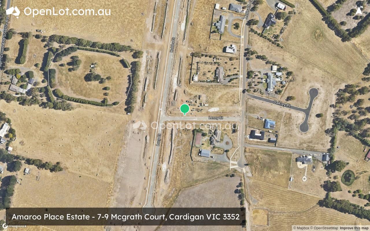
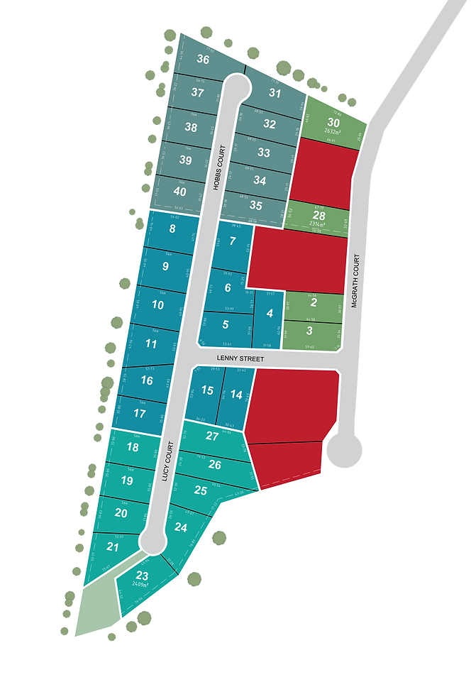
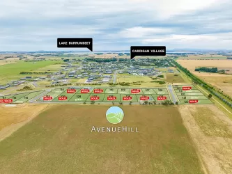
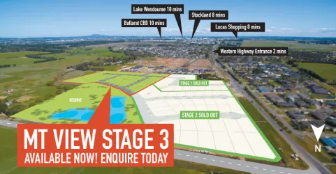
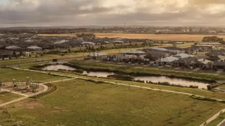
Amaroo Place Estate - Cardigan


- Titles for stage 1 – Late December 2023, end of January 2024
- Fully serviced (sewer, water, gas, power, nbn)
- Kerb and Channel and footpaths
- NBN – Fibre to the Premises
Property types for sale
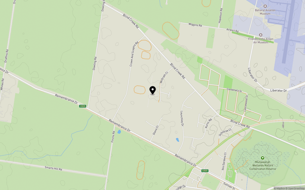
Location & Map for Amaroo Place Estate - Cardigan
Schools near Amaroo Place Estate - Cardigan
Overview
This information is estimated by the OpenLot research team. Let us know here to provide up-to-date information about this development.
| Total new homes | |
| Area Size | 11.12 hectares |
| Growth Region | City of Ballarat Growth Areas |
| City Council | Ballarat City Council |
| Developer | N/A |
| Project Marketer | Doepel Lilley & Taylor |
| Distance to |
Land Price Trend in Cardigan VIC 3352
Below shows the price trend from vacant land sales recorded in Cardigan VIC 3352.
The data and information provided by Terralytics (Aust) Pty Ltd (Terralytics Data) is general in nature and is not intended to constitute professional advice. Read more
It should not be relied upon as a substitute for legal, financial, valuation, or other specialist advice relevant to your specific circumstances.
Terralytics uses commercially reasonable endeavours to ensure the Terralytics Data is current and accurate. However, as the Terralytics Data incorporates information sourced from third parties, Terralytics makes no representation or warranty — express or implied — as to its accuracy, completeness, or currency. To the maximum extent permitted by applicable law, Terralytics excludes all liability for any loss or damage (including consequential loss) arising out of or in connection with reliance on the Terralytics Data, whether arising in contract, tort (including negligence), statute, or otherwise.
Popular Estates near Amaroo Place Estate - Cardigan


Not exactly what you're looking for? Try surrounding suburbs
Lucas VIC 3350
2 estates | Ballarat City Council
3.3km south-east
Winter Valley VIC 3358
11 estates | Ballarat City Council
7.2km south-east
Miners Rest VIC 3352
5 estates | Ballarat City Council
6.7km north-east
Alfredton VIC 3350
10 estates | Ballarat City Council
7.0km south-east
Smythes Creek VIC 3351
4 estates | Ballarat City Council
8.0km south
Mitchell Park VIC 3355
1 estate | Ballarat City Council
2.6km north-east
Latest published articles


FAQs about Amaroo Place Estate - Cardigan
Amaroo Place Estate - Cardigan consists of 30 homes.
The total area for Amaroo Place Estate - Cardigan is 11.12 hectares.
Amaroo Place Estate - Cardigan falls under Ballarat City Council.
Amaroo Place Estate - Cardigan is 7 km north-west of Ballarat CBD.
Doepel Lilley & Taylor is the project marketer for Amaroo Place Estate - Cardigan.
Nearby schools for Amaroo Place Estate - Cardigan:
- Siena Catholic Primary School - 2.3km south-east
- Lucas Primary School - 2.5km south-east
- St Thomas More School - 4.0km south-east
- Alfredton Primary School - 4.2km south-east
- Yuille Park Community College - 4.6km east
- Our Lady Help of Christians School - 5.1km east