
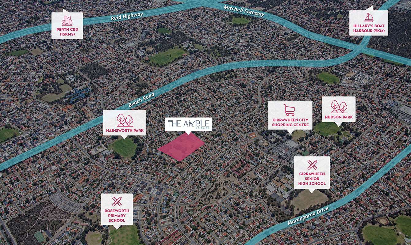
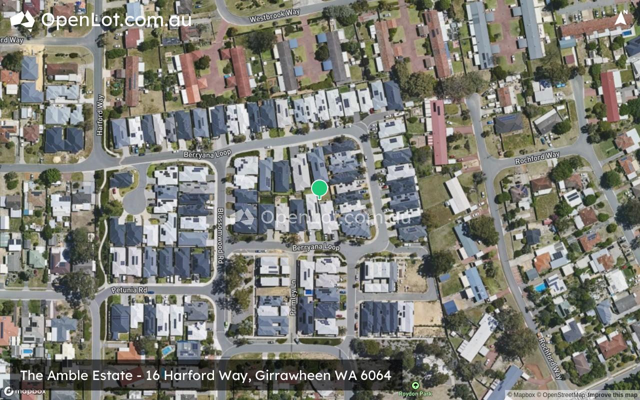
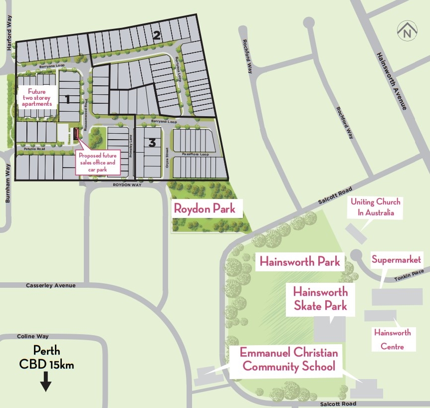
Location & Map for The Amble Estate - Girrawheen
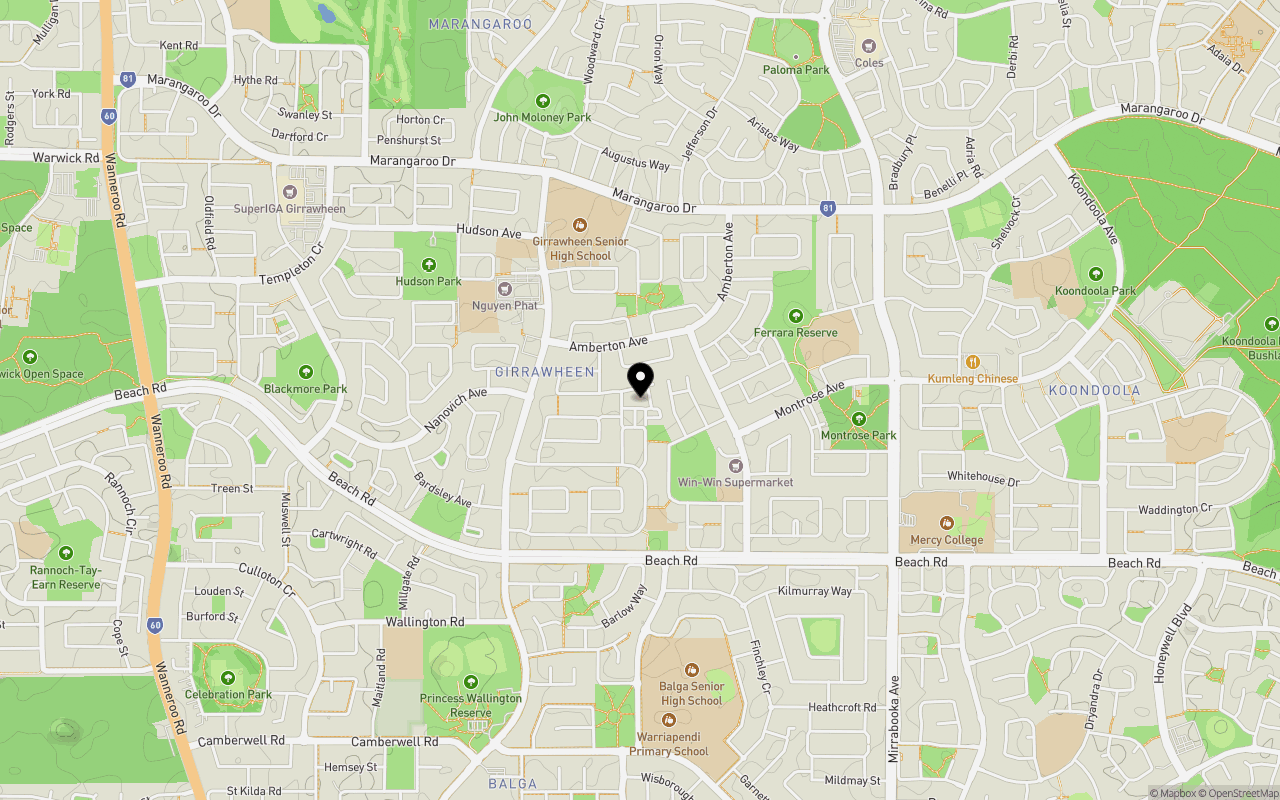
Schools near The Amble Estate - Girrawheen
The Amble Girrawheen Video
Overview
This information is estimated by the OpenLot research team. Let us know here to provide up-to-date information about this development.
| Total new homes | |
| Area Size | 4.20 hectares |
| Growth Region | Perth North West Growth Areas |
| City Council | City of Wanneroo |
| Developer | Yolk Property Group |
| Project Marketer | Link Residential Group |
Updates for The Amble Estate - Girrawheen


Popular Estates near The Amble Estate - Girrawheen

Not exactly what you're looking for? Try surrounding suburbs
Landsdale WA 6065
7 estates | City of Wanneroo
4.1km north-east
Balcatta WA 6021
1 estate | City of Stirling
4.1km south-west
Darch WA 6065
2 estates | City of Wanneroo
3.2km north
Greenwood WA 6024
1 estate | City of Joondalup
3.9km west
Carine WA 6020
1 estate | City of Stirling
5.1km west
Madeley WA 6065
1 estate | City of Wanneroo
3.4km north
Latest published articles


FAQs about The Amble Estate - Girrawheen
Yolk Property Group is the developer behind The Amble Estate - Girrawheen.
The Amble Estate - Girrawheen consists of 130 homes.
The total area for The Amble Estate - Girrawheen is 4.20 hectares.
The Amble Estate - Girrawheen falls under City of Wanneroo.
Link Residential Group is the project marketer for The Amble Estate - Girrawheen.
Nearby schools for The Amble Estate - Girrawheen:
- Emmanuel Christian Community School - 492m south-east
- Girrawheen Senior High School - 647m north-west
- Hudson Park Primary School - 765m north-west
- Roseworth Primary School - 805m east
- Roseworth Education Support Centre - 805m east
- Our Lady of Mercy Primary School - 832m north-west