
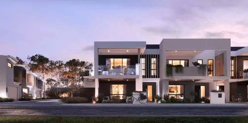
Property types for sale
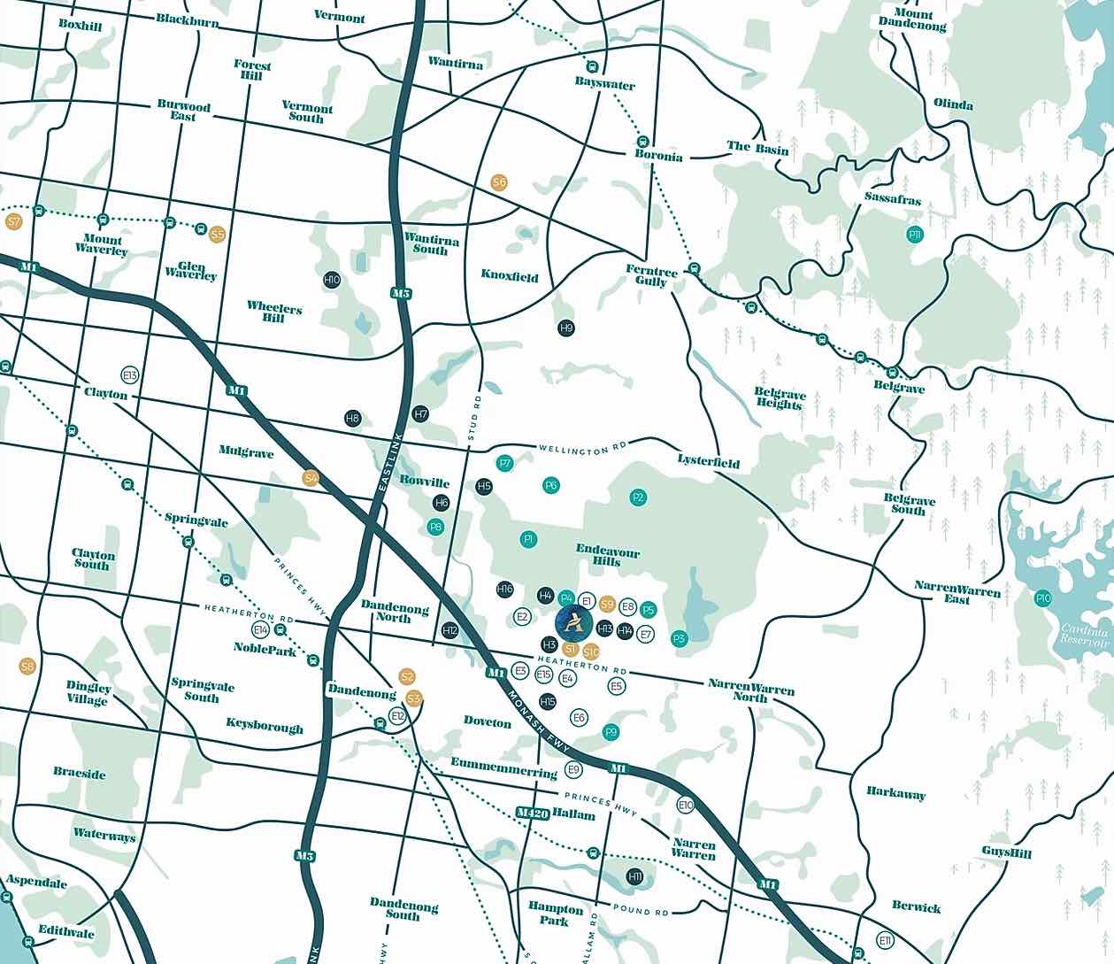
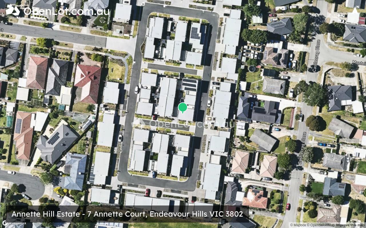
Location & Map for Annette Hill Estate - Endeavour Hills
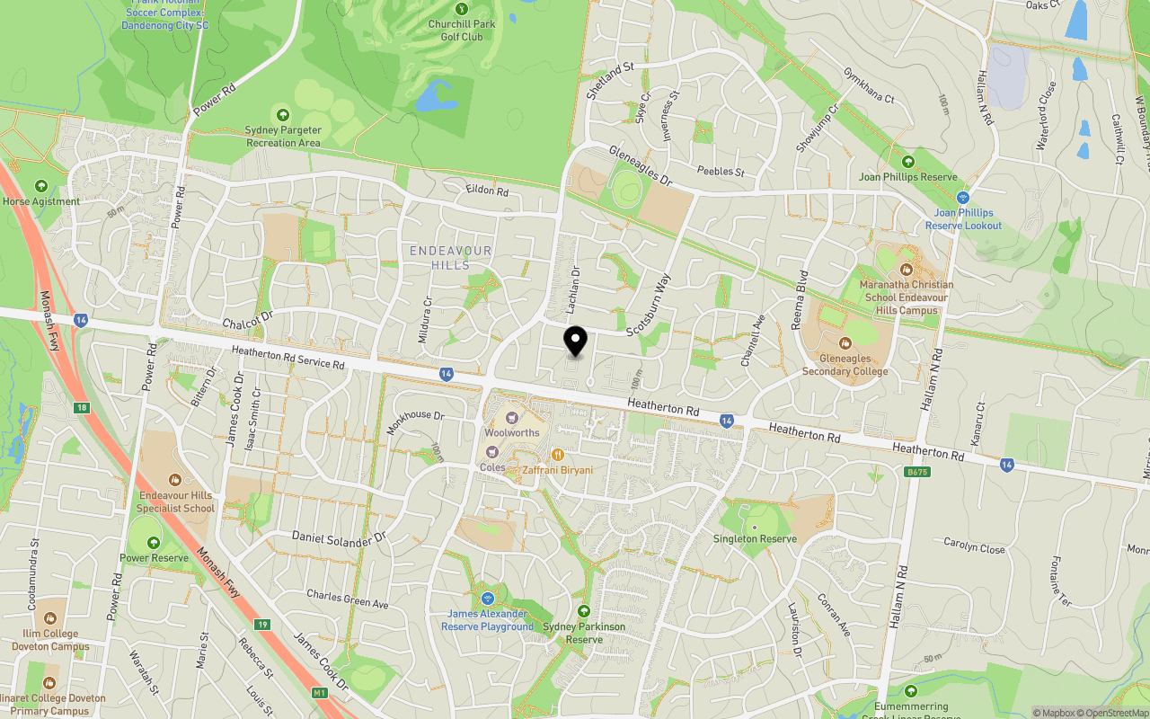
Schools near Annette Hill Estate - Endeavour Hills
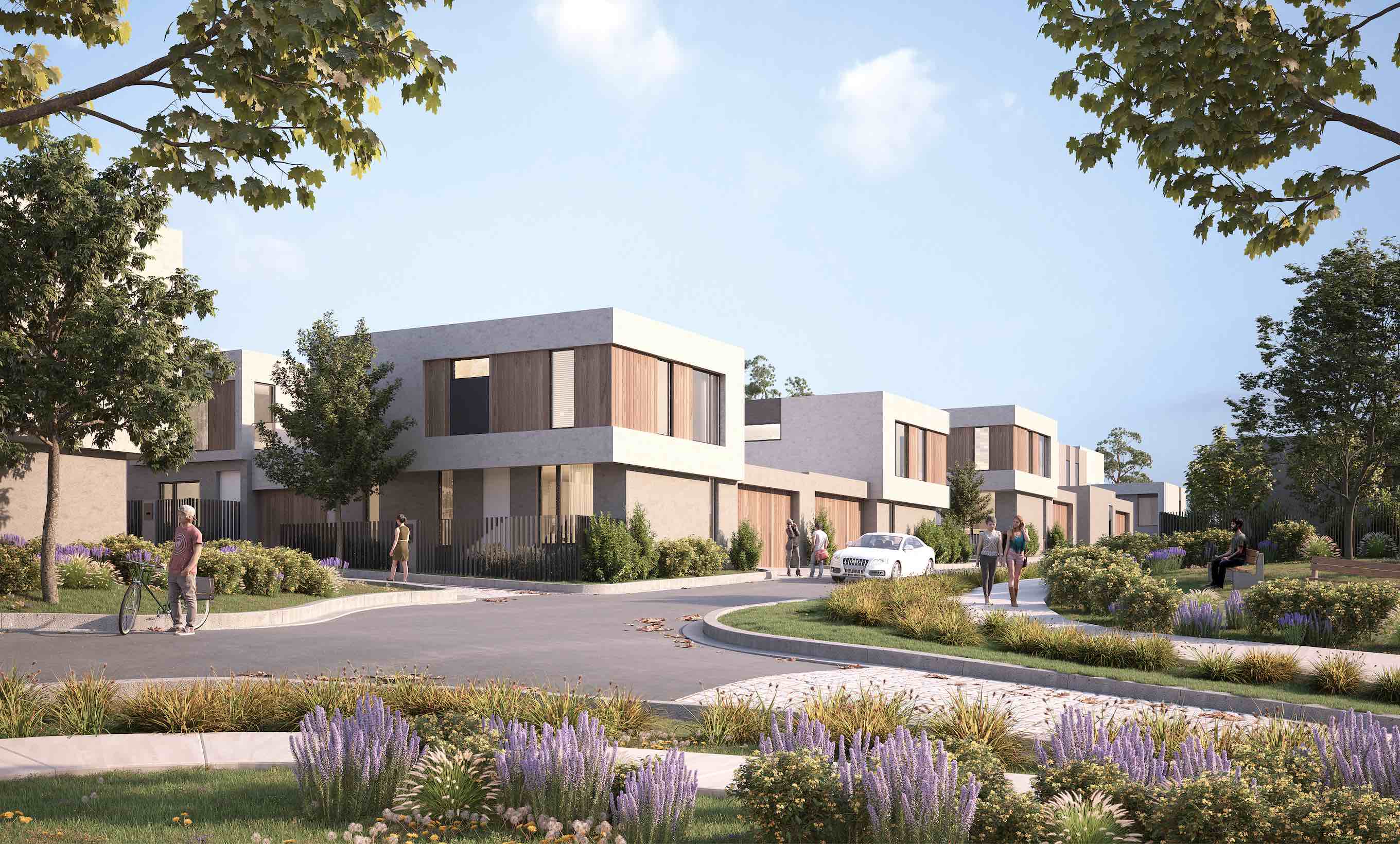
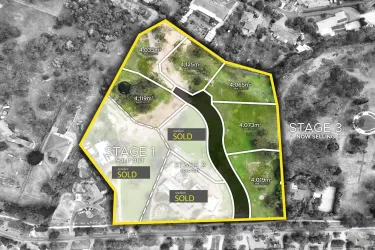
Overview
This information is estimated by the OpenLot research team. Let us know here to provide up-to-date information about this development.
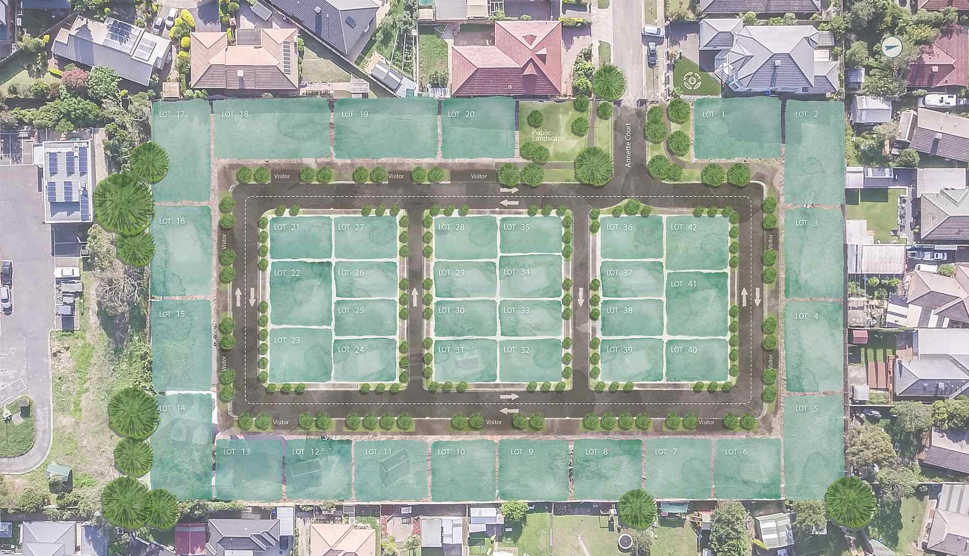
| Total new homes | |
| Area Size | 1.27 hectares |
| Growth Region | Melbourne South East Growth Corridor |
| City Council | Casey City Council |
| Developer | Monolith Projects |
| Project Marketer | Nest Projects |
| Creative Agency | Z Creative Studio |
| Distance to |
Updates for Annette Hill Estate - Endeavour Hills
Popular Estates near Annette Hill Estate - Endeavour Hills


Not exactly what you're looking for? Try surrounding suburbs
Doveton VIC 3177
2 estates | Casey City Council
2.1km south-west
Lysterfield VIC 3156
4 estates | Knox City Council
5.5km north-east
Narre Warren North VIC 3804
5 estates | Casey City Council
5.6km east
Hallam VIC 3803
1 estate | Casey City Council
4.1km south
Eumemmerring VIC 3177
1 estate | Casey City Council
3.2km south
Dandenong VIC 3175
2 estates | City Of Greater Dandenong
3.4km south-west
Latest published articles


FAQs about Annette Hill Estate - Endeavour Hills
Monolith Projects is the developer behind Annette Hill Estate - Endeavour Hills.
Annette Hill Estate - Endeavour Hills consists of 42 homes.
The total area for Annette Hill Estate - Endeavour Hills is 1.27 hectares.
Annette Hill Estate - Endeavour Hills falls under Casey City Council.
Annette Hill Estate - Endeavour Hills is 32 km south-east of Melbourne CBD.
Nest Projects is the project marketer for Annette Hill Estate - Endeavour Hills.
Nearby schools for Annette Hill Estate - Endeavour Hills:
- St Paul Apostle North School - 729m north
- St Paul Apostle South School - 810m south-west
- Mossgiel Park Primary School - 816m north-east
- Gleneagles Secondary College - 1.2km east
- Thomas Mitchell Primary School - 1.3km south-east
- Chalcot Lodge Primary School - 1.4km west