
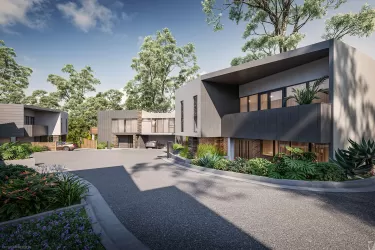
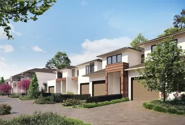
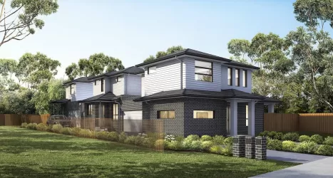
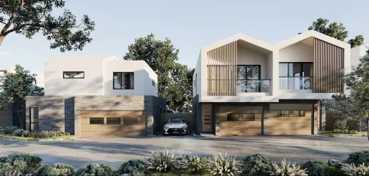
Property types for sale
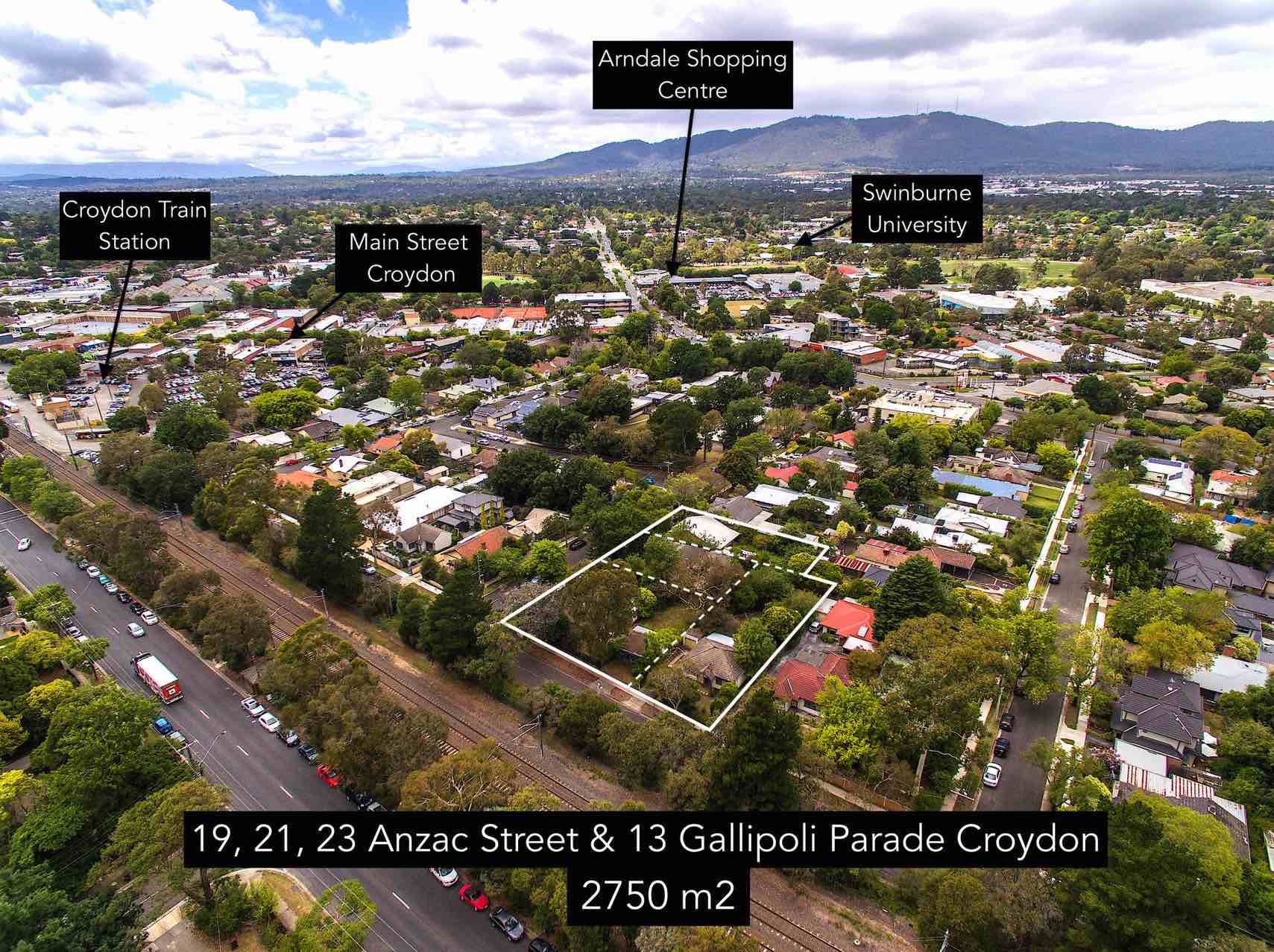
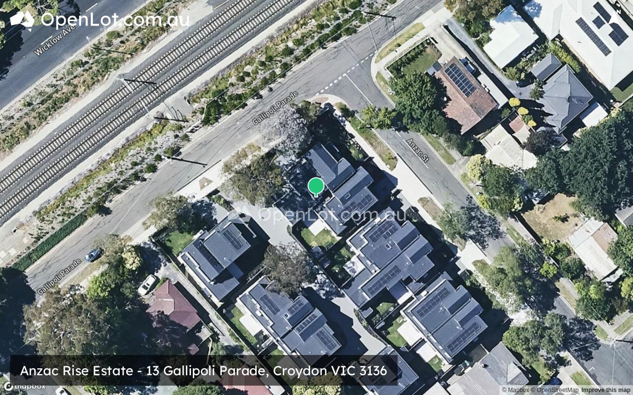
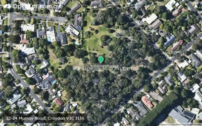
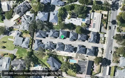
Location & Map for Anzac Rise Estate - Croydon
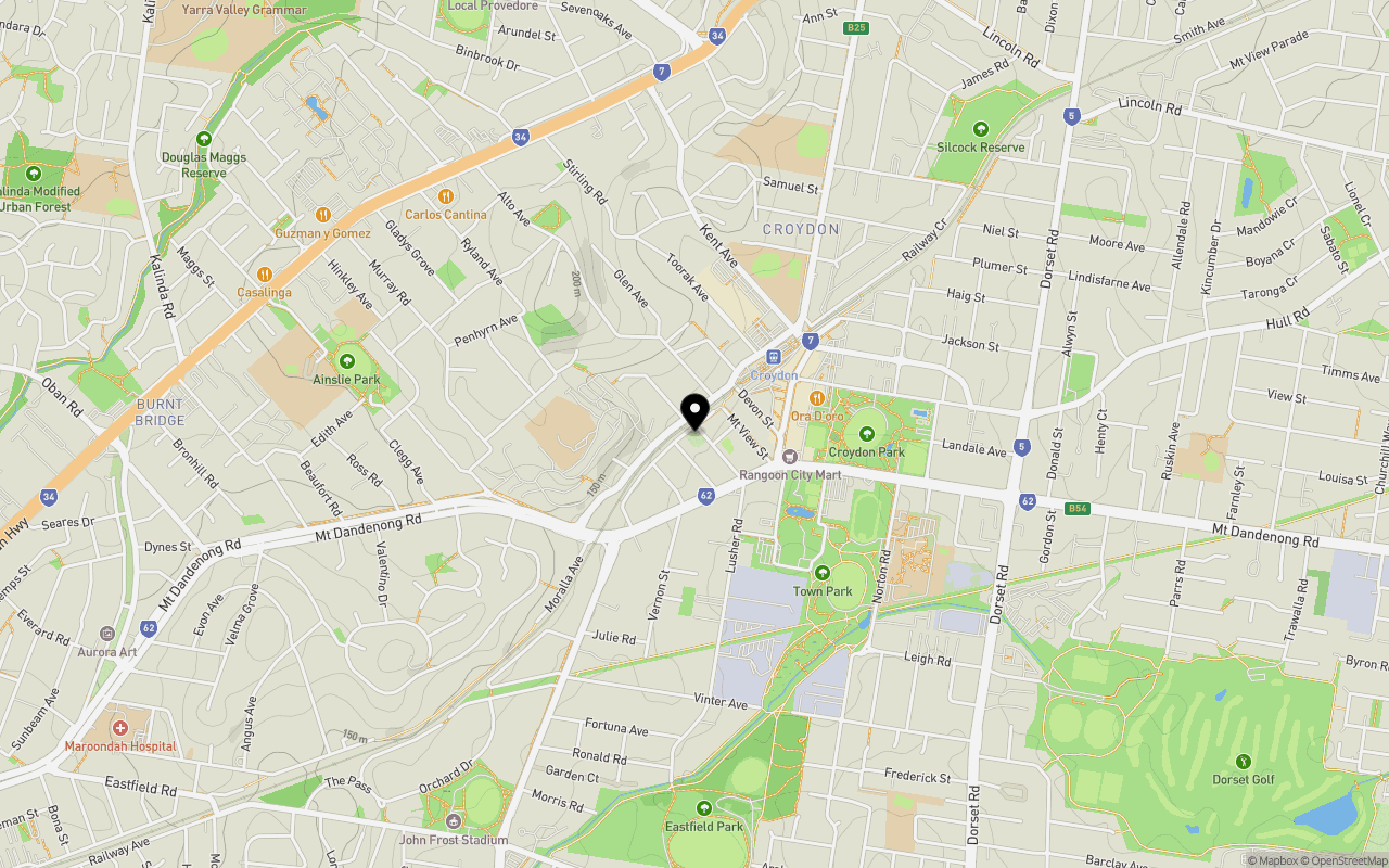
Schools near Anzac Rise Estate - Croydon
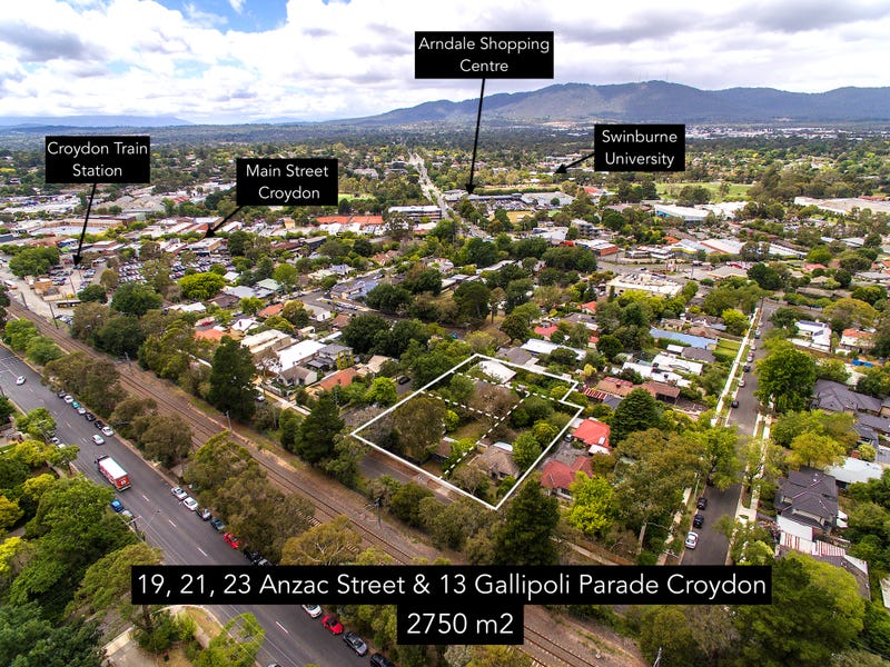
Overview
This information is estimated by the OpenLot research team. Let us know here to provide up-to-date information about this development.
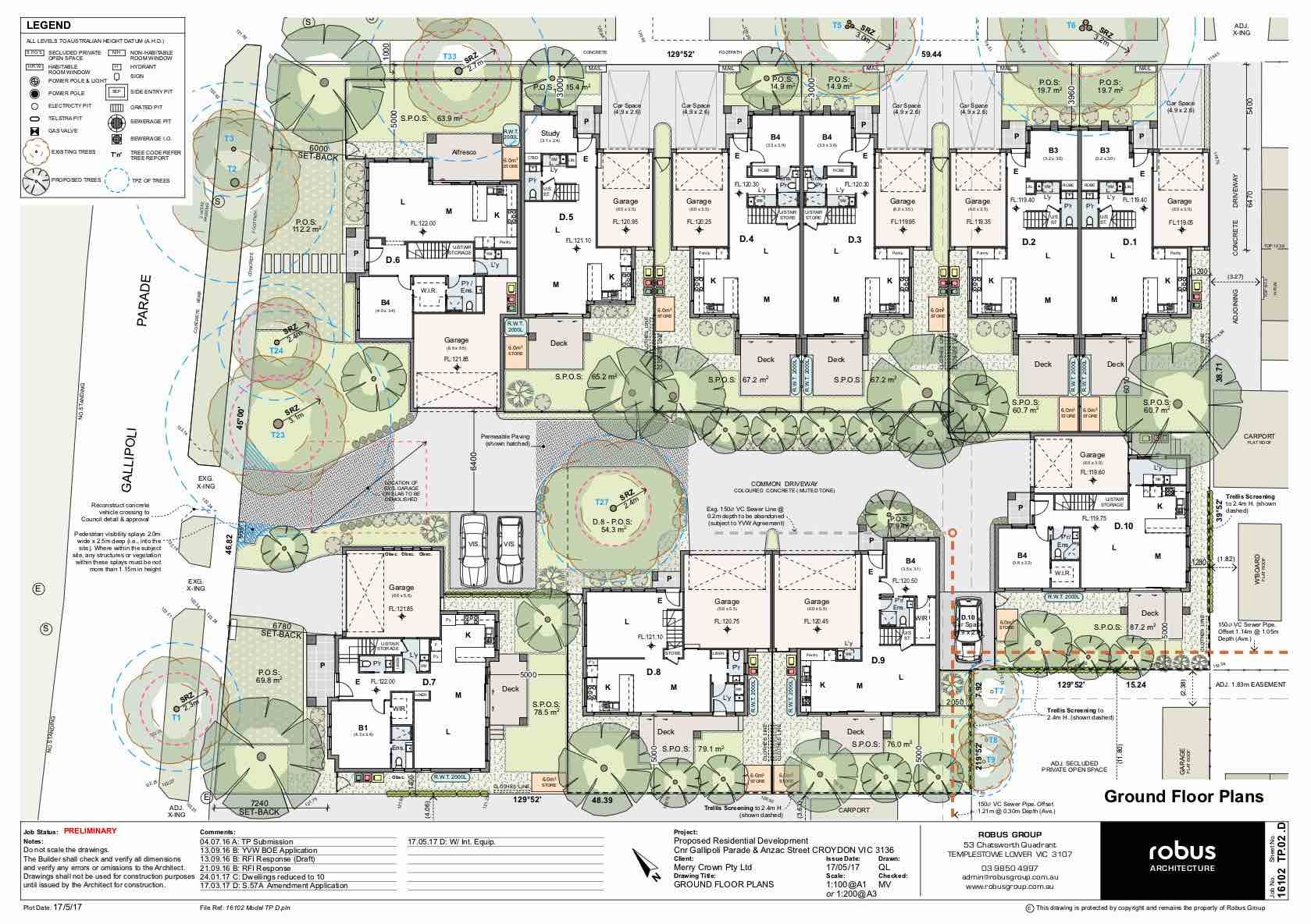
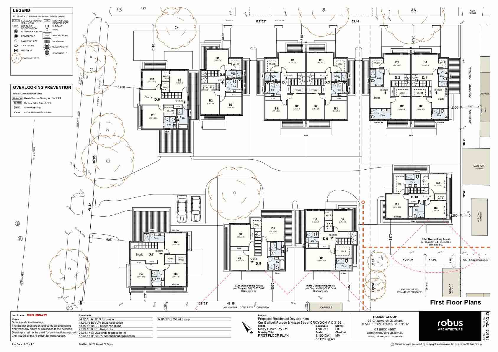
| Total new homes | |
| Area Size | 0.27 hectares |
| Growth Region | Melbourne East |
| City Council | Maroondah City Council |
| Developer | WOLF International Group |
| Distance to |
Updates for Anzac Rise Estate - Croydon

Land Price Trend in Croydon VIC 3136
Below shows the price trend from vacant land sales recorded in Croydon VIC 3136.
The data and information provided by Terralytics (Aust) Pty Ltd (Terralytics Data) is general in nature and is not intended to constitute professional advice. Read more
It should not be relied upon as a substitute for legal, financial, valuation, or other specialist advice relevant to your specific circumstances.
Terralytics uses commercially reasonable endeavours to ensure the Terralytics Data is current and accurate. However, as the Terralytics Data incorporates information sourced from third parties, Terralytics makes no representation or warranty — express or implied — as to its accuracy, completeness, or currency. To the maximum extent permitted by applicable law, Terralytics excludes all liability for any loss or damage (including consequential loss) arising out of or in connection with reliance on the Terralytics Data, whether arising in contract, tort (including negligence), statute, or otherwise.
Popular Estates near Anzac Rise Estate - Croydon

Not exactly what you're looking for? Try surrounding suburbs
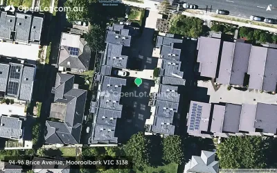
Mooroolbark VIC 3138
8 estates | Yarra Ranges Shire Council
4.1km east
Ringwood VIC 3134
5 estates | Maroondah City Council
4.1km south-west
Ringwood East VIC 3135
2 estates | Maroondah City Council
2.9km south-west
Croydon North VIC 3136
1 estate | Maroondah City Council
2.3km north-east
Croydon South VIC 3136
1 estate | Maroondah City Council
2.8km south
Warranwood VIC 3134
1 estate | Maroondah City Council
2.6km north-west
Latest published articles


FAQs about Anzac Rise Estate - Croydon
WOLF International Group is the developer behind Anzac Rise Estate - Croydon.
Anzac Rise Estate - Croydon consists of 10 homes.
The total area for Anzac Rise Estate - Croydon is 0.27 hectares.
Anzac Rise Estate - Croydon falls under Maroondah City Council.
Anzac Rise Estate - Croydon is 28 km east of Melbourne CBD.
Nearby schools for Anzac Rise Estate - Croydon:
- Sacred Heart School - 394m west
- Croydon Primary School - 620m north-east
- Croydon Community School - 977m north
- Ainslie Parklands Primary School - 1.2km west
- Melba Secondary College - 1.5km west
- Dorset Primary School - 1.6km south-east