
Property types for sale
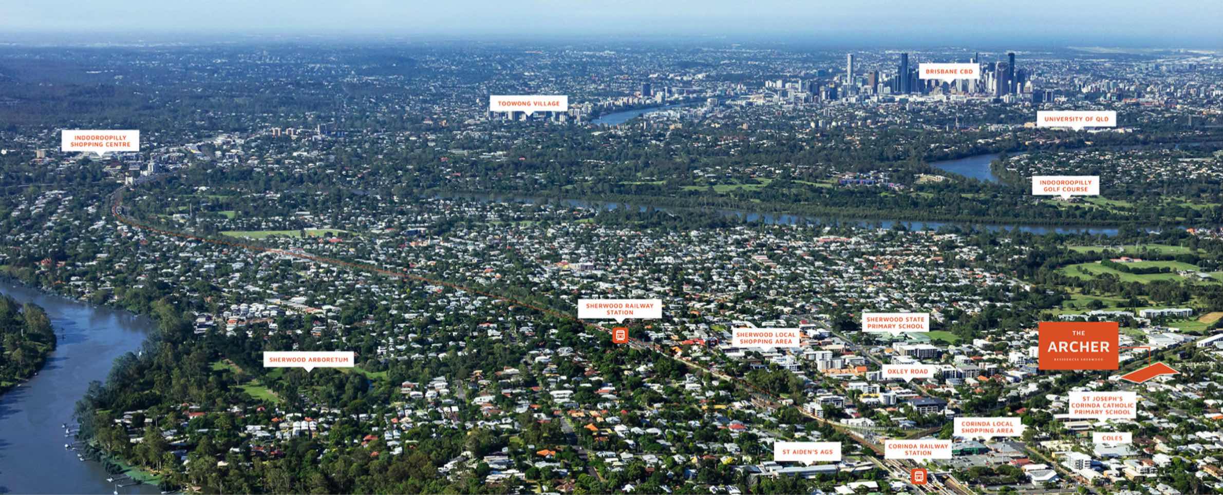
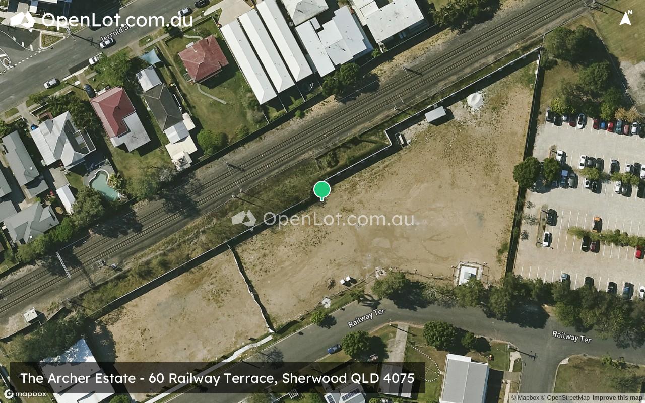
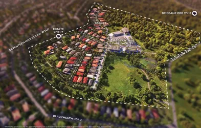
Location & Map for The Archer Estate - Sherwood
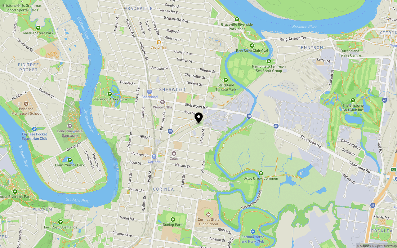
Schools near The Archer Estate - Sherwood
The Archer Sherwood Video
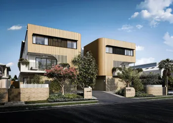
Overview
This information is estimated by the OpenLot research team. Let us know here to provide up-to-date information about this development.
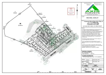
| Total new homes | |
| Area Size | 0.62 hectares |
| Growth Region | Greater Brisbane Growth Areas |
| City Council | Brisbane City Council |
| Developer | N/A |
| Project Marketer | Position Property |
| Creative Agency | Ruby Ink |
| Distance to |
Updates for The Archer Estate - Sherwood


Popular Estates near The Archer Estate - Sherwood


Not exactly what you're looking for? Try surrounding suburbs
Fig Tree Pocket QLD 4069
3 estates | Brisbane City Council
2.6km west
Oxley QLD 4075
10 estates | Brisbane City Council
3.6km south
Indooroopilly QLD 4068
3 estates | Brisbane City Council
2.7km north
Yeerongpilly QLD 4105
1 estate | Brisbane City Council
3.1km east
Taringa QLD 4068
3 estates | Brisbane City Council
3.9km north
Yeronga QLD 4104
3 estates | Brisbane City Council
3.8km north-east
Latest published articles


FAQs about The Archer Estate - Sherwood
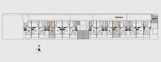
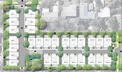
The Archer Estate - Sherwood consists of 38 homes.
The total area for The Archer Estate - Sherwood is 0.62 hectares.
The Archer Estate - Sherwood falls under Brisbane City Council.
The Archer Estate - Sherwood is 8 km south-west of Brisbane CBD.
Position Property is the project marketer for The Archer Estate - Sherwood.
Nearby schools for The Archer Estate - Sherwood:
- St Joseph's Primary School - 424m south-west
- Sherwood State School - 485m north-west
- St Aidan's Anglican Girls School - 799m south-west
- Corinda State High School - 1.0km south
- Corinda State School - 1.6km south
- Millenba - 1.9km north-east