
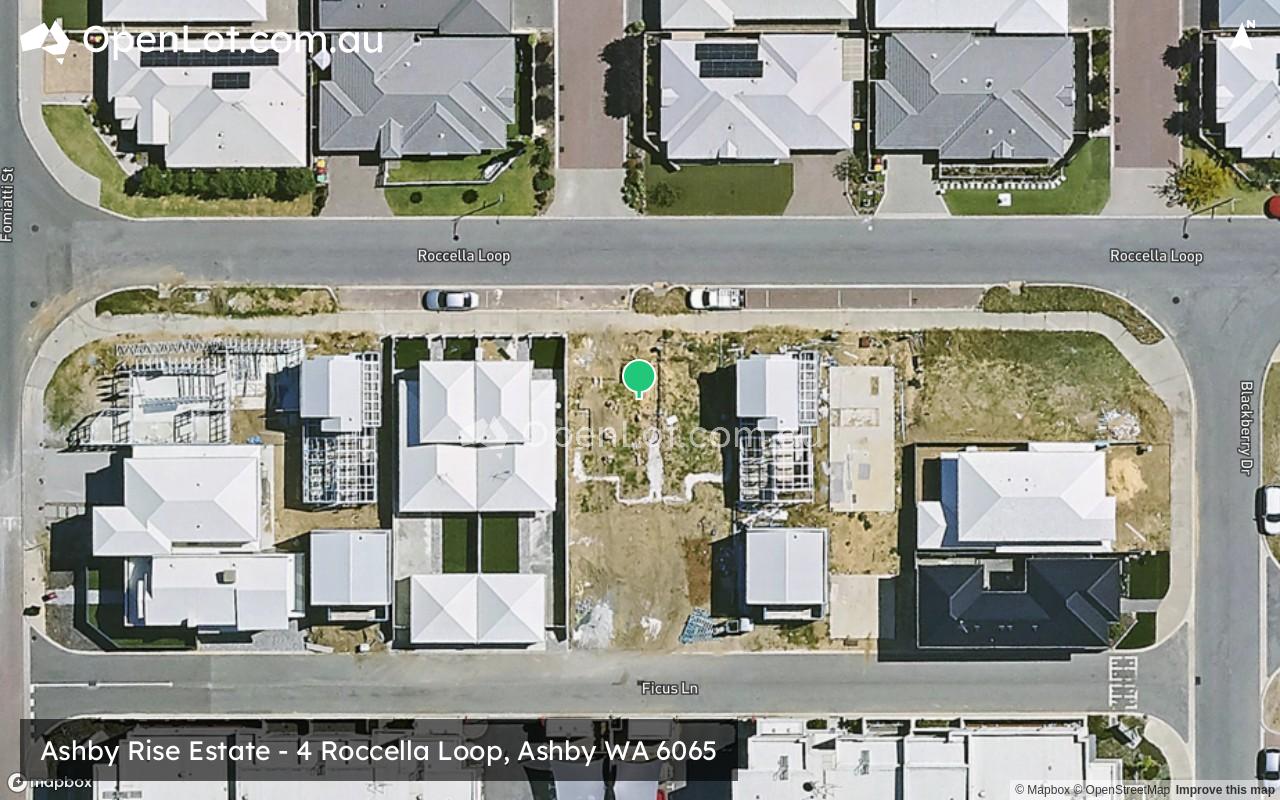
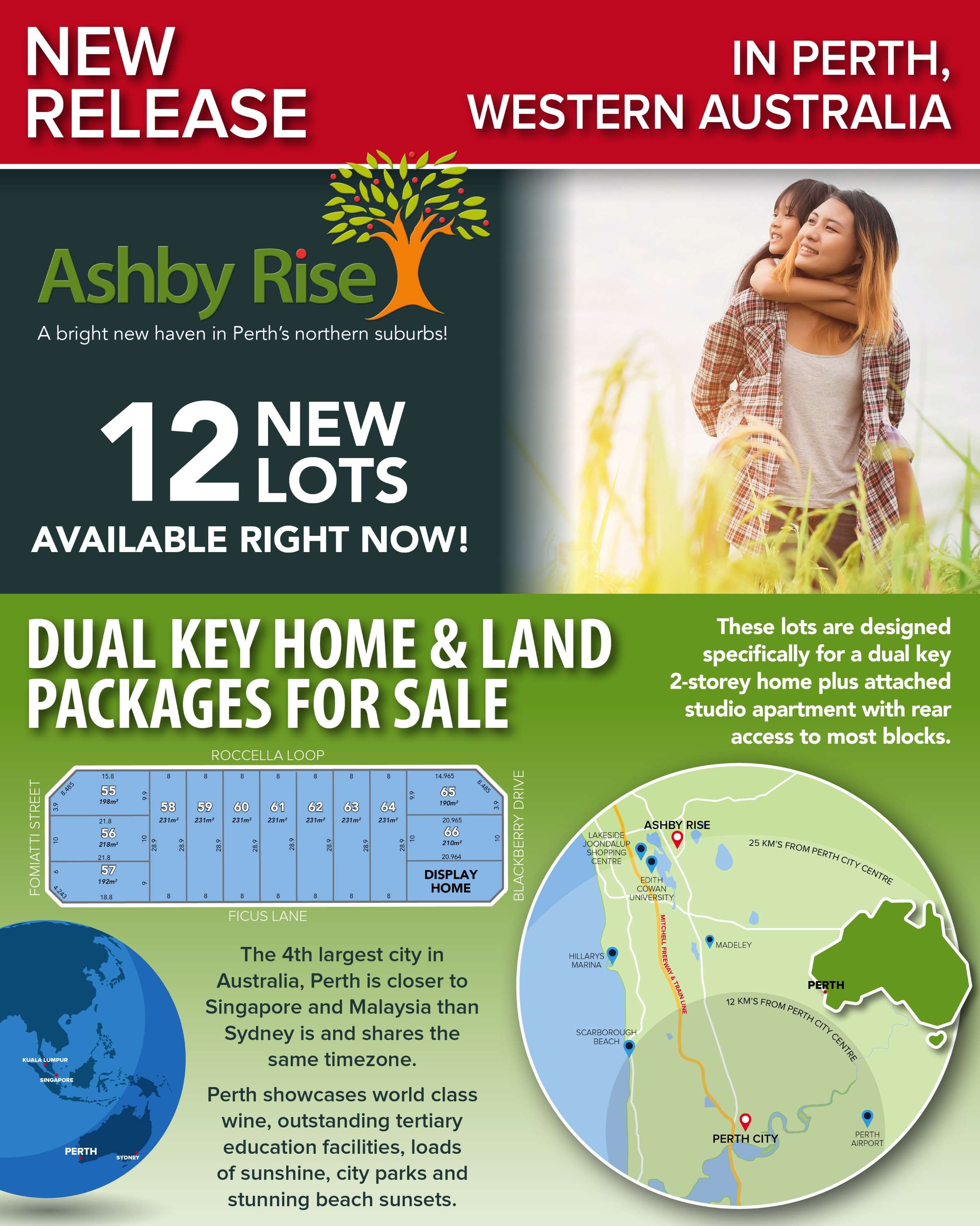
Property types for sale
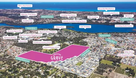
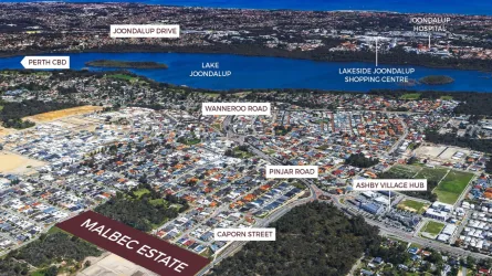
Location & Map for Ashby Rise Estate - Ashby
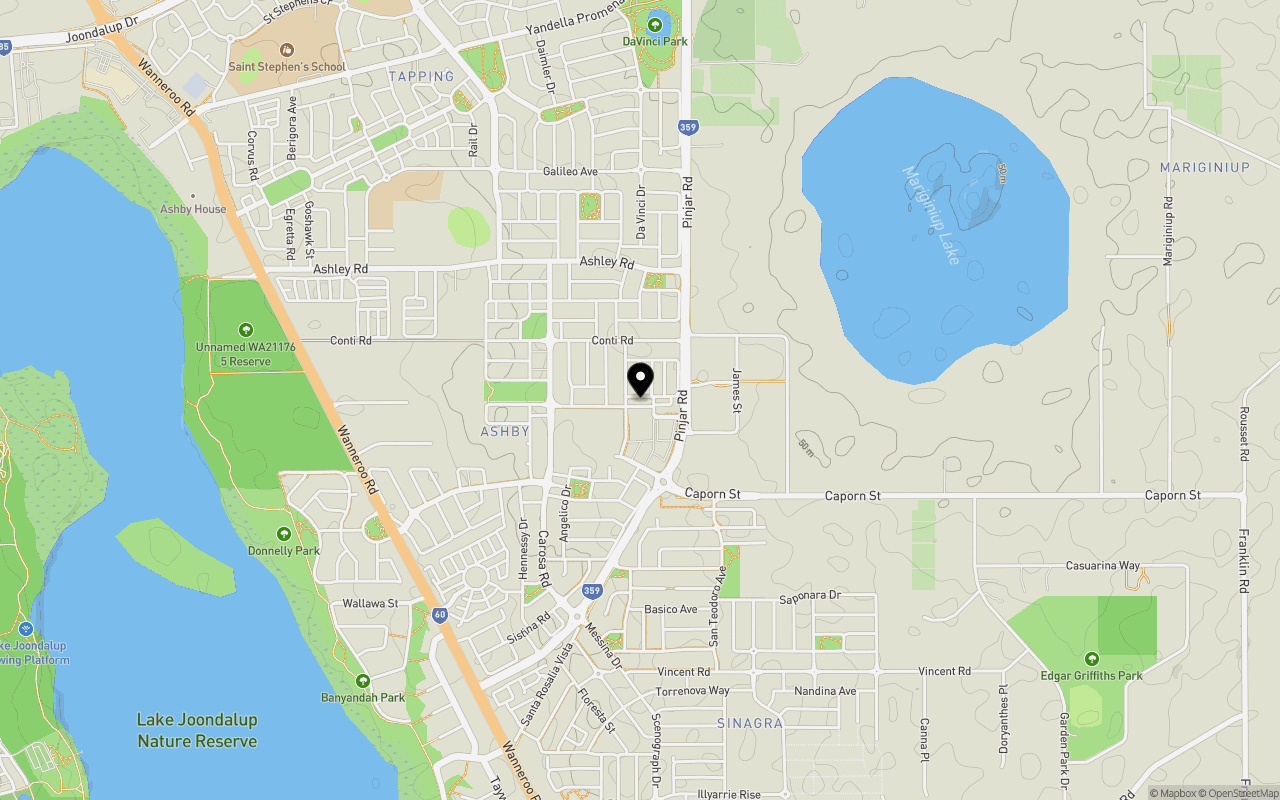
Schools near Ashby Rise Estate - Ashby
Overview
This information is estimated by the OpenLot research team. Let us know here to provide up-to-date information about this development.
| Total new homes | |
| Area Size | 0.26 hectares |
| Growth Region | Perth North West Growth Areas |
| City Council | City of Wanneroo |
| Developer | N/A |
| Project Marketer | Resiwest Real Estate |
Updates for Ashby Rise Estate - Ashby

Popular Estates near Ashby Rise Estate - Ashby
Not exactly what you're looking for? Try surrounding suburbs
Currambine WA 6028
0 estates
5.4km west
Wanneroo WA 6065
2 estates | City of Wanneroo
2.2km south
Sinagra WA 6065
6 estates | City of Wanneroo
1.0km south
Tapping WA 6065
1 estate | City of Wanneroo
1.9km north-west
Banksia Grove WA 6031
1 estate | City of Wanneroo
3.6km north
Hocking WA 6065
1 estate | City of Wanneroo
4.3km south
Latest published articles


FAQs about Ashby Rise Estate - Ashby
Ashby Rise Estate - Ashby consists of 12 homes.
The total area for Ashby Rise Estate - Ashby is 0.26 hectares.
Ashby Rise Estate - Ashby falls under City of Wanneroo.
Resiwest Real Estate is the project marketer for Ashby Rise Estate - Ashby.
Nearby schools for Ashby Rise Estate - Ashby:
- Spring Hill Primary School - 1.3km north-west
- Tapping Primary School - 1.9km north-west
- St Anthony's School - 2.1km south
- Wanneroo Primary School - 2.4km south
- Carramar Primary School - 2.7km north-west
- Banksia Grove Primary School - 3.1km north