Averley Estate - Pakenham East
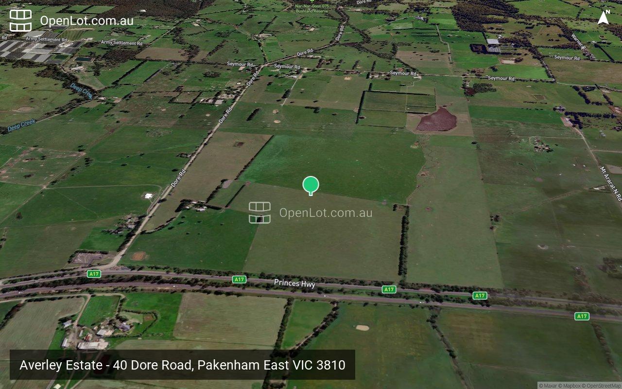
 40 Dore Road, Pakenham East VIC 3810
This information is estimated by the OpenLot research team. Let us know here to provide up-to-date information about this development.
| Total new homes | 1,500 |
| Area size | 113.00 hectares |
| Growth Region | Melbourne South East Growth Corridor |
| City council | Cardinia Shire Council |
| Developer | Lendlease Group |
| Distance to | Melbourne CBD - 57 km south-east |
Land for Sale, House and Land Packages:
Popular Estates near Averley Estate - Pakenham East


Updates for Averley Estate - Pakenham East
Facebook updates:
Related news:
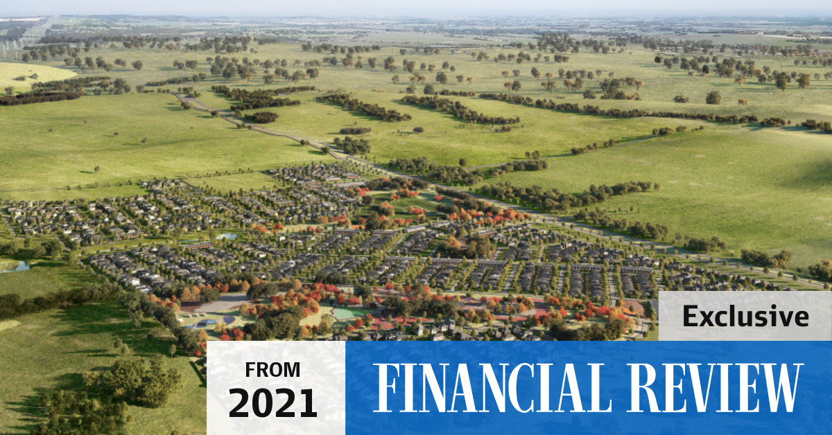
The global construction giant’s Averley Estate in the newly approved suburb of Pakenham East will accommodate more than 1500 homes about 60 kilometres from the centre of Melbourne.
A pair of cattle-herding brothers will make upwards of $80m in a huge land deal — but they almost missed out.

A relatively small piece of grazing country on the south-east of Melbourne has sold to developers for more than $80 million.

The developers behind Lakeside will transform an 83 hectare cattle farm into a brand new estate within the upcoming Pakenham …
Missing articles? Send us a link here.
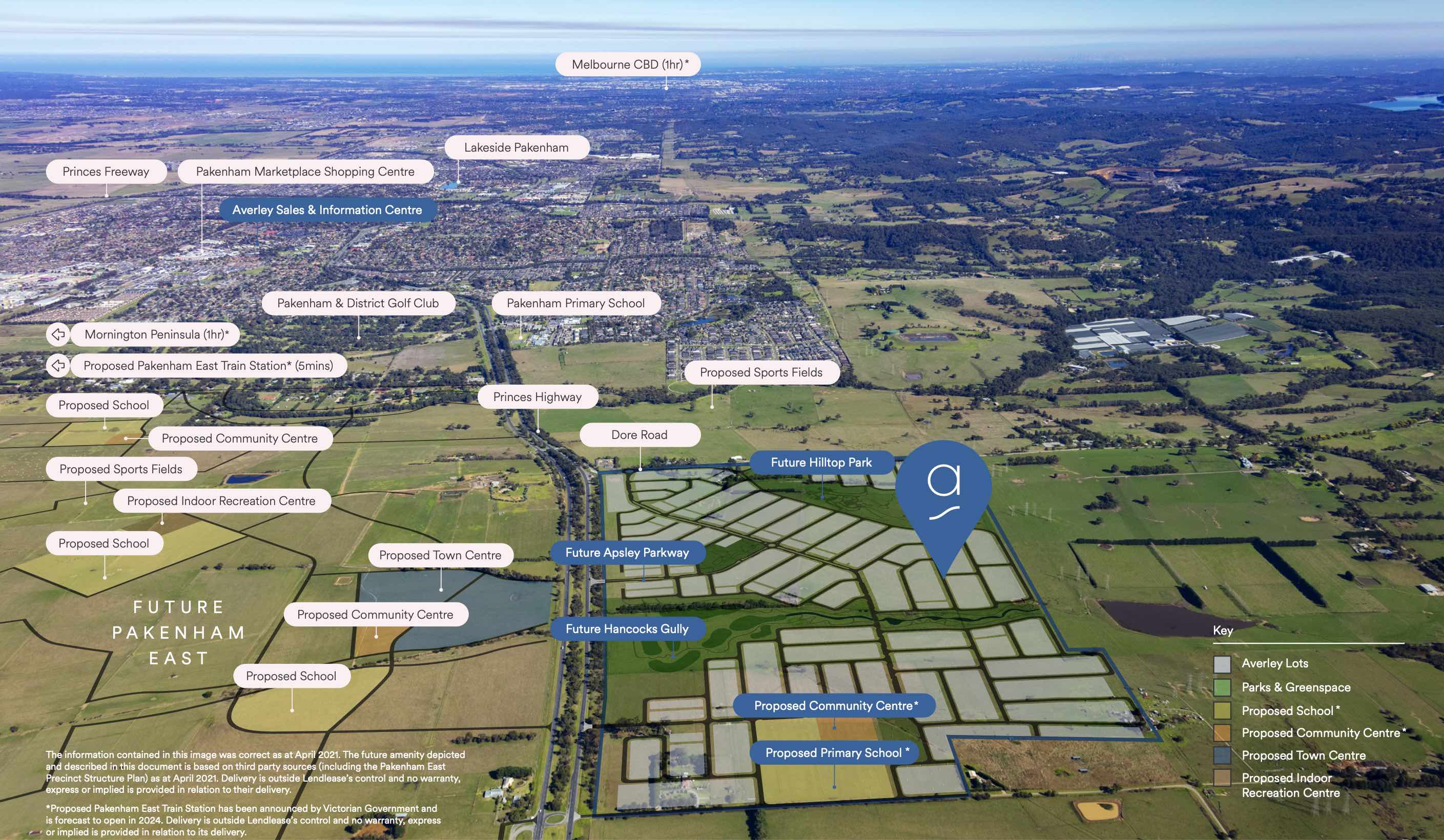
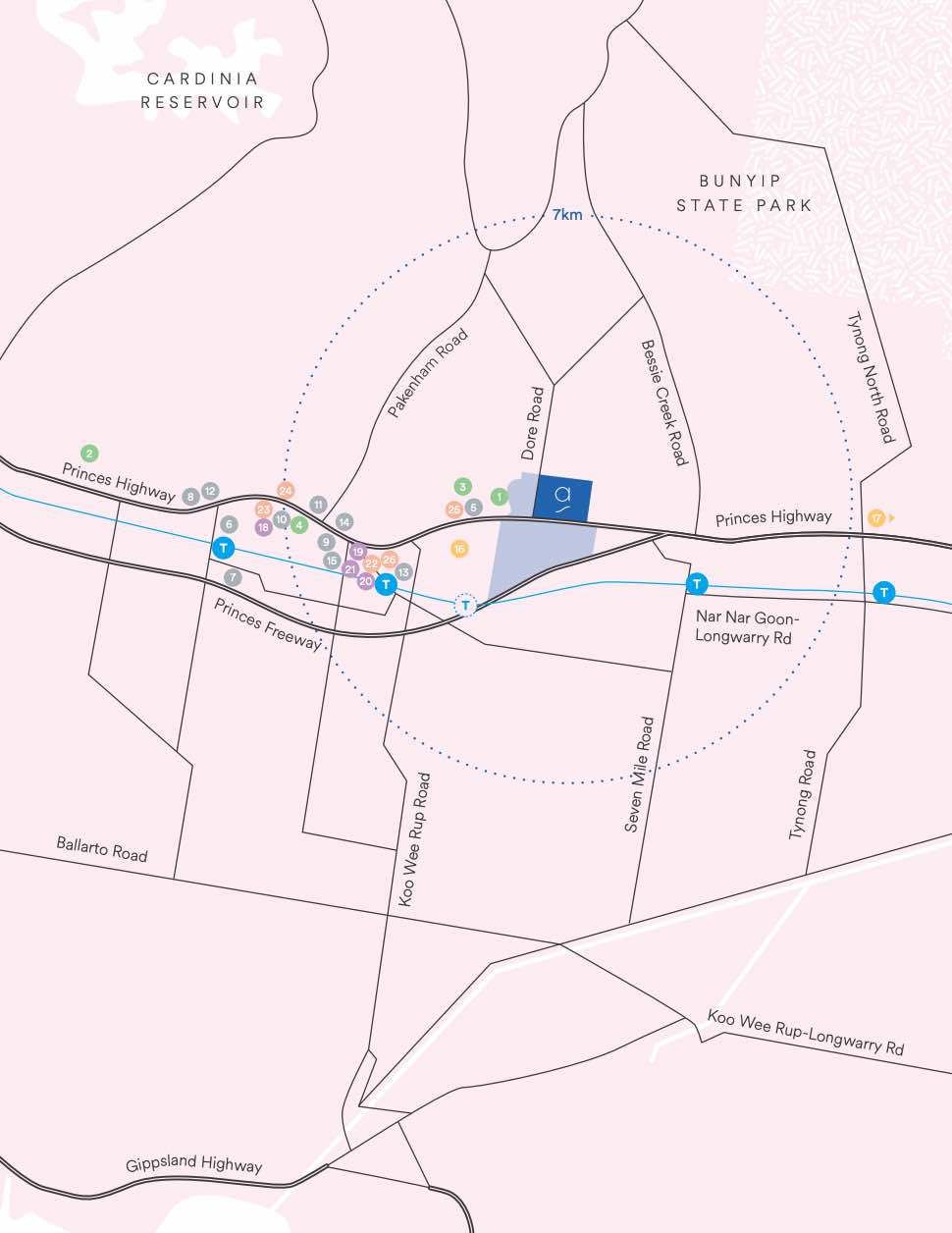
Location & Map for Averley Estate - Pakenham East
Display Homes near Averley Estate - Pakenham East

Vacancy Rate in Pakenham East VIC 3810
View full vacancy rate history in Pakenham East VIC 3810 via SQM Research.
Schools near Averley Estate - Pakenham East
Here are 6 schools near Averley Estate - Pakenham East:
Prep-6 Government Primary School
Prep-6 Government Primary School
Prep-6 Catholic Primary School
Prep-6 Government Primary School
Prep-6 Catholic Primary School
7-12 Government Secondary School
Suburb Planning Review in Pakenham East VIC 3810
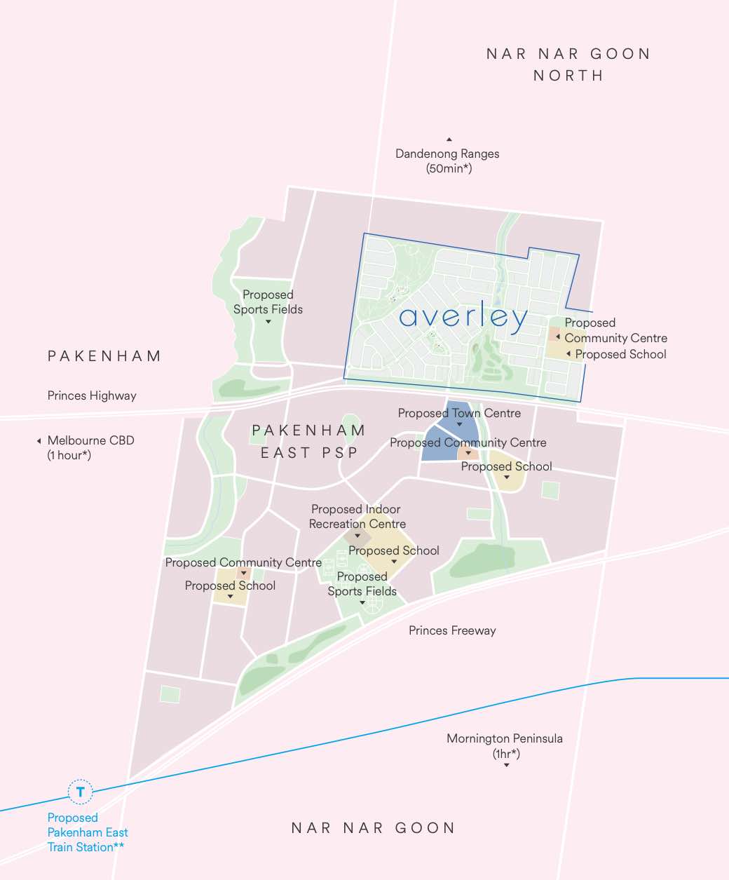
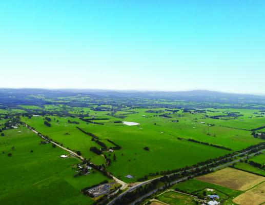
Pakenham East is located in the Shire of Cardinia, the fringe of Melbourne’s Urban Growth Boundary and logical expansion of the existing Pakenham township. The new 630ha suburb area is located on either side of the Princes Highway and is bounded by natural features, existing urban community, infrastructure and farmland.

The Pakenham East Precinct Structure Plan (PSP) and Native Vegetation Precinct Plan (NVPP) were prepared to guide the redevelopment of the released land, protection of natural assets and where services are planned to support the suburb growth. This includes local heritage, landscape and environmental values of the area while delivering a variety of housing options and community and recreational facilities as a logical extension of the Pakenham township.

Both the Pakenham East PSP and NVPP were prepared by Victorian Planning Authority (VPA) in consultation with the Cardinia Shire Council and was approved on 2 January 2021 by the Minister for Planning in December 2020. The decision was officially gazetted on 21 January 2021 under Amendment C234 of the Cardinia Planning Scheme.
The Vision
“for a sustainable and resilient community with plenty of housing choices, open space, well-connected streets, future schools and a local town centre and convenience centre. It will complement Pakenham, with an extensive network of cycling paths, public transport and pedestrian links to central Pakenham”.

Benefits
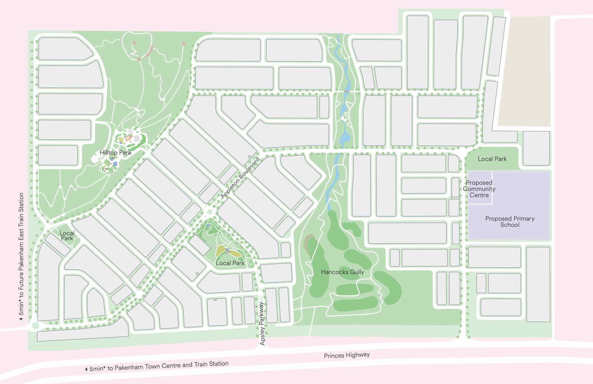
The amendments allow the rezoning of Farming and Low Density Residential Zones to Urban Growth Zone. This allows the new greenfield sites to provide for a new residential community, protect natural features and sports and recreation areas. A series of new schools, local community hubs, a town centre and a convenience centre will provide local employment.
Transportation
Pakenham East is well connected to public passenger transport, with the Pakenham rail line set to be extended to a new station to be built adjacent to Deep Creek Reserve within the Pakenham community fringe and car parking access from Ryan Road. The passenger train service on the Orbost mainline will connect Flinders Street and the new Pakenham East train station.
While located just outside the new suburb boundary the train station will be well connected to a network of shared paths including cycle links and the local road network. The Princes Highway will provide vehicle access to the Princes Freeway and a direct connection to Melbourne CBD or the east coastline of Victoria.


Summary
References
Premier of Victoria – New Station
Planning Applications for Averley Estate - Pakenham East
Reviews & Comments on Averley Estate - Pakenham East
Estate Brochure, Masterplan, Engineering Plan, Plan of Subdivision (POS), Design Guidelines
FAQs about Averley Estate - Pakenham East
View all estates from Lendlease Group
- Pakenham Primary School - 2.0km west
- Pakenham Hills Primary School - 3.3km west
- St James School - 3.8km east
- Nar Nar Goon Primary School - 4.3km south-east
- St Patrick's School - 5.2km west
- Pakenham Secondary College - 5.5km west
Popular Estates near Averley Estate - Pakenham East
Latest New Home Articles for You

10/May/2024
13
content here.
10/May/2024
14
Content here.
10/May/2024
15
Content here.
10/May/2024
16
Content here.
10/May/2024
17
Content here.
10/May/2024
18
Content here.
10/May/2024
19
Content here.

10/May/2024
20
Lorem ipsum dolor sit amet, consectetur adipiscing elit. Etiam turpis era...
10/May/2024
21
Content here.