
Property types for sale
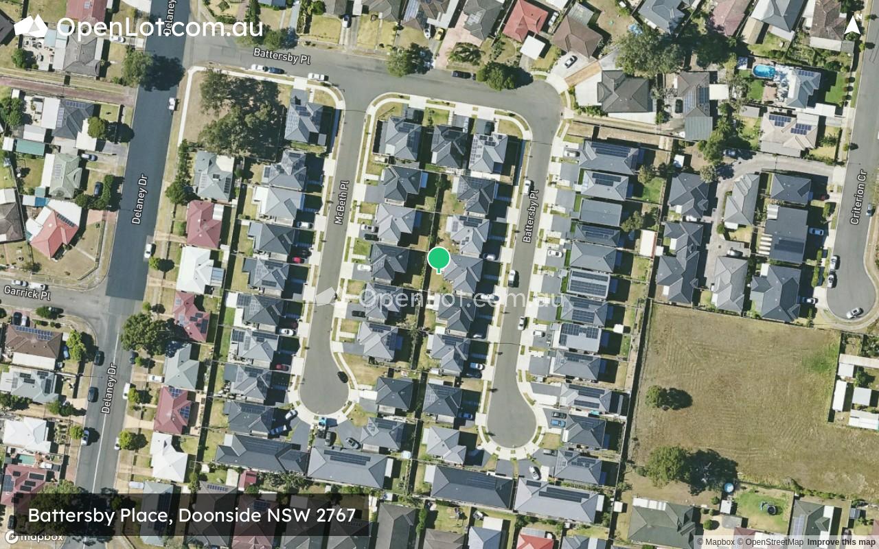
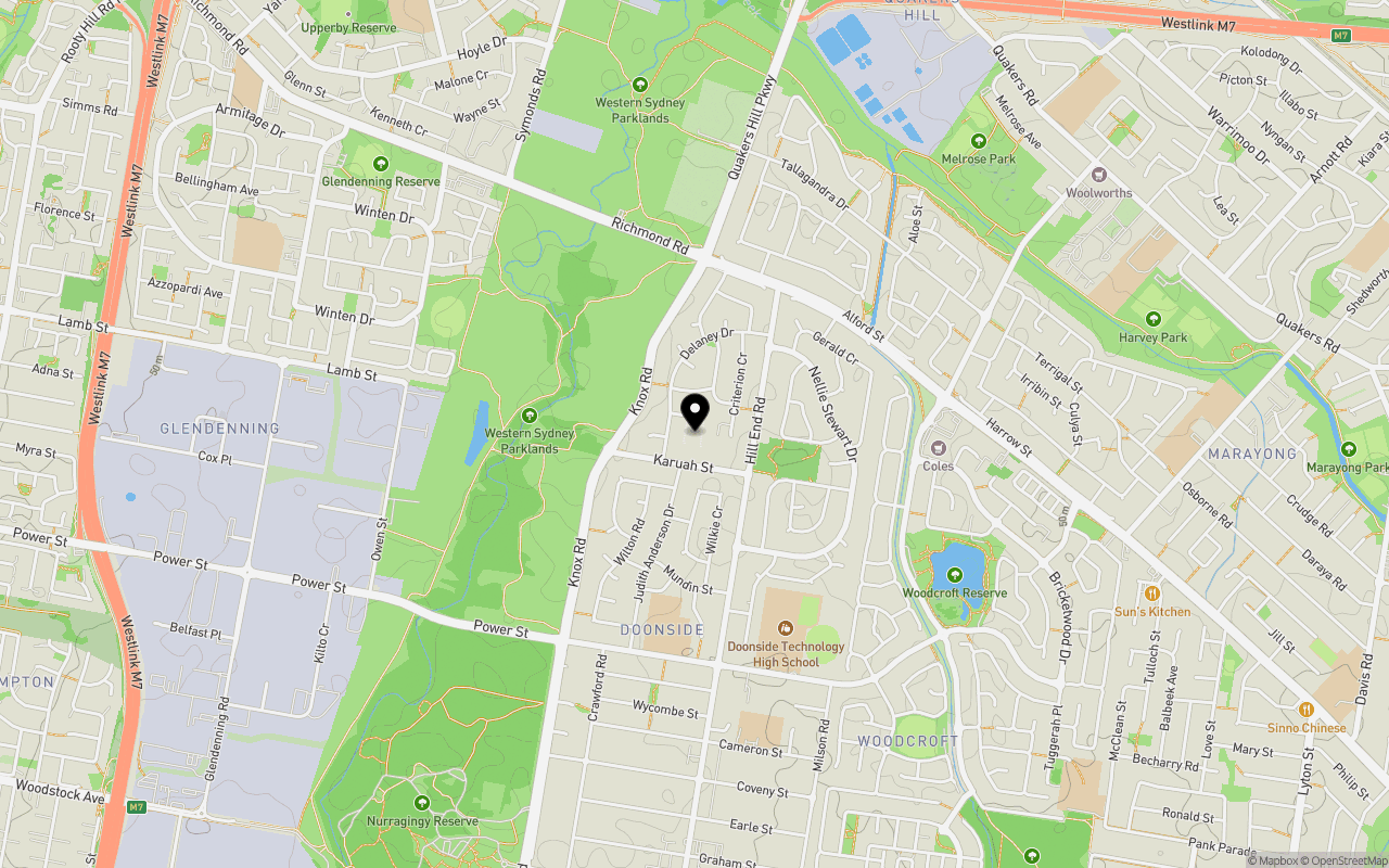
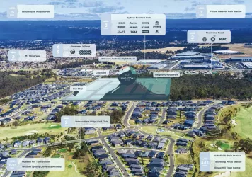
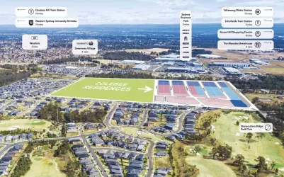
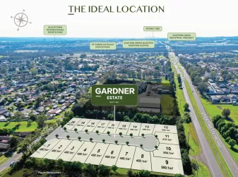
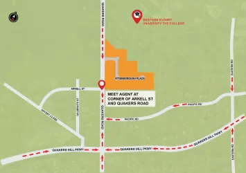
Location & Map for Battersby Place, Doonside NSW 2767
Schools near Battersby Place, Doonside NSW 2767
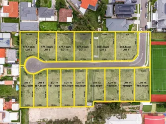
Overview
This information is estimated by the OpenLot research team. Let us know here to provide up-to-date information about this development.
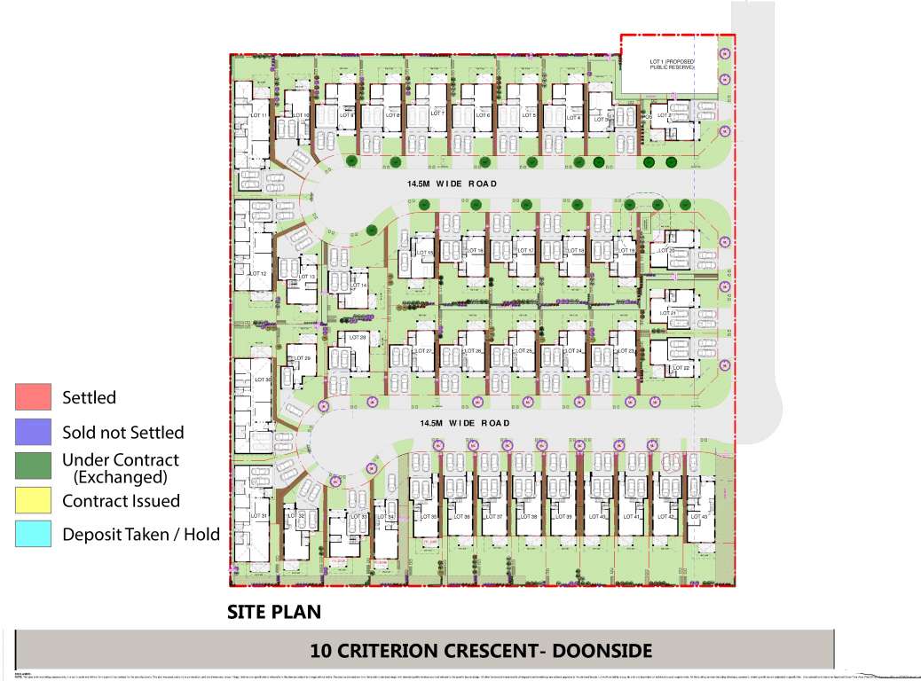
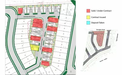
| Total new homes | |
| Area Size | 1.76 hectares |
| Growth Region | Sydney North West Growth Areas |
| City Council | Blacktown City Council |
| Developer | N/A |
| Project Marketer | Wee Nest Realty |
| Distance to |
Updates for Battersby Place, Doonside
Land Price Trend in Doonside NSW 2767
Below shows the price trend from vacant land sales recorded in Doonside NSW 2767.
The data and information provided by Terralytics (Aust) Pty Ltd (Terralytics Data) is general in nature and is not intended to constitute professional advice. Read more
It should not be relied upon as a substitute for legal, financial, valuation, or other specialist advice relevant to your specific circumstances.
Terralytics uses commercially reasonable endeavours to ensure the Terralytics Data is current and accurate. However, as the Terralytics Data incorporates information sourced from third parties, Terralytics makes no representation or warranty — express or implied — as to its accuracy, completeness, or currency. To the maximum extent permitted by applicable law, Terralytics excludes all liability for any loss or damage (including consequential loss) arising out of or in connection with reliance on the Terralytics Data, whether arising in contract, tort (including negligence), statute, or otherwise.
Popular Estates near Battersby Place, Doonside


Not exactly what you're looking for? Try surrounding suburbs
Colebee NSW 2761
2 estates | Blacktown City Council
4.5km north
Nirimba Fields NSW 2763
2 estates | Blacktown City Council
5.0km north
Blacktown NSW 2148
2 estates | Blacktown City Council
2.2km south-east
Quakers Hill NSW 2763
3 estates | Blacktown City Council
3.9km north
Rooty Hill NSW 2766
2 estates | Blacktown City Council
2.7km south-west
Plumpton NSW 2761
1 estate | Blacktown City Council
3.2km north-west
Latest published articles


FAQs about Battersby Place, Doonside NSW 2767
Battersby Place, Doonside NSW 2767 consists of 42 homes.
The total area for Battersby Place, Doonside NSW 2767 is 1.76 hectares.
Battersby Place, Doonside NSW 2767 falls under Blacktown City Council.
Battersby Place, Doonside NSW 2767 is 32 km north-west of Sydney CBD.
Wee Nest Realty is the project marketer for Battersby Place, Doonside NSW 2767.
Nearby schools for Battersby Place, Doonside NSW 2767:
- Crawford Public School - 706m south
- Doonside High School - 795m south-east
- St John Vianney's Primary School - 1.1km south
- St Andrews College - 1.7km north-east
- Glendenning Public School - 1.7km north-west
- St Andrews Primary School - 1.8km east