
Property types for sale
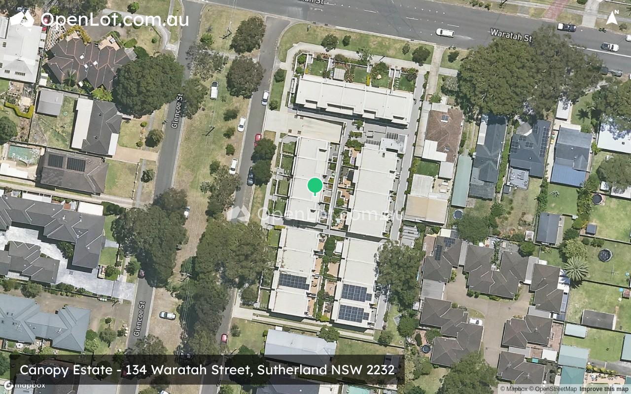
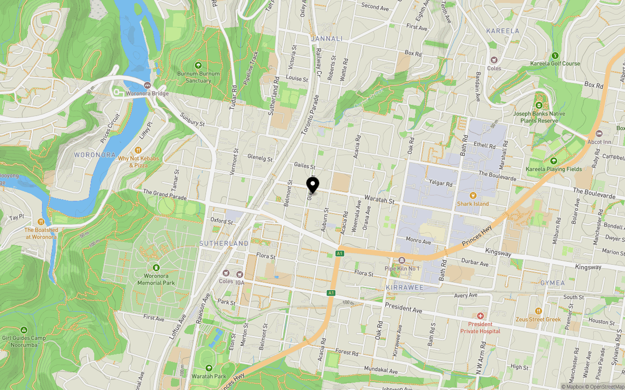
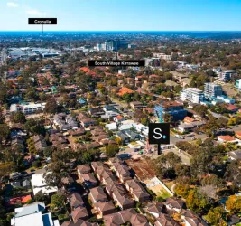
Location & Map for Canopy Estate - Sutherland
Schools near Canopy Estate - Sutherland
Canopy Sutherland Video
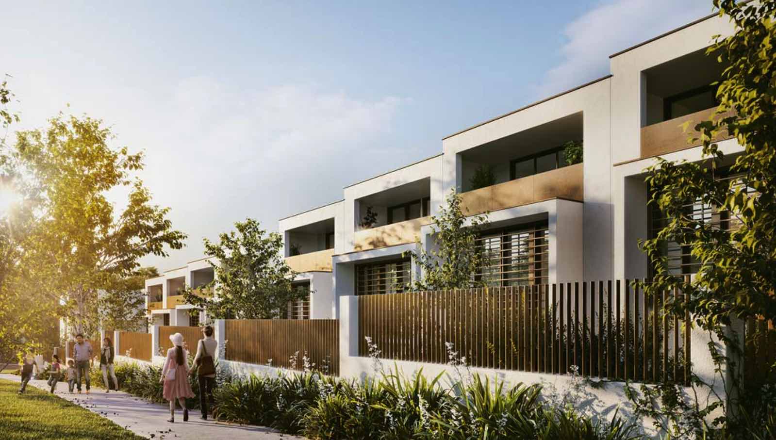
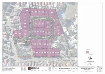
Overview
This information is estimated by the OpenLot research team. Let us know here to provide up-to-date information about this development.
| Total new homes | |
| Area Size | 0.33 hectares |
| Growth Region | Sydney South West Growth Areas |
| City Council | Sutherland Shire Council |
| Developer | Thirdi Group |
| Project Marketer | Highland Project Marketing |
| Distance to |
Updates for Canopy Estate - Sutherland

Popular Estates near Canopy Estate - Sutherland


Not exactly what you're looking for? Try surrounding suburbs
Barden Ridge NSW 2234
1 estate | Sutherland Shire Council
4.7km west
Heathcote NSW 2233
2 estates | Sutherland Shire Council
10.7km south-west
Sylvania NSW 2224
1 estate | Sutherland Shire Council
5.1km north-east
Narwee NSW 2209
1 estate | City of Canterbury Bankstown
10.0km north
Lugarno NSW 2210
1 estate | Georges River Council
6.0km north
Bexley North NSW 2207
1 estate | Bayside Council (Sydney)
12.1km north-east
Latest published articles


FAQs about Canopy Estate - Sutherland
Thirdi Group is the developer behind Canopy Estate - Sutherland.
Canopy Estate - Sutherland consists of 21 homes.
The total area for Canopy Estate - Sutherland is 0.33 hectares.
Canopy Estate - Sutherland falls under Sutherland Shire Council.
Canopy Estate - Sutherland is 21 km south-west of Sydney CBD.
Highland Project Marketing is the project marketer for Canopy Estate - Sutherland.
Nearby schools for Canopy Estate - Sutherland:
- Sutherland North Public School - 255m north-east
- St Patrick's Catholic Primary School - 672m south
- Sutherland Public School - 770m south-west
- St Patrick's College Sutherland - 859m south-west
- Minerva School - 967m south-west
- Jannali Public School - 1.1km north