
Cascadia Calderwood - Calderwood
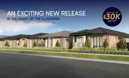
[NEW RELEASE] Cascadia Calderwood – SHAWOOD homes and vacant land Now Selling


- New release of completed SHAWOOD 4 and 5 bedroom residences, priced from $1,335,000
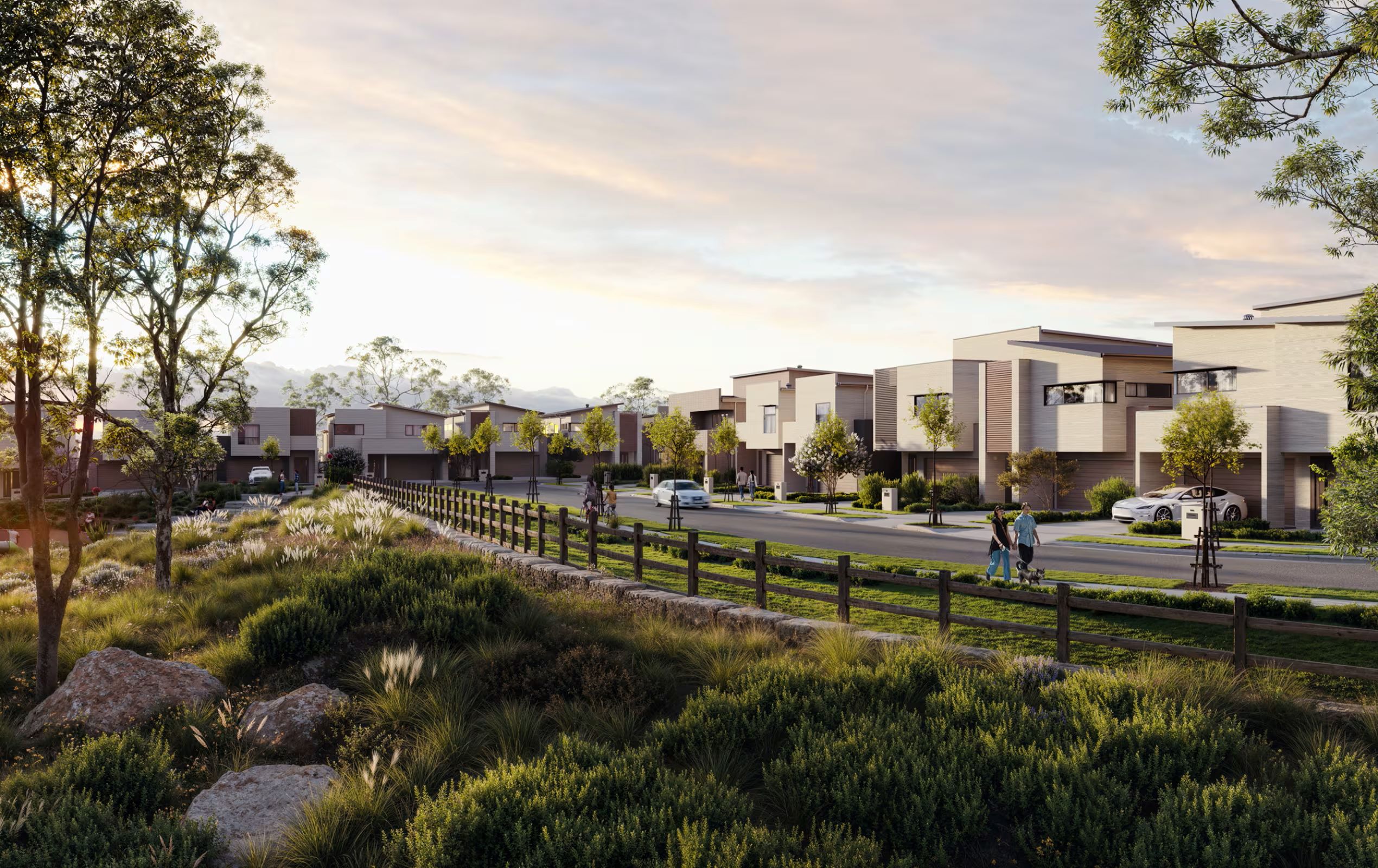
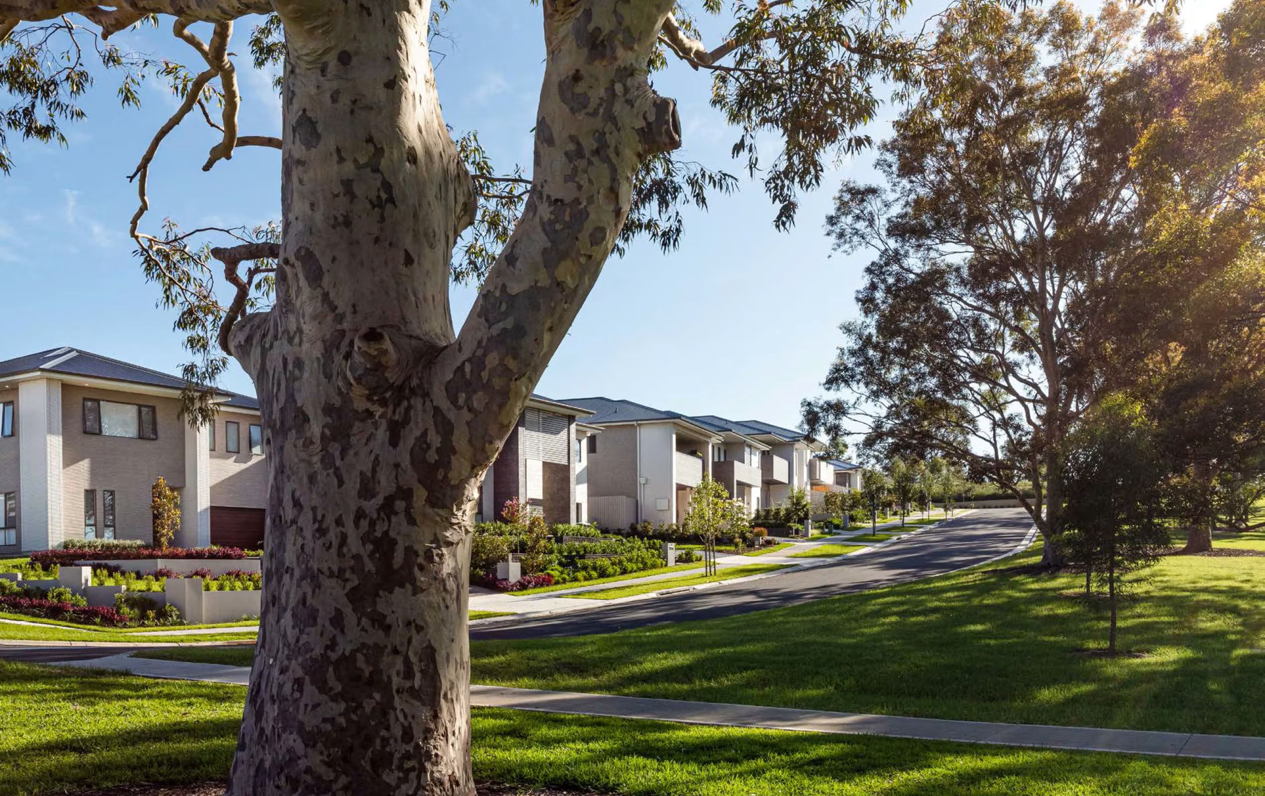
- Thoughtfully designed masterplanned community by Sekisui House
- Premium vacant land lots ranging in size from 439sqm to 926sqm and nature.
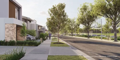
- Ready-to-move-in contemporary SHAWOOD homes, with premium appointments
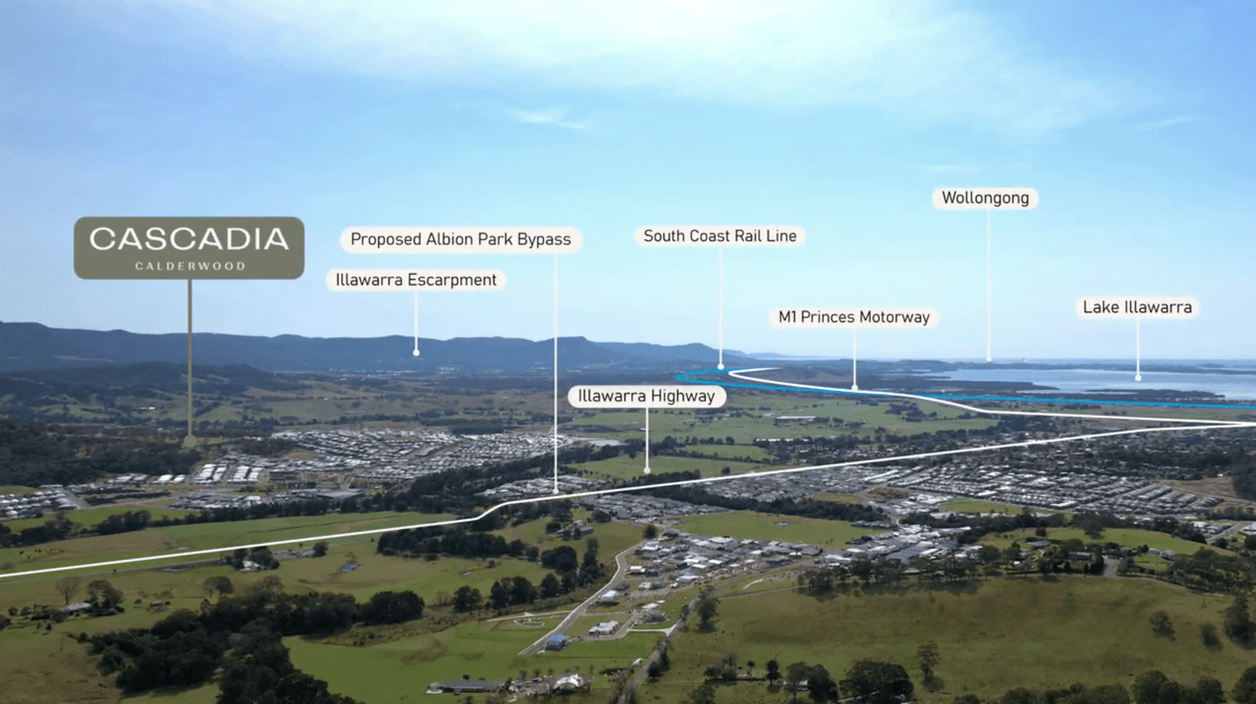
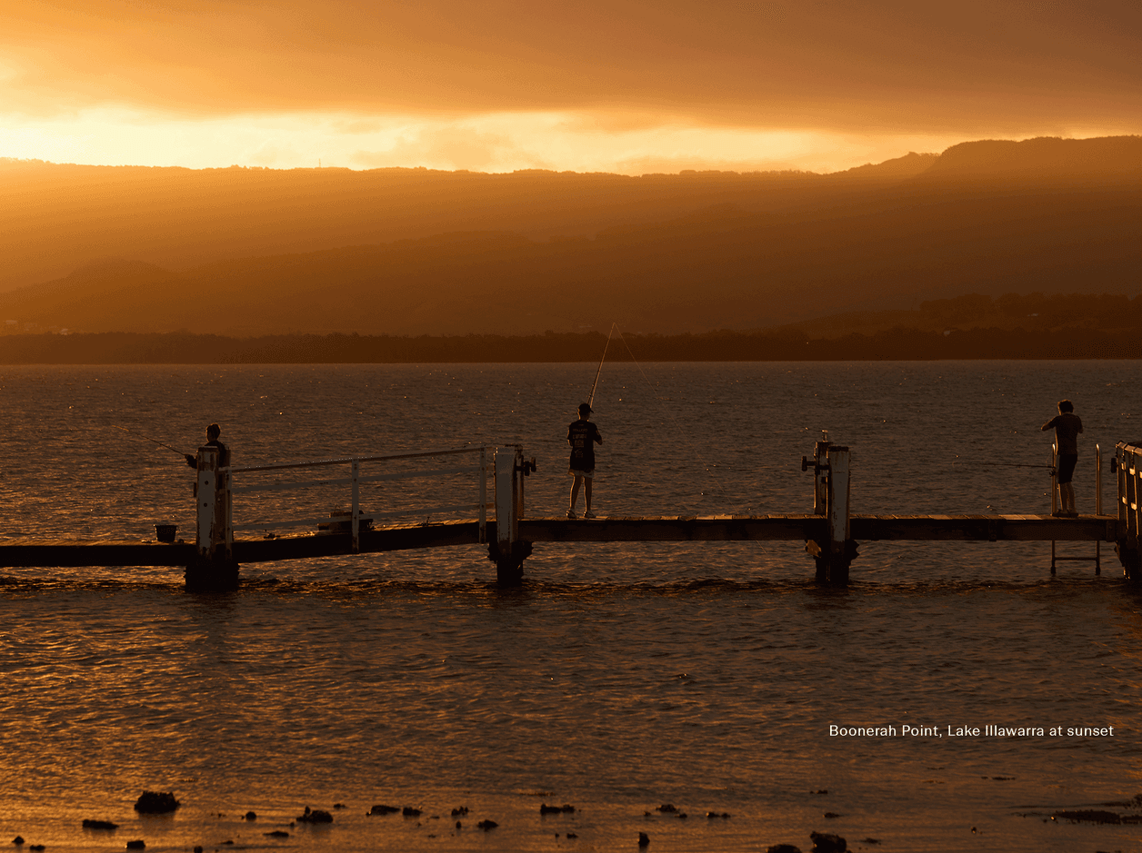
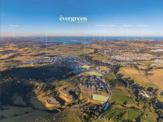
- Elevated views of Lake Illawarra and the Escarpment
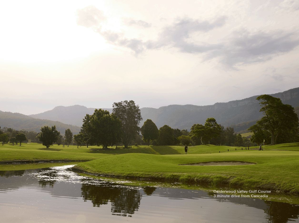
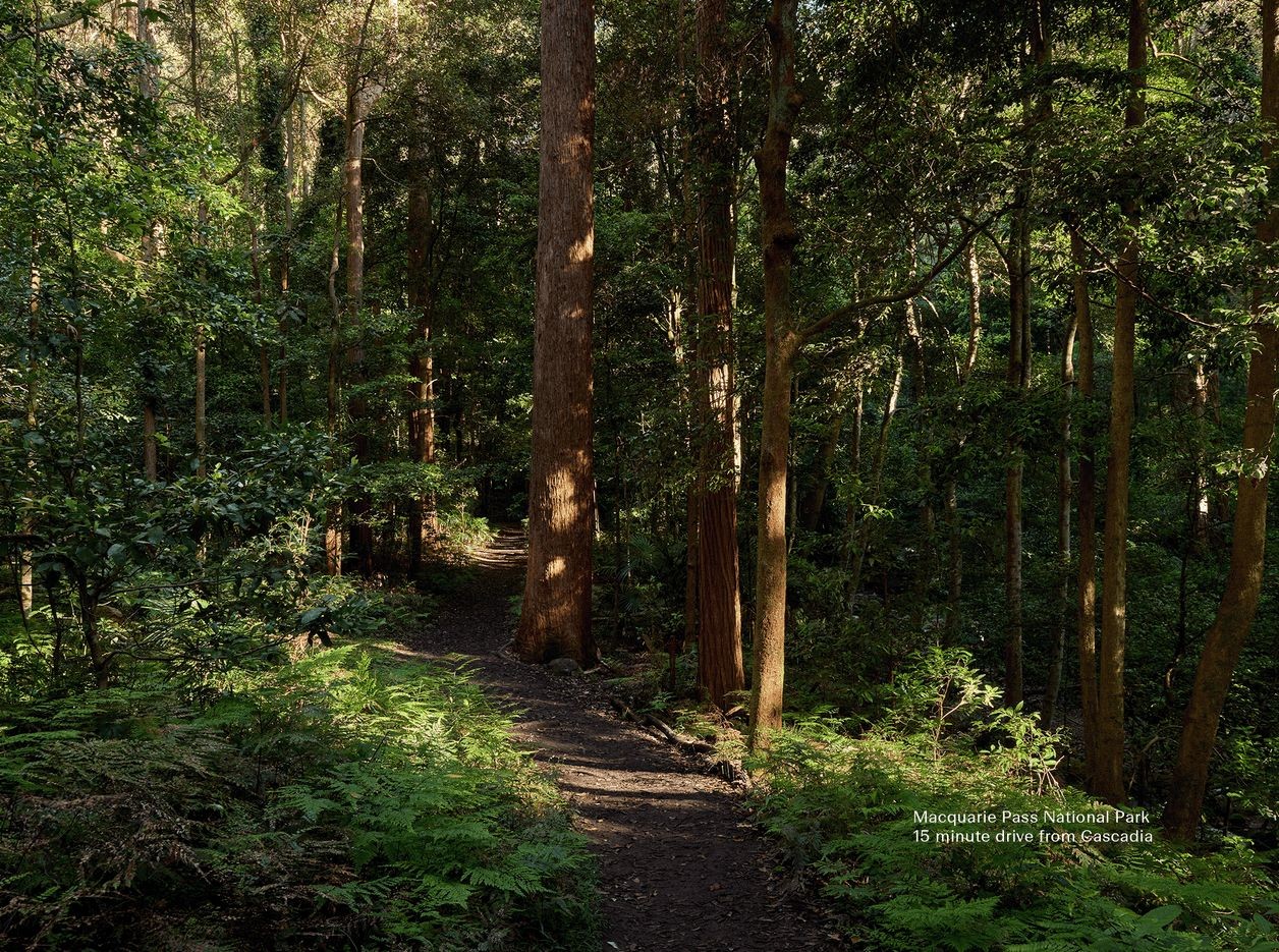
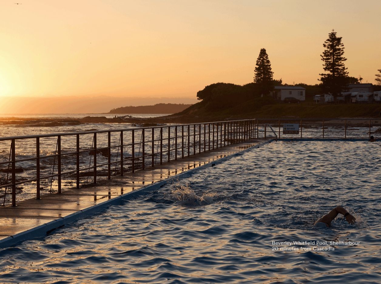
- Close to Shellharbour beaches, schools, and Wollongong
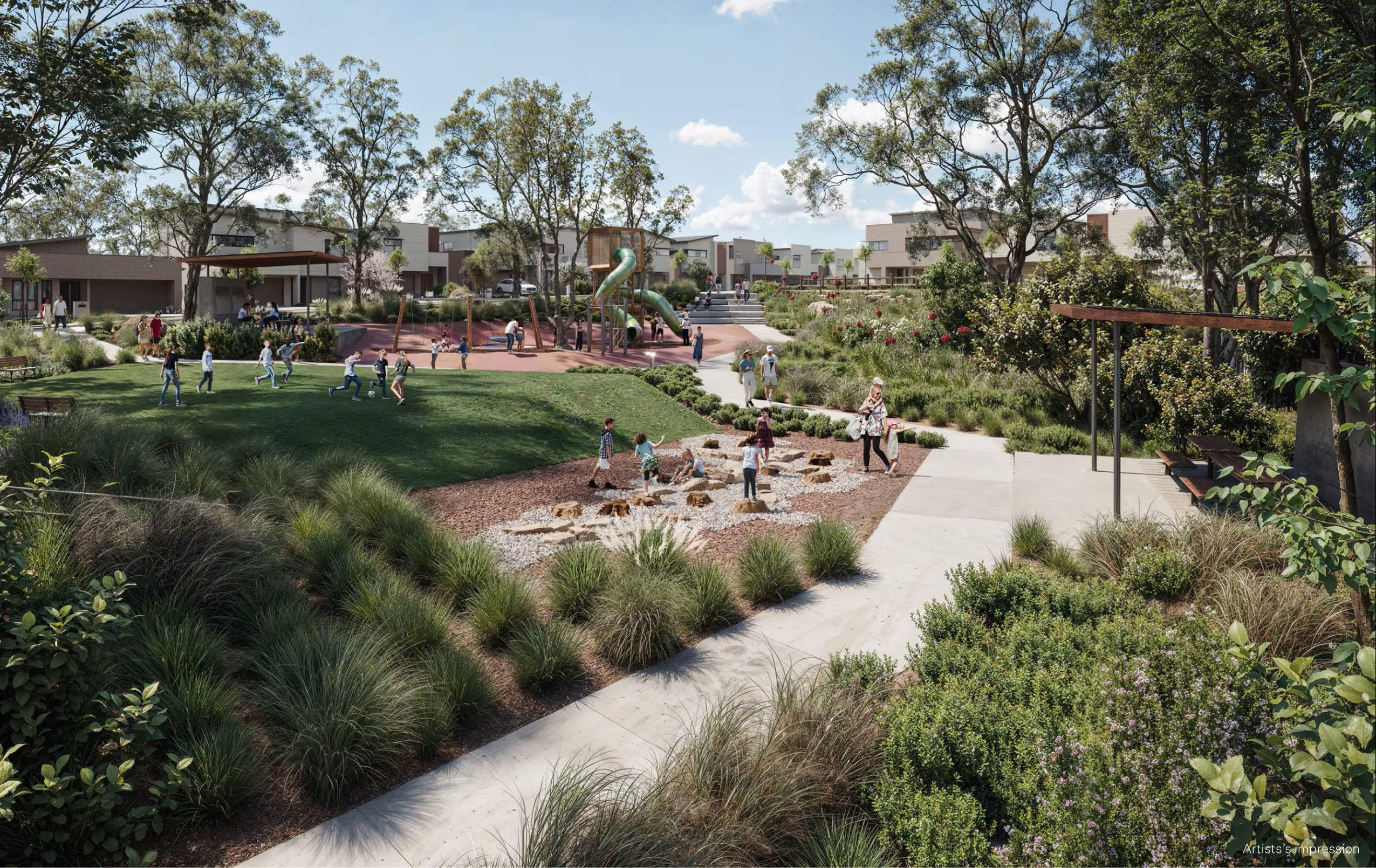
- Community-first design philosophy - featuring multiple parks in the development, dedicated green spaces, kilometres of walk and cycleways and tree lined streets
- Designed for families, upgraders, and lifestyle seekers alike.
- Sekisui House is a trusted developer with global reputation - having won awards globally and locally for masterplan communities in Gledswood Hills, NSW.
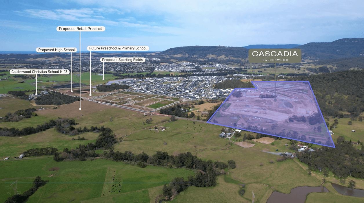
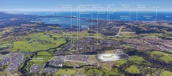
- Calderwood is poised for exponential growth in the coming years with new proposed infrastructure including - shopping village, Primary School, High School, Sporting Fields
Property types for sale
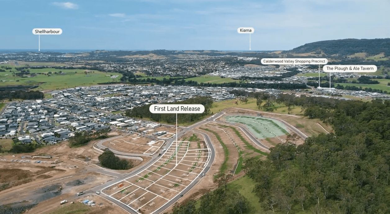
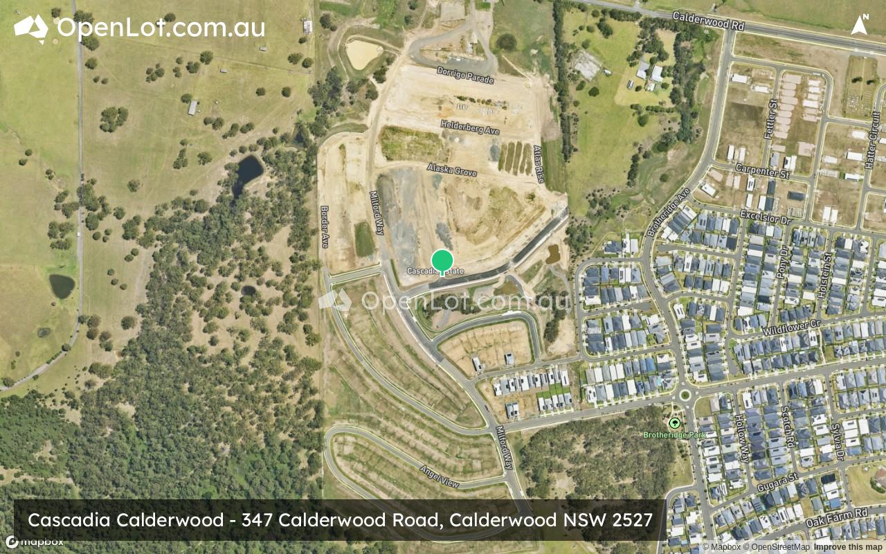
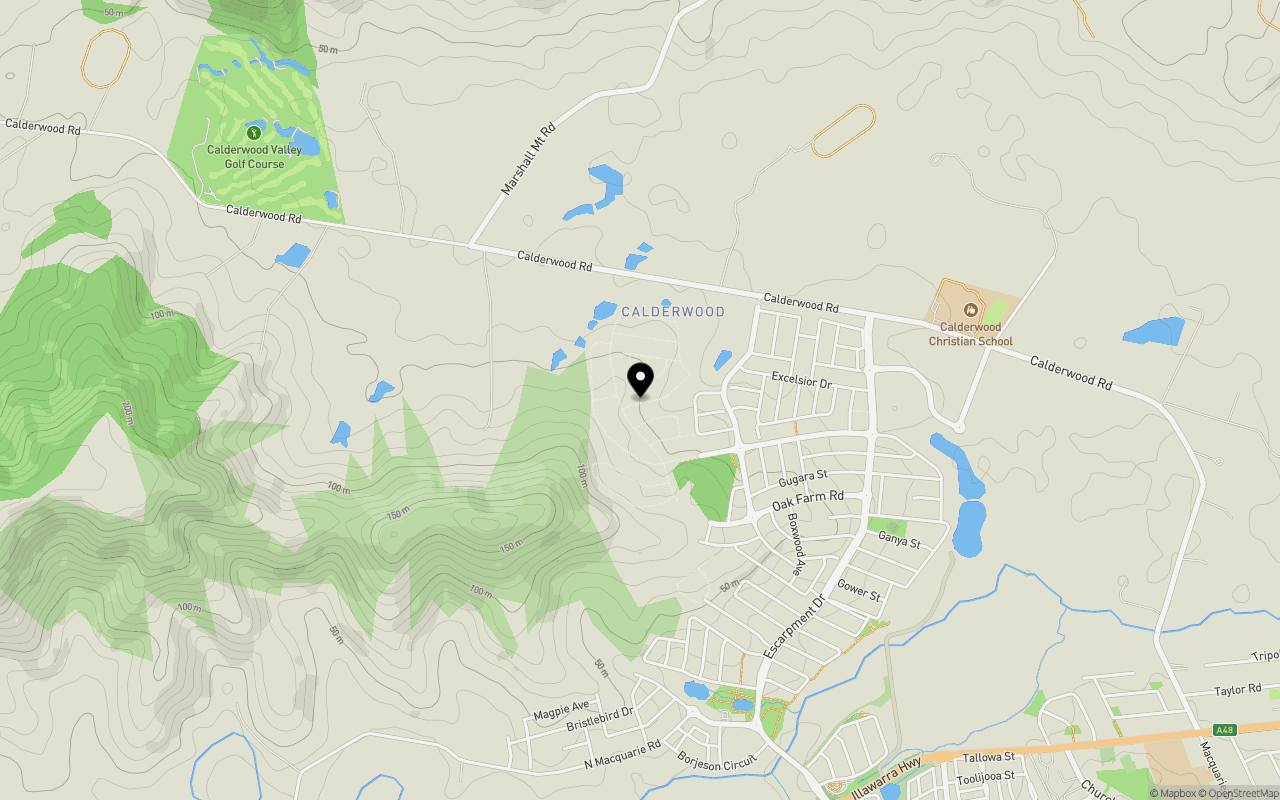
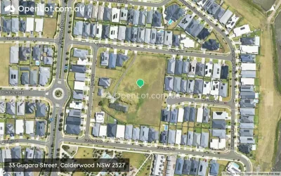
Location & Map for Cascadia Calderwood - Calderwood
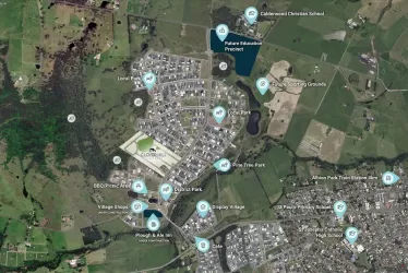
Schools near Cascadia Calderwood - Calderwood
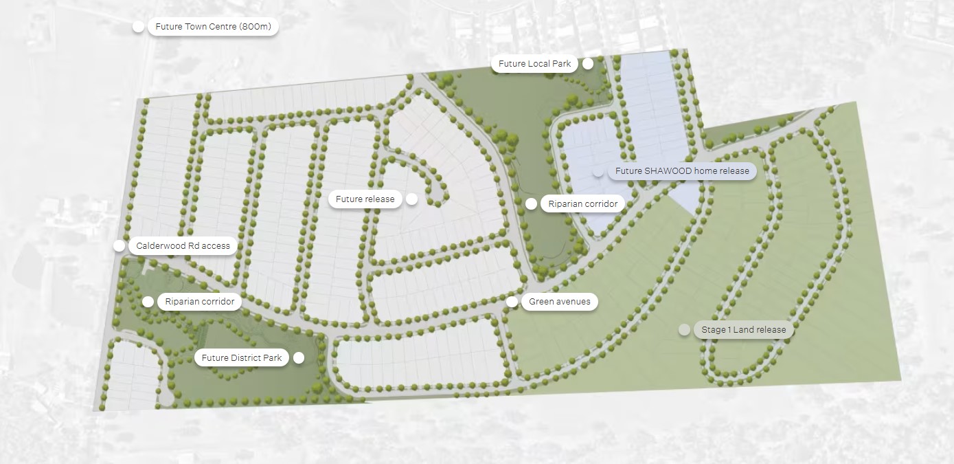
18 Land Lots in Cascadia Calderwood - Calderwood
3 House and Land Packages in Cascadia Calderwood - Calderwood
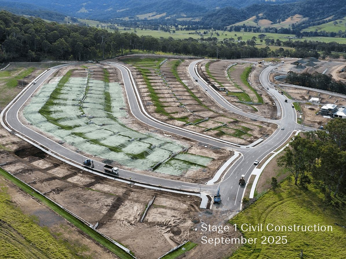
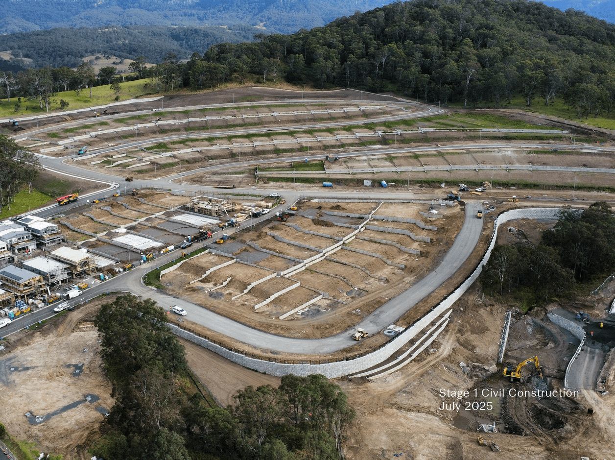
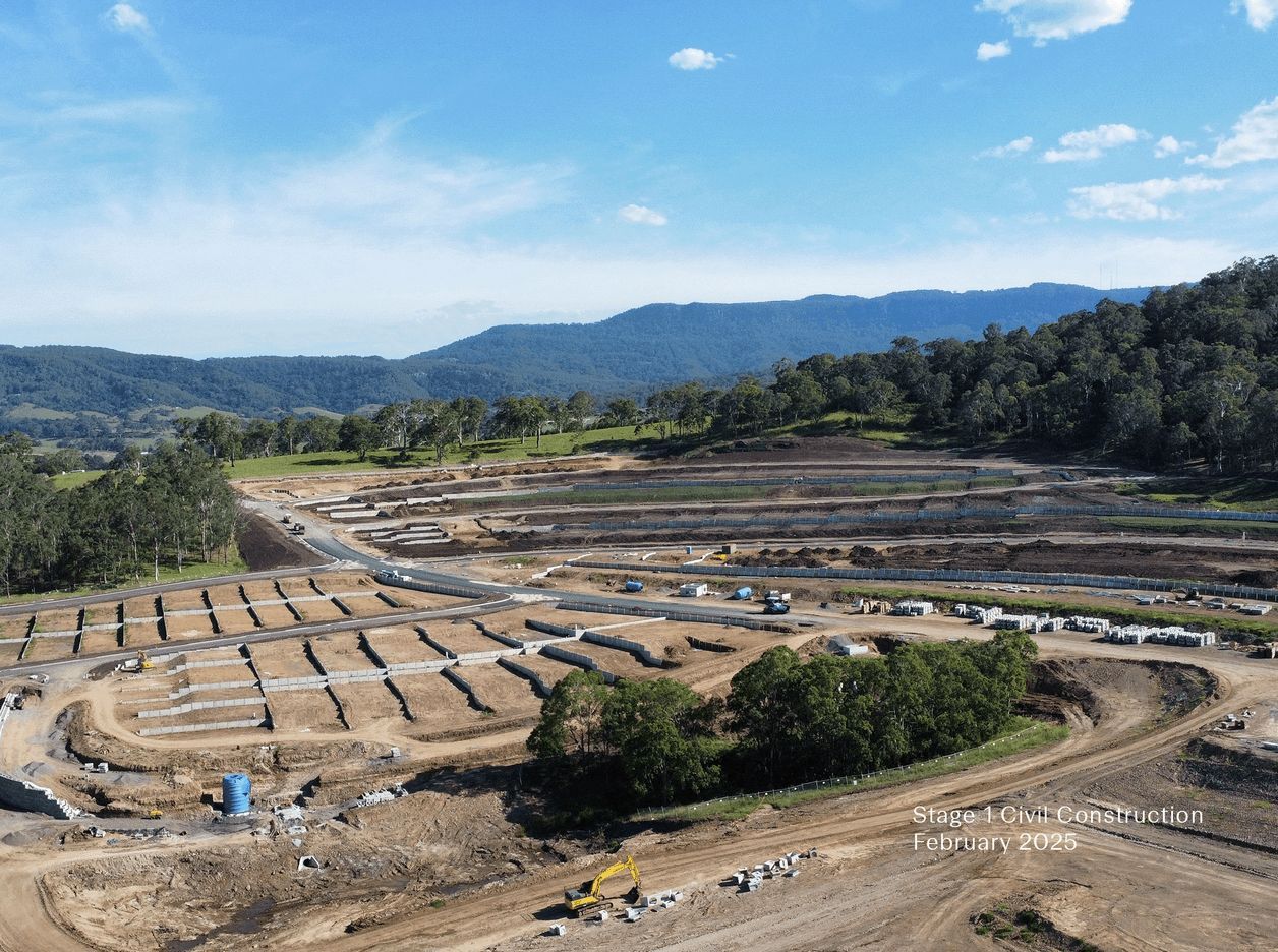
Cascadia Calderwood - Calderwood Video
Overview
This information is estimated by the OpenLot research team. Let us know here to provide up-to-date information about this development.
| Total new homes | |
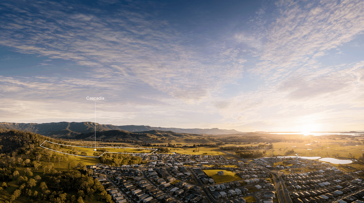
| Area Size | 36.77 hectares |
| Growth Region | Wollongong (Illawarra-Shoalhaven Region) |
| City Council | Shellharbour City Council |
| Developer | Sekisui House |
| Distance to |
Suburb Planning Review in Calderwood NSW 2527
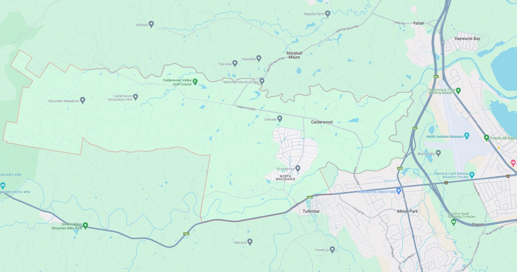
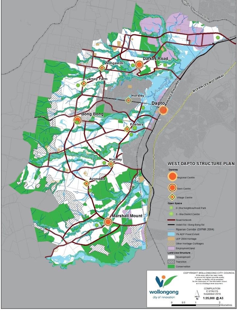
Calderwood is approximately 17.8 square kilometres within the Shellharbour City Council, forming part of the Sydney Basin area in New South Wales, located 136 kilometres south of Sydney and 25 kilometres to Wollongong. The suburb is located inland near the base of the Macquarie Pass National Park located to the south of the Upper Nepean State Conservation Area.
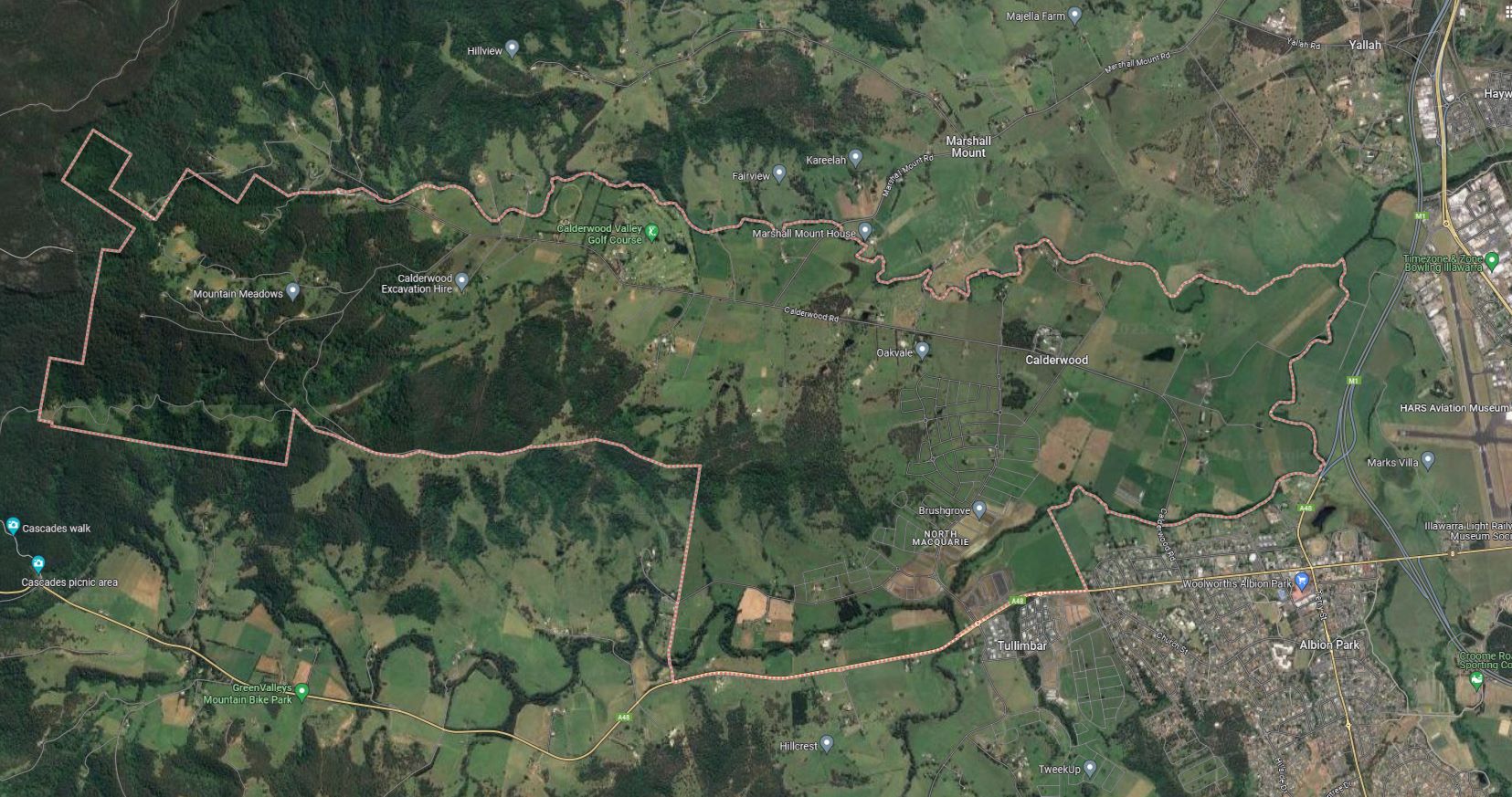
The suburb boundary is located along Marshall Mount Creek to the north and Macquarie Rivulet to the east. The Illawarra Highway, property boundaries and fire trails provide the boundary that makes up the entire southern boundary and property boundaries and the Macquarie Pass National Park provides the western boundary.
The Princes Motorway and rail line corridor run parallel together to the east of the suburb (north to south) separating the suburb area from the local airport and Lake Illawarra. Calderwood Road provides local road access (north to south) and connects the local road network found throughout Calderwood. Escarpment Drive and Marshall Mount Road provide north and south connections to surrounding suburbs.
The narrow suburb of Calderwood is located south-west of Wollongong and primarily rural land holdings, with Calderwood found to contain the eastern portion of the Macquarie Pass National Park and rural residential properties. The suburb does not have a business district, though contains a large golf course in the north and a new urban development area to the south.
The Calderwood boundary was officially extended in 2016, with the council proposing to expand the locality of Calderwood to encompass North Macquarie and the northern part of Tullimbar, Development in Calderwood will stretch into the proposed new boundary and the site has been known to the community as Calderwood or Calderwood Valley for the duration of its rejuvenation.
Illawarra Shoalhaven Regional Plan 2036 and 2041
The Illawarra Shoalhaven Regional Plan (ISRP) was released in 2021 and provides the strategic framework for future growth in the Region over the next 20 years. Since then, the NSW Government has delivered further documents, including the State Infrastructure Strategy 2018-2038, Future Transport 2056, A 20-year Economic Vision for Regional NSW and NSW South Coast Marine Tourism Strategy 2019.
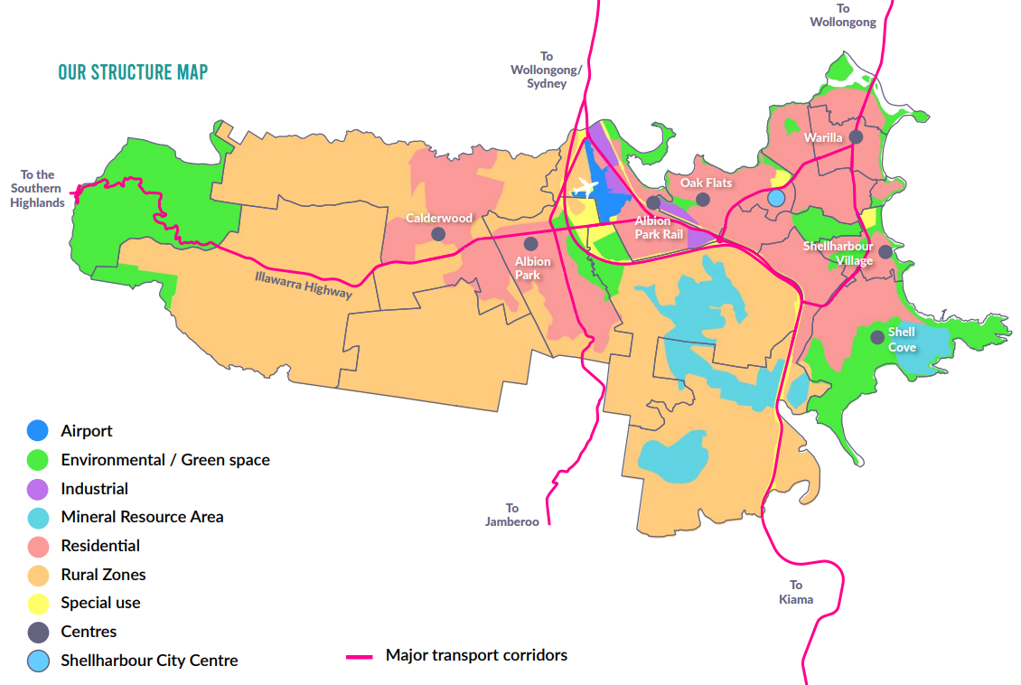
The Regional Plan was revised in 2021 and identifies 15 regionally significant precincts that will drive jobs creation, housing diversity, and vibrant communities. These places contain more than 2,300 hectares for employment, hubs for recreation, culture, housing, and innovation, as well as almost 45,000 jobs, and growth areas.
The regional cities of Shellharbour and Nowra align with the vision for the Illawarra Shoalhaven to serve as a central hub for business, government, and culture. They are envisioned as gathering places for civic events, community engagement, and social gatherings, while also serving as attractive destinations for visitors. Both regional cities are strategically situated adjacent to the regionally significant growth areas of West Lake Illawarra and Nowra Bomaderry.
Collectively, these areas comprise the largest urban expansion areas in regional New South Wales, with a combined capacity for 37,600 housing lots. The residents settling in these regions will rely on the regional cities for employment opportunities, access to healthcare and educational services, and recreational activities.
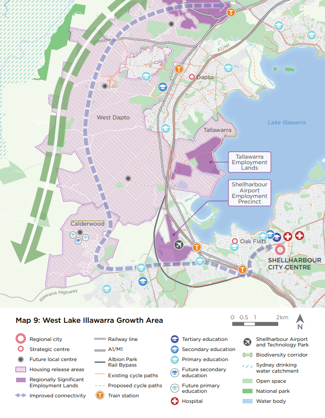
The Regional Plan outlined that a major regional land release area in the West Lake Illawarra growth area includes Calderwood in the most southern area.
Shellharbour City Council Local Strategic Planning Statement 2022
The NSW State Government prepared the Illawarra Shoalhaven Regional Plan in 2015 (Regional Plan) which estimates that by 2050 the Illawarra-Shoalhaven region will have a population of about half a million people.
In response to the Shellharbour City Council prepared the leased the Local Strategic Planning Statement (LSPS) 2022, which builds on the community’s aspirations expressed in the Community Strategic Plan 2022-2032.
The LSPS details a 20-year vision for Shellharbour City, guiding Council decisions aligned with economic, social, and environmental needs. It anticipates changes to create a favourable future for residents and visitors, encompassing land use planning strategies to preserve the city's unique identity
The planning statement outlines that the Shellharbour City Council estimates the population will be approximately 100,000 people and needs to provide about 15,000 dwellings and an additional population of about 27,000 people once fully developed over 20 plus years. A release plan was also prepared to stage out the proposed land availability to ensure services, infrastructure and community services were included in all new urban redevelopment.
Shellharbour City Council Vision
In 2042, Shellharbour City has a diversity of housing, providing for the lifestyle and needs of its residents. Housing choice offers affordable options and a range of housing products to meet community needs. Housing caters for changing needs over time and is adequately serviced with essential infrastructure. Residential areas have high quality design, a range of densities and character attributes.
The Planning Statement priorities of Calderwood
- Rural lands should be protected and enhanced
- Maintain open spaces
- Preserve our rural outlook
- Rural land is not lost to housing development
- The balance between urban, rural and scenic areas
- Make Shellharbour City a great place to live, and this needs to be protected and maintained
- Protect and enhance our rural lands and outlook towards the Illawarra Escarpment
- Consider other land uses that will broaden the potential use of agricultural lands
- Identify complementary land uses that are appropriate to occur in rural lands
- Improve the viability of rural industries
Shellharbour Local Environmental Plan 2013
Shellharbour Local Environmental Plan 2013 (LEP) provides the guidance for the future development of the growth area and aims to adhere to environmental planning regulations for Shellharbour's land. It specifically targets promoting arts and cultural activities, encouraging balanced and sustainable development, meeting diverse community needs, enhancing residential areas, retaining affordable housing, ensuring safer development, boosting the City Centre's vitality, improving connectivity, conserving heritage and significant landscapes, safeguarding natural resources and habitats, preserving agricultural land's productivity, and minimizing risks from environmental hazards like flooding and bushfires.
Calderwood - State Significant Site
The NSW State Government designated land in Calderwood as a State Significant Site in January 2011, consequently excluding it from the Shellharbour Local Environmental Plan (LEP) 2013. Instead, it falls under the jurisdiction of the State Environmental Planning Policy (Precinct - Regional) 2021.
The specific planning regulations for Calderwood are outlined in the Calderwood Development Control Plan, superseding the previous comprehensive Development Control Plan (DCP) for this project zone.
Consolidated Development Control Strategy 2010
In 2010, the NSW State Government approved the Concept Plan for the Calderwood Urban Development Project. This plan outlines the development of about 4,800 residential units, 50 hectares of mixed-use spaces, open areas, environmental zones, internal roads, essential infrastructure, and community facilities. Additionally, it establishes broad principles for local infrastructure necessities.
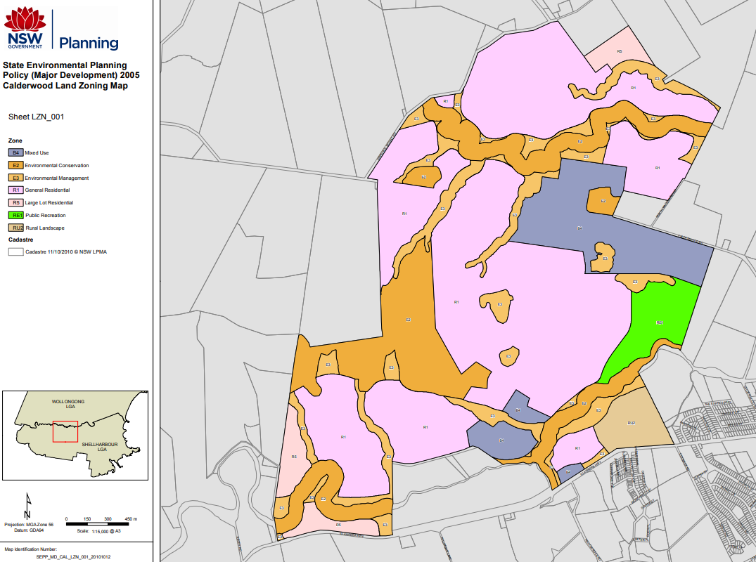
Calderwood Urban Development Project
The Calderwood Urban Development Project covers around 700 hectares of rural land northwest of Albion Park, spanning both Shellharbour (593 hectares) and Wollongong (107 hectares) Local Government Areas.
In 2010, the NSW State Government approved the Concept Plan for the Calderwood Urban Development Project, detailing 4,800 residential homes, 50 hectares of mixed-use areas, open spaces, environmental zones, roads, infrastructure, and community facilities. This plan also outlined basic guidelines for local infrastructure needs.
Calderwood Suburb Summary
References
Illawarra Shoalhaven Regional Plan – NSW State Government
Shellharbour City Council Local Strategic Planning Statement 2022
Shellharbour Local Environmental Plan 2013
Calderwood - State Significant Site
Calderwood Development Control Plan
Calderwood Urban Development Project
NSW Planning (ePlanning Spatial Viewer) - Rezoned Area
Google Streetview and Aerial
Updates for Cascadia Calderwood - Calderwood

Land Price Trend in Calderwood NSW 2527
Below shows the price trend from vacant land sales recorded in Calderwood NSW 2527.
The data and information provided by Terralytics (Aust) Pty Ltd (Terralytics Data) is general in nature and is not intended to constitute professional advice. Read more
It should not be relied upon as a substitute for legal, financial, valuation, or other specialist advice relevant to your specific circumstances.
Terralytics uses commercially reasonable endeavours to ensure the Terralytics Data is current and accurate. However, as the Terralytics Data incorporates information sourced from third parties, Terralytics makes no representation or warranty — express or implied — as to its accuracy, completeness, or currency. To the maximum extent permitted by applicable law, Terralytics excludes all liability for any loss or damage (including consequential loss) arising out of or in connection with reliance on the Terralytics Data, whether arising in contract, tort (including negligence), statute, or otherwise.
Popular Estates near Cascadia Calderwood - Calderwood


Not exactly what you're looking for? Try surrounding suburbs
Avondale NSW 2530
1 estate | Wollongong City Council
4.8km north-east
Yallah NSW 2530
1 estate | Wollongong City Council
7.3km east
Tullimbar NSW 2527
5 estates | Shellharbour City Council
3.8km south-east
Albion Park NSW 2527
3 estates | Shellharbour City Council
6.0km south-east
Marshall Mount NSW 2530
1 estate | Wollongong City Council
1.8km north
Huntley NSW 2530
2 estates | Wollongong City Council
6.9km north
Latest published articles


FAQs about Cascadia Calderwood - Calderwood
Sekisui House is the developer behind Cascadia Calderwood - Calderwood.
Cascadia Calderwood - Calderwood consists of 455 homes.
The total area for Cascadia Calderwood - Calderwood is 36.77 hectares.
Cascadia Calderwood - Calderwood falls under Shellharbour City Council.
Cascadia Calderwood - Calderwood is 20 km south-west of Wollongong CBD.
Nearby schools for Cascadia Calderwood - Calderwood:
- Calderwood Christian School - 1.3km east
- Tullimbar Public School - 2.0km south-east
- St Paul's Catholic Primary School - 2.5km south-east
- St Joseph's Catholic High School - 2.7km south-east
- Albion Park Public School - 3.1km east
- Albion Park High School - 3.5km south-east