


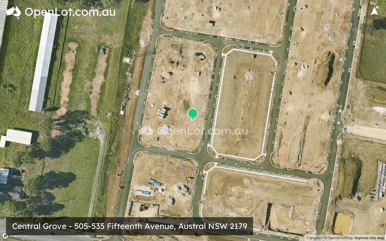
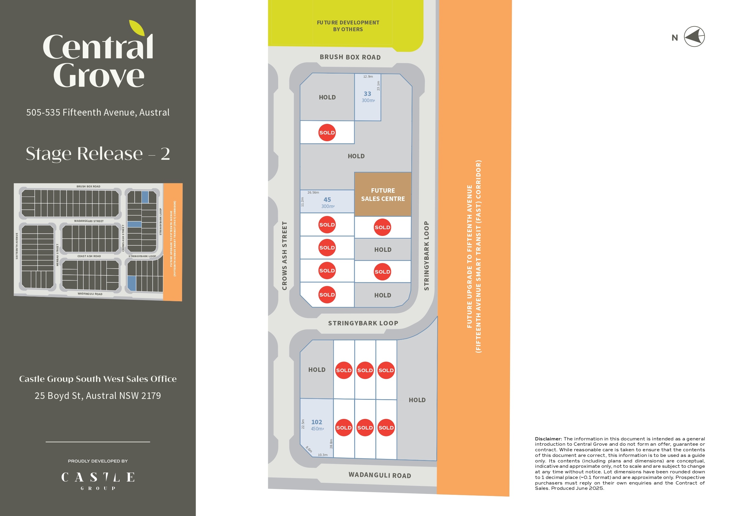
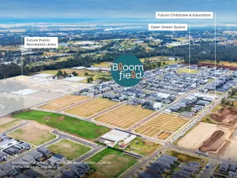
Central Grove - Austral
[NEW RELEASE] New Release | Lots from 300m2 Now Selling


- Central Grove is your opportunity to be part of something bigger — a vibrant new neighbourhood with parks, schools and shops already a short walk away, and a bold future just ahead. Central Grove is already over 70% sold. Register your interest now to stay informed about the upcoming release in the new year.
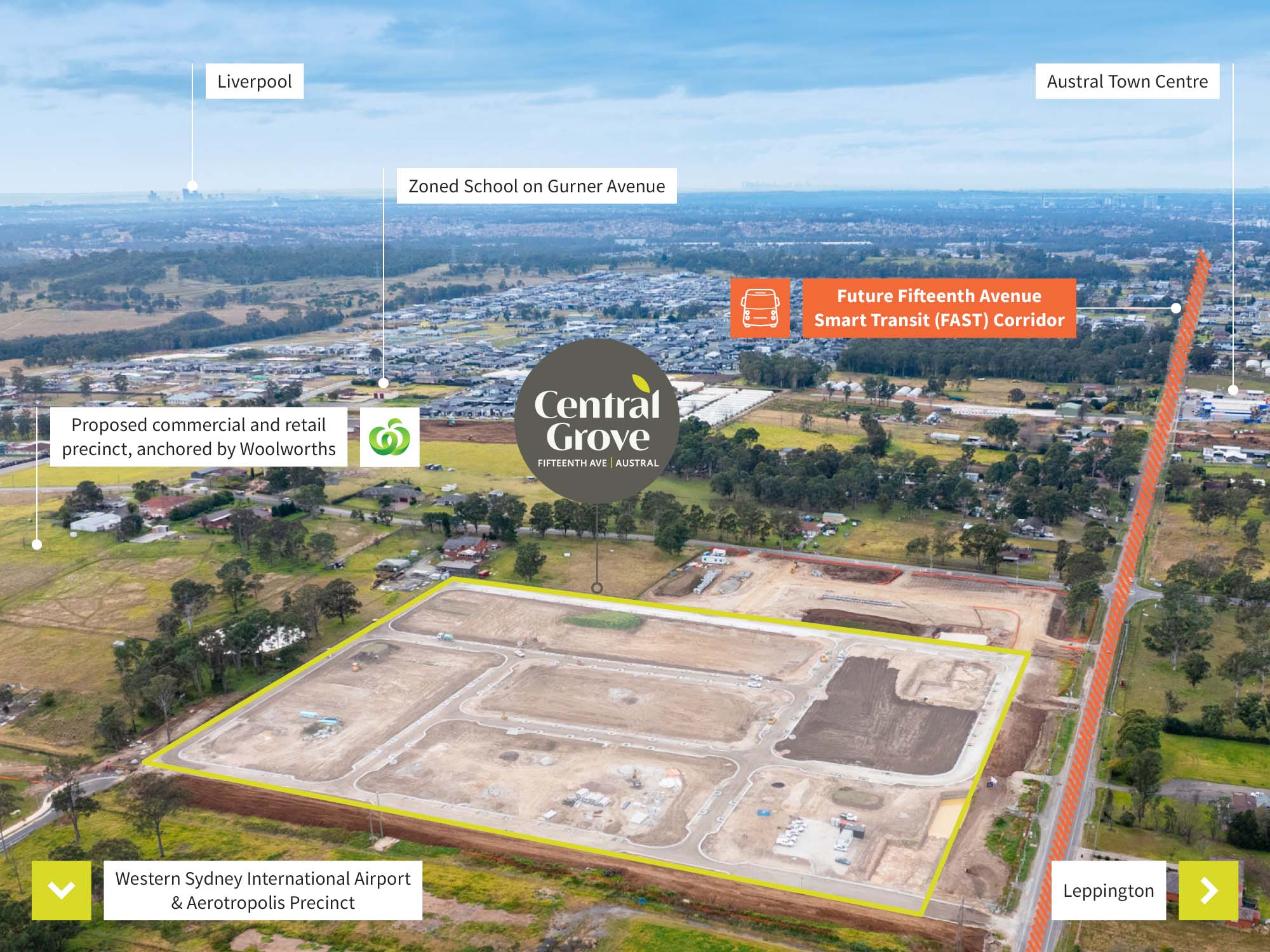
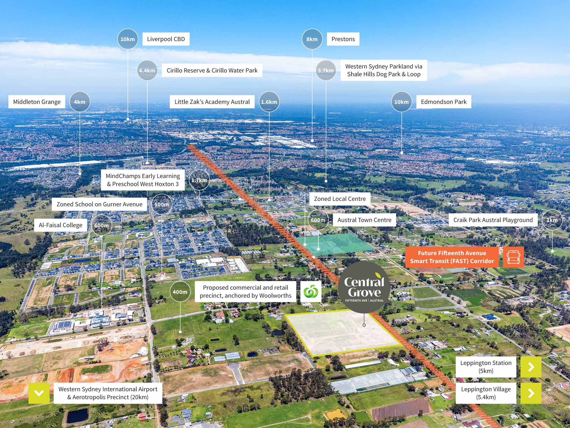
- With the upcoming $1 billion FAST Corridor set to transform Fifteenth Avenue into a gateway between the Western Sydney Airport and Liverpool CBD, this is where everyday convenience meets long-term potential.
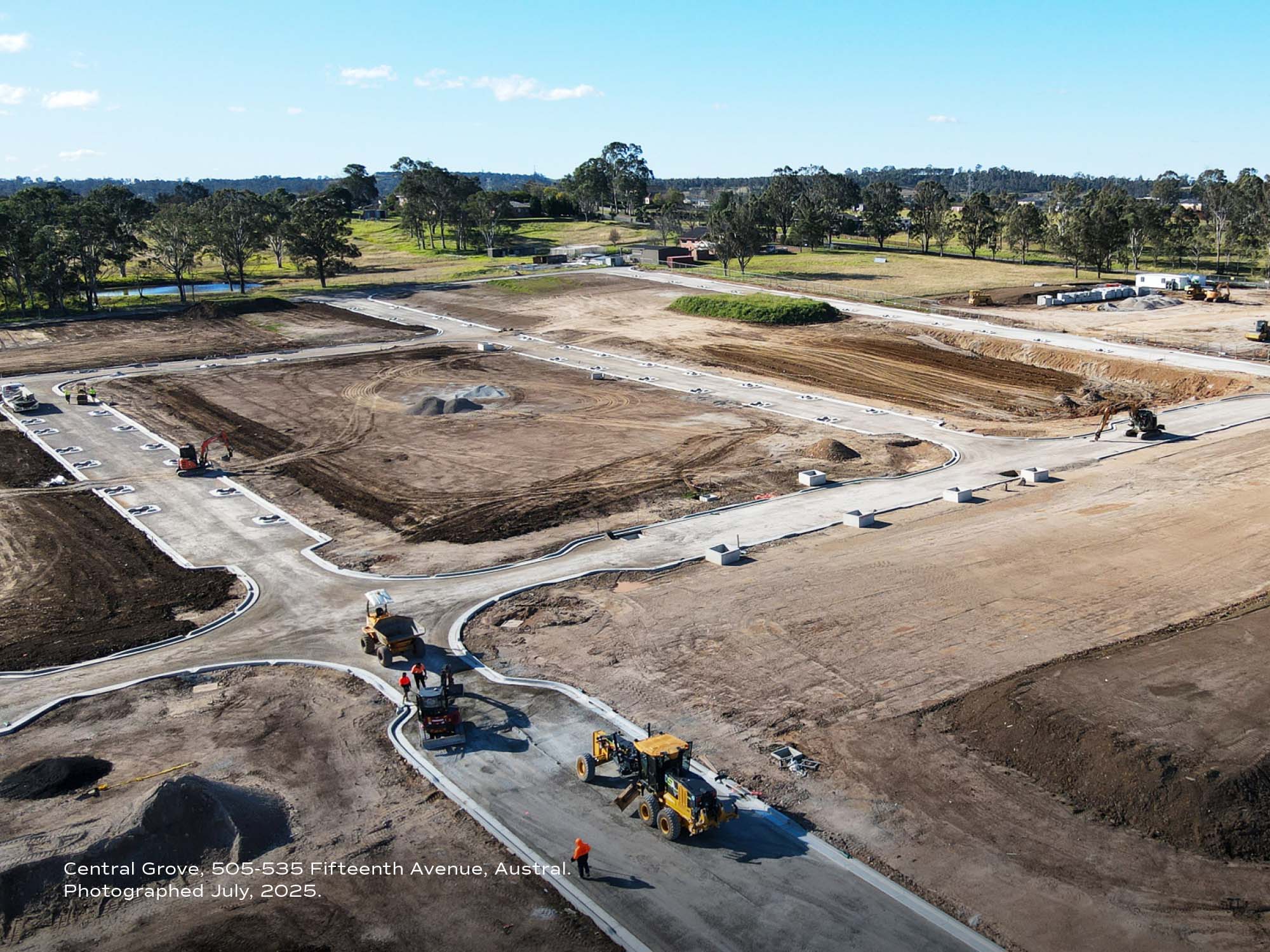
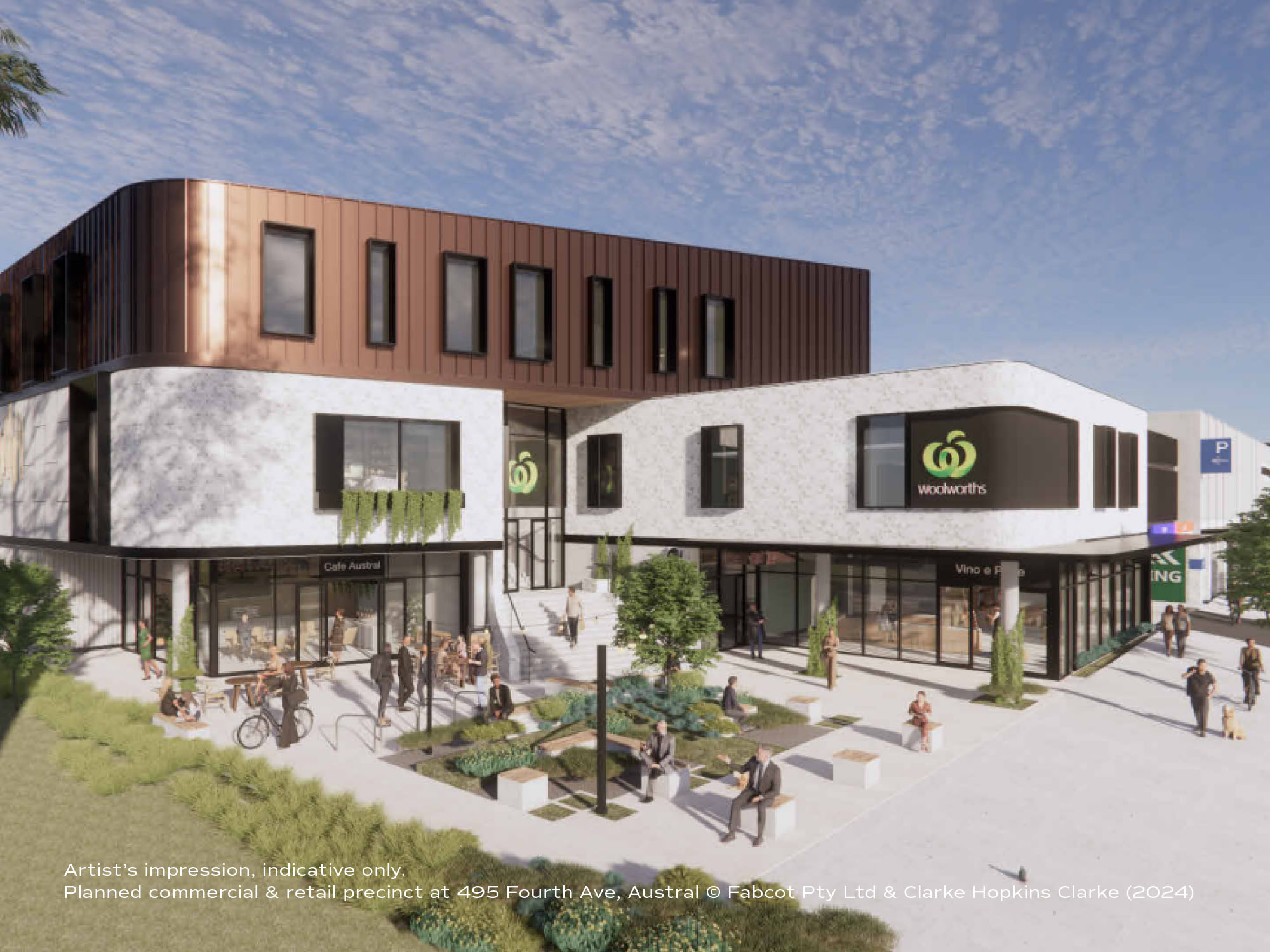
- More than 120 new trees will line the streets of Central Grove, shaping a green, walkable community surrounded by future parks, schools, and retail.
- Delivered with a bold, modern vision, this is a neighbourhood designed to balance lifestyle, connection and long-term growth — right in the heart of one of Sydney’s fastest-growing corridors.
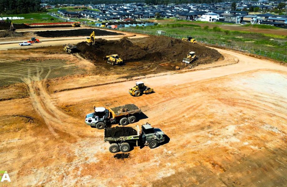
- Construction is now well underway. Land registration anticipated in Q1, 2026*. (subject to weather and approvals)
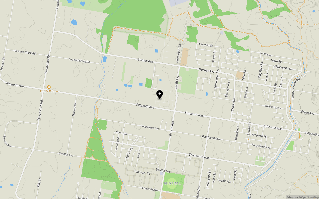
- 📍 Castle Group South West Sales Office: 25 Boyd Street, Austral
TRADING HOURS:
Monday, Tuesday, Thursday - Saturday from 10am–4pm (excludes Public Holidays).
Closed: 25–26 December and 1 January (Public Holidays).
Property types for sale
Location & Map for Central Grove - Austral
Schools near Central Grove - Austral
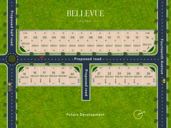
5 Land Lots in Central Grove - Austral
Overview
This information is estimated by the OpenLot research team. Let us know here to provide up-to-date information about this development.
| Total new homes | |
| Area Size | 7.07 hectares |
| Growth Region | Sydney South West Growth Areas |
| City Council | Liverpool City Council |
| Developer | Castle Group |
| Distance to | |
| OpenLot Offer | $200 Cashback |
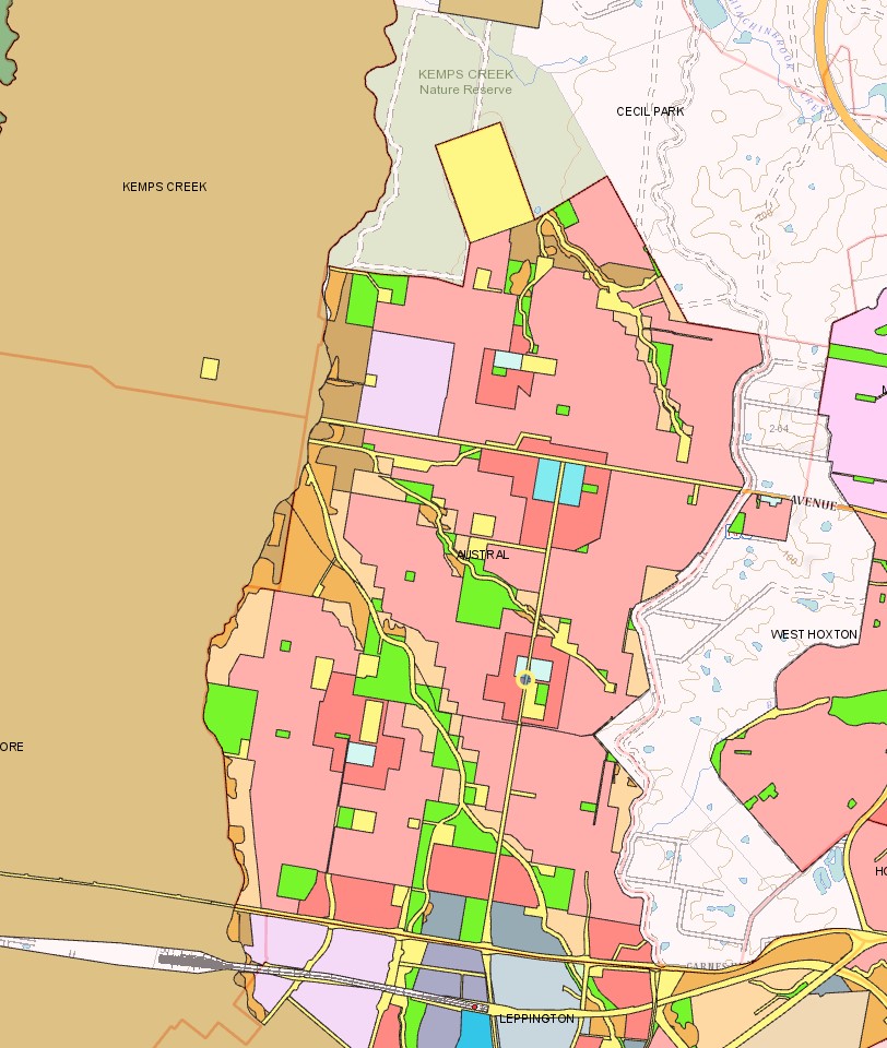
Suburb Planning Review in Austral NSW 2179
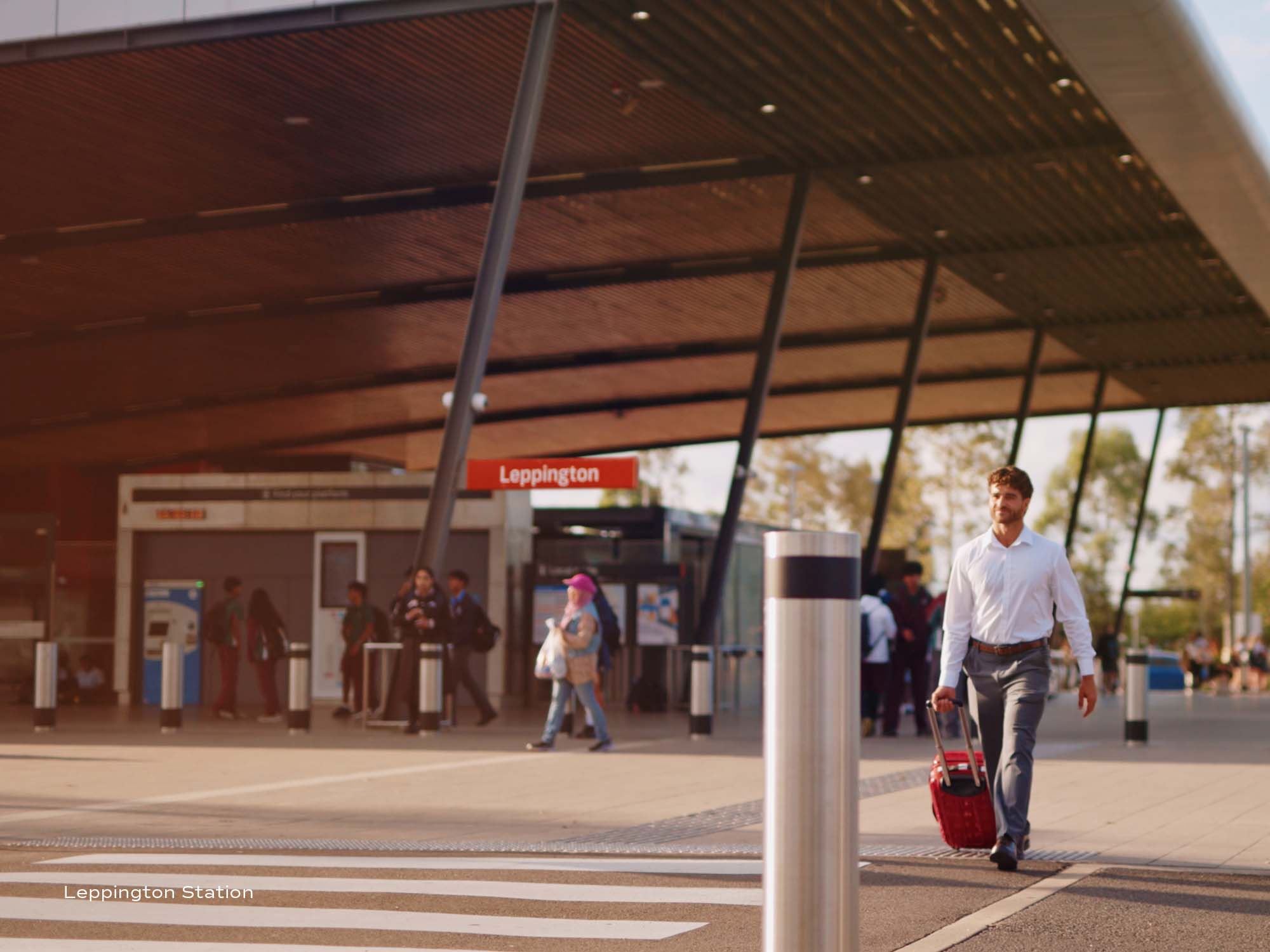
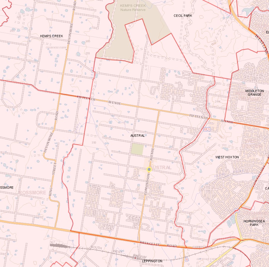
Austral is approximately 14.33 square kilometres located within the Liverpool Council and Camden Council forming part of the Greater Western Sydney region in New South Wales, located 42 kilometres south-west of Sydney. The suburb is primarily large agricultural land holdings and rural residential properties, with sporadic residential development increasing the density across the suburb. The suburb has a small business district in a central location, providing a strip of urban conveniences, retail and services that provide for the area. The Leppington train station is found to the south, outside the suburb boundary.
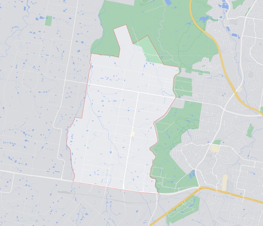
The suburb boundary is located along Kemps Creek and property boundaries are to the west, with the suburb boundary found along a drainage channel to the east. The suburb boundary is located along Bringelly Road to the south, with the TransGrid – Kemps Creek Electrical Substation and property boundaries providing the suburb boundary to the north.
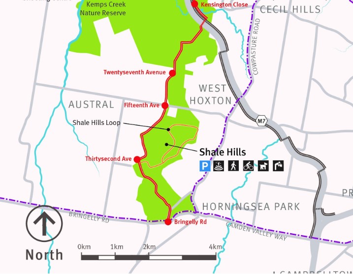
A unique vegetated preservation area located to the north and east, known as the Western Sydney Parklands covers 5,280 hectares and features a great assortment of picnic areas, walking and cycling tracks, and other entertainment facilities.
Fifteenth Avenue and Edmondson Avenue are the two major roads that provide access to the surrounding suburbs and the local roads network sound within the suburb. Kemps Creek continues from the adjoining suburb of Kemps Creek and splinters into other smaller creek corridors that traverse the suburb.
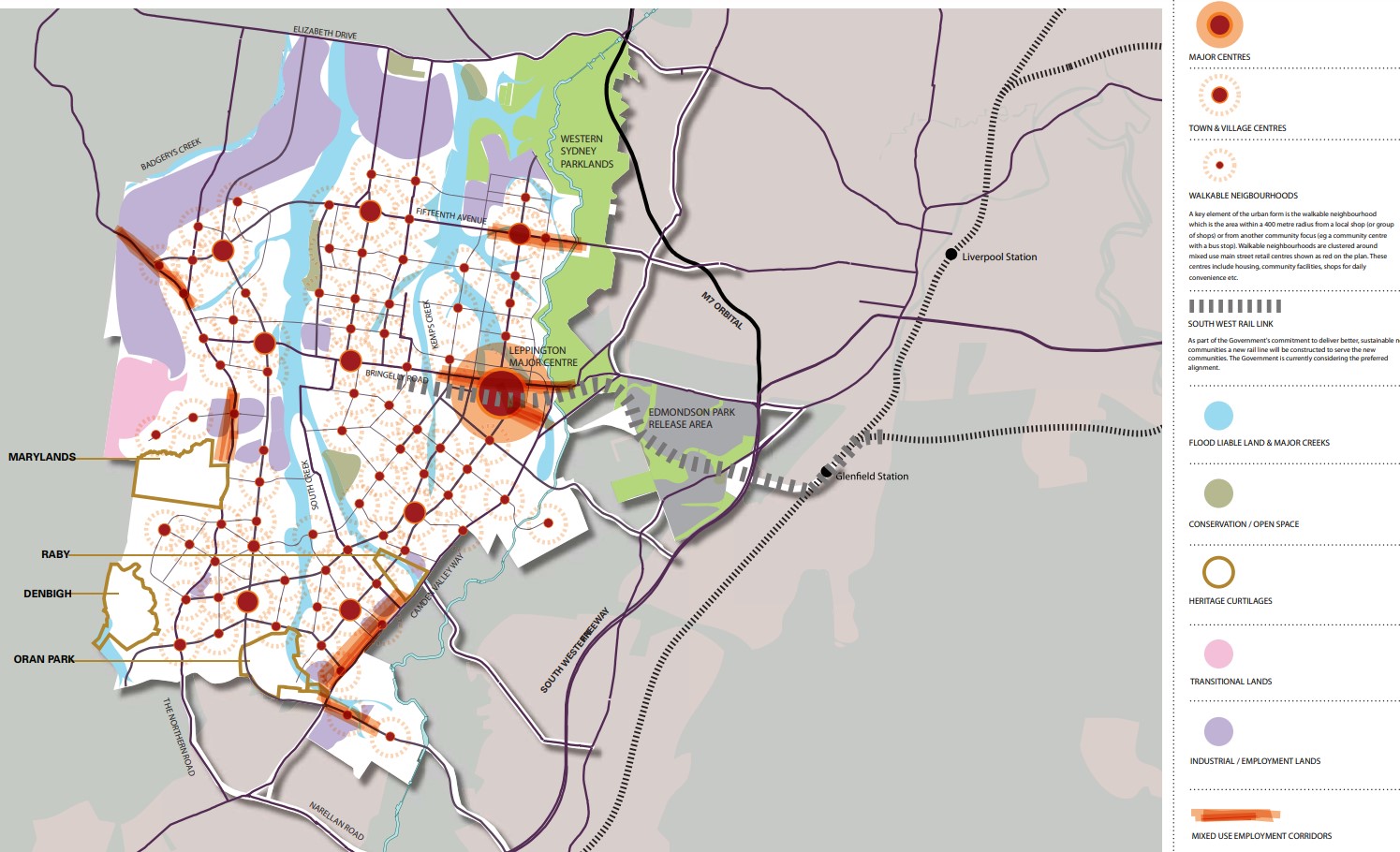
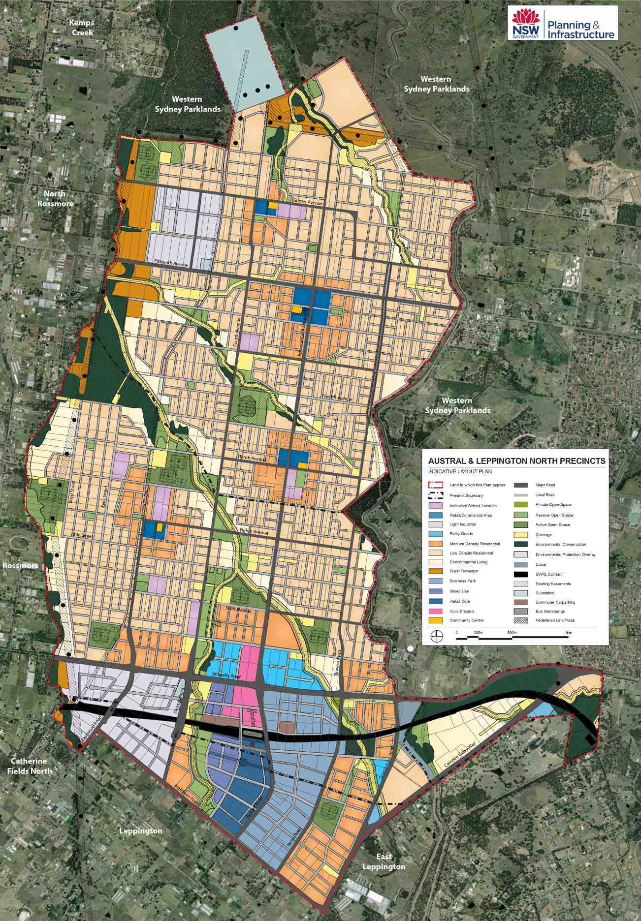
South West Priority Growth Area
The Austral Precinct is within an urban release area in Sydney’s South West Growth Centre and the Liverpool Local Government Area prepared the Liverpool Contributions Plan in 2014. The plan was to authorise the imposition of development contributions on development expected to occur in the Austral Precinct that would assist in the funding of new and augmented infrastructure needs. The Plan was adopted by Council on 26 May 2015 and came into effect on 3 June 2015.
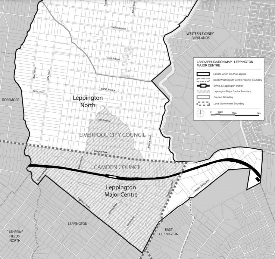
The Liverpool Contributions Plan allocated a portion of Austral in the rezoning to a new precinct called Leppington North and a Leppington Major Centre. As a result, the suburb of Austral is now a reduced size and shape, with the new southern boundary along the Kemps Creek corridor and Ninth Avenue.
The NSW State Government Department of Planning and Environment is preparing an update of the SGWA Structure Plan as a lot has occurred since it was published (below). Work has commenced with the relevant councils (Camden, Campbelltown and Liverpool Councils) as well as other state agencies and industry groups, to ensure the Structure Plan reflects current planning for the area.
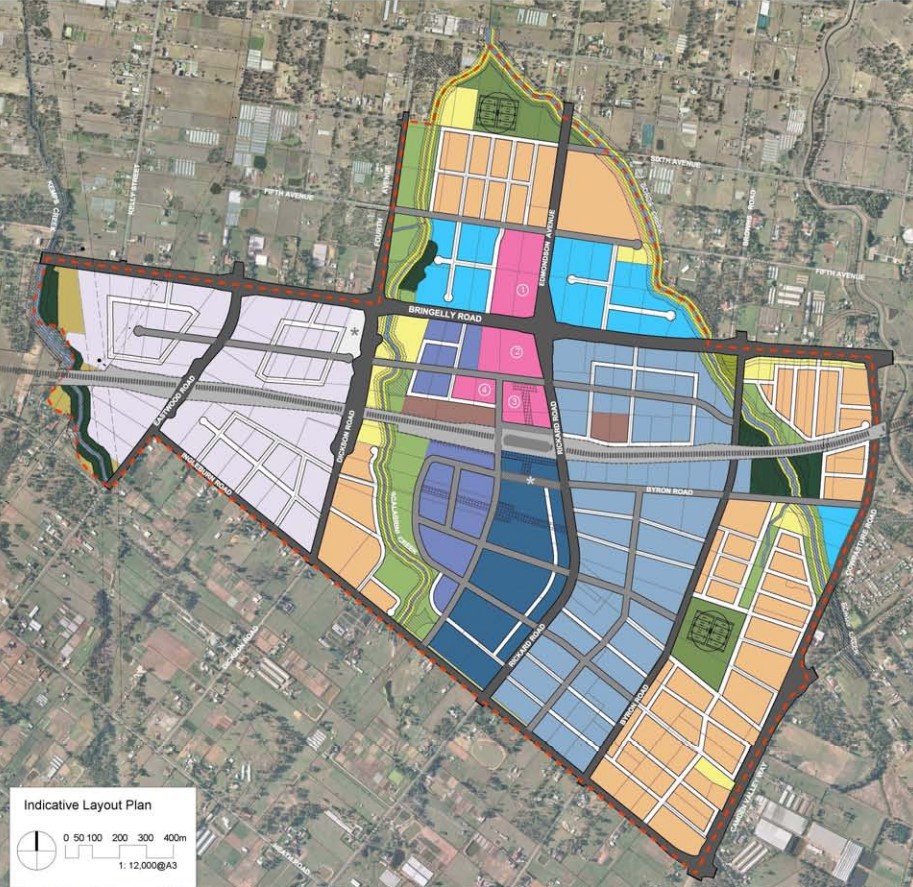
Austral forms part of the South West Growth Area and a Development Control Plan (DCP) was prepared to embed density controls in precinct plans to ensure that infrastructure planning aligns with growth. This Plan is known as the Liverpool Growth Centre Precincts Development Control Plan (DCP), particularly Schedule 1 – Austral and Leppington North Precincts and Schedule 2 - Leppington Major Centre Precinct was adopted and came into force on 3 April 2013 and was recently amended on 18 June 2021 (Austral ILP Amendment).
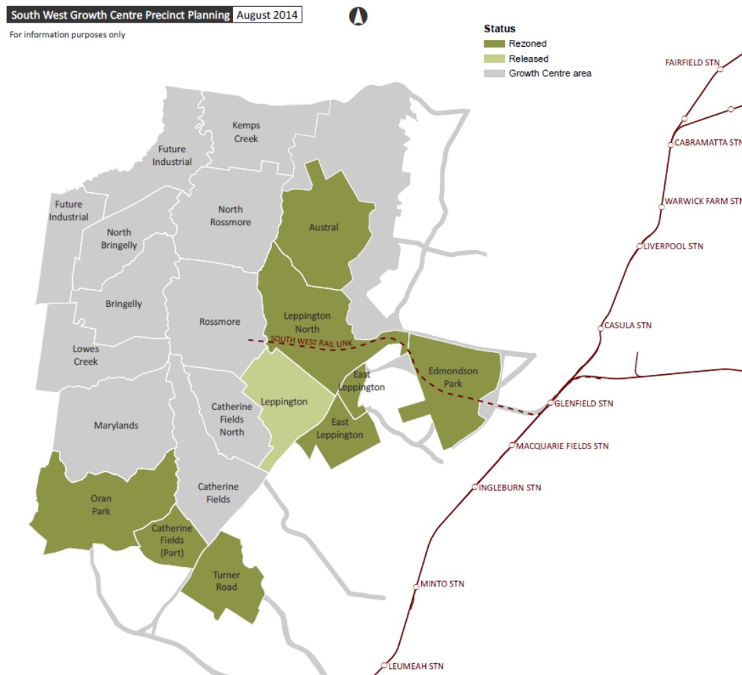
The DCP was prepared to provide additional guidance to developers, simplify the planning and ensure the orderly, efficient and environmentally sensitive development within the Precinct. The Liverpool Growth Centre Precinct is to be envisaged by the South West Sector Structure Plan and refined by both the Indicative Layout Plan for Austral and Leppington North Precincts and Leppington Major Centre.
Austral & Leppington North
- new Major Centre
- the new Leppington station
- three neighbourhood centres
- 220 hectares of employment land
- 135 hectares of open space and recreation areas
- upgrades to major roads
- new primary and high schools
- protection of significant vegetation, and major creek corridors
- improved connections to encourage walking and cycling.
The newly revitalised community at Austral & Leppington North will benefit from up to 17,350 new homes and the delivery of local amenities close to transport options, including:
Precinct Zoning of Austral
The existing zoning will be amended to provide for future infrastructures to facilitate future development within the Austral and Leppington North Precinct and Leppington Major Centre Precinct. A major centre is to be established above the Leppington Train station and localised town/village centres provided at major intersections. The structure plan provides for the community including supermarkets, community facilities, retail and services to meet the local shopping needs of future residents.
A new road network has been designed to help provide safe streets for residents, cycling and walking paths, and provide direct access to the village centre. The new roads will enable bus services to connect people to surrounding suburbs and areas for schools, employment, retail, open spaces and services. Pedestrian and cyclist facilities will be constructed along open space and creek corridors that will access the new residential areas.
Green spaces will be integrated with new homes with landscaping and tree planting along streets and in public domain areas and protected vegetation.
Austral Suburb Summary
References
- Leppington North and Austral – NSW State Government
- South West Grown Area Structure Plan
- NSW State Government Planning Portal
- Western Sydney Parkland
- Leppington - Precinct Rezoning Plan
- The Hills Shire Council Growth Centres Precinct - Development Control Plan
- NSW Planning (ePlanning Spatial Viewer)- Rezoned Area
- Google Streetview and Aerial
Updates for Central Grove - Austral


Land Price Trend in Austral NSW 2179
Below shows the price trend from vacant land sales recorded in Austral NSW 2179.
The data and information provided by Terralytics (Aust) Pty Ltd (Terralytics Data) is general in nature and is not intended to constitute professional advice. Read more
It should not be relied upon as a substitute for legal, financial, valuation, or other specialist advice relevant to your specific circumstances.
Terralytics uses commercially reasonable endeavours to ensure the Terralytics Data is current and accurate. However, as the Terralytics Data incorporates information sourced from third parties, Terralytics makes no representation or warranty — express or implied — as to its accuracy, completeness, or currency. To the maximum extent permitted by applicable law, Terralytics excludes all liability for any loss or damage (including consequential loss) arising out of or in connection with reliance on the Terralytics Data, whether arising in contract, tort (including negligence), statute, or otherwise.
Popular Estates near Central Grove - Austral


Not exactly what you're looking for? Try surrounding suburbs
Bringelly NSW 2556
1 estate | Camden Council
6.1km west
Horningsea Park NSW 2171
1 estate | Liverpool City Council
5.4km south-east
Denham Court NSW 2565
3 estates | Campbelltown City Council - NSW, Liverpool City Council
6.6km south
Leppington NSW 2179
53 estates | Camden Council, Liverpool City Council
5.8km south
Middleton Grange NSW 2171
6 estates | Liverpool City Council
4.2km east
Carnes Hill NSW 2171
4 estates | Liverpool City Council
5.1km east
Latest published articles


FAQs about Central Grove - Austral
Castle Group is the developer behind Central Grove - Austral.
Central Grove - Austral consists of 117 homes.
The total area for Central Grove - Austral is 7.07 hectares.
Central Grove - Austral falls under Liverpool City Council.
Central Grove - Austral is 36 km west of Sydney CBD.
Nearby schools for Central Grove - Austral:
- Al-Faisal College - Liverpool - 874m north-east
- Arrahman College - 1.3km east
- St Anthony of Padua Catholic College - 1.6km south
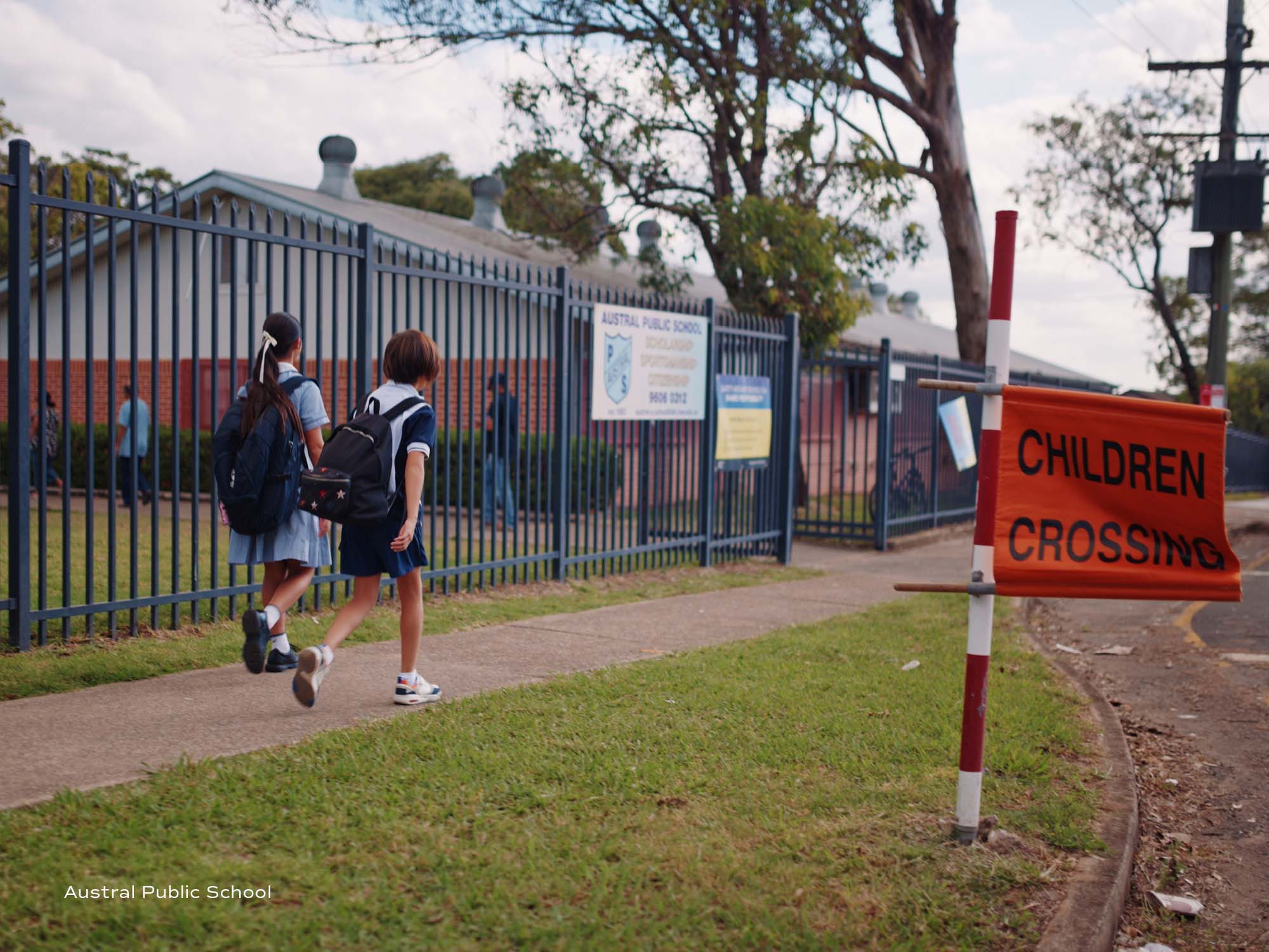
- Austral Public School - 2.1km south
- Thomas Hassall Anglican College - 3.1km east
- Unity Grammar College - 3.2km south