
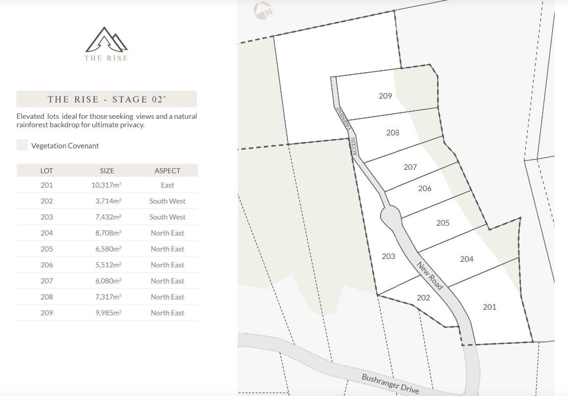
Property types for sale
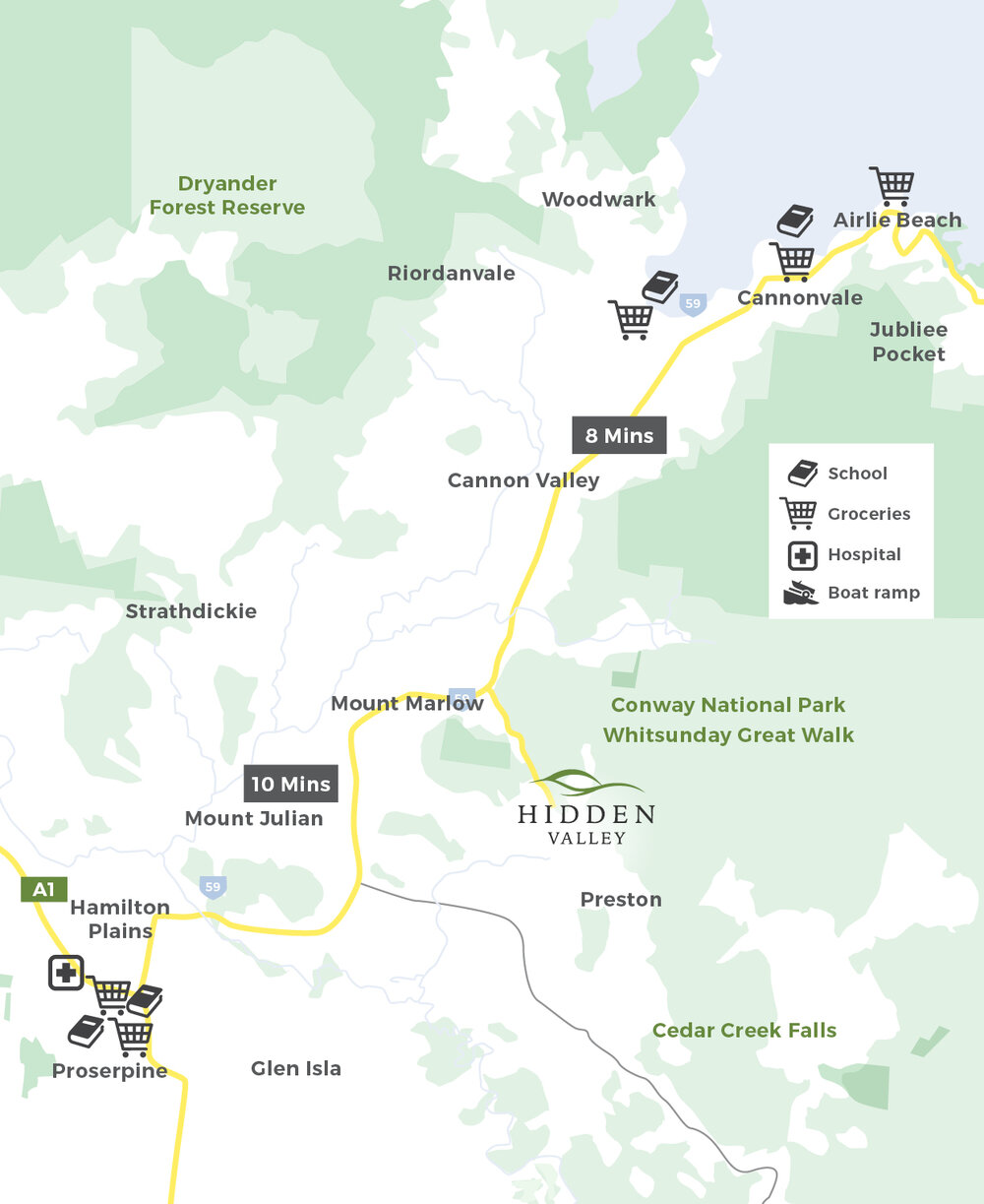
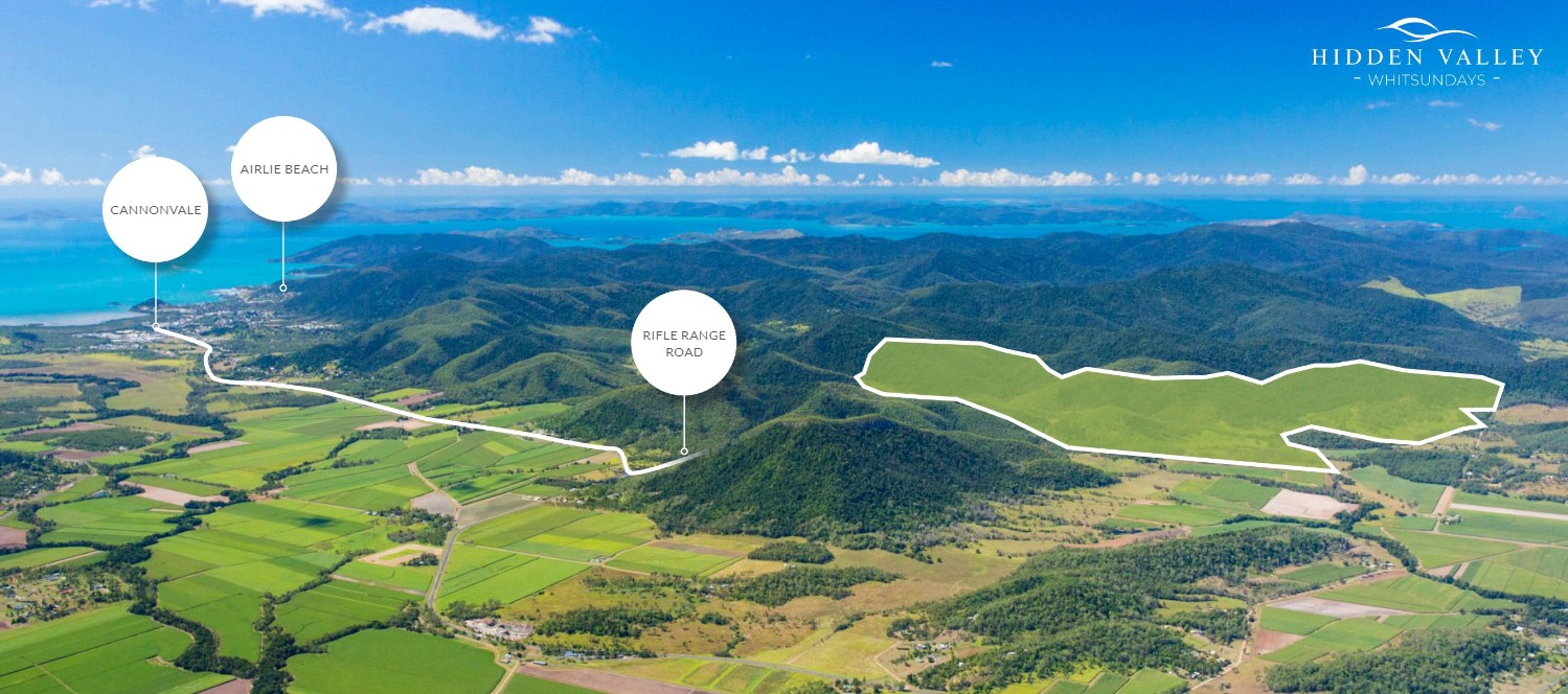
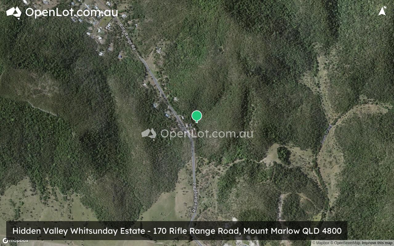
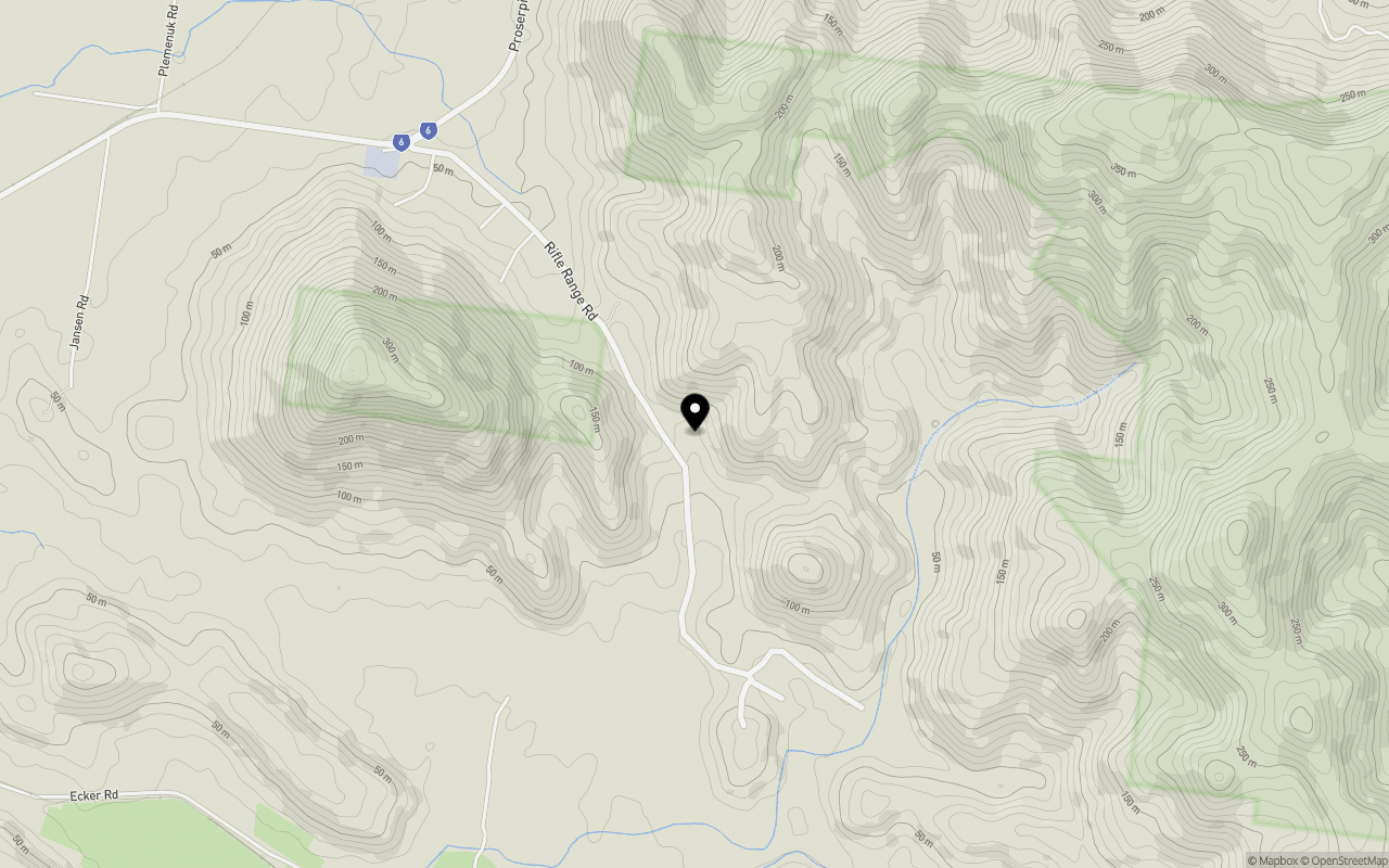
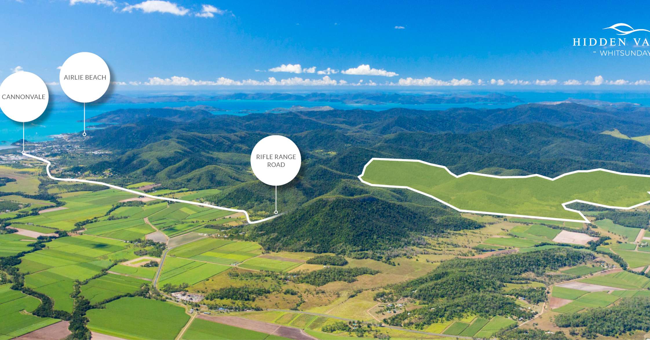
Location & Map for Hidden Valley Whitsunday Estate - Mount Marlow
Schools near Hidden Valley Whitsunday Estate - Mount Marlow
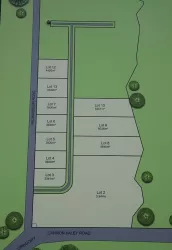
Overview
This information is estimated by the OpenLot research team. Let us know here to provide up-to-date information about this development.
| Total new homes | |
| Area Size | 405.00 hectares |
| City Council | Whitsunday Regional Council |
| Developer | N/A |
| Project Marketer | Ray White Whitsunday |
Updates for Hidden Valley Whitsunday Estate - Mount Marlow
Popular Estates near Hidden Valley Whitsunday Estate - Mount Marlow


Not exactly what you're looking for? Try surrounding suburbs
Glen Isla QLD 4800
1 estate | Whitsunday Regional Council
7.4km south
Cannon Valley QLD 4800
3 estates | Whitsunday Regional Council
4.4km north-east
Strathdickie QLD 4800
1 estate | Whitsunday Regional Council
4.2km north-west
Proserpine QLD 4800
1 estate | Whitsunday Regional Council
9.4km south-west
Riordanvale QLD 4800
1 estate | Whitsunday Regional Council
7.6km north
Sugarloaf QLD 4800
1 estate | Whitsunday Regional Council
4.6km north
Latest published articles


FAQs about Hidden Valley Whitsunday Estate - Mount Marlow
Hidden Valley Whitsunday Estate - Mount Marlow consists of 36 homes.
The total area for Hidden Valley Whitsunday Estate - Mount Marlow is 405.00 hectares.
Hidden Valley Whitsunday Estate - Mount Marlow falls under Whitsunday Regional Council.
Ray White Whitsunday is the project marketer for Hidden Valley Whitsunday Estate - Mount Marlow.
Nearby schools for Hidden Valley Whitsunday Estate - Mount Marlow:
- Whitsunday Christian College - 7.8km north
- St Catherine's Catholic College The Whitsundays - 8.9km south-west
- Proserpine State High School - 9.3km south-west
- Proserpine State School - 9.5km south-west
- Cannonvale State School - 10.2km north-east
- Hamilton Island State School - 31.2km east