
Property types for sale
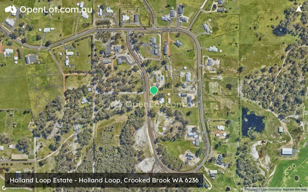
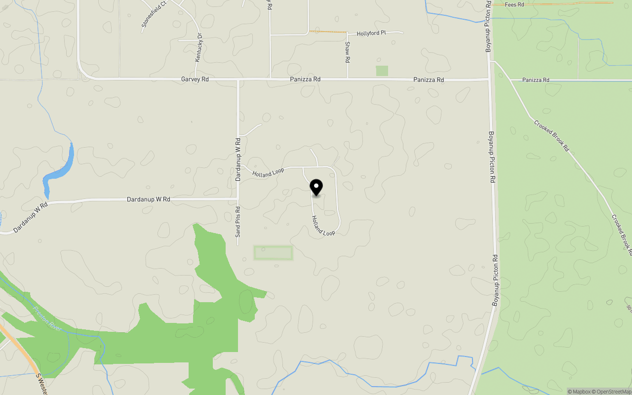
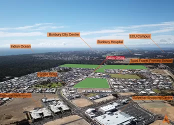
Location & Map for Holland Loop Estate - Crooked Brook
Schools near Holland Loop Estate - Crooked Brook
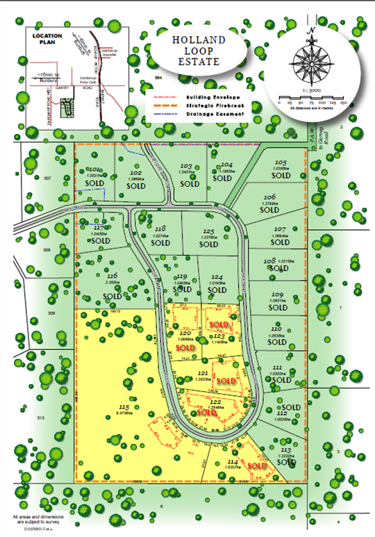
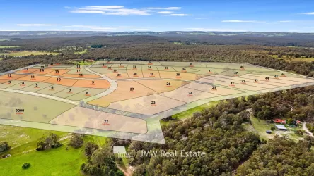
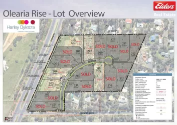
Overview
This information is estimated by the OpenLot research team. Let us know here to provide up-to-date information about this development.
| Total new homes | |
| Area Size | 43.20 hectares |
| Growth Region | Bunbury (The South West Region) |
| City Council | Shire of Dardanup |
| Developer | N/A |
| Project Marketer | Vantage Land |
Updates for Holland Loop Estate - Crooked Brook
Popular Estates near Holland Loop Estate - Crooked Brook
Not exactly what you're looking for? Try surrounding suburbs
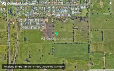
Dardanup WA 6236
2 estates | Shire of Dardanup
7.8km north
Dalyellup WA 6230
3 estates | Shire of Capel
17.0km north-west
Glen Iris WA 6230
2 estates | City of Bunbury
17.3km north-west
Gelorup WA 6230
1 estate | Shire of Capel
14.4km north-west
College Grove WA 6230
1 estate | City of Bunbury
15.9km north-west
Boyanup WA 6237
1 estate | Shire of Capel
5.0km west
Latest published articles


FAQs about Holland Loop Estate - Crooked Brook
Holland Loop Estate - Crooked Brook consists of 26 homes.
The total area for Holland Loop Estate - Crooked Brook is 43.20 hectares.
Holland Loop Estate - Crooked Brook falls under Shire of Dardanup.
Vantage Land is the project marketer for Holland Loop Estate - Crooked Brook.
Nearby schools for Holland Loop Estate - Crooked Brook:
- Our Lady of Lourdes School - 3.0km north-east
- Dardanup Primary School - 3.1km north-east
- Child Side School - 7.2km south
- Boyanup Primary School - 7.3km south
- Bunbury Cathedral Grammar School - 9.4km west
- South West Community College - Bunbury Campus - 14.5km north-west