
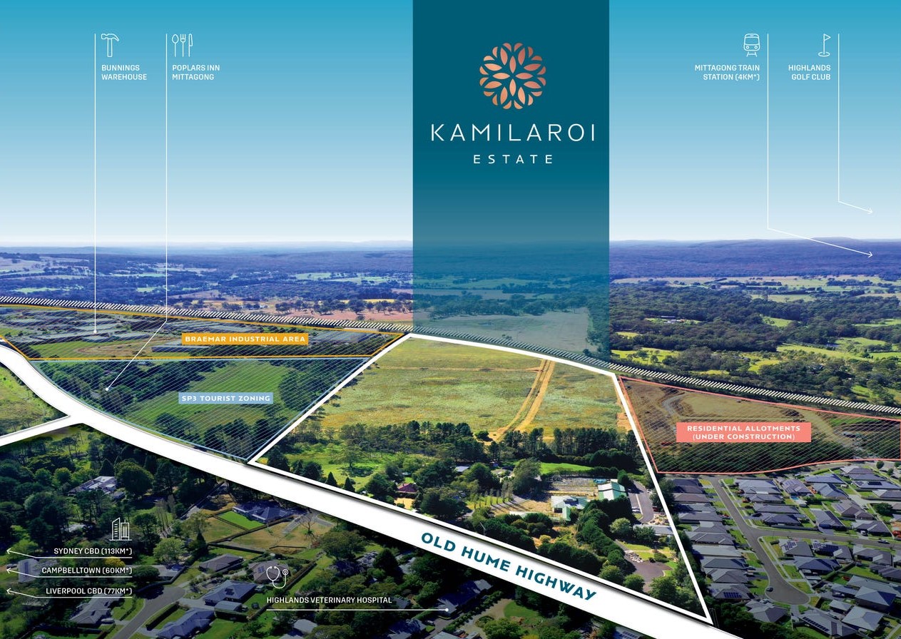
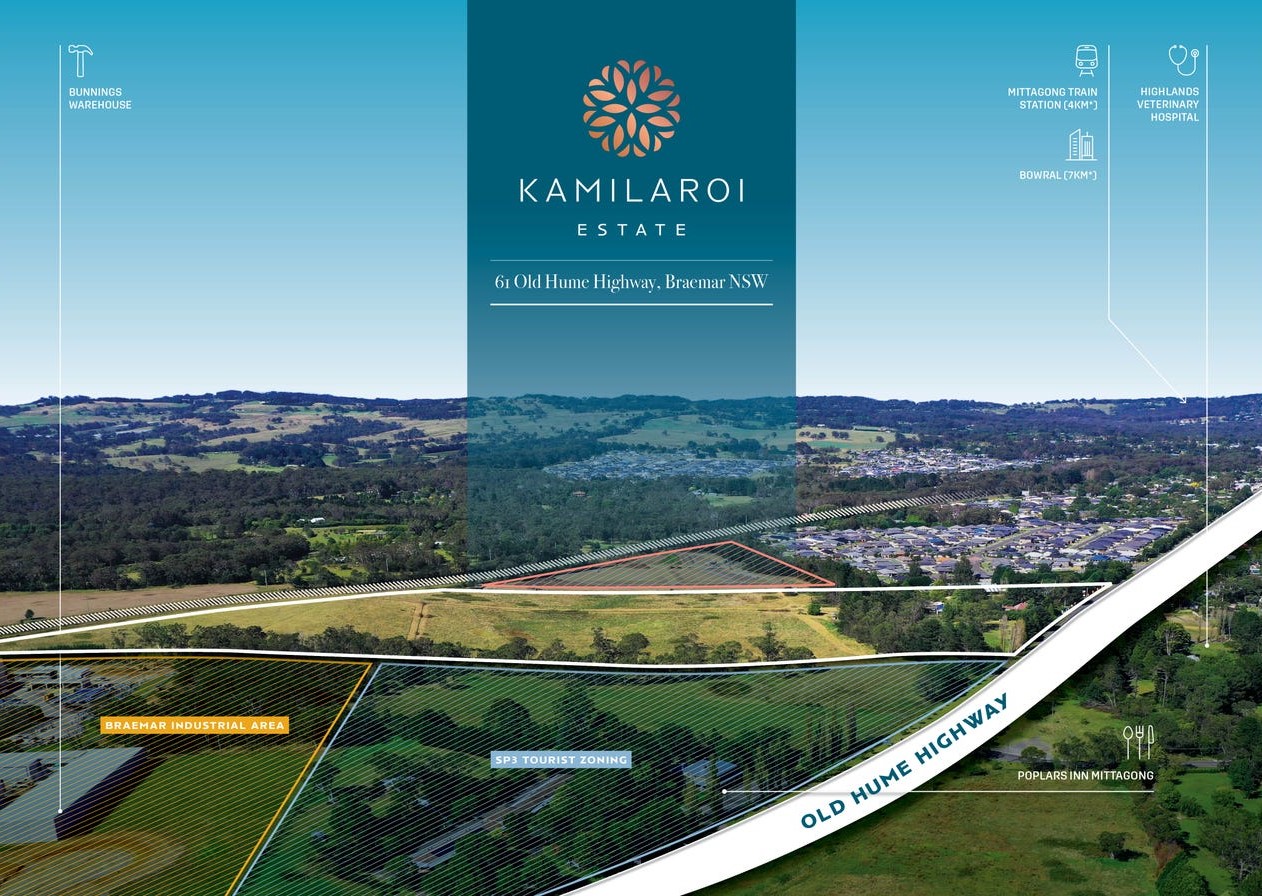
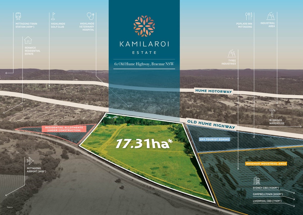
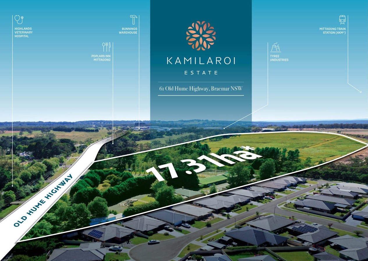
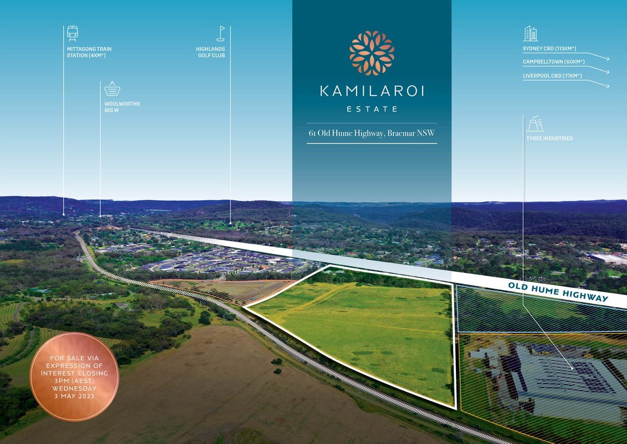
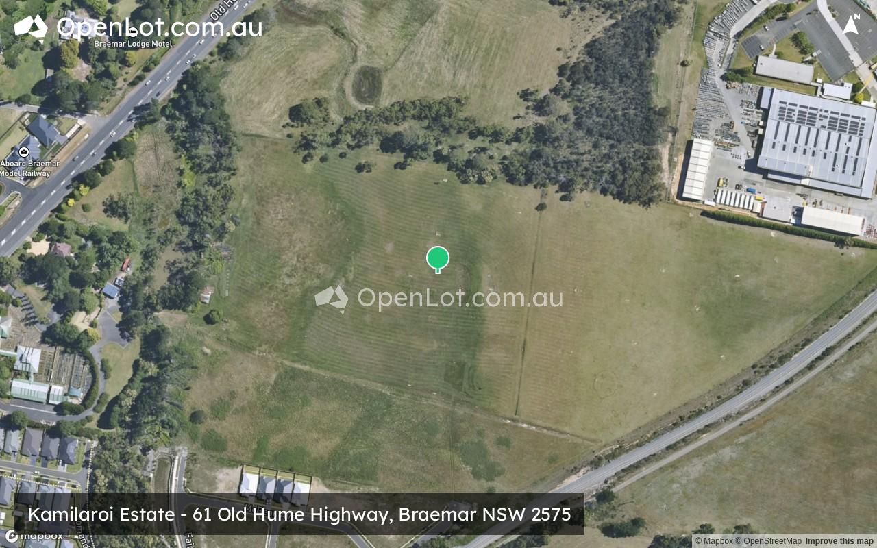
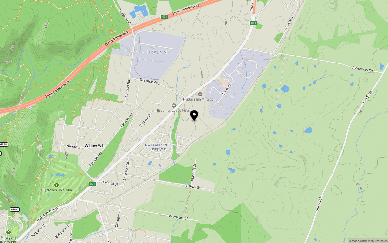
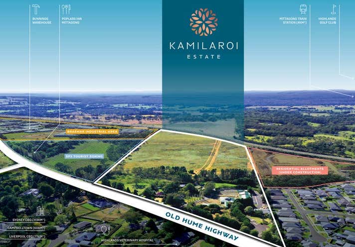
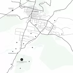
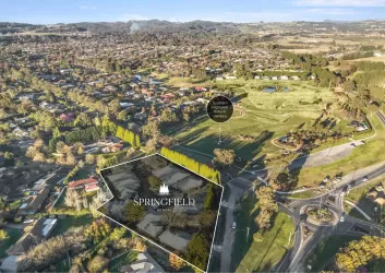
Location & Map for Kamilaroi Estate - Braemar
Schools near Kamilaroi Estate - Braemar
Kamilaroi Braemar Video
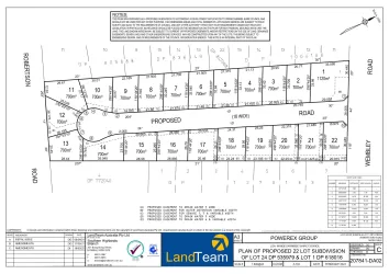
Overview
This information is estimated by the OpenLot research team. Let us know here to provide up-to-date information about this development.
| Total new homes | |
| Area Size | 17.31 hectares |
| Growth Region | Wollongong (Illawarra-Shoalhaven Region) |
| City Council | Wingecarribee Shire Council |
| Developer | N/A |
| Distance to |
Updates for Kamilaroi Estate - Braemar
Land Price Trend in Braemar NSW 2575
Below shows the price trend from vacant land sales recorded in Braemar NSW 2575.
The data and information provided by Terralytics (Aust) Pty Ltd (Terralytics Data) is general in nature and is not intended to constitute professional advice. Read more
It should not be relied upon as a substitute for legal, financial, valuation, or other specialist advice relevant to your specific circumstances.
Terralytics uses commercially reasonable endeavours to ensure the Terralytics Data is current and accurate. However, as the Terralytics Data incorporates information sourced from third parties, Terralytics makes no representation or warranty — express or implied — as to its accuracy, completeness, or currency. To the maximum extent permitted by applicable law, Terralytics excludes all liability for any loss or damage (including consequential loss) arising out of or in connection with reliance on the Terralytics Data, whether arising in contract, tort (including negligence), statute, or otherwise.
Popular Estates near Kamilaroi Estate - Braemar


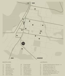
Not exactly what you're looking for? Try surrounding suburbs
Burradoo NSW 2576
1 estate | Wingecarribee Shire Council
12.1km south-west
Mittagong NSW 2575
1 estate | Wingecarribee Shire Council
5.8km south-west
Renwick NSW 2575
1 estate | Wingecarribee Shire Council
2.4km south-west
Huntley NSW 2530
2 estates | Wollongong City Council
23.9km east
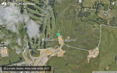
Moss Vale NSW 2577
6 estates | Wingecarribee Shire Council
16.2km south-west
Bowral NSW 2576
3 estates | Wingecarribee Shire Council
7.7km south-west
Latest published articles


FAQs about Kamilaroi Estate - Braemar
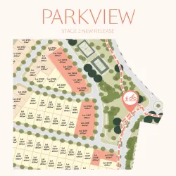
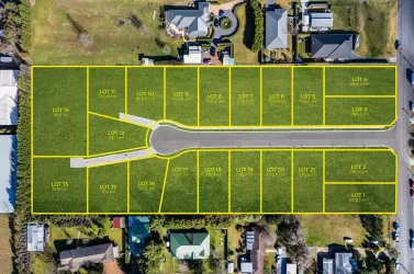
Kamilaroi Estate - Braemar consists of 129 homes.
The total area for Kamilaroi Estate - Braemar is 17.31 hectares.
Kamilaroi Estate - Braemar falls under Wingecarribee Shire Council.
Kamilaroi Estate - Braemar is 90 km south-west of Sydney CBD.
Nearby schools for Kamilaroi Estate - Braemar:
- Highlands School - 2.4km south
- Tangara School - 2.5km south-west
- St Michael's Catholic Primary School - 3.5km south-west
- Colo Vale Public School - 3.6km north
- Frensham School - 3.8km south-west
- Mittagong Public School - 4.0km south-west