
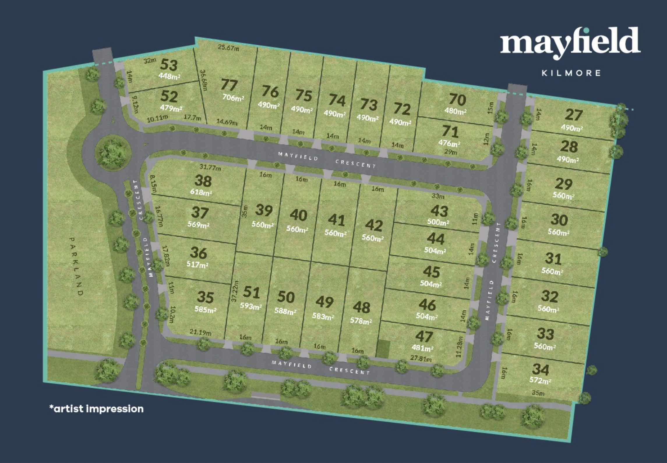
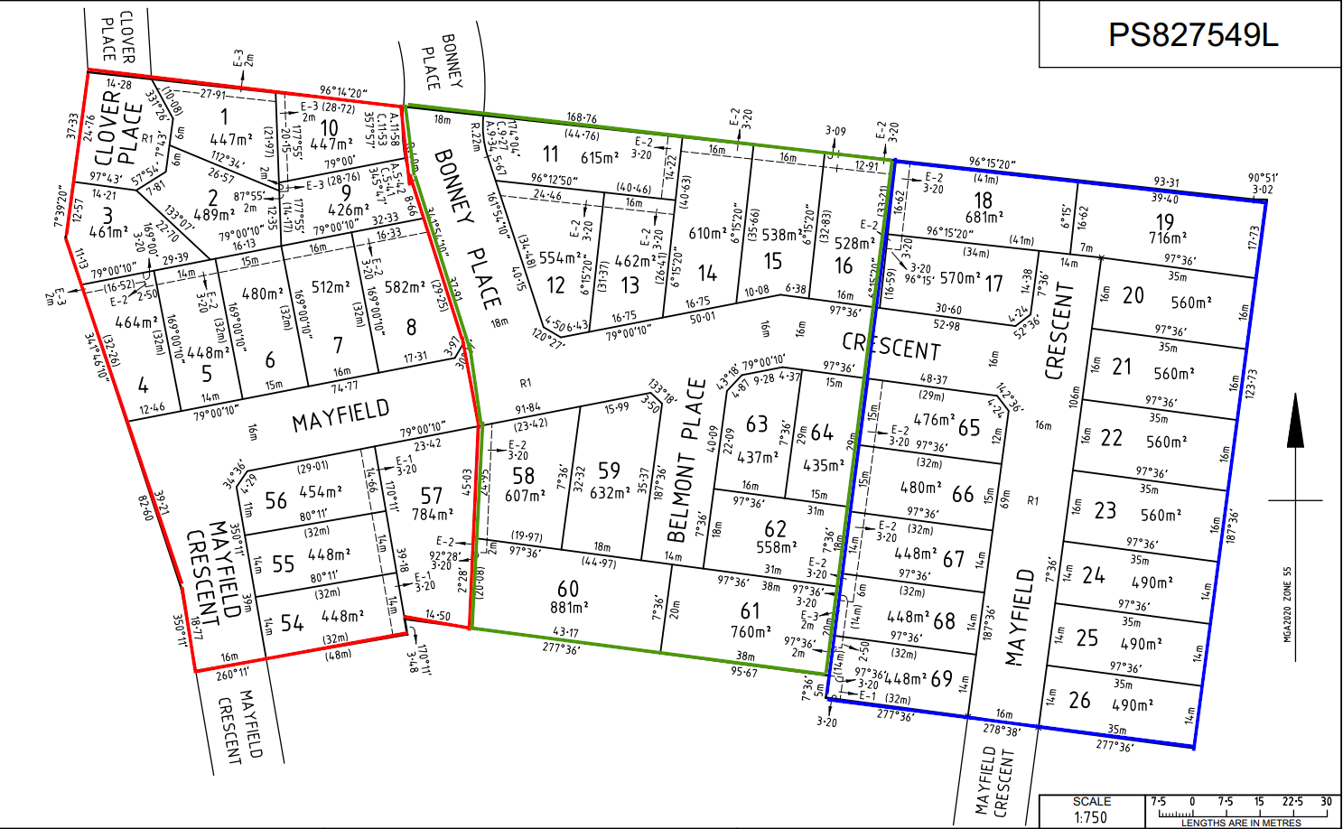
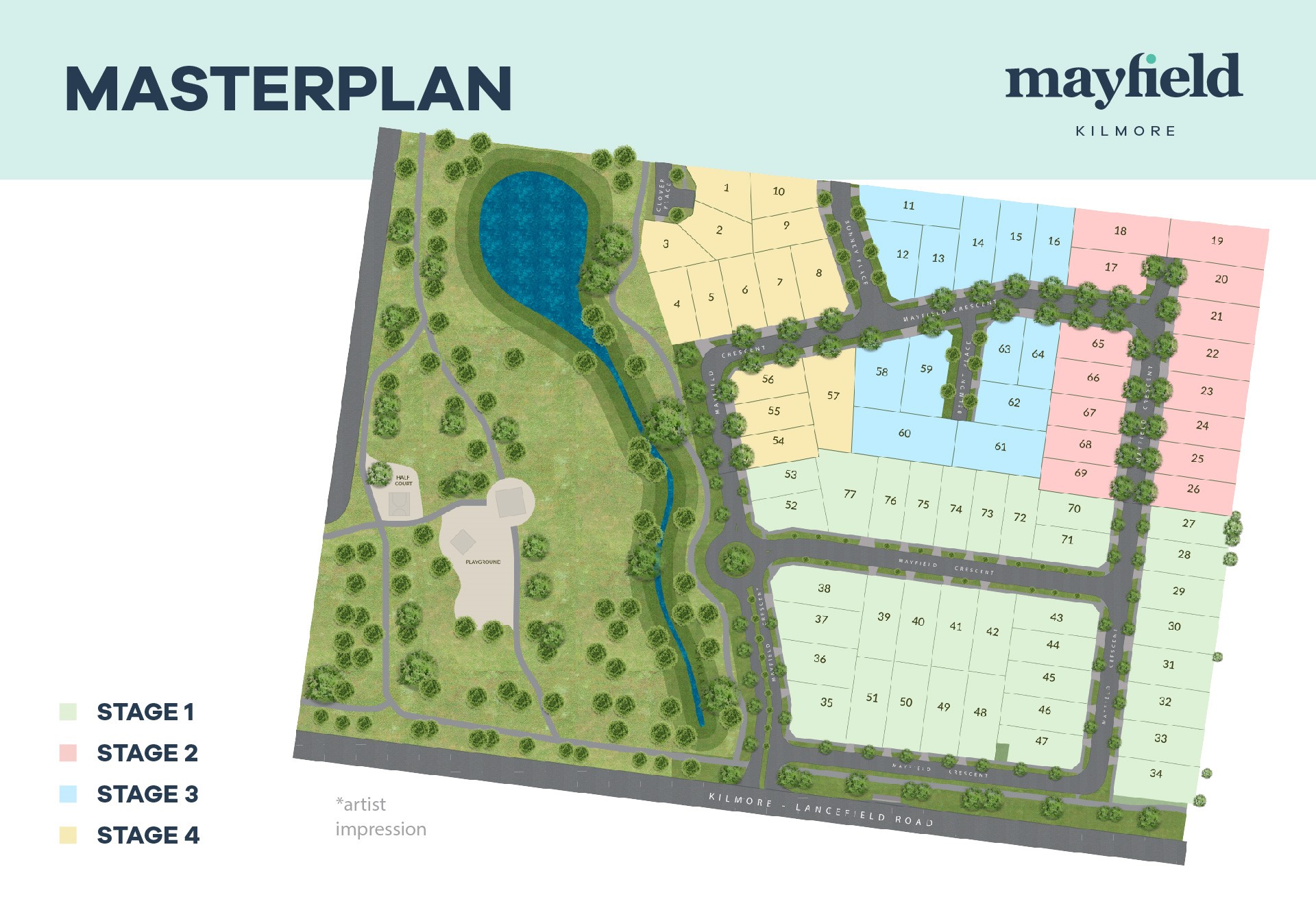
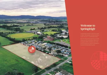
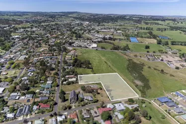
Mayfield Estate - Kilmore
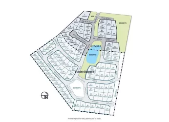
[LIMITED OFFER] Stage 1 selling now!


- Overlooking magnificent parkland within the heart of Kilmore
- Just a short drive to Melbourne
- All services ready including NBN
Property types for sale
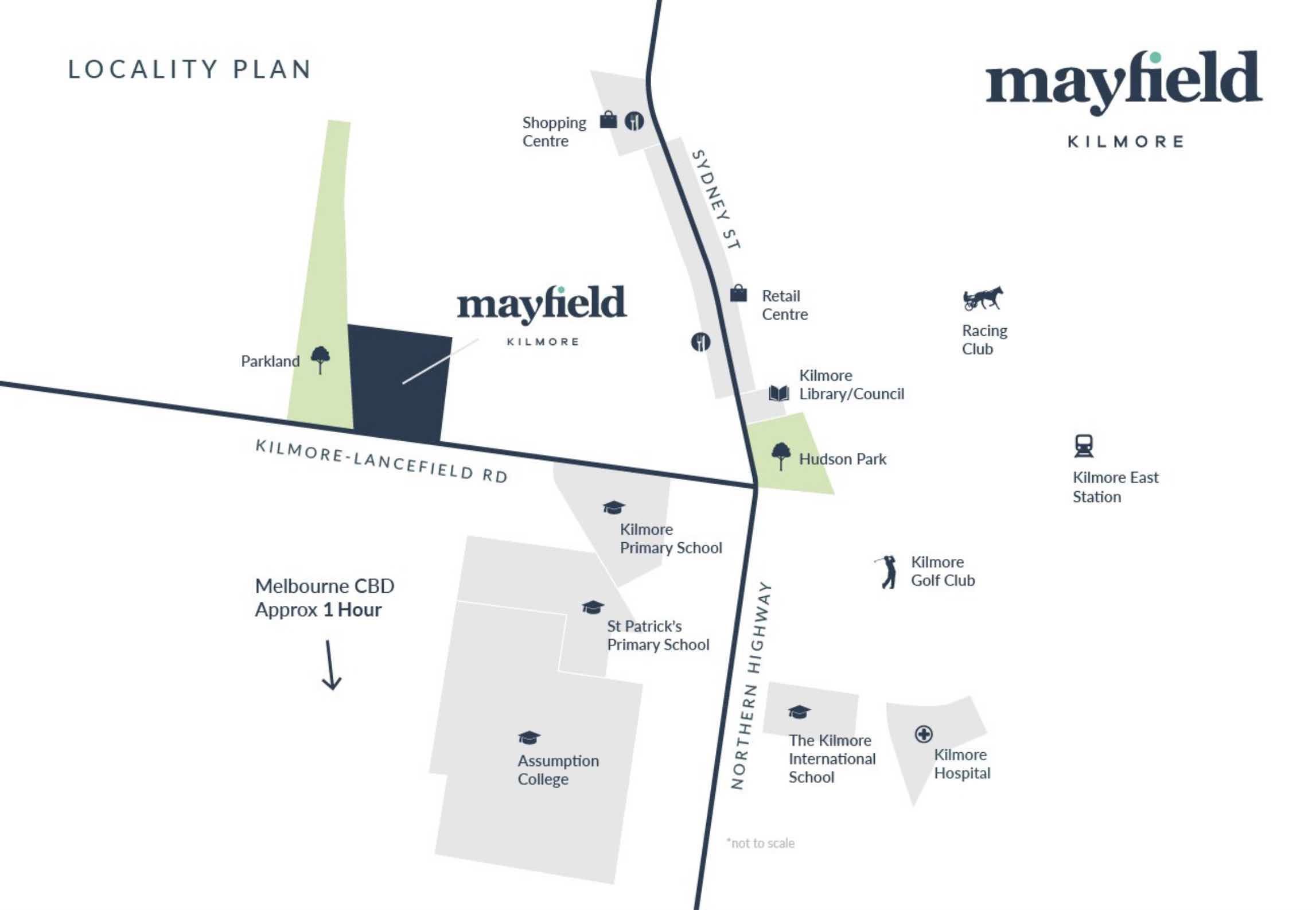
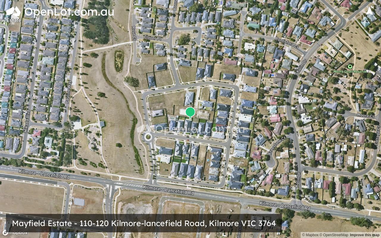
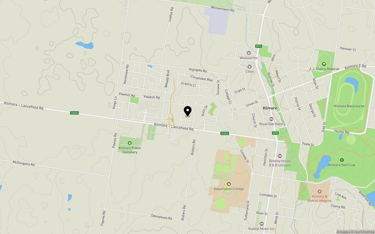
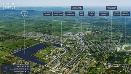
Location & Map for Mayfield Estate - Kilmore
Schools near Mayfield Estate - Kilmore
Overview
This information is estimated by the OpenLot research team. Let us know here to provide up-to-date information about this development.
| Total new homes | |
| Area Size | 6.73 hectares |
| Growth Region | Melbourne North Growth Corridor |
| City Council | Mitchell Shire Council |
| Developer | Westrock Development |
| Project Marketer | Buxton Outer North |
| Distance to |
Land Price Trend in Kilmore VIC 3764
Below shows the price trend from vacant land sales recorded in Kilmore VIC 3764.
The data and information provided by Terralytics (Aust) Pty Ltd (Terralytics Data) is general in nature and is not intended to constitute professional advice. Read more
It should not be relied upon as a substitute for legal, financial, valuation, or other specialist advice relevant to your specific circumstances.
Terralytics uses commercially reasonable endeavours to ensure the Terralytics Data is current and accurate. However, as the Terralytics Data incorporates information sourced from third parties, Terralytics makes no representation or warranty — express or implied — as to its accuracy, completeness, or currency. To the maximum extent permitted by applicable law, Terralytics excludes all liability for any loss or damage (including consequential loss) arising out of or in connection with reliance on the Terralytics Data, whether arising in contract, tort (including negligence), statute, or otherwise.
Popular Estates near Mayfield Estate - Kilmore


Not exactly what you're looking for? Try surrounding suburbs
Kalkallo VIC 3064
7 estates | Hume City Council
25.9km south
Wallan VIC 3756
22 estates | Mitchell Shire Council
13.2km south
Broadford VIC 3658
7 estates | Mitchell Shire Council
13.5km north-east
Beveridge VIC 3753
23 estates | Mitchell Shire Council
20.3km south
Wandong VIC 3758
2 estates | Mitchell Shire Council
9.3km south-east
Romsey VIC 3434
7 estates | Macedon Ranges Shire Council
19.5km west
Latest published articles


FAQs about Mayfield Estate - Kilmore
Westrock Development is the developer behind Mayfield Estate - Kilmore.
The total area for Mayfield Estate - Kilmore is 6.73 hectares.
Mayfield Estate - Kilmore falls under Mitchell Shire Council.
Mayfield Estate - Kilmore is 58 km north of Melbourne CBD.
Buxton Outer North is the project marketer for Mayfield Estate - Kilmore.
Nearby schools for Mayfield Estate - Kilmore:
- Kilmore Primary School - 804m east
- St Patrick's Primary School - 1.1km south-east
- Assumption College - 1.1km south-east
- Colmont School - 1.5km south-east
- Willowmavin Primary School - 5.9km north-west
- Wandong Primary School - 10.8km south-east