
Property types for sale
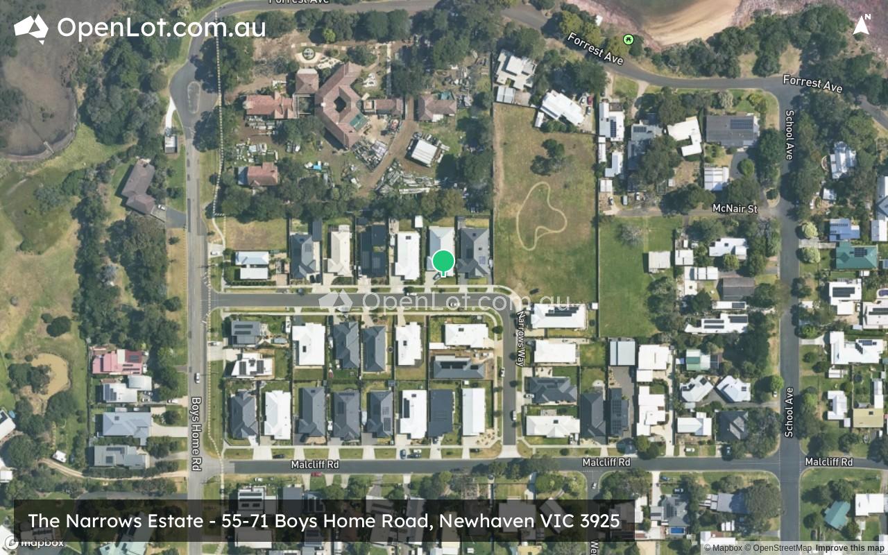
Location & Map for The Narrows Estate - Newhaven
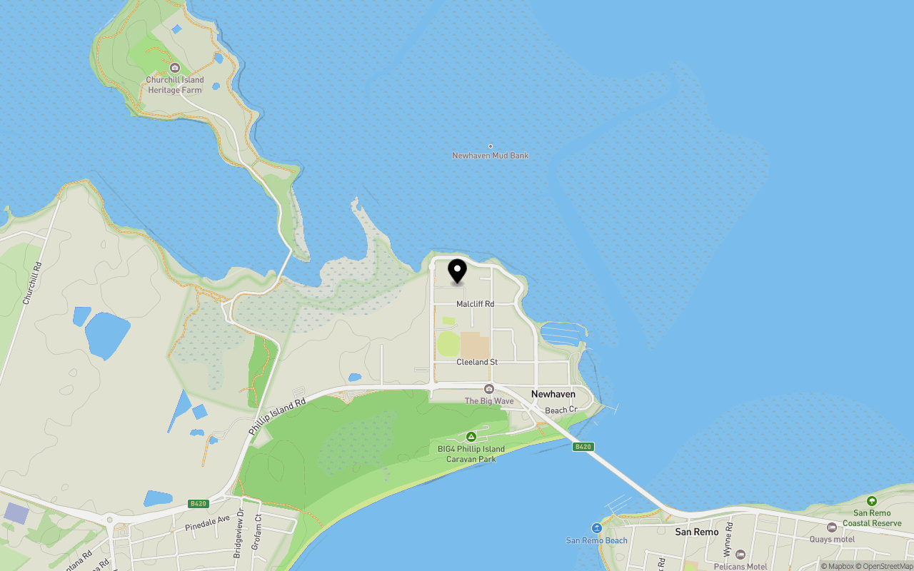
Schools near The Narrows Estate - Newhaven
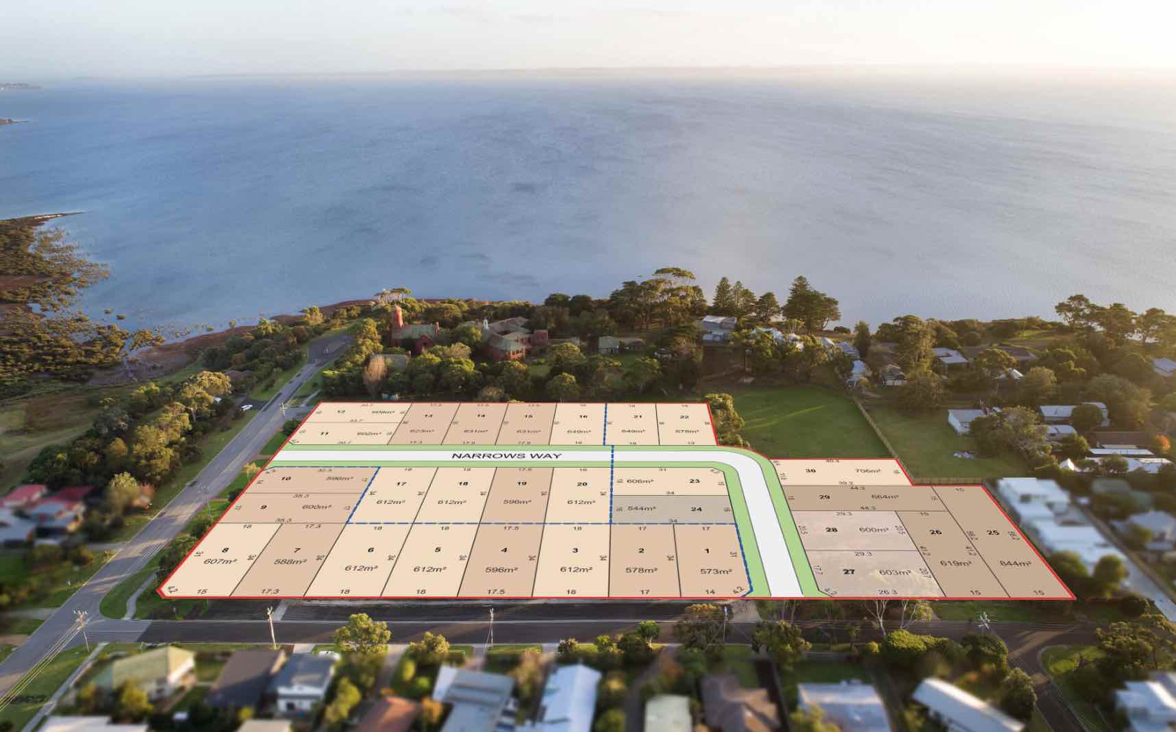
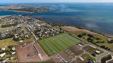
Overview
This information is estimated by the OpenLot research team. Let us know here to provide up-to-date information about this development.
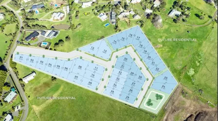
| Total new homes | |
| Area Size | 2.76 hectares |
| Growth Region | Gippsland Regional Growth Areas |
| City Council | Bass Coast Shire Council |
| Developer | N/A |
| Project Marketer | Victorian House & Land Specialists |
| Creative Agency | J Squared Designs, Coastal Snaps |
| Other Names | Newhaven College |
| Distance to |
Land Price Trend in Newhaven VIC 3925
Below shows the price trend from vacant land sales recorded in Newhaven VIC 3925. *
Popular Estates near The Narrows Estate - Newhaven


Not exactly what you're looking for? Try surrounding suburbs
San Remo VIC 3925
9 estates | Bass Coast Shire Council
1.5km south-east
Cowes VIC 3922
7 estates | Bass Coast Shire Council
12.6km north-west
Kilcunda VIC 3995
2 estates | Bass Coast Shire Council
10.9km east
Coronet Bay VIC 3984
3 estates | Bass Coast Shire Council
11.4km north-east
Corinella VIC 3984
4 estates | Bass Coast Shire Council
12.9km north-east
Bass VIC 3991
1 estate | Bass Coast Shire Council
10.5km north-east
Latest published articles


FAQs about The Narrows Estate - Newhaven
The Narrows Estate - Newhaven consists of 30 homes.
The total area for The Narrows Estate - Newhaven is 2.76 hectares.
The Narrows Estate - Newhaven falls under Bass Coast Shire Council.
The Narrows Estate - Newhaven is 84 km south-east of Melbourne CBD.
Victorian House & Land Specialists is the project marketer for The Narrows Estate - Newhaven.
Nearby schools for The Narrows Estate - Newhaven:
- Newhaven Primary School - 397m south-east
- San Remo Primary School - 2.0km south-east
- Newhaven College - 8.1km west
- Our Lady Star of the Sea Catholic Primary School - 10.4km north-west
- Cowes Primary School - 11.6km north-west
- Phillip Island Village School - 13.4km west