
Property types for sale
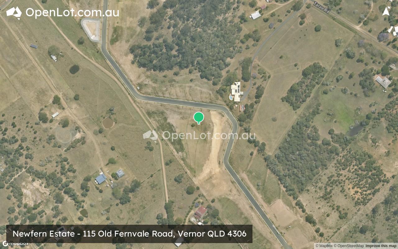
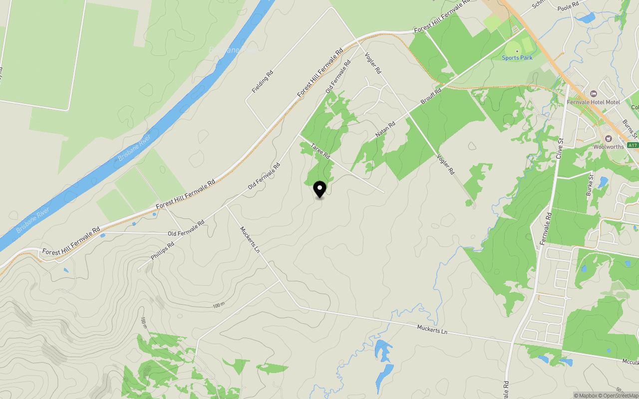
Location & Map for Newfern Estate - Vernor
Schools near Newfern Estate - Vernor
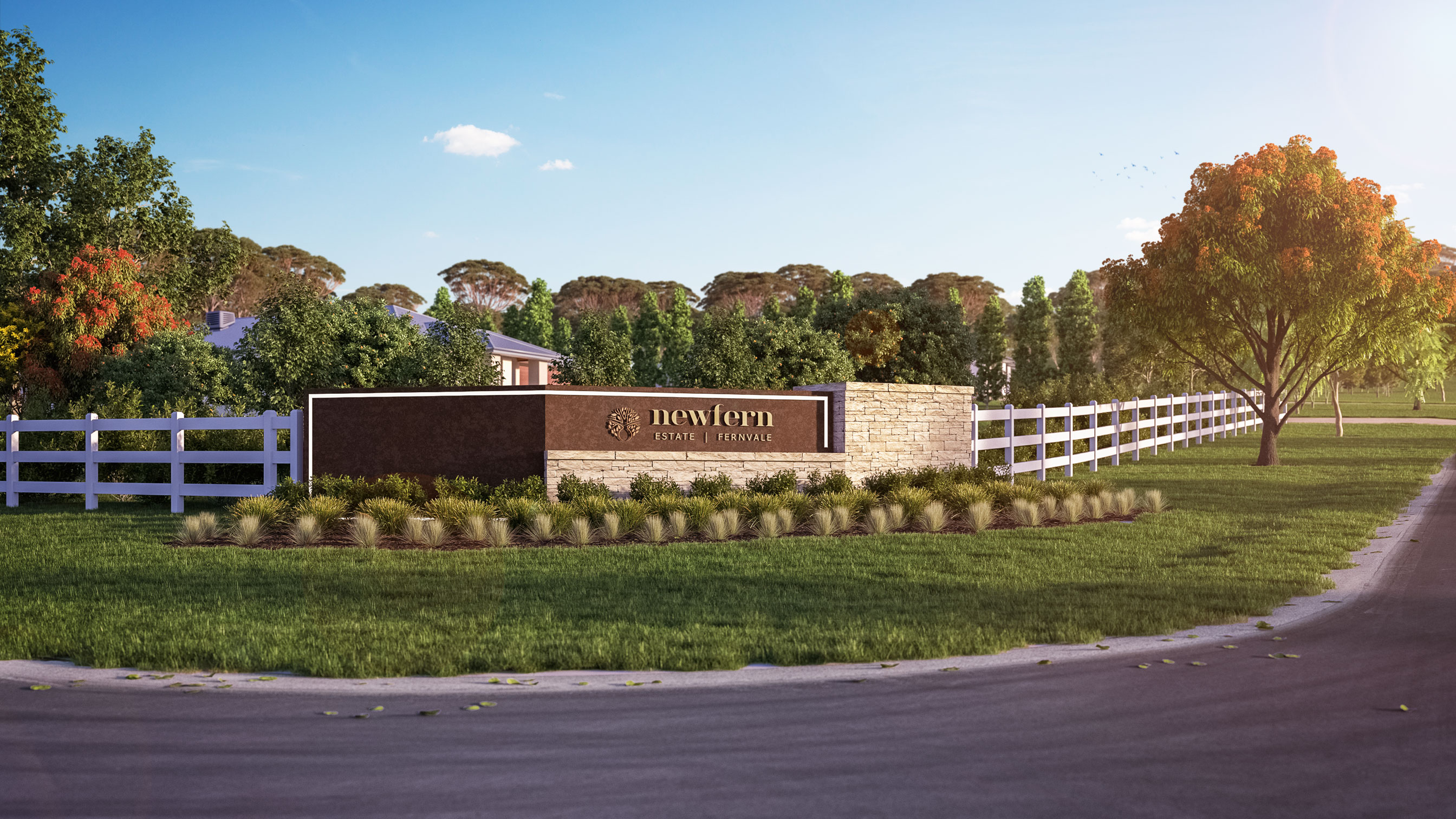
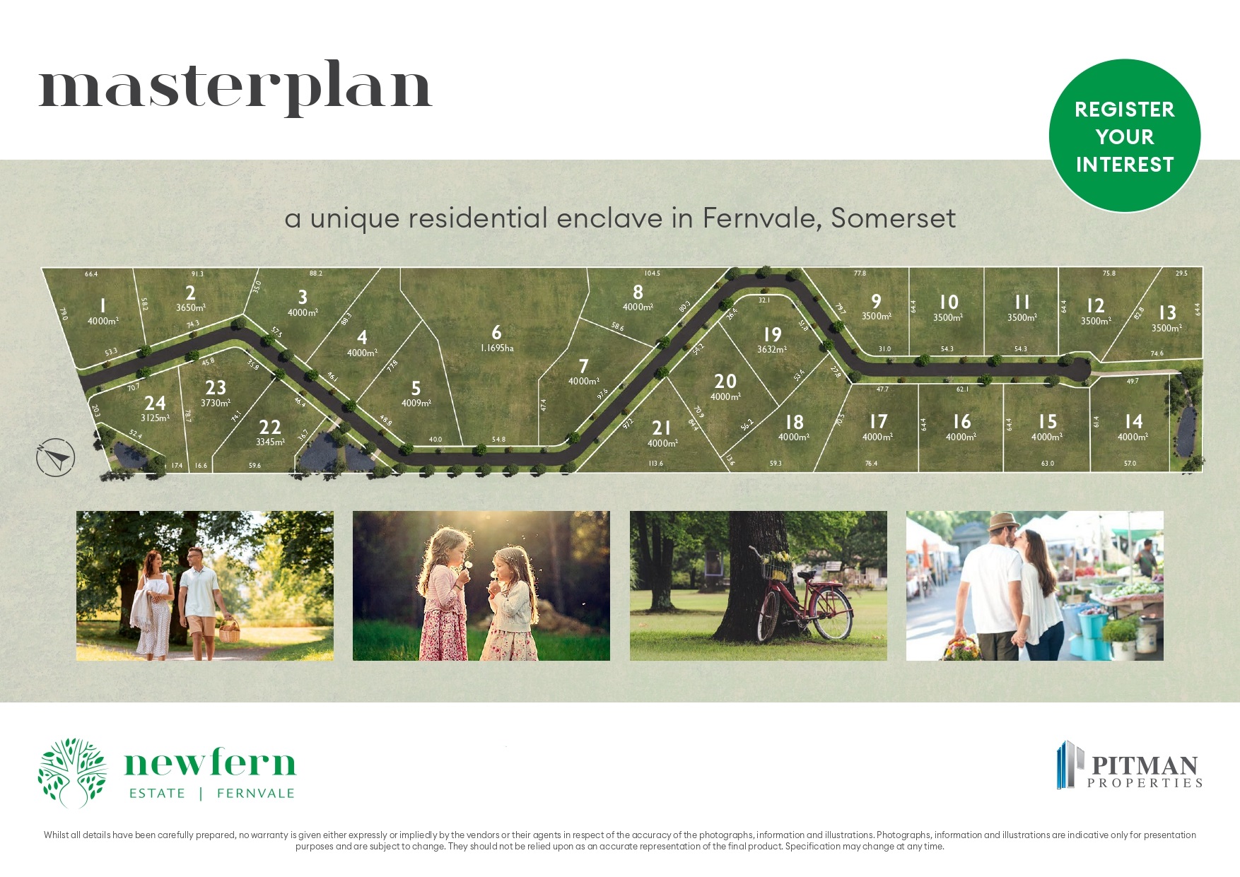
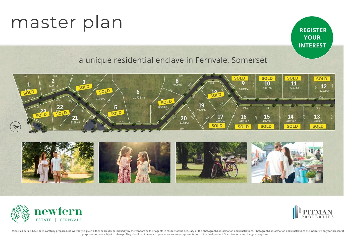
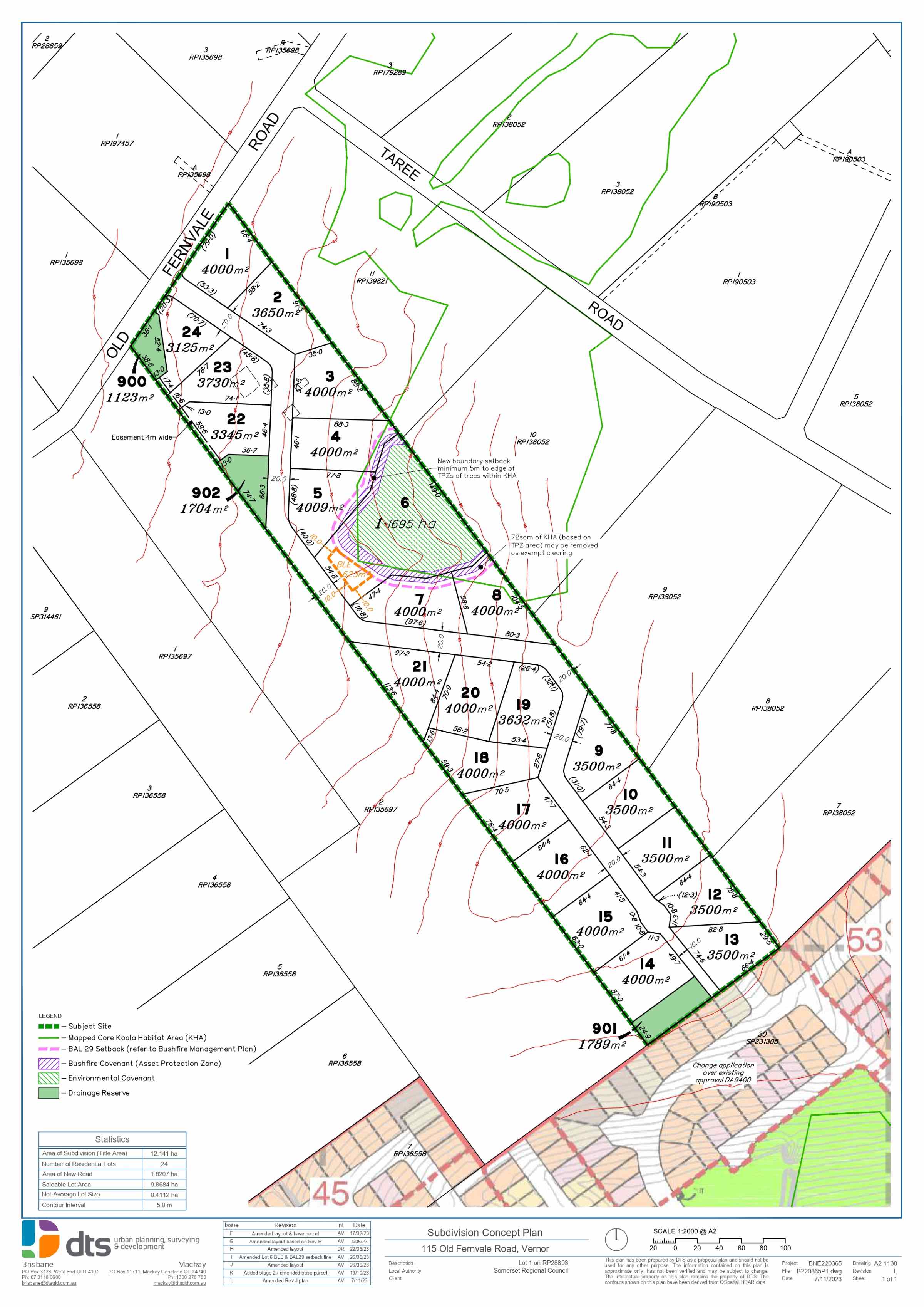
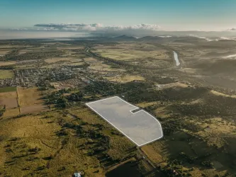
Overview
This information is estimated by the OpenLot research team. Let us know here to provide up-to-date information about this development.
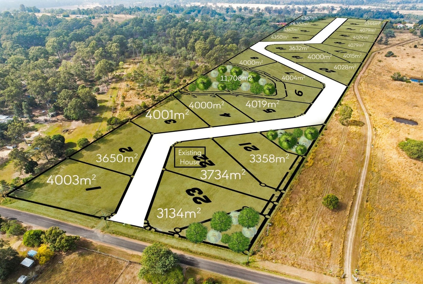
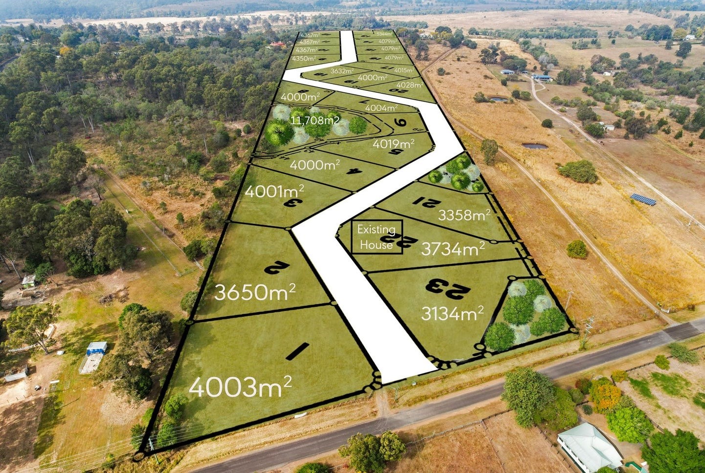
| Total new homes | |
| Area Size | 12.14 hectares |
| Growth Region | Greater Brisbane Growth Areas |
| City Council | Somerset Regional Council |
| Developer | Pitman Properties |
| Project Marketer | Ray White Ipswich |
| Distance to |
Updates for Newfern Estate - Vernor

Popular Estates near Newfern Estate - Vernor


Not exactly what you're looking for? Try surrounding suburbs
Rifle Range QLD 4311
1 estate | Somerset Regional Council
9.1km west
Fernvale QLD 4306
11 estates | Somerset Regional Council
3.7km east
Marburg QLD 4346
3 estates | Ipswich City Council
11.4km south
Lowood QLD 4311
7 estates | Somerset Regional Council
4.0km west
Mount Marrow QLD 4306
1 estate | Ipswich City Council
14.8km south
Walloon QLD 4306
5 estates | Ipswich City Council
16.1km south
Latest published articles


FAQs about Newfern Estate - Vernor
Pitman Properties is the developer behind Newfern Estate - Vernor.
Newfern Estate - Vernor consists of 23 homes.
The total area for Newfern Estate - Vernor is 12.14 hectares.
Newfern Estate - Vernor falls under Somerset Regional Council.
Newfern Estate - Vernor is 39 km west of Brisbane CBD.
Ray White Ipswich is the project marketer for Newfern Estate - Vernor.
Nearby schools for Newfern Estate - Vernor:
- Fernvale State School - 2.3km north-east
- Lowood State High School - 4.6km west
- Lowood State School - 4.7km west
- Glamorgan Vale State School - 5.8km south
- Patrick Estate State School - 8.3km north-west
- Tarampa State School - 8.6km west