


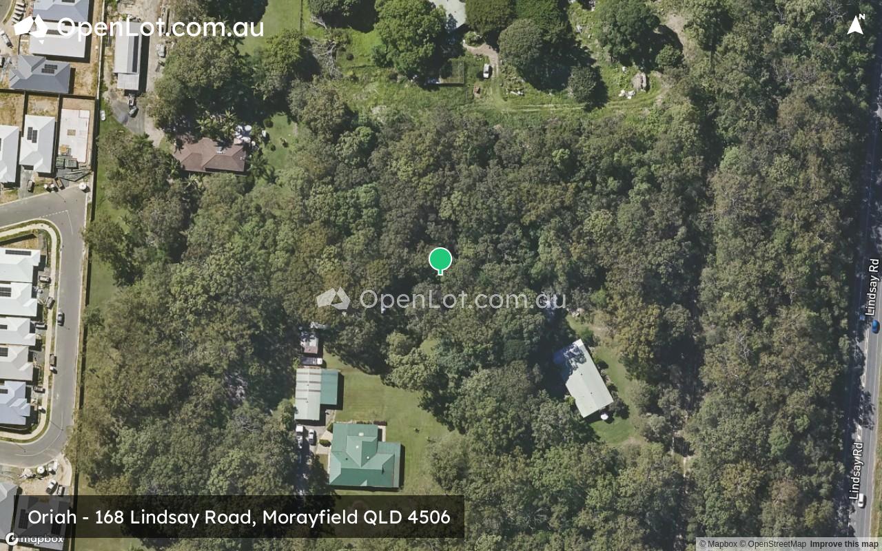
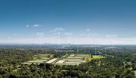
Oriah - Morayfield
[NEW RELEASE] Fixed Price, Turnkey House & Land Packages Now Selling
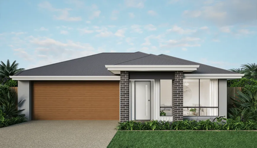


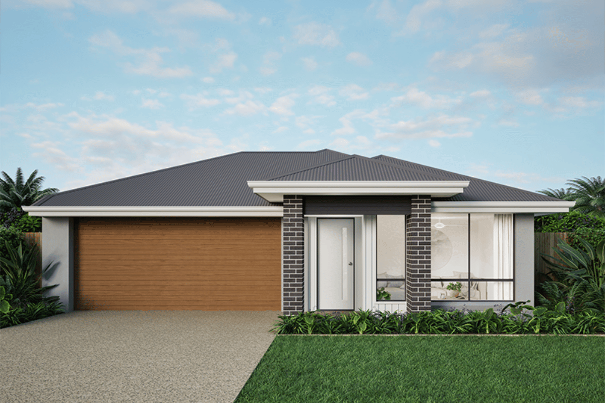
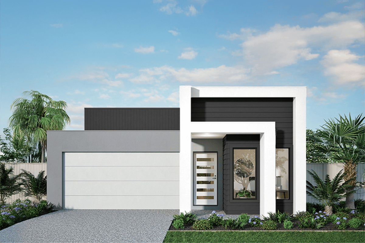
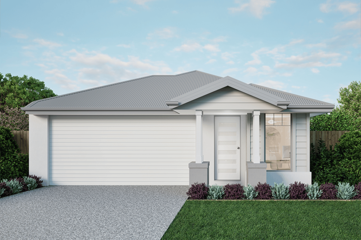
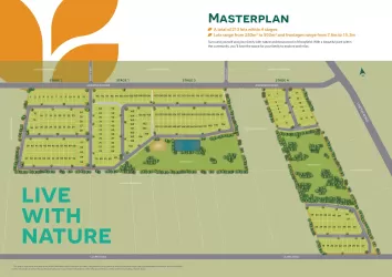
- Discover contemporary living at Oriah Morayfield, a thoughtfully planned community positioned in one of Moreton Bay’s most exciting growth areas. Offering a limited collection of stylish turnkey homes, Oriah combines modern design, premium inclusions and fixed-price certainty to deliver exceptional value with no hidden surprises.
Turnkey Living
With Urbane Homes 100% fixed-price turnkey package, your new home is delivered complete and ready to move in. Everything is included from landscaping and fencing to premium internal finishes so you can enjoy a seamless building journey without unexpected costs.
• Fixed price contract
• Full turnkey inclusions
• No hidden costs or extras
• Landscaping, fencing & finishes included
• Move-in ready convenience
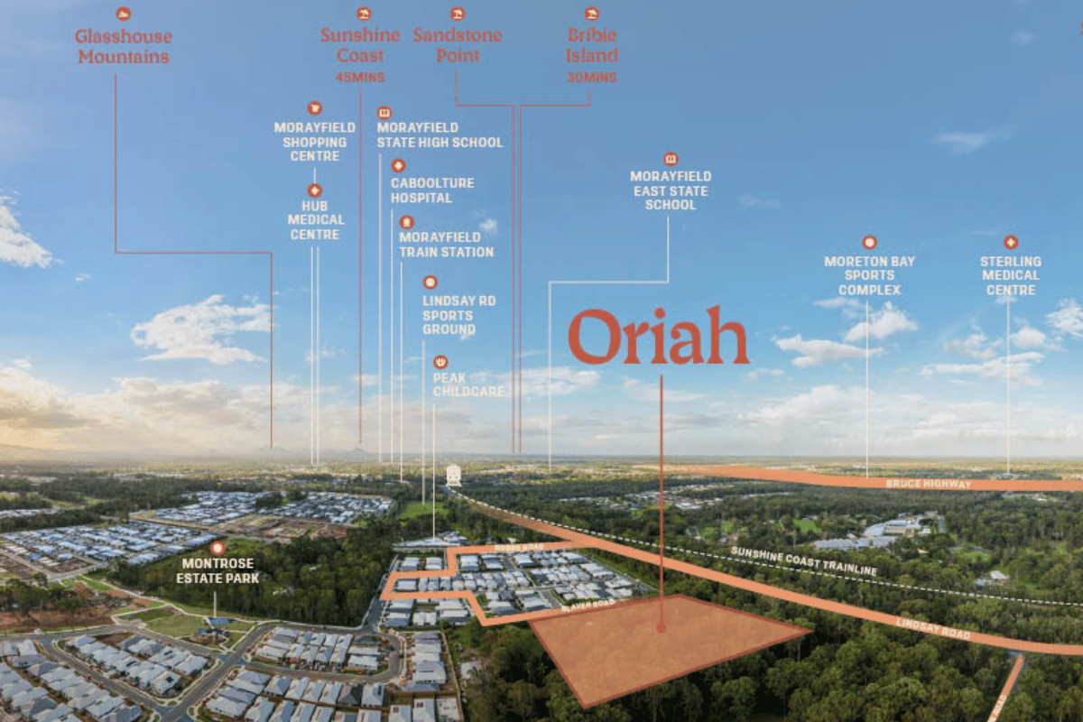
Oriah introduces a boutique new address to Morayfield
These beautiful homes are carefully planned to suit real life, featuring open-plan layouts that connect kitchen, living, and dining spaces seamlessly. Natural light, smart storage, and functional design choices enhance everyday comfort, while outdoor areas provide the perfect space to unwind or entertain.
Set within a quiet pocket bordered by a protected environmental corridor, the neighbourhood offers a sense of space, privacy, and natural outlooks while keeping everyday convenience close by. Schools, local shops, transport links, and essential services are all just minutes away, placing ease and accessibility at the centre of daily life.
Quality comes standard in every home:
• All site preparation & service connections
• BlueScope TRUECORE® steel frame
• Colorbond steel roof
• 2x Daikin split system air-conditioning units
• Ceiling fans in bedrooms & living areas
• Built-in & walk-in wardrobes
• Flyscreens on all openable windows & doors + front door barrier screen
• Lovelight roller blinds to bedrooms & living areas
• 3 coats of Wattyl premium paint
• Tailored front & rear landscaping, fencing & side gate
• NBN ready connection
• And more
Urbane Homes delivers peace of mind with proven quality:
• 100% fixed-price turnkey homes
• 45+ years building experience
• 100+ communities completed
• 3,000+ homes built
• 25-year structural warranty
• 50-year steel frame warranty
• 7-star energy rating
Location & Lifestyle
Enjoy unbeatable convenience in Morayfield:
• Morayfield East State School & Morayfield State High School – 6 min drive
• Morayfield Train Station – 6 min drive
• Burpengary Shopping Precinct – 6 min drive
• Sheep Station Creek Conservation Park – 8 min drive
• Caboolture Hospital – 12 min drive
• Westfield North Lakes – 20 min drive
Everything you need for modern family living is close by.
Secure Your Turnkey Home Today
With fixed pricing, premium inclusions, and a fully turnkey delivery, Oriah offers an exceptional opportunity to move into a brand-new home with complete confidence. Contact Urbane Homes today to secure your lot.
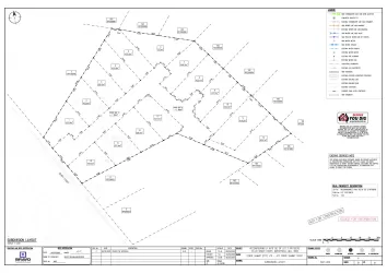
Property types for sale
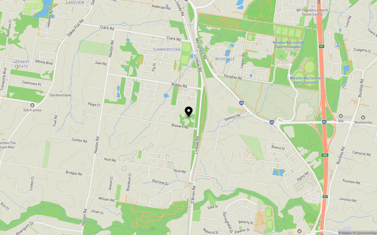
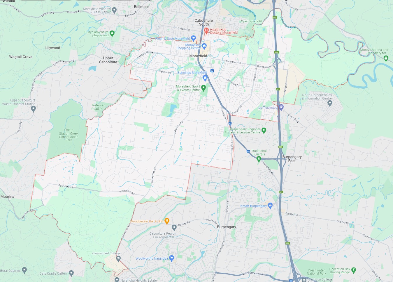
Location & Map for Oriah - Morayfield
Schools near Oriah - Morayfield
Overview
This information is estimated by the OpenLot research team. Let us know here to provide up-to-date information about this development.
| Total new homes | |
| Area Size | N/A |
| Growth Region | Greater Brisbane Growth Areas |
| City Council | Moreton Bay Regional Council |
| Developer | Heritage Pacific |
| Distance to |
Suburb Planning Review in Morayfield QLD 4506
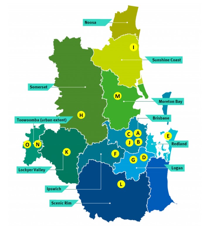
Morayfield is approximately 44.5 square kilometres within the City of Moreton Bay, forming part of the northernmost urban area of the greater Brisbane metropolitan region within South East Queensland, located 44 kilometres north of Brisbane and west of Mount Pleasant.
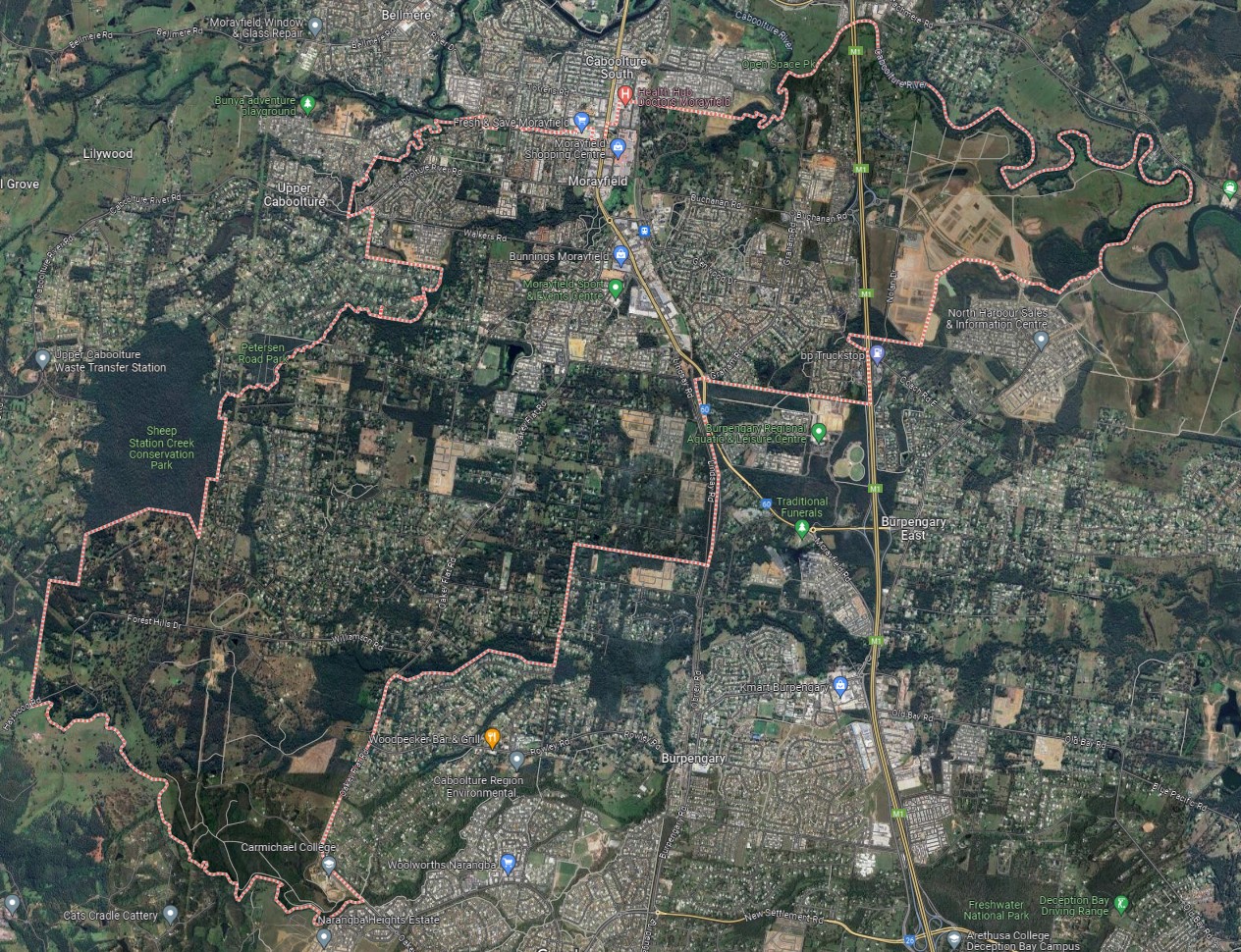
The suburb boundary is located along Dobsons Creek, Caboolture River and property boundaries to the north. The Sheep Station Creek and property boundaries make up the western boundary. The Bruce Highway, Railway Line, Hauton Road and property boundaries make up the eastern boundary. Oakey Flat Road, Burpengary Creek, and property boundaries make up the southern boundary.
Oakey Flat Road, Graham Road and Morayfield Road provide local road access (north to south) and connect the local road network found throughout Morayfield. The Bruce Highway (M1) traverses through Morayfield's northern suburb portion, segregating east-west connections through the area and providing one interchange in the Morayfield area.
The M1 interchange allows connections in an eastern direction but also provides direct access for anyone travelling through the region via the M1. Forest Hill Drive, Nairn Road, Buchanan Road and Caboolture River Road all provide local access and the next townships to the west.
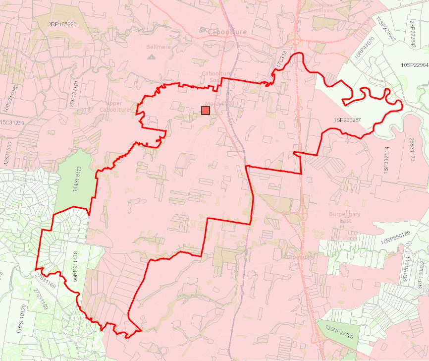
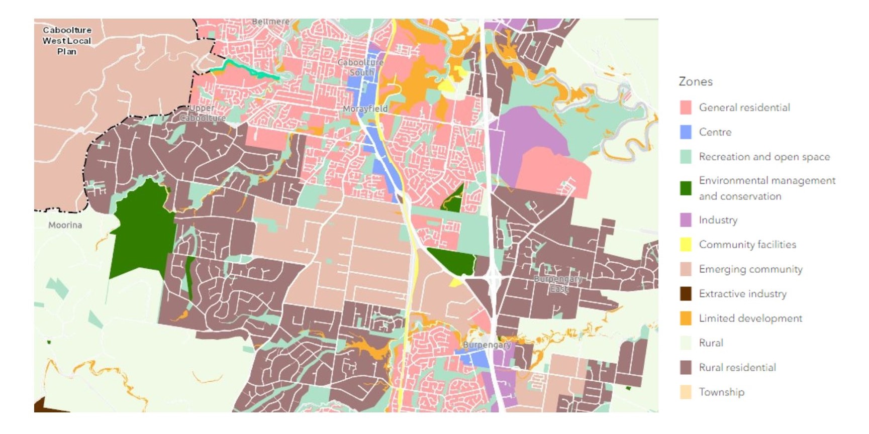
The suburb of Morayfield provides a mix of land uses, with the eastern portion past the M1 currently being developed and access provided from the Buchanan Road interchange. Pockets of rural living properties and the vegetated waterway corridor of Caboolture River are located to the north. Morayfield has a large retail, food and business district, and dense urban development along Morayfield Road through the northern portion of the suburb. This includes a major train station, shopping centre and a Bunnings Warehouse. Further rural living, recreational areas, natural watercourses, and proximity to national parks exist in the large south-western portion of the suburb. New urban development is occurring in the north and centre portions of the suburb. A new city is planned to the north-west of the Morayfield CBD, which has been labelled Caboolture West and has been expressed as a Potential Future Growth Area.
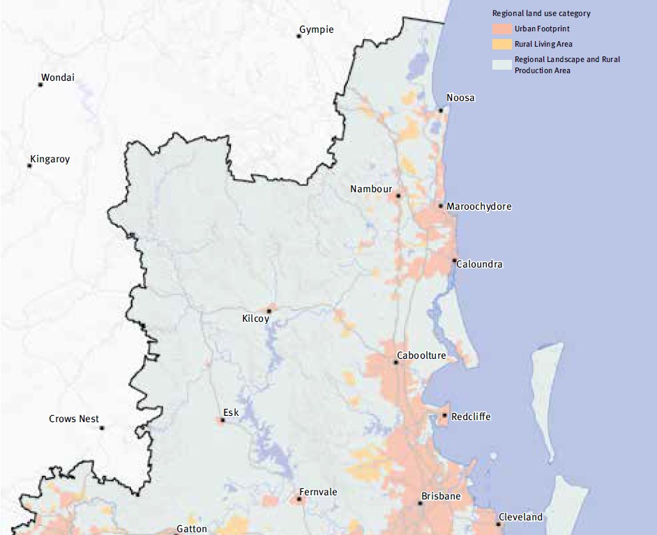
SEQ Regional Plan 2009–2031
The South East Queensland Regional Plan 2017, also known as ShapingSEQ is a regional plan for South East Queensland (SEQ), Australia and includes Central Coast Regional Council (urban extent only).
It is a long-term strategic plan that guides land use and development in the region. Developed by the Queensland Government, ShapingSEQ is intended to support sustainable growth and development while protecting the region's natural and cultural heritage. The plan includes policies and guidelines on land use, infrastructure, transport, environment, and economic development.
The plan identifies priority growth areas and development corridors, and sets targets for population growth and housing supply in the region. It also includes strategies for managing urban sprawl, protecting natural resources and biodiversity, and addressing climate change impacts.
The plan also lays out the vision for the region in 2041 which includes a liveable, sustainable, and prosperous region, with a focus on protecting the environment and encouraging sustainable development, as well as improving connectivity and accessibility throughout the region. ShapingSEQ provides a regional framework for growth management and sets the planning direction for sustainable growth, global economic competitiveness, and high-quality living by:
- Identifying a long-term sustainable pattern of development which focuses more on growth in existing urban areas
- Harnessing regional economic strengths and clusters to compete globally
- Ensuring land use and infrastructure planning are integrated
- Valuing and protecting the natural environment, productive land, resources, landscapes, and cultural heritage
- Promoting more choice of housing and lifestyle options
- Locating people and jobs closer together, and moving people and goods more efficiently and reliably
- Promoting vibrant, fair, healthy, and affordable living and housing to meet all the community's needs
- Valuing design and embracing the climate to create high-quality living environments
- Maximising the use of existing infrastructure and planning for smarter solutions for new infrastructure
- Supporting strong rural communities and economic diversification.
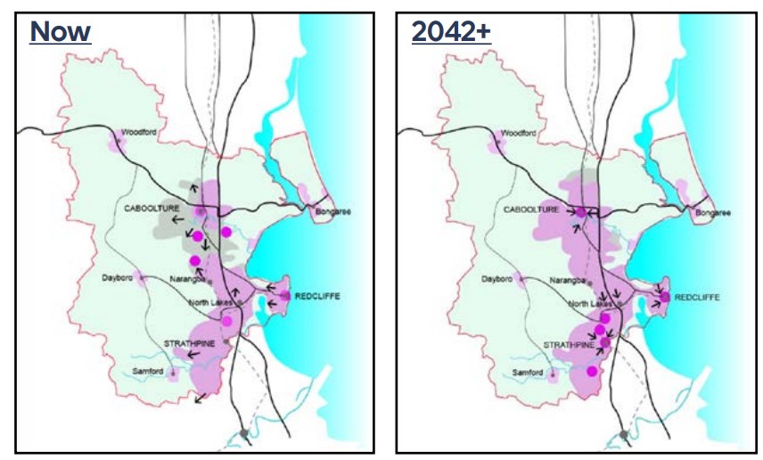
Regional Growth Management Strategy 2042
The Growth Management Strategy 2042 provides a roadmap for sustainable growth in the region over the next 20 years, aligned with the 'Our Well-Planned Places' goal of the Corporate Plan 2022-2027. It outlines strategic priorities, policies, and actions for short, medium, and long-term outcomes, with a focus on monitoring progress. As one of six central council strategies, it ensures an integrated approach to planning, responding to the South East Queensland Regional Plan 2017. It builds on past achievements, addresses gaps, and responds to housing challenges while preserving local character. Neighbourhood planning and employment opportunities are emphasized, with collaboration being key to its success.
South East Queensland City Deal – Implementation Plan
The Australian Government, Queensland Government, and Council of Mayors (SEQ) are already delivering for local communities throughout South East Queensland. They are focused on commitments that meet four strategic outcomes: accelerating future jobs across SEQ; a faster, more connected SEQ region; a more liveable SEQ; and creating thriving communities for SEQ.
The SEQ City Deal agreement was signed on 21 March 2022 by the Australian Government, Queensland Government and Council of Mayors (SEQ). The accompanying Deal document sets out the vision, objectives, and commitments.
The SEQ City Deal Implementation Plan was released in July 2023 and provides details about how the Deal will be delivered, commitment milestones and funding arrangements. The document identifies the Moreton Bay Region council area as M (Growth Area Compact).
Caboolture West - Growth Area Compact
The new Caboolture West deal includes the commencement of the Caboolture West Interim Structure Plan on March 14, 2023. This plan establishes a regulatory framework for assessing and approving 13,000 new homes, covering roughly half of Morayfield West. The Australian Government, Queensland Government, and Moreton Bay Regional Council are collaborating to establish a Growth Area Compact for Caboolture West.
The Growth Area Compact aims to coordinate infrastructure development to support affordable housing options in the area. The Australian Government has committed a $100 million loan (in principle) for trunk communications infrastructure, while the Queensland Government and Moreton Bay Regional Council will invest in trunk infrastructure and overall area development. Key milestones include infrastructure planning, project selection, and construction, with future milestones subject to negotiation. Responsibility lies with the Queensland Government, with financial commitments totalling $210 million, including the loan. Engagement with the private sector for potential partnerships and funding support will also be pursued.
Moreton Bay Regional Council Planning Scheme
The council is responsible for ensuring adequate housing, facilities, infrastructure, and services for new residents and businesses. It sets the policy direction for regional growth through the Moreton Bay Regional Council Planning Scheme 2021, which came into effect on 12 December 2021.
This scheme serves as a local planning framework, incorporating state and regional policies while responding to local needs. The council regularly reviews and enhances the planning scheme to address emerging issues. Importantly, the scheme dictates permissible development, land use regulations, approval processes, expected outcomes, and criteria for assessment by the council.
Morayfield Suburb Summary
Land Price Trend in Morayfield QLD 4506
Below shows the price trend from vacant land sales recorded in Morayfield QLD 4506.
The data and information provided by Terralytics (Aust) Pty Ltd (Terralytics Data) is general in nature and is not intended to constitute professional advice. Read more
It should not be relied upon as a substitute for legal, financial, valuation, or other specialist advice relevant to your specific circumstances.
Terralytics uses commercially reasonable endeavours to ensure the Terralytics Data is current and accurate. However, as the Terralytics Data incorporates information sourced from third parties, Terralytics makes no representation or warranty — express or implied — as to its accuracy, completeness, or currency. To the maximum extent permitted by applicable law, Terralytics excludes all liability for any loss or damage (including consequential loss) arising out of or in connection with reliance on the Terralytics Data, whether arising in contract, tort (including negligence), statute, or otherwise.
Popular Estates near Oriah - Morayfield


Not exactly what you're looking for? Try surrounding suburbs
Narangba QLD 4504
16 estates | Moreton Bay Regional Council
7.0km south-west
Burpengary QLD 4505
19 estates | Moreton Bay Regional Council
2.4km south
Upper Caboolture QLD 4510
7 estates | Moreton Bay Regional Council
5.1km west
Burpengary East QLD 4505
10 estates | Moreton Bay Regional Council
6.0km east
Caboolture South QLD 4510
2 estates | Moreton Bay Regional Council
4.5km north
Lilywood QLD 4513
5 estates | Moreton Bay Regional Council
5.6km north-west
Latest published articles


FAQs about Oriah - Morayfield
Heritage Pacific is the developer behind Oriah - Morayfield.
Oriah - Morayfield consists of 37 homes.
Oriah - Morayfield falls under Moreton Bay Regional Council.
Oriah - Morayfield is 37 km north of Brisbane CBD.
Nearby schools for Oriah - Morayfield:
- Redwood College - 776m east
- St Eugene College - 1.7km south-east
- Burpengary State School - 2.1km south
- Morayfield East State School - 2.6km north
- Burpengary Meadows State School - 3.1km south-west
- The Younity School - 3.3km south