
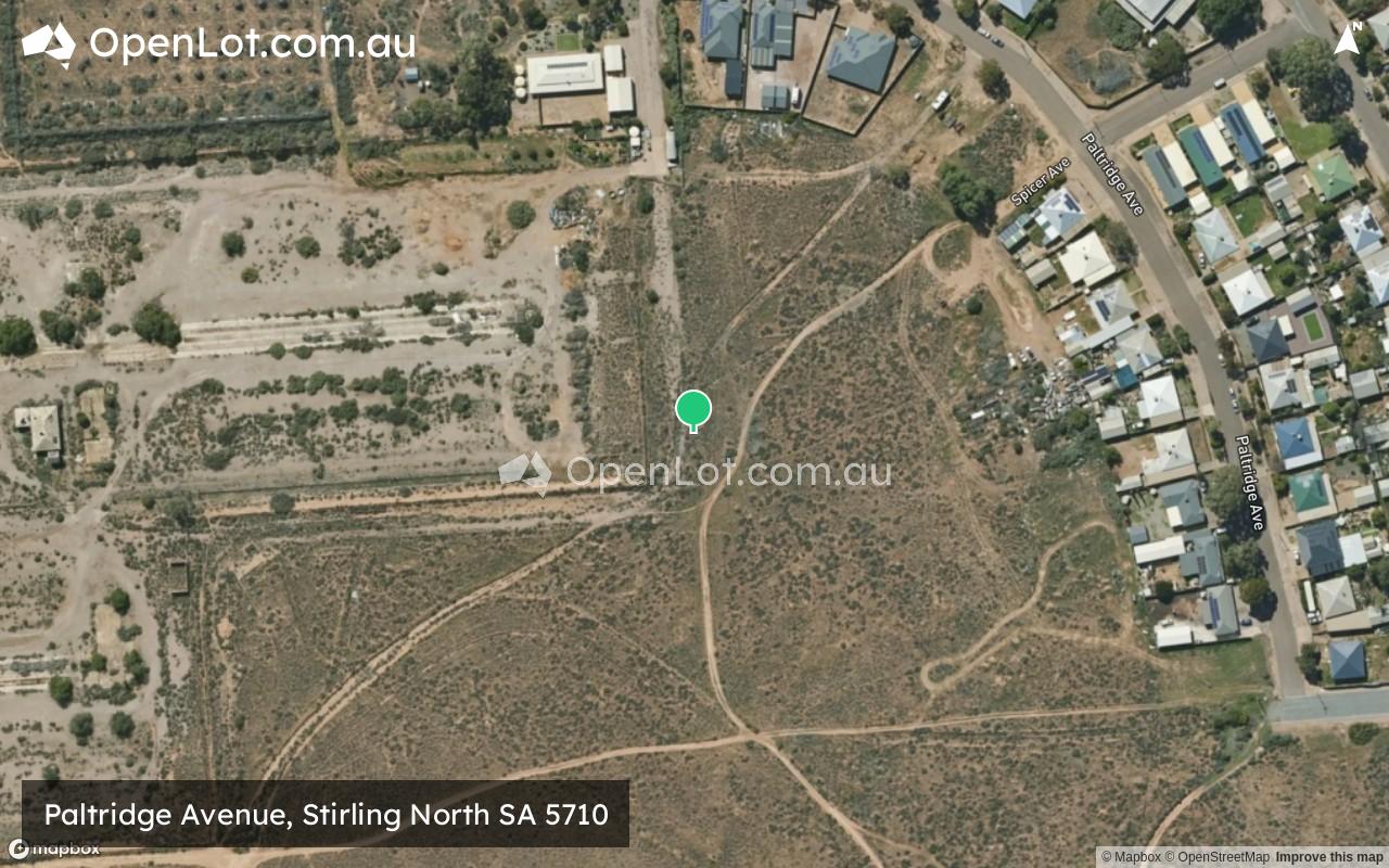
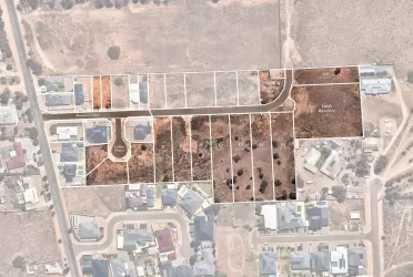
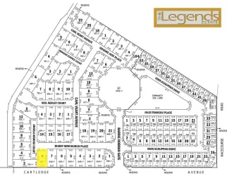
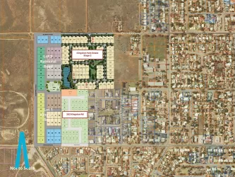
Location & Map for Paltridge Avenue, Stirling North SA 5710
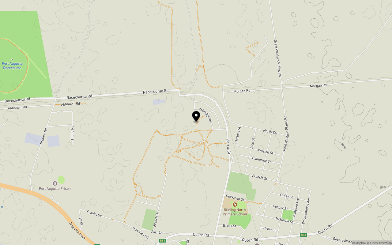
Schools near Paltridge Avenue, Stirling North SA 5710
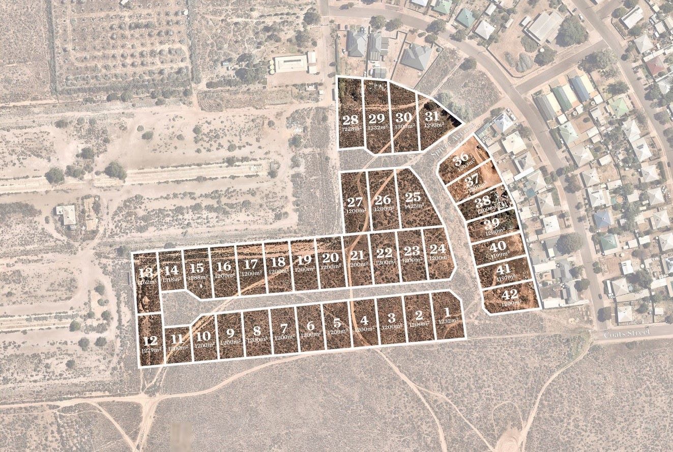
Overview
This information is estimated by the OpenLot research team. Let us know here to provide up-to-date information about this development.
| Total new homes | |
| Area Size | 5.68 hectares |
| City Council | Port Augusta City Council |
| Developer | N/A |
Land Price Trend in Stirling North SA 5710
Below shows the price trend from vacant land sales recorded in Stirling North SA 5710.
The data and information provided by Terralytics (Aust) Pty Ltd (Terralytics Data) is general in nature and is not intended to constitute professional advice. Read more
It should not be relied upon as a substitute for legal, financial, valuation, or other specialist advice relevant to your specific circumstances.
Terralytics uses commercially reasonable endeavours to ensure the Terralytics Data is current and accurate. However, as the Terralytics Data incorporates information sourced from third parties, Terralytics makes no representation or warranty — express or implied — as to its accuracy, completeness, or currency. To the maximum extent permitted by applicable law, Terralytics excludes all liability for any loss or damage (including consequential loss) arising out of or in connection with reliance on the Terralytics Data, whether arising in contract, tort (including negligence), statute, or otherwise.
Popular Estates near Paltridge Avenue, Stirling North


Not exactly what you're looking for? Try surrounding suburbs
Port Augusta SA 5700
1 estate | Port Augusta City Council
6.7km west
Port Augusta West SA 5700
3 estates | Port Augusta City Council
13.5km west
Whyalla Norrie SA 5608
1 estate | Whyalla City Council
64.2km south-west
Risdon Park SA 5540
4 estates | Port Pirie Regional Council
76.6km south
Wilmington SA 5485
1 estate | District Council of Mount Remarkable
31.0km south-east
Whyalla Jenkins SA 5609
1 estate | Whyalla City Council
65.6km south-west
Latest published articles


FAQs about Paltridge Avenue, Stirling North SA 5710
Paltridge Avenue, Stirling North SA 5710 consists of 38 homes.
The total area for Paltridge Avenue, Stirling North SA 5710 is 5.68 hectares.
Paltridge Avenue, Stirling North SA 5710 falls under Port Augusta City Council.
Nearby schools for Paltridge Avenue, Stirling North SA 5710:
- Stirling North Primary School - 1.2km south-east
- Augusta Park Primary School - 4.5km west
- Seaview Christian College - 4.6km west
- Willsden Primary School - 4.9km west
- Carlton School - 5.8km west
- Port Augusta Secondary School - 6.1km west