


Panora Rise Estate - Narangba


- Registered & ready to build
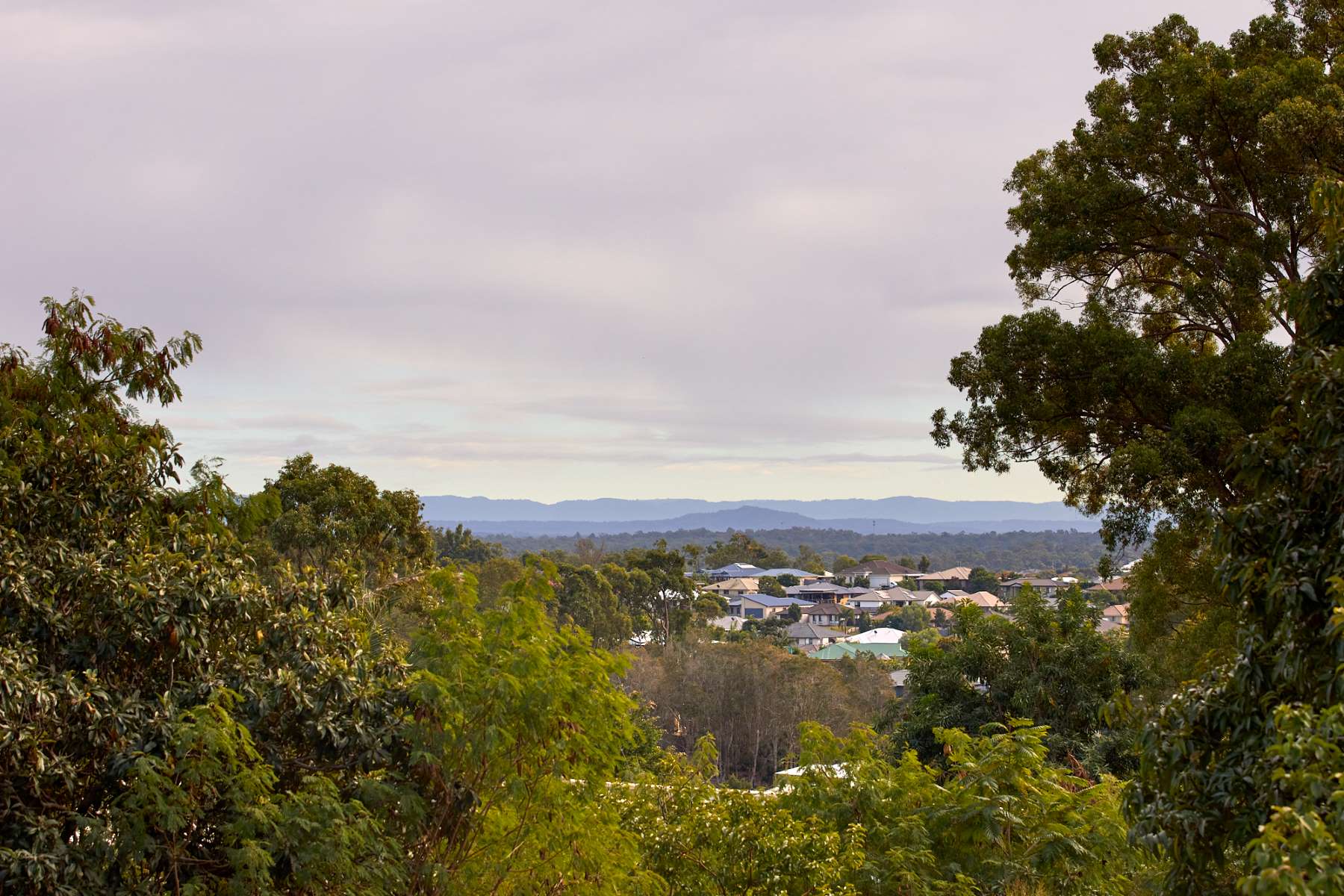
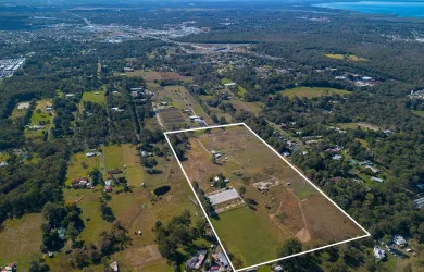
- Large Suburban blocks surrounded by nature
- Close to public transport
- House & Land packages available
- Final blocks now selling
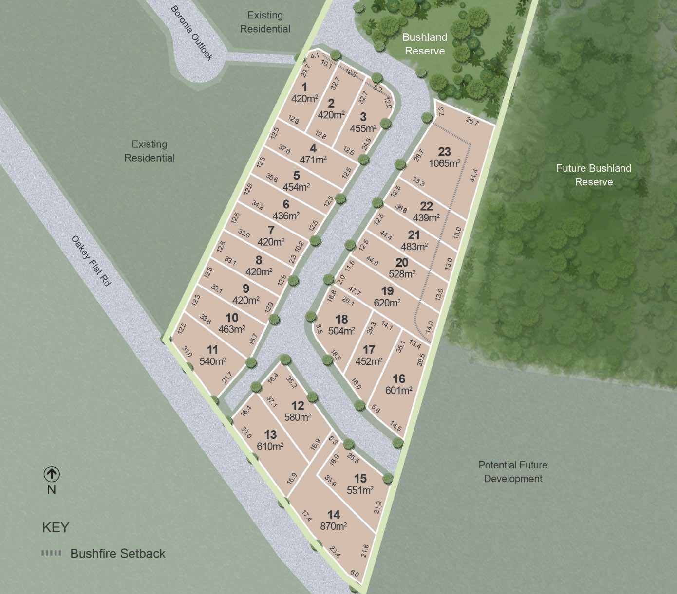
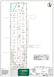
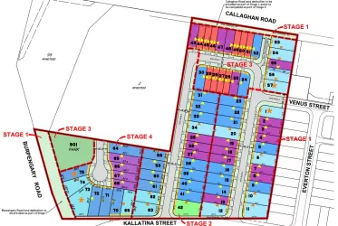
Property types for sale
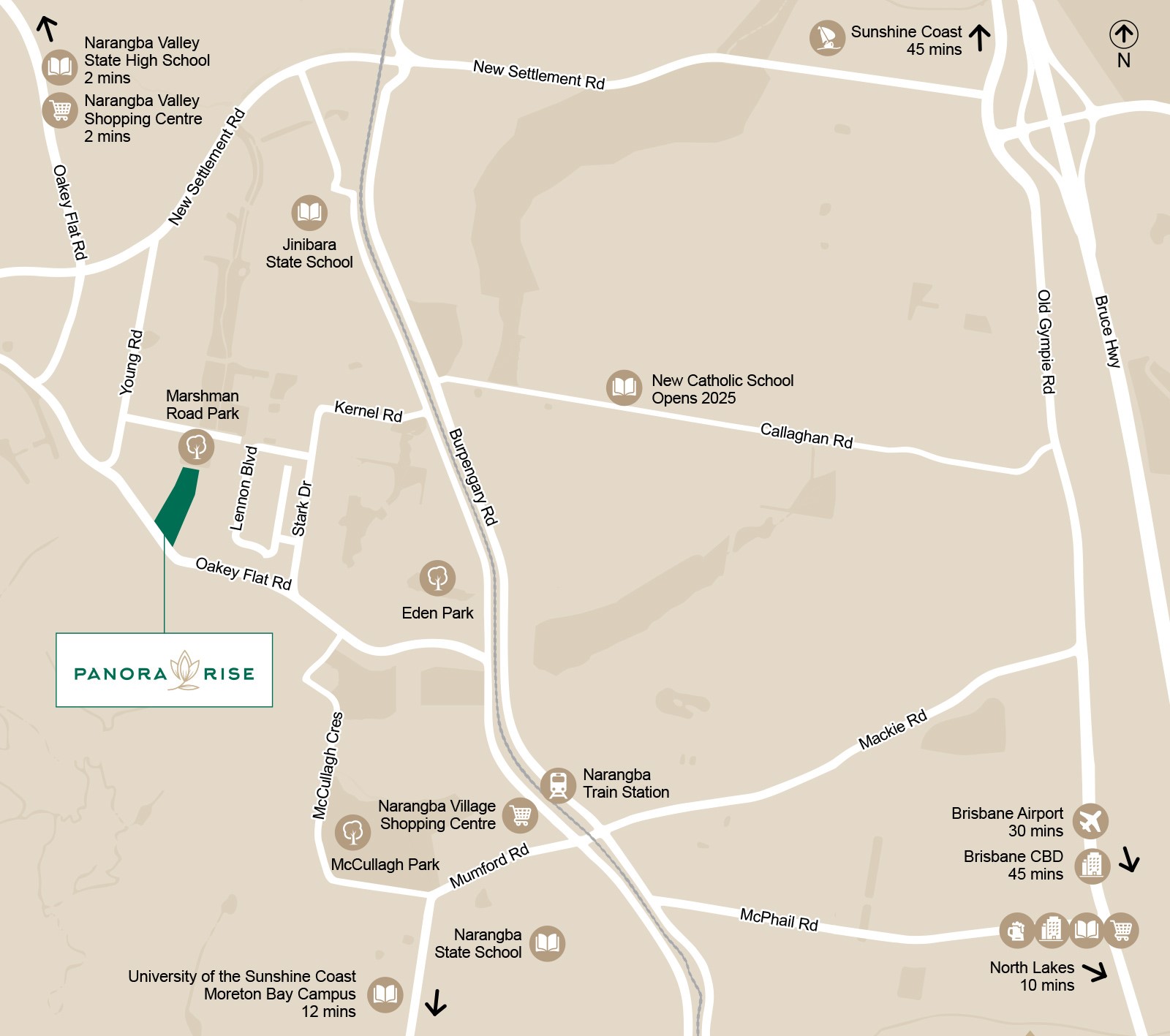
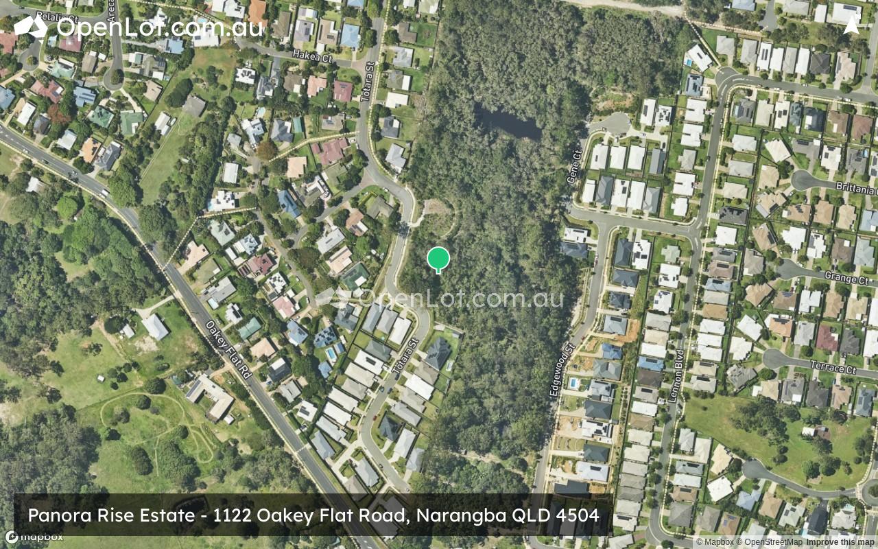
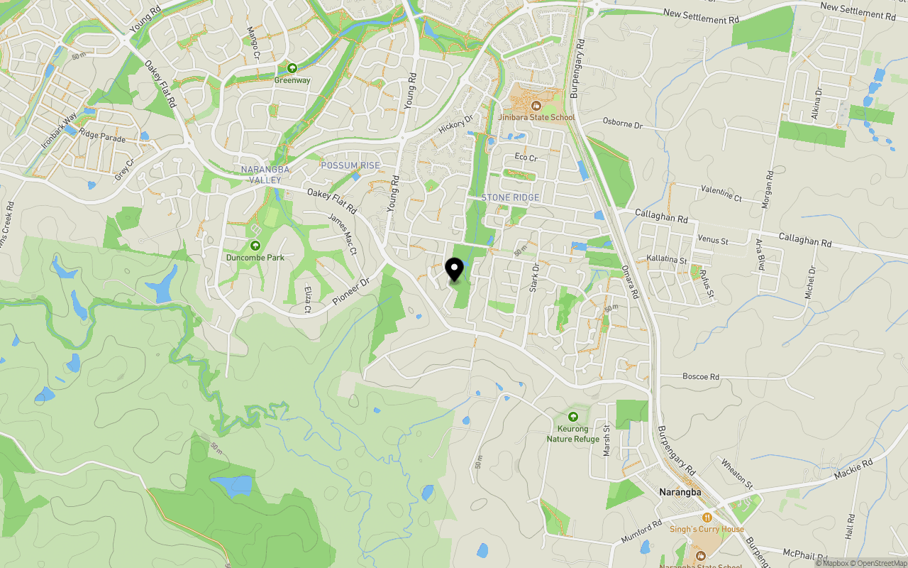
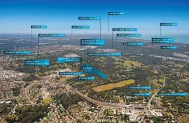
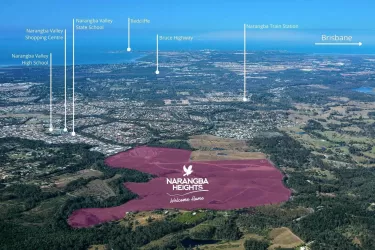
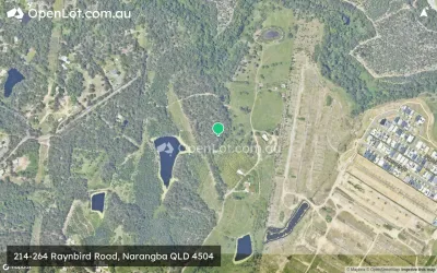
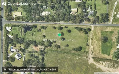
Location & Map for Panora Rise Estate - Narangba
Schools near Panora Rise Estate - Narangba
Overview
This information is estimated by the OpenLot research team. Let us know here to provide up-to-date information about this development.
| Total new homes | |
| Area Size | 2.62 hectares |
| Growth Region | Greater Brisbane Growth Areas |
| City Council | Moreton Bay Regional Council |
| Developer | Nolah Property Developments |
| Project Marketer | Colliers |
| Distance to |
Land Price Trend in Narangba QLD 4504
Below shows the price trend from vacant land sales recorded in Narangba QLD 4504.
The data and information provided by Terralytics (Aust) Pty Ltd (Terralytics Data) is general in nature and is not intended to constitute professional advice. Read more
It should not be relied upon as a substitute for legal, financial, valuation, or other specialist advice relevant to your specific circumstances.
Terralytics uses commercially reasonable endeavours to ensure the Terralytics Data is current and accurate. However, as the Terralytics Data incorporates information sourced from third parties, Terralytics makes no representation or warranty — express or implied — as to its accuracy, completeness, or currency. To the maximum extent permitted by applicable law, Terralytics excludes all liability for any loss or damage (including consequential loss) arising out of or in connection with reliance on the Terralytics Data, whether arising in contract, tort (including negligence), statute, or otherwise.
Popular Estates near Panora Rise Estate - Narangba

Not exactly what you're looking for? Try surrounding suburbs
Burpengary QLD 4505
19 estates | Moreton Bay Regional Council
5.3km north-east
Upper Caboolture QLD 4510
7 estates | Moreton Bay Regional Council
7.9km north
Morayfield QLD 4506
46 estates | Moreton Bay Regional Council
7.0km north-east
Dakabin QLD 4503
3 estates | Moreton Bay Regional Council
9.2km south-east
Armstrong Creek QLD 4520
1 estate | Moreton Bay Regional Council
9.1km south-west
King Scrub QLD 4521
1 estate | Moreton Bay Regional Council
7.2km west
Latest published articles


FAQs about Panora Rise Estate - Narangba
Nolah Property Developments is the developer behind Panora Rise Estate - Narangba.
Panora Rise Estate - Narangba consists of 23 homes.
The total area for Panora Rise Estate - Narangba is 2.62 hectares.
Panora Rise Estate - Narangba falls under Moreton Bay Regional Council.
Panora Rise Estate - Narangba is 32 km north of Brisbane CBD.
Colliers is the project marketer for Panora Rise Estate - Narangba.
Nearby schools for Panora Rise Estate - Narangba:
- Jinibara State School - 1.2km north
- Narangba Valley State High School - 2.0km north
- Narangba State School - 2.2km south-east
- Narangba Valley State School - 2.4km north-west
- The Younity School - 3.1km north-east
- Carmichael College - 3.2km north-west