
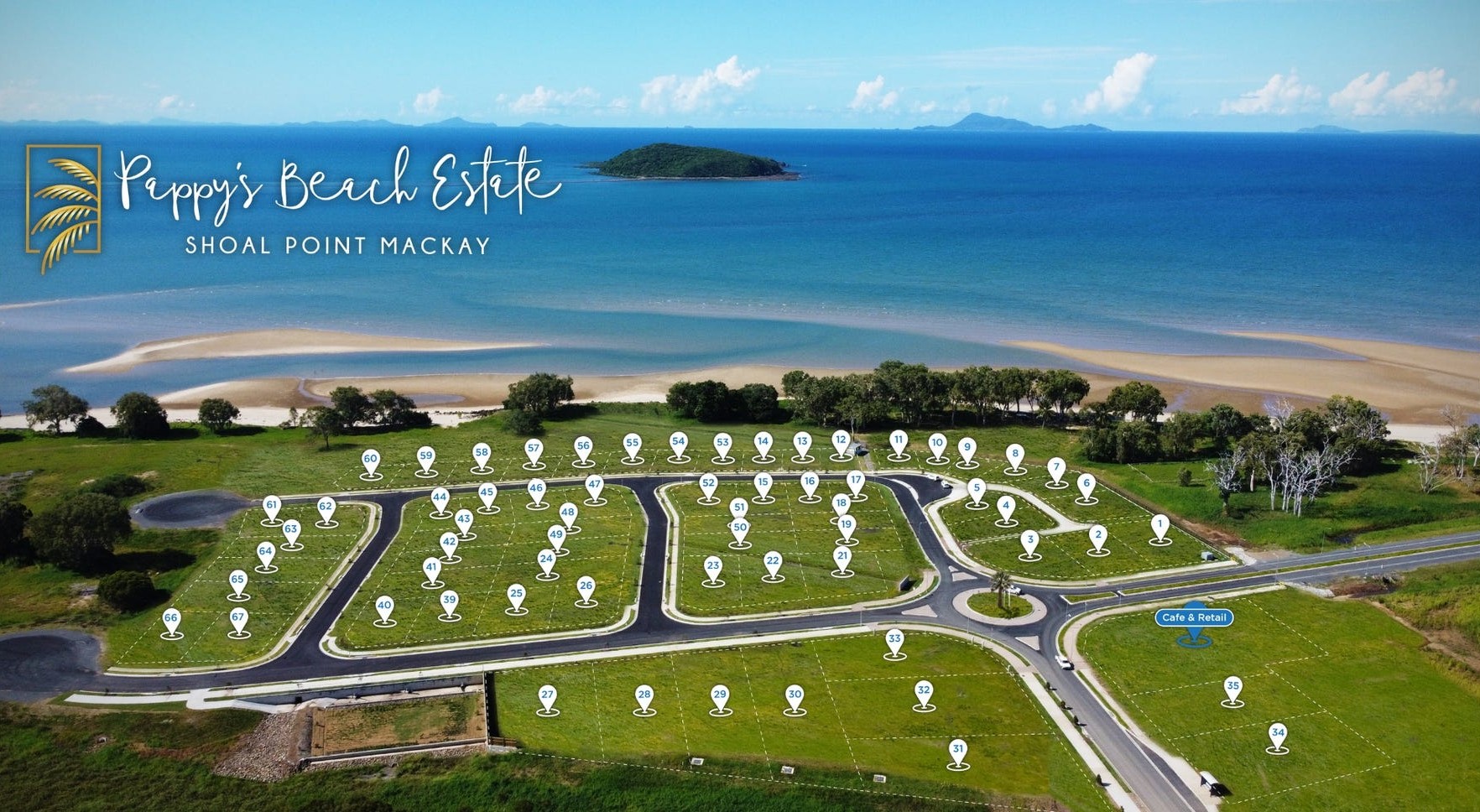
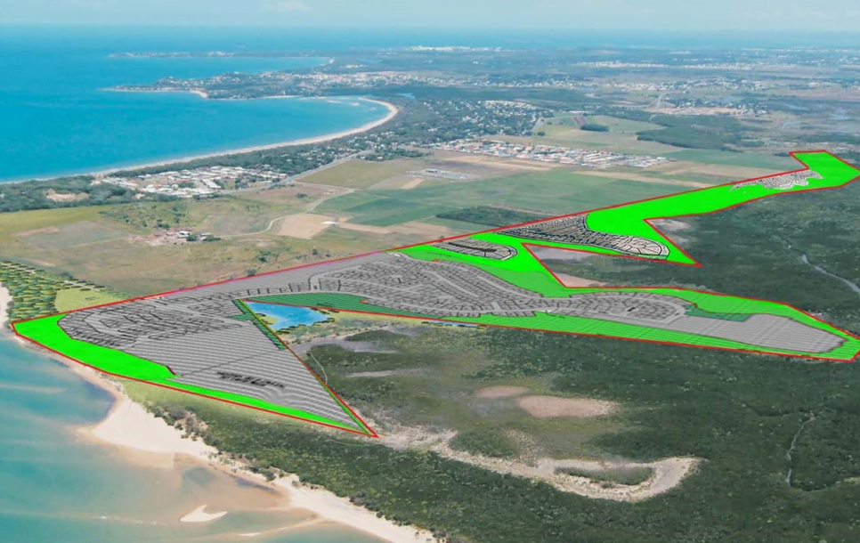
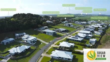
Pappy's Beach Estate - Shoal Point
[NEW RELEASE] North Facing Absolute Beachfront


- Pappy's Beach Estate North Facing Absolute Beachfront Shoalpoint Mackay Ring Me Directly On Site, The Locals Are Snapping Them Up
Property types for sale
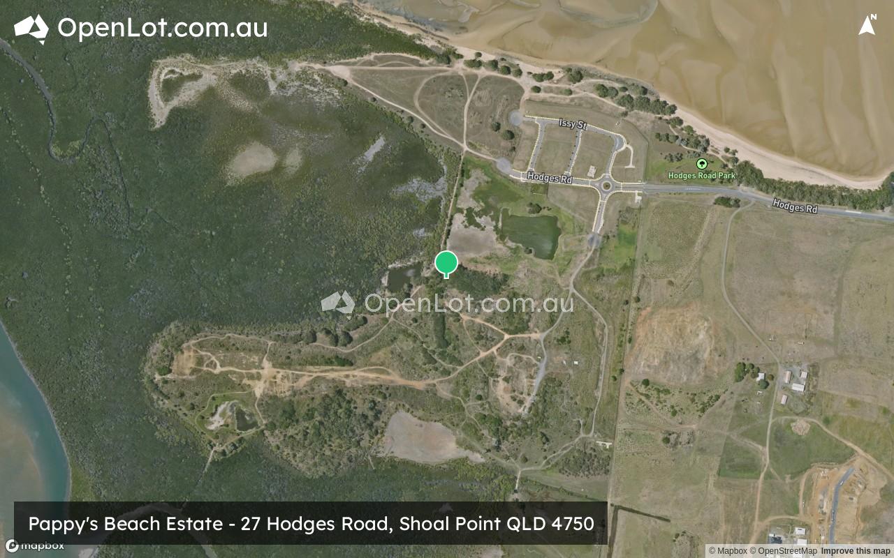
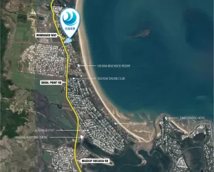
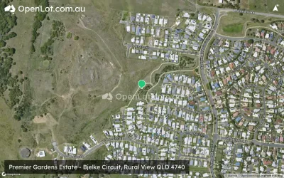
Location & Map for Pappy's Beach Estate - Shoal Point
Schools near Pappy's Beach Estate - Shoal Point
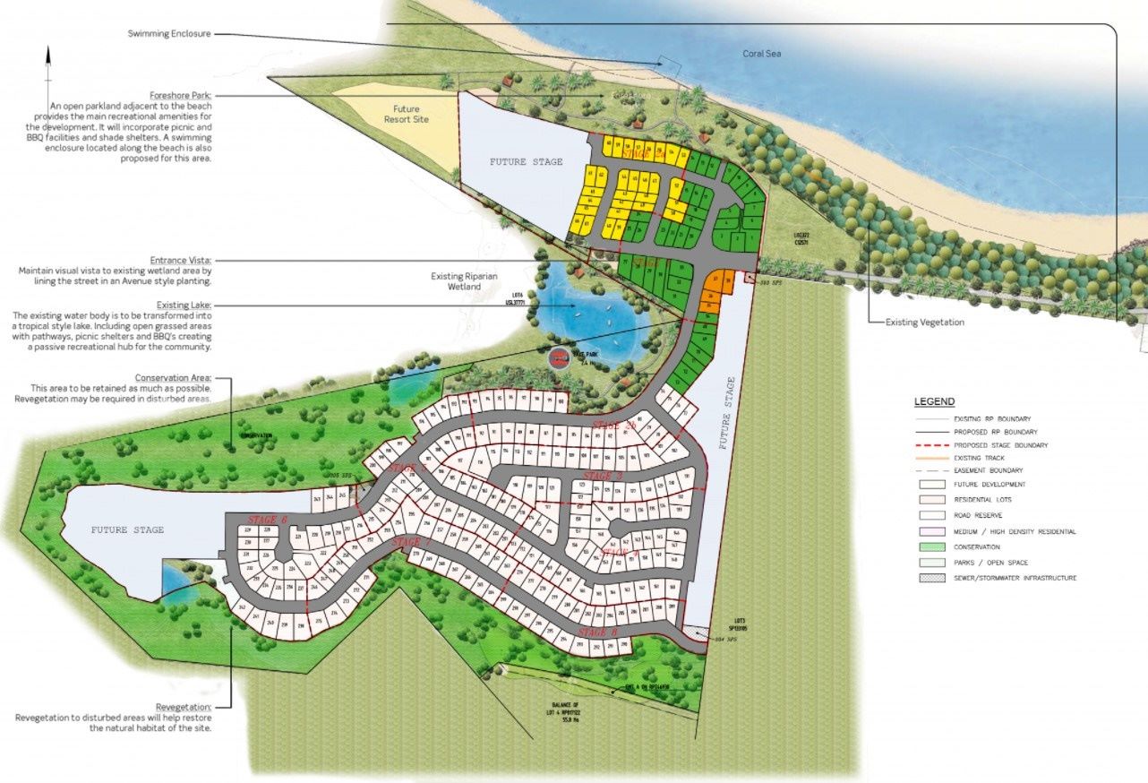
Overview
This information is estimated by the OpenLot research team. Let us know here to provide up-to-date information about this development.
| Total new homes | |
| Area Size | 95.80 hectares |
| City Council | Mackay Regional Council |
| Developer | Point Bay Developments |
Updates for Pappy's Beach Estate - Shoal Point

Land Price Trend in Shoal Point QLD 4750
Below shows the price trend from vacant land sales recorded in Shoal Point QLD 4750.
The data and information provided by Terralytics (Aust) Pty Ltd (Terralytics Data) is general in nature and is not intended to constitute professional advice. Read more
It should not be relied upon as a substitute for legal, financial, valuation, or other specialist advice relevant to your specific circumstances.
Terralytics uses commercially reasonable endeavours to ensure the Terralytics Data is current and accurate. However, as the Terralytics Data incorporates information sourced from third parties, Terralytics makes no representation or warranty — express or implied — as to its accuracy, completeness, or currency. To the maximum extent permitted by applicable law, Terralytics excludes all liability for any loss or damage (including consequential loss) arising out of or in connection with reliance on the Terralytics Data, whether arising in contract, tort (including negligence), statute, or otherwise.
Popular Estates near Pappy's Beach Estate - Shoal Point


Not exactly what you're looking for? Try surrounding suburbs
Beaconsfield QLD 4740
3 estates | Mackay Regional Council
8.8km south
Richmond QLD 4740
2 estates | Mackay Regional Council
8.5km south
Blacks Beach QLD 4740
1 estate | Mackay Regional Council
7.2km south-east
Bucasia QLD 4750
2 estates | Mackay Regional Council
2.6km south
Rural View QLD 4740
5 estates | Mackay Regional Council
6.1km south
Habana QLD 4740
1 estate | Mackay Regional Council
6.5km west
Latest published articles


FAQs about Pappy's Beach Estate - Shoal Point
Point Bay Developments is the developer behind Pappy's Beach Estate - Shoal Point.
Pappy's Beach Estate - Shoal Point consists of 428 homes.
The total area for Pappy's Beach Estate - Shoal Point is 95.80 hectares.
Pappy's Beach Estate - Shoal Point falls under Mackay Regional Council.
Nearby schools for Pappy's Beach Estate - Shoal Point:
- Bucasia State School - 3.4km south-east
- St Brendan's Catholic Primary School - 5.6km south
- Eimeo Road State School - 6.4km south
- Mackay Northern Beaches State High School - 7.3km south
- MacKillop Catholic Primary School - 9.8km south-east
- Andergrove State School - 10.3km south-east