
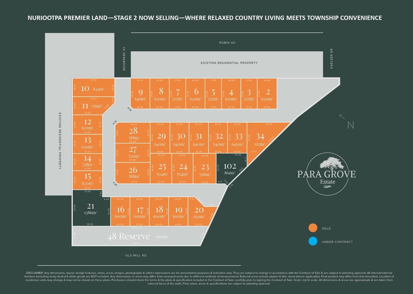
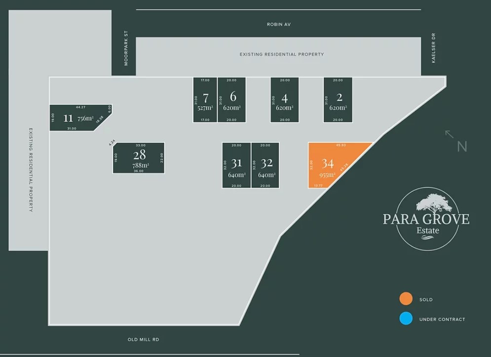
Property types for sale
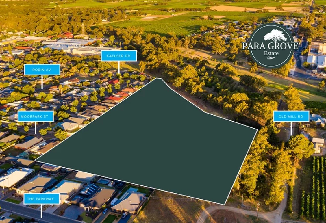
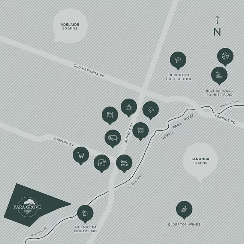
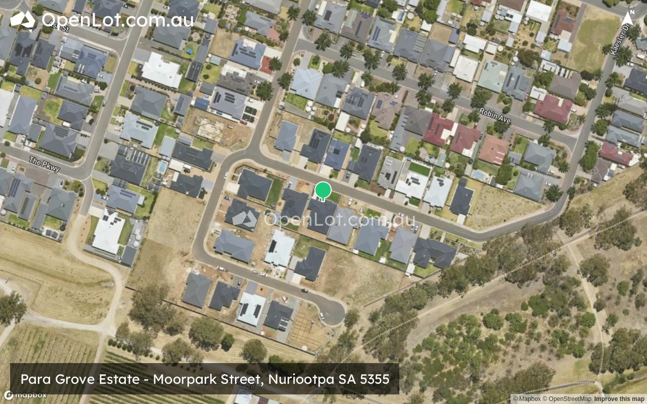
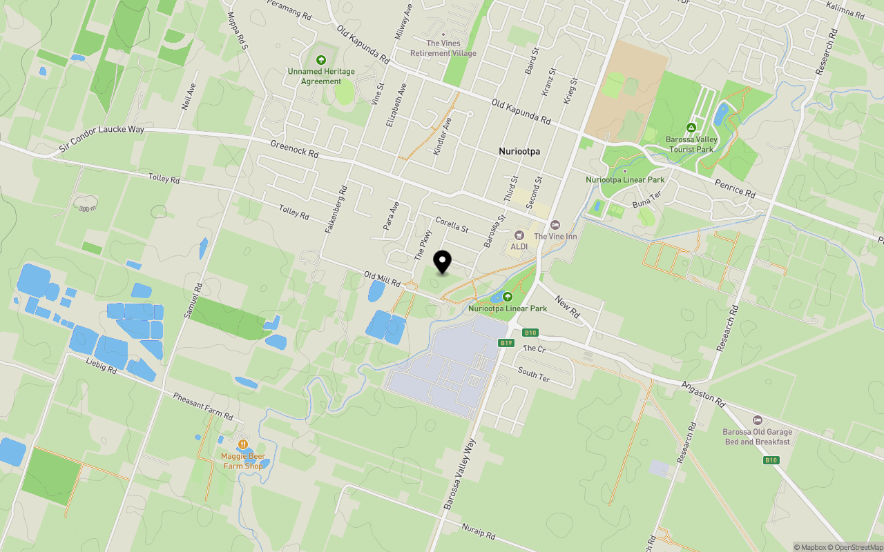
Location & Map for Para Grove Estate - Nuriootpa
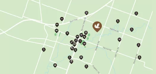
Schools near Para Grove Estate - Nuriootpa
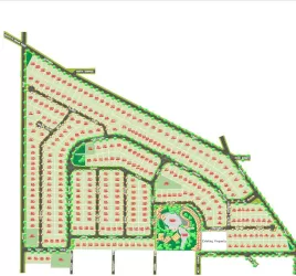
Overview
This information is estimated by the OpenLot research team. Let us know here to provide up-to-date information about this development.
| Total new homes | |
| Area Size | 3.38 hectares |
| City Council | The Barossa Council |
| Developer | N/A |
| Project Marketer | Homburg Real Estate |
| Creative Agency | Retailink |
| Distance to |
Land Price Trend in Nuriootpa SA 5355
Below shows the price trend from vacant land sales recorded in Nuriootpa SA 5355.
The data and information provided by Terralytics (Aust) Pty Ltd (Terralytics Data) is general in nature and is not intended to constitute professional advice. Read more
It should not be relied upon as a substitute for legal, financial, valuation, or other specialist advice relevant to your specific circumstances.
Terralytics uses commercially reasonable endeavours to ensure the Terralytics Data is current and accurate. However, as the Terralytics Data incorporates information sourced from third parties, Terralytics makes no representation or warranty — express or implied — as to its accuracy, completeness, or currency. To the maximum extent permitted by applicable law, Terralytics excludes all liability for any loss or damage (including consequential loss) arising out of or in connection with reliance on the Terralytics Data, whether arising in contract, tort (including negligence), statute, or otherwise.
Popular Estates near Para Grove Estate - Nuriootpa


Not exactly what you're looking for? Try surrounding suburbs
Freeling SA 5372
2 estates | Light Regional Council
15.0km west
Roseworthy SA 5371
3 estates | Light Regional Council
21.8km west
Kapunda SA 5373
2 estates | Light Regional Council
16.9km north
Tanunda SA 5352
4 estates | The Barossa Council
6.6km south
Angaston SA 5353
1 estate | The Barossa Council
11.3km south-east
Lyndoch SA 5351
1 estate | The Barossa Council
16.9km south-west
Latest published articles


FAQs about Para Grove Estate - Nuriootpa
The total area for Para Grove Estate - Nuriootpa is 3.38 hectares.
Para Grove Estate - Nuriootpa falls under The Barossa Council.
Para Grove Estate - Nuriootpa is 62 km north-east of Adelaide CBD.
Homburg Real Estate is the project marketer for Para Grove Estate - Nuriootpa.
Nearby schools for Para Grove Estate - Nuriootpa:
- Nuriootpa Primary School - 1.2km east
- Redeemer Lutheran School - 1.2km north
- Nuriootpa High School - 1.4km north-east
- Light Pass Primary School - 3.4km east
- Faith Lutheran College - 5.0km south
- Angaston Primary School - 6.2km south-east