
Property types for sale
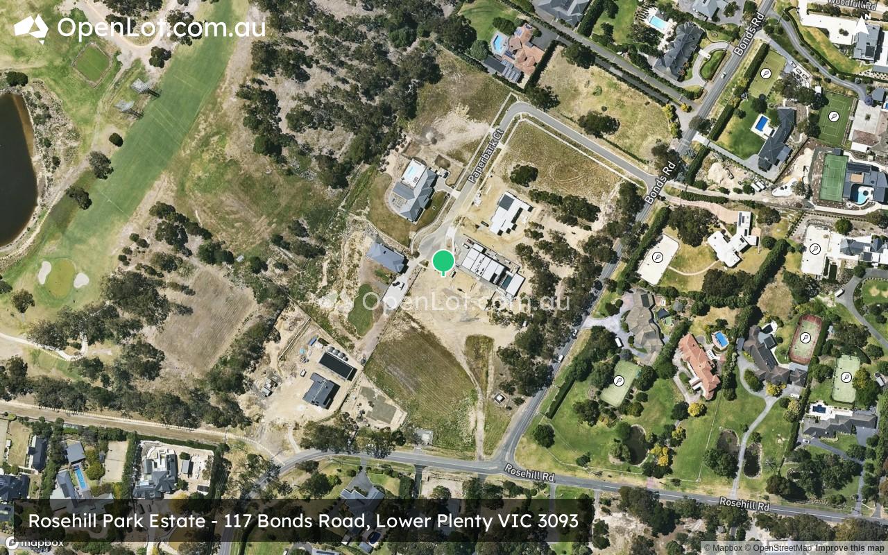
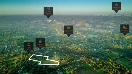
Location & Map for Rosehill Park Estate - Lower Plenty
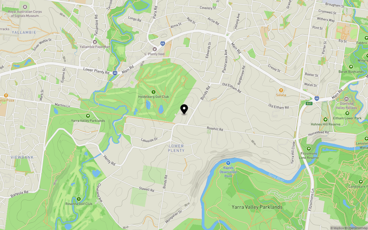
Schools near Rosehill Park Estate - Lower Plenty
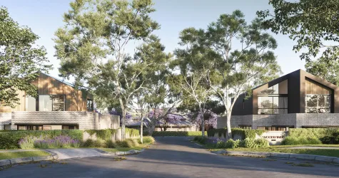
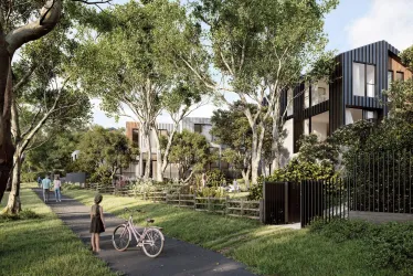
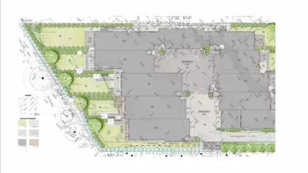
Overview
This information is estimated by the OpenLot research team. Let us know here to provide up-to-date information about this development.
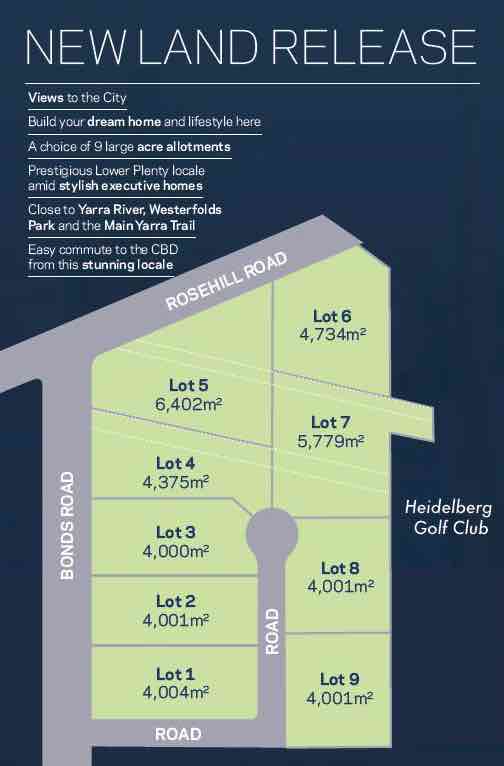
| Total new homes | |
| Area Size | 4.53 hectares |
| Growth Region | Melbourne North Growth Corridor |
| City Council | Banyule City Council |
| Developer | N/A |
| Project Marketer | Mason White McDougall |
| Other Names | Former Lower Plenty Substation |
| Distance to |
Updates for Rosehill Park Estate - Lower Plenty
Popular Estates near Rosehill Park Estate - Lower Plenty

Not exactly what you're looking for? Try surrounding suburbs
Rosanna VIC 3084
2 estates | Banyule City Council
4.1km west
Briar Hill VIC 3088
2 estates | Banyule City Council
3.7km north
Templestowe Lower VIC 3107
3 estates | Manningham City Council
2.9km south
Templestowe VIC 3106
6 estates | Manningham City Council
2.7km south-east
Watsonia North VIC 3087
1 estate | Banyule City Council
4.3km north-west
Bulleen VIC 3105
2 estates | Manningham City Council
3.8km south-west
Latest published articles


FAQs about Rosehill Park Estate - Lower Plenty
Rosehill Park Estate - Lower Plenty consists of 9 homes.
The total area for Rosehill Park Estate - Lower Plenty is 4.53 hectares.
Rosehill Park Estate - Lower Plenty falls under Banyule City Council.
Rosehill Park Estate - Lower Plenty is 16 km north-east of Melbourne CBD.
Mason White McDougall is the project marketer for Rosehill Park Estate - Lower Plenty.
Nearby schools for Rosehill Park Estate - Lower Plenty:
- Lower Plenty Primary School - 1.0km north
- Montmorency South Primary School - 1.5km north-east
- Montmorency Primary School - 2.0km north
- Streeton Primary School - 2.1km north-west
- St Francis Xavier Primary School - 2.3km north
- Montmorency Secondary College - 2.3km north