

Property types for sale
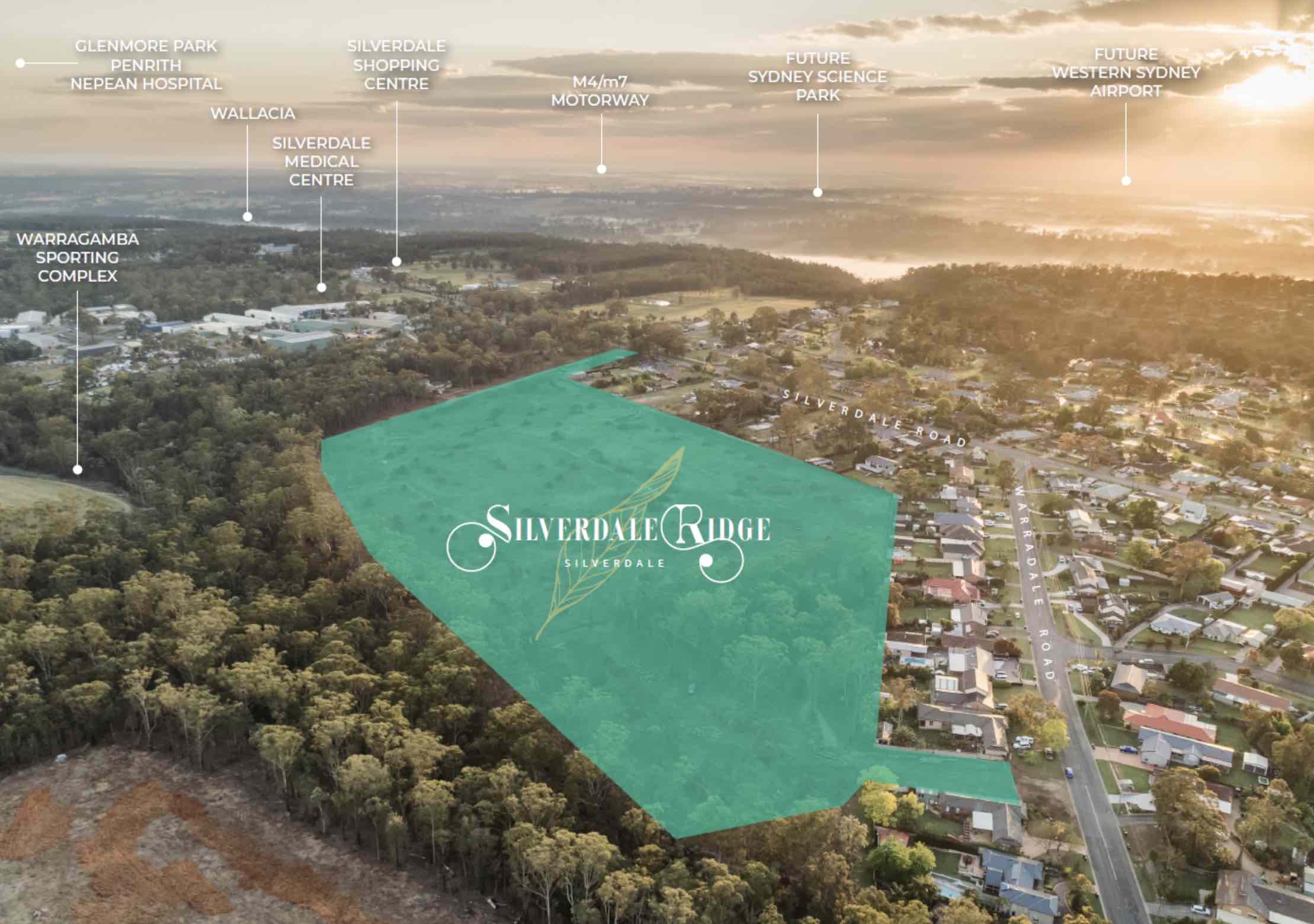
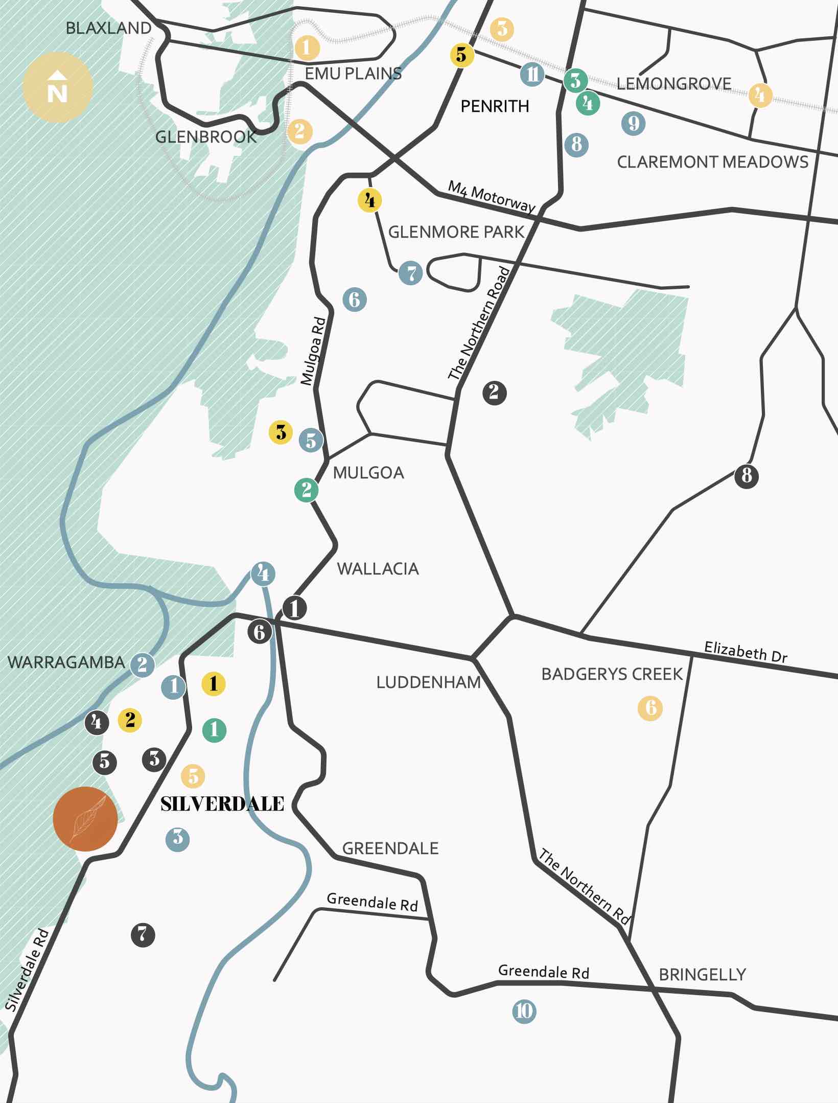
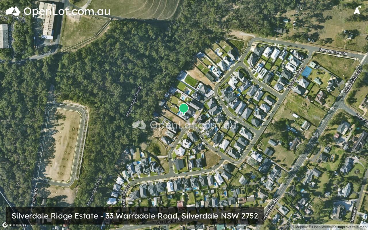
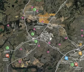
Location & Map for Silverdale Ridge Estate - Silverdale

Schools near Silverdale Ridge Estate - Silverdale
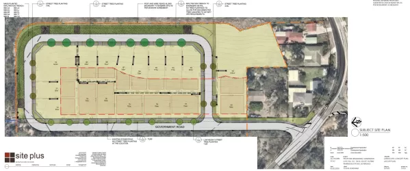
Overview
This information is estimated by the OpenLot research team. Let us know here to provide up-to-date information about this development.
| Total new homes | |
| Area Size | 20.60 hectares |
| Growth Region | Sydney South West Growth Areas |
| City Council | Wollondilly Shire Council |
| Developer | N/A |
| Distance to |
Land Price Trend in Silverdale NSW 2752
Below shows the price trend from vacant land sales recorded in Silverdale NSW 2752.
The data and information provided by Terralytics (Aust) Pty Ltd (Terralytics Data) is general in nature and is not intended to constitute professional advice. Read more
It should not be relied upon as a substitute for legal, financial, valuation, or other specialist advice relevant to your specific circumstances.
Terralytics uses commercially reasonable endeavours to ensure the Terralytics Data is current and accurate. However, as the Terralytics Data incorporates information sourced from third parties, Terralytics makes no representation or warranty — express or implied — as to its accuracy, completeness, or currency. To the maximum extent permitted by applicable law, Terralytics excludes all liability for any loss or damage (including consequential loss) arising out of or in connection with reliance on the Terralytics Data, whether arising in contract, tort (including negligence), statute, or otherwise.
Popular Estates near Silverdale Ridge Estate - Silverdale


Not exactly what you're looking for? Try surrounding suburbs
Glenmore Park NSW 2745
3 estates | Penrith City Council
17.9km north-east
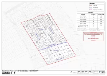
Cobbitty NSW 2570
5 estates | Camden Council
11.8km south-east
Luddenham NSW 2745
1 estate | Liverpool City Council
15.0km north-east
Bringelly NSW 2556
1 estate | Camden Council
16.2km east
Mulgoa NSW 2745
1 estate | Penrith City Council
14.4km north-east
Oran Park NSW 2570
11 estates | Camden Council
17.6km south-east
Latest published articles


FAQs about Silverdale Ridge Estate - Silverdale
Silverdale Ridge Estate - Silverdale consists of 87 homes.
The total area for Silverdale Ridge Estate - Silverdale is 20.60 hectares.
Silverdale Ridge Estate - Silverdale falls under Wollondilly Shire Council.
Silverdale Ridge Estate - Silverdale is 53 km west of Sydney CBD.
Nearby schools for Silverdale Ridge Estate - Silverdale:
- Warragamba Public School - 779m north-west
- Wallacia Public School - 4.8km north-east
- Holy Family Primary School - 7.2km east
- Luddenham Public School - 7.7km east
- Mulgoa Public School - 7.7km north-east
- Nepean Christian School - 8.5km north-east