
Property types for sale
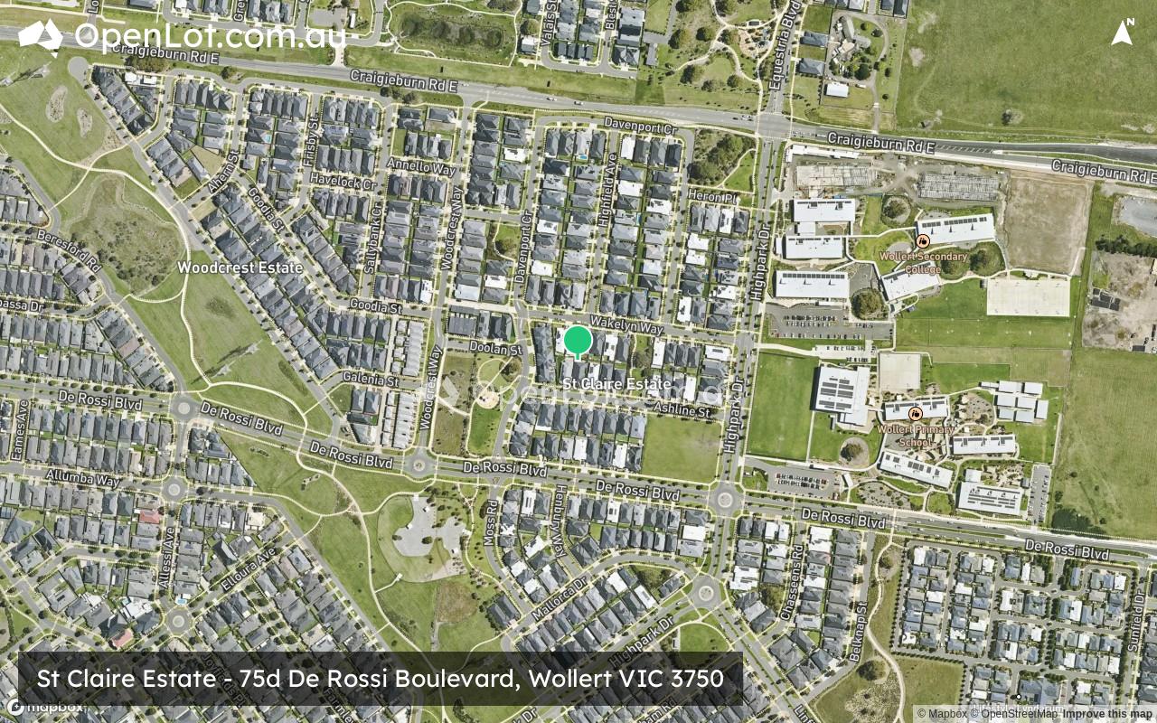
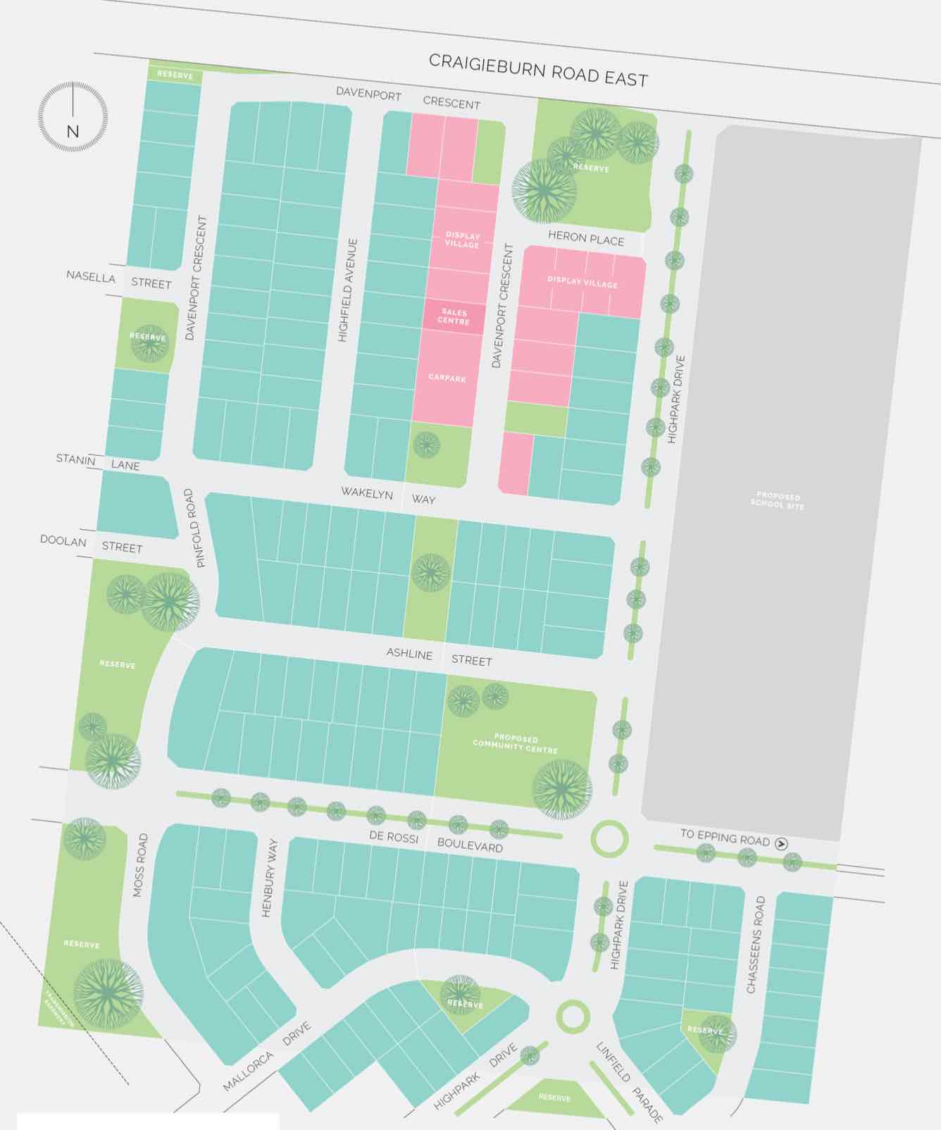
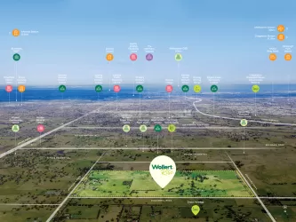
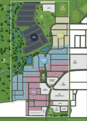
Location & Map for St Claire Estate - Wollert
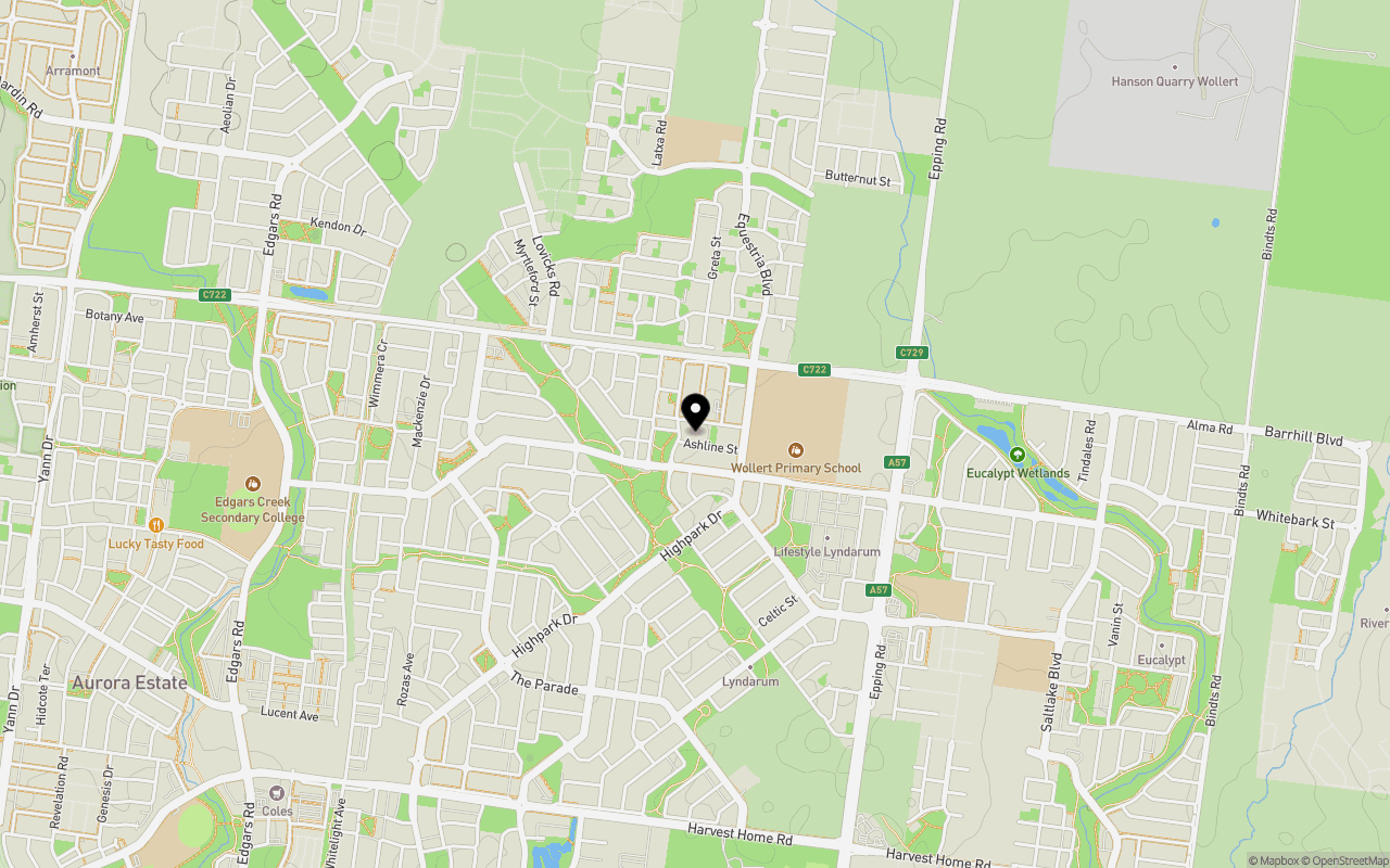
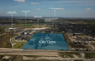
Schools near St Claire Estate - Wollert
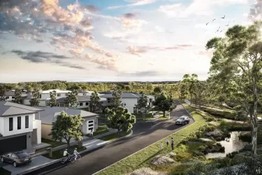
Overview
This information is estimated by the OpenLot research team. Let us know here to provide up-to-date information about this development.
| Total new homes | |
| Area Size | N/A |
| Growth Region | Melbourne North Growth Corridor |
| City Council | Whittlesea City Council |
| Developer | Henley |
| Distance to |
Updates for St Claire Estate - Wollert

Land Price Trend in Wollert VIC 3750
Below shows the price trend from vacant land sales recorded in Wollert VIC 3750.
The data and information provided by Terralytics (Aust) Pty Ltd (Terralytics Data) is general in nature and is not intended to constitute professional advice. Read more
It should not be relied upon as a substitute for legal, financial, valuation, or other specialist advice relevant to your specific circumstances.
Terralytics uses commercially reasonable endeavours to ensure the Terralytics Data is current and accurate. However, as the Terralytics Data incorporates information sourced from third parties, Terralytics makes no representation or warranty — express or implied — as to its accuracy, completeness, or currency. To the maximum extent permitted by applicable law, Terralytics excludes all liability for any loss or damage (including consequential loss) arising out of or in connection with reliance on the Terralytics Data, whether arising in contract, tort (including negligence), statute, or otherwise.
Popular Estates near St Claire Estate - Wollert

Not exactly what you're looking for? Try surrounding suburbs
Mernda VIC 3754
19 estates | Whittlesea City Council
6.0km east
Lalor VIC 3075
4 estates | Whittlesea City Council
8.1km south
Epping VIC 3076
17 estates | Whittlesea City Council
6.2km south
South Morang VIC 3752
21 estates | Whittlesea City Council
6.9km south-east
Woodstock VIC 3751
4 estates | Whittlesea City Council
5.4km north
Mill Park VIC 3082
1 estate | Whittlesea City Council
8.0km south
Latest published articles


FAQs about St Claire Estate - Wollert
Henley is the developer behind St Claire Estate - Wollert.
St Claire Estate - Wollert consists of 200 homes.
St Claire Estate - Wollert falls under Whittlesea City Council.
St Claire Estate - Wollert is 24 km north of Melbourne CBD.
Nearby schools for St Claire Estate - Wollert:
- Wollert Secondary College - 239m south-east
- Wollert Primary School - 469m south-east
- Glowrey Catholic Primary School - 1.0km south-east
- Edgars Creek Primary School - 1.6km west
- Edgars Creek Secondary College - 1.7km south-west
- St Mary of the Cross MacKillop Catholic Parish Primary School - 2.0km south-west