
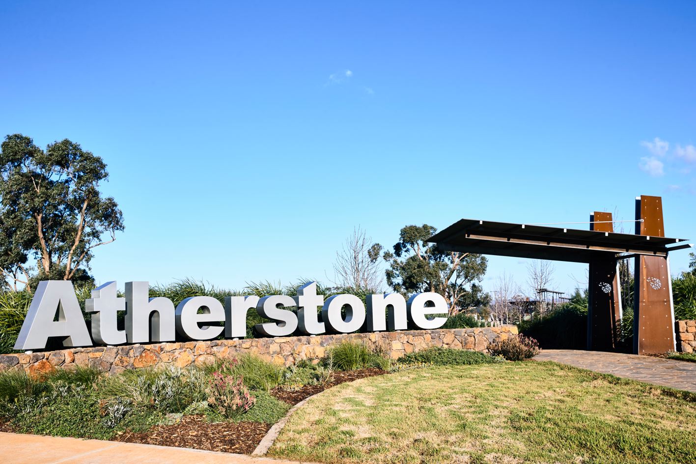

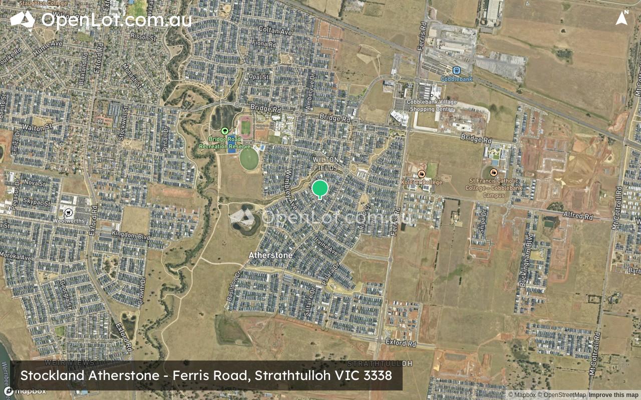
Stockland Atherstone - Strathtulloh
[LIMITED OFFER] New land selling from just $306k*
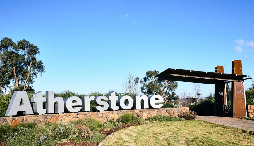


- Make your move to Atherstone, with new land now selling!
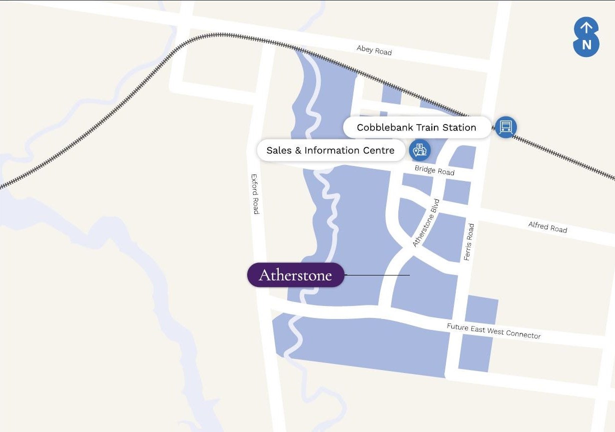
- Stockland Atherstone is just 44km west of Melbourne CBD, so you can reach the city in less than 40 minutes via train from Cobblebank Station.
- With new land in this vibrant community releasing soon, reach out and enquire today to ensure you're among the first to receive updates about our releases.
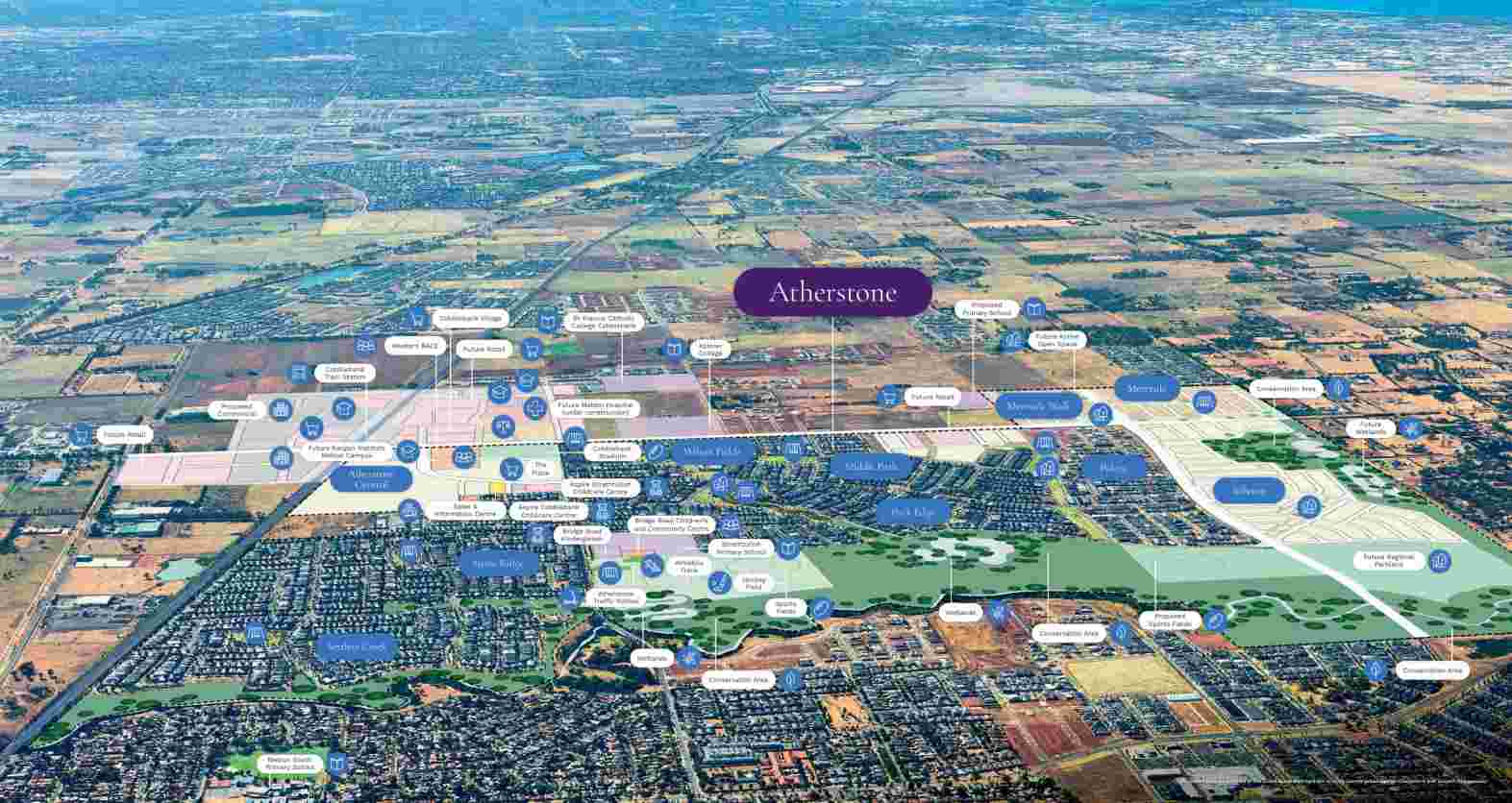
- Stockland Atherstone already has so much in place to help you feel settled from the moment you arrive.
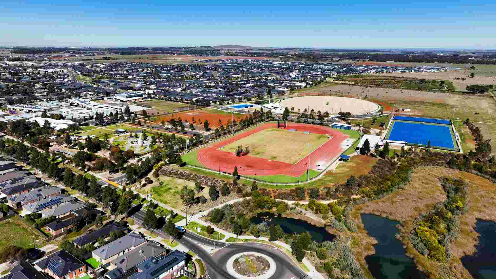
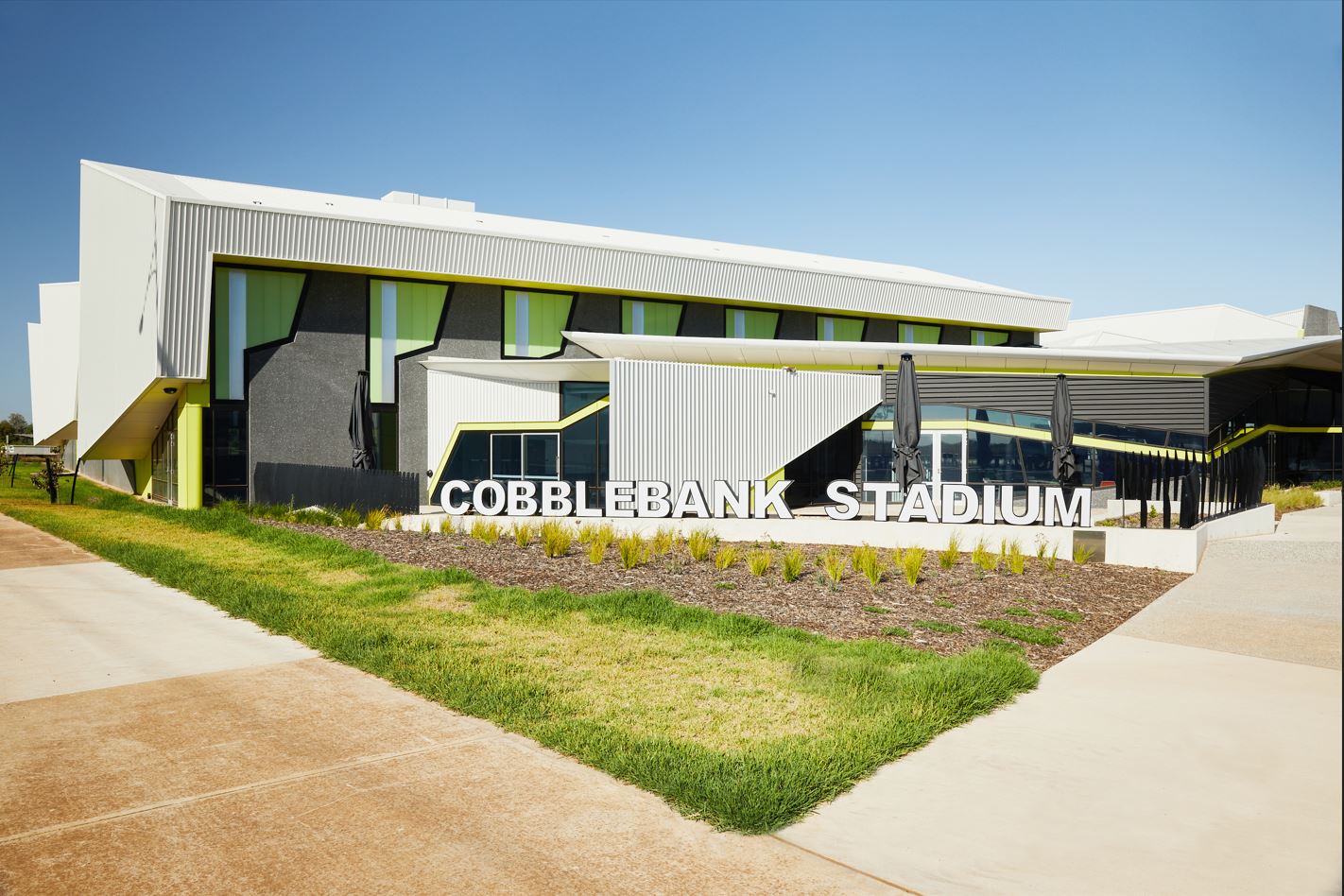
- Atherstone gives you great access to local sporting facilities, including Cobblebank Stadium and the Bridge Road Athletics Precinct. Whether you enjoy indoor sports, running or staying active with the family, there are plenty of ways to get moving.
- 44km West of Melbourne CBD
- 10+ Education options already open on your doorstep from early learning through to high school
- 750m to Strathtulloh Train Station, putting the CBD less than 40 mins away
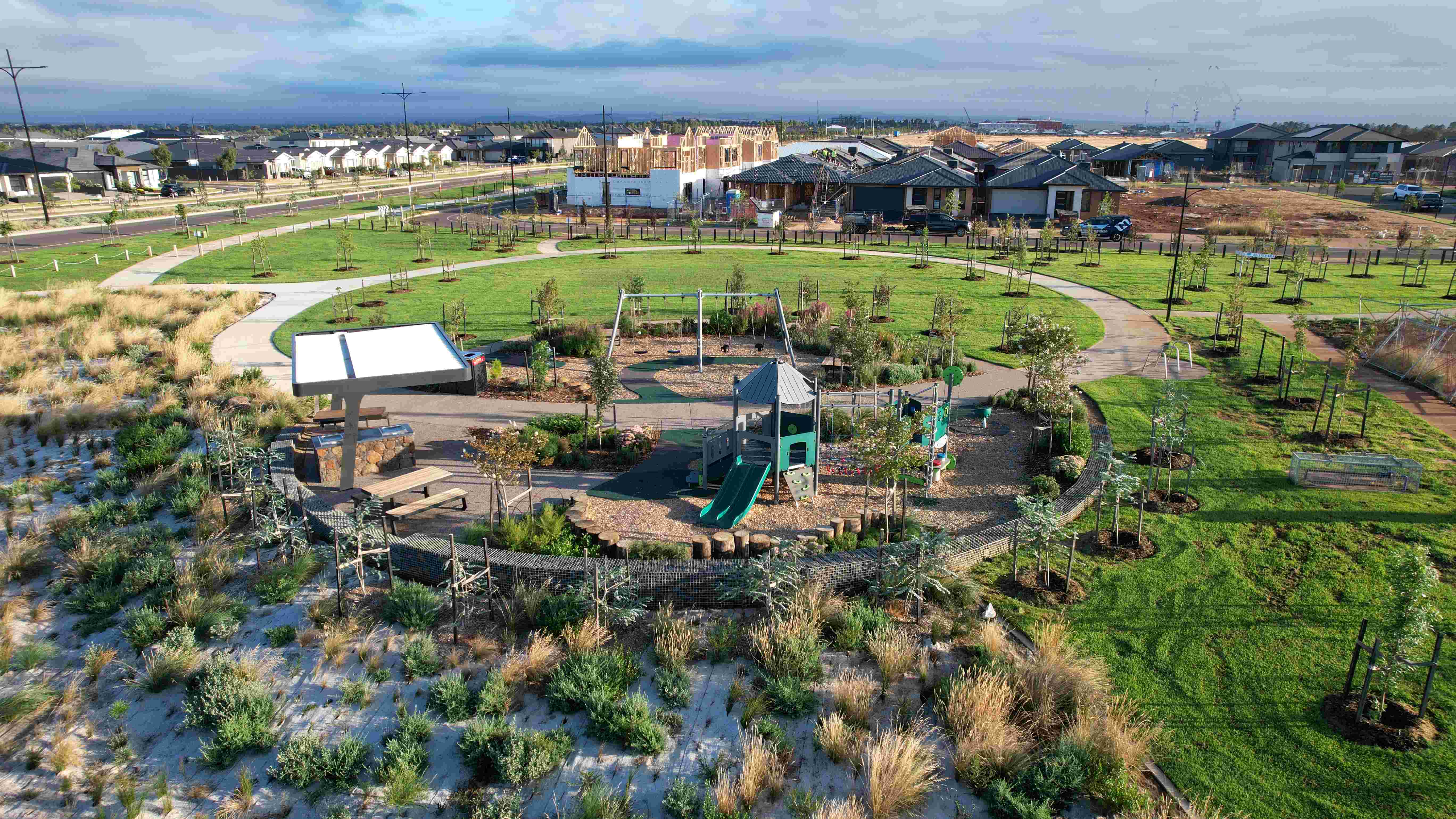
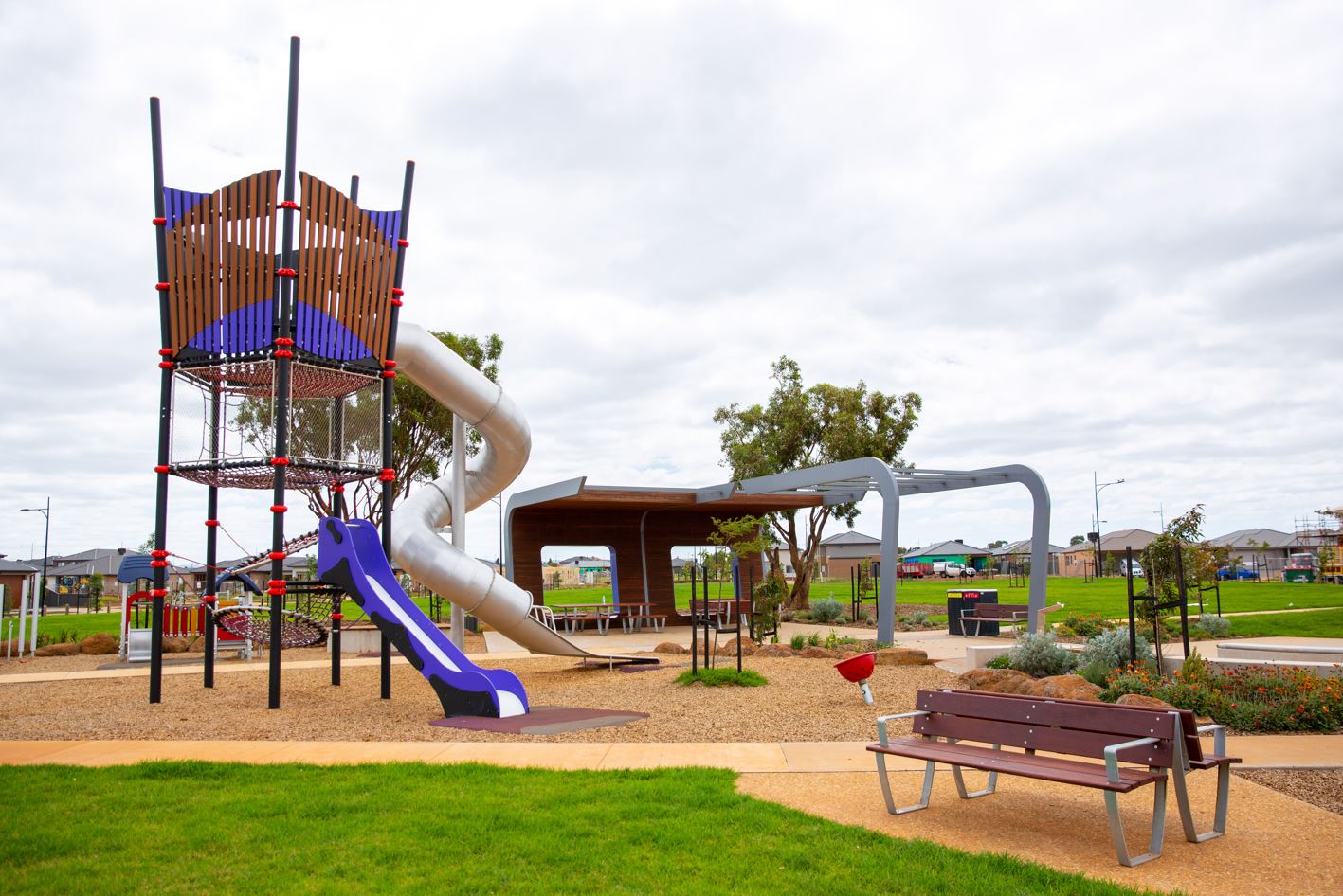
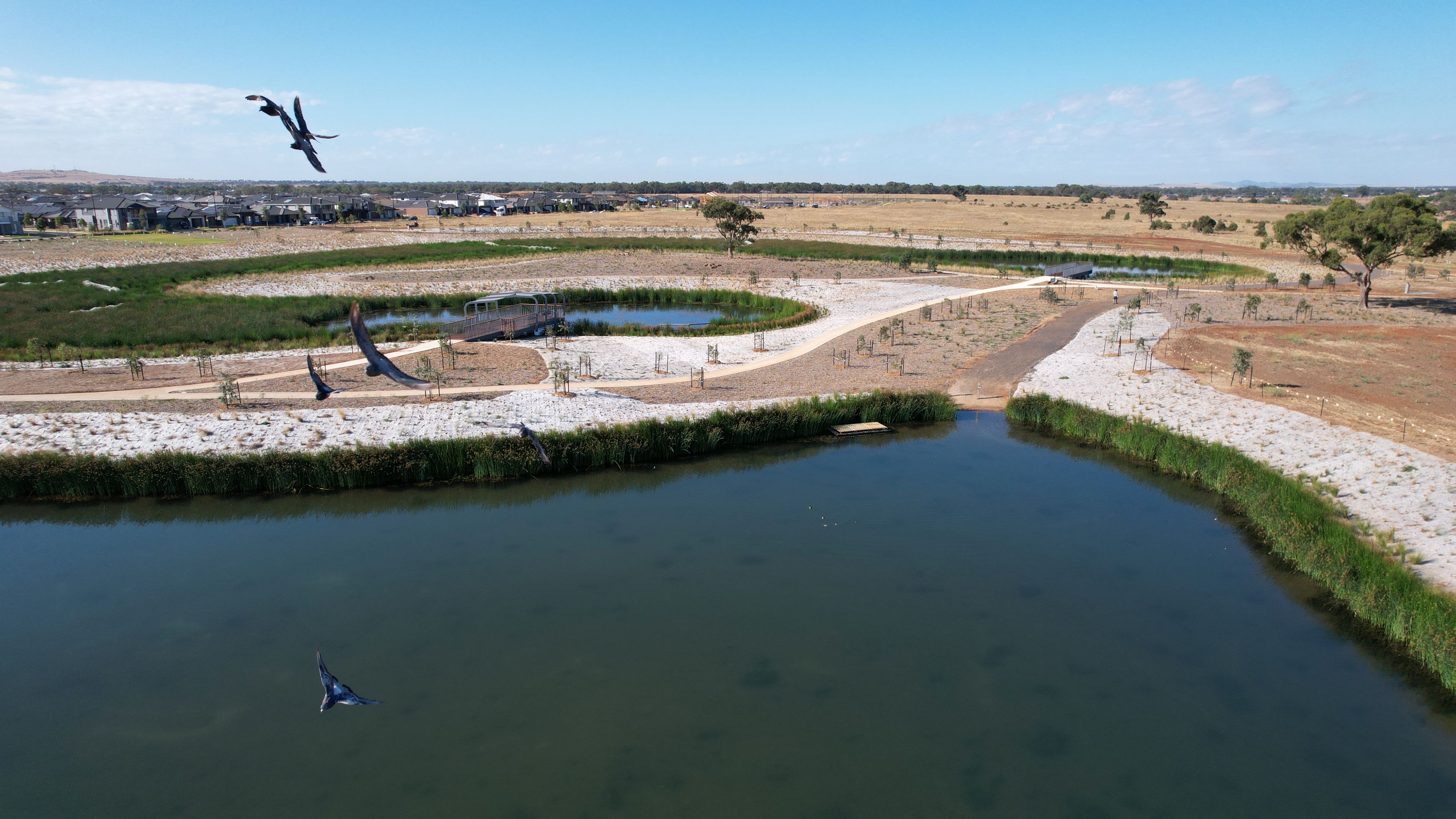
- ¼ of the community is dedicated to green open space with multiple parks ready for play
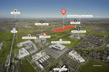
- Cobblebank Village, with a Coles, is now open
- Future Cobblebank CBD will be conveniently located across the road
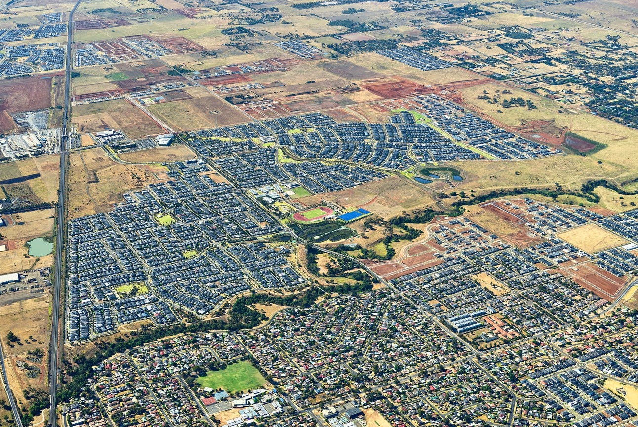
- Atherstone will eventually be home to 15,000 residents
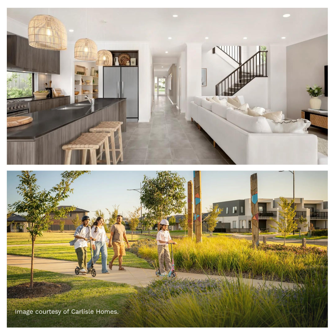
- Schools, parks, playgrounds, open spaces, shops and transport are all part of the community, giving you the comfort of knowing the essentials are ready now. It's a place where you can picture your life taking shape, surrounded by friendly neighbours and everyday conveniences that make life feel simple and enjoyable. Whether it's the school run, picking up groceries or time spent outdoors, everything you need is close by and ready to welcome you home.
- Atherstone is beside the 130 hectare Toolern Regional Park, offering wide open space, walking trails and nature experiences. Wetlands, parks and outdoor areas make it easy to enjoy time outside every day.
- Future Cobblebank CBD will be conveniently located across the road
- Construction is underway on the new Melton Hospital in Cobblebank, which is set to open in 2029. The hospital will include 24 hour emergency care, maternity and neonatal services, mental health support and more, with room to treat 130k patients each year.
- A new Kangan Institute Melton TAFE campus is coming to Cobblebank, set to open in 2028. Located on the corner of Hollingsworth Drive and Ferris Road, the $55 million dollar campus will offer hands-on training in construction, trades and emerging tech.
- *Price correct as at 20.04.2026. Subject to change and availability.
- ^All details (including any prices), images and statements are based on the intention of, and information available to, Stockland as at the date of this email and may change due to future circumstances. This email is not legally binding on Stockland. Stockland does not give any warranty in relation to any information contained in this email. Stockland does not accept any liability for loss or damage arising as a result of any reliance on this email or its contents. Images are are subject to change. Stockland is only responsible for the sale of the land. Price does not include stamp duty, registration fees or any incidental fees.
Property types for sale
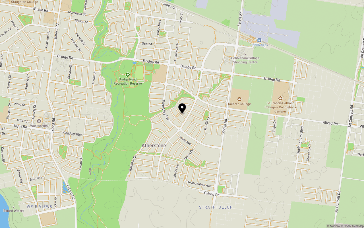
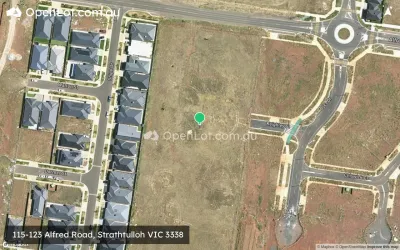
Location & Map for Stockland Atherstone - Strathtulloh
Schools near Stockland Atherstone - Strathtulloh
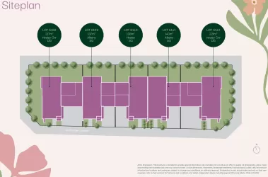
9 Land Lots in Stockland Atherstone - Strathtulloh
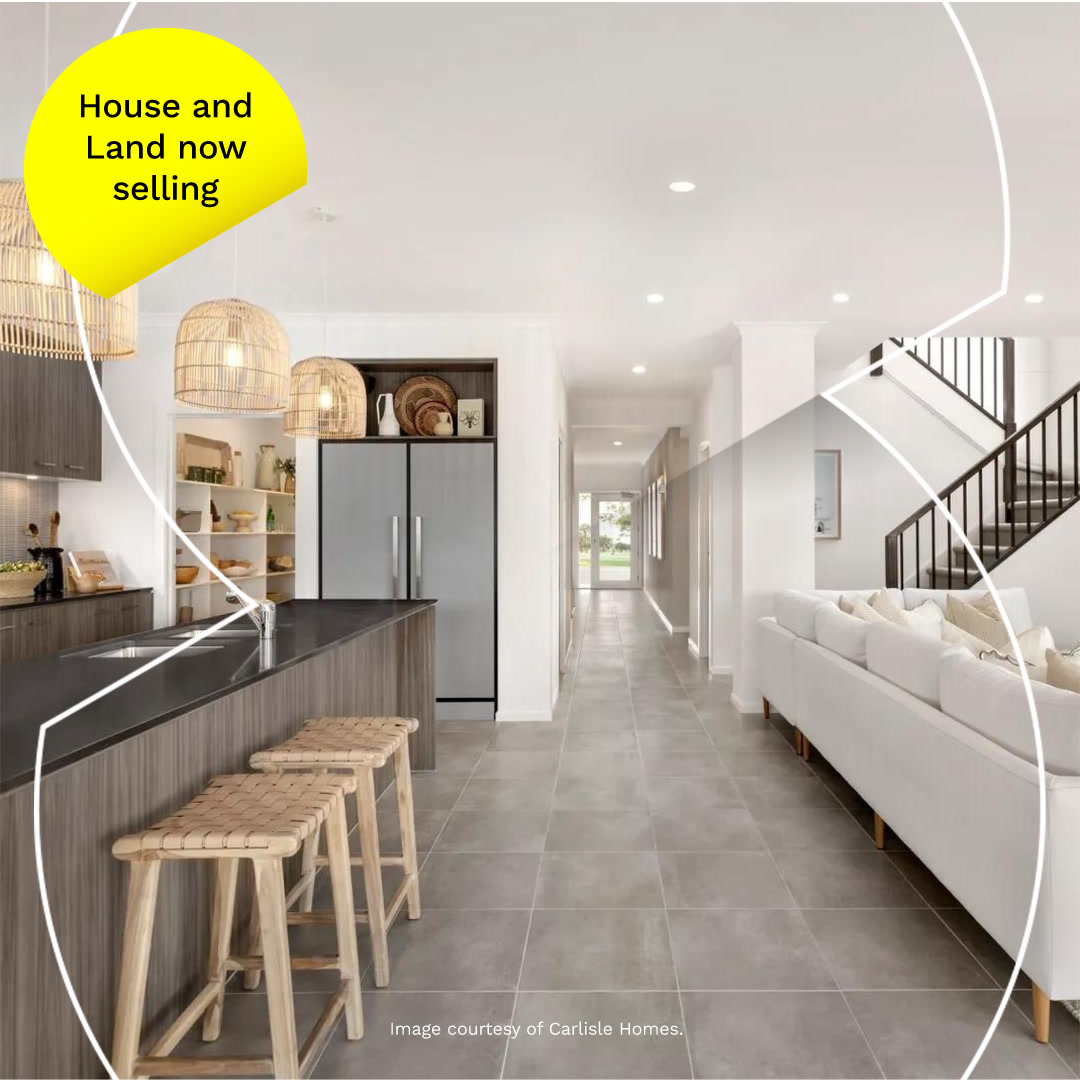
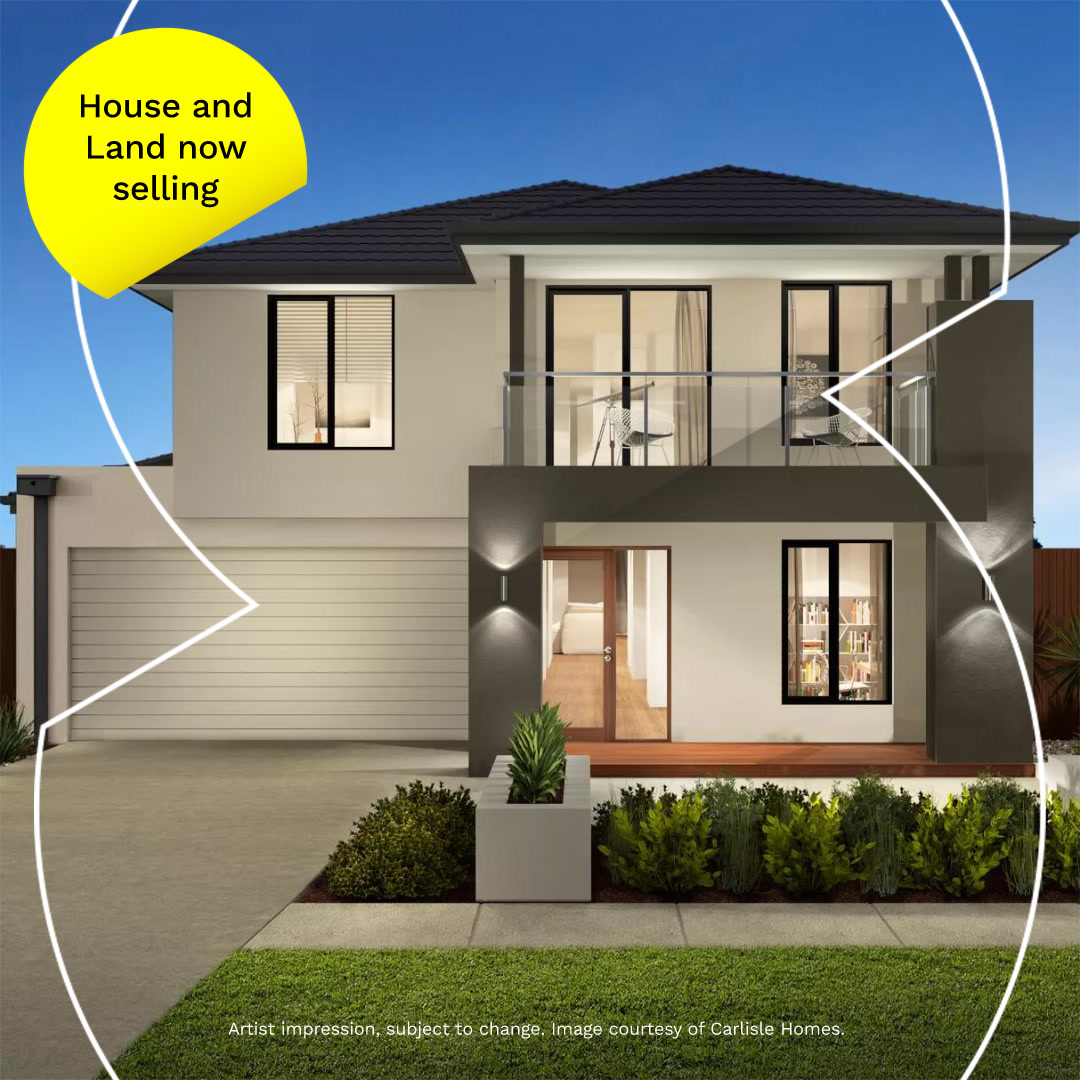
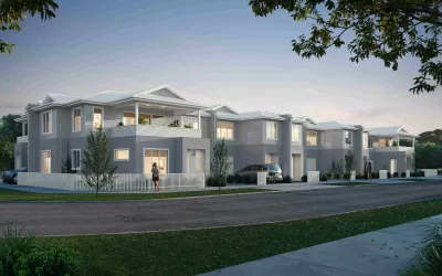
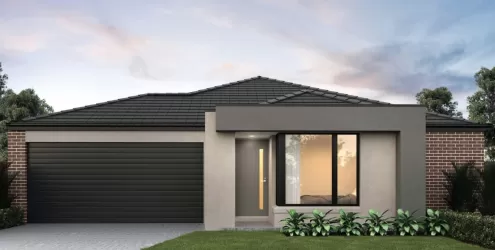
2 House and Land Packages in Stockland Atherstone - Strathtulloh
Stockland Atherstone - Strathtulloh Video
Overview
This information is estimated by the OpenLot research team. Let us know here to provide up-to-date information about this development.
| Total new homes | |
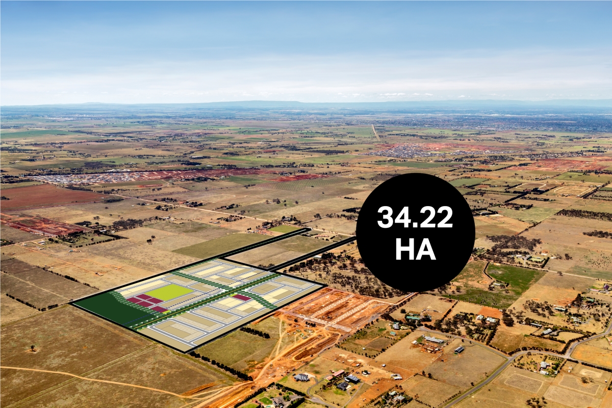
| Area Size | 481.00 hectares |
| Growth Region | Melbourne West Growth Corridor |
| City Council | Melton City Council |
| Developer | Stockland |
| Other Names | Wilton Fields, Park Edge, Middle Park, Stone Ridge, Settlers Creek |
| Distance to | |
| OpenLot Offer | $200 Cashback |
Suburb Planning Review in Strathtulloh VIC 3338
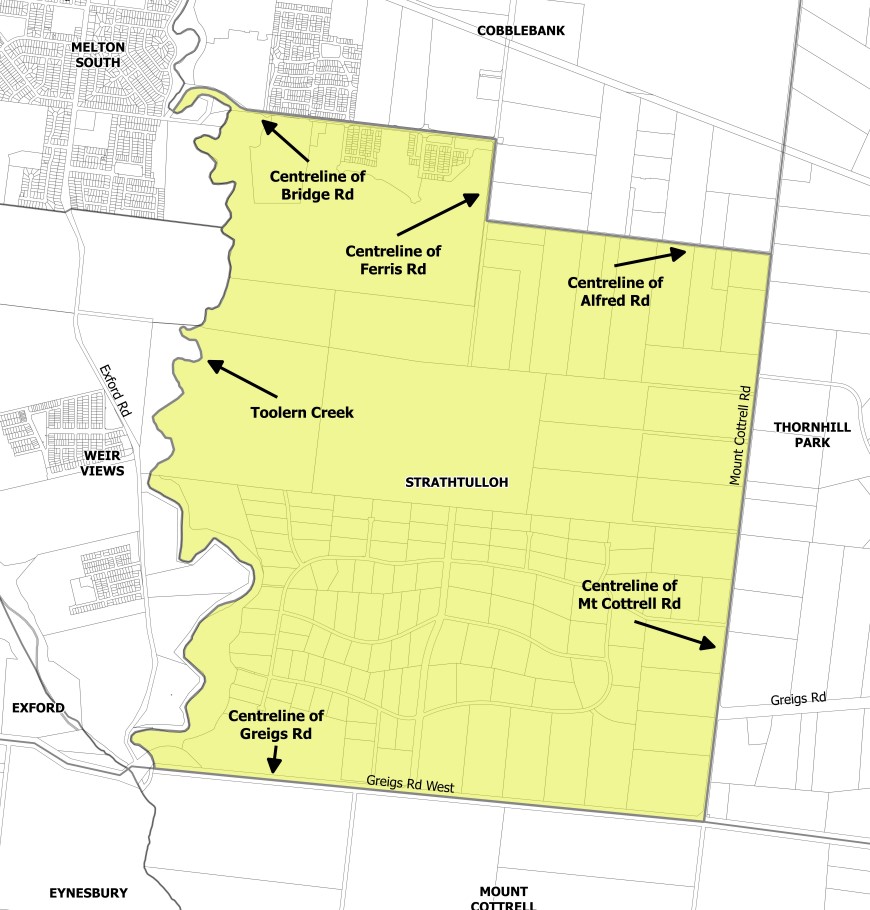
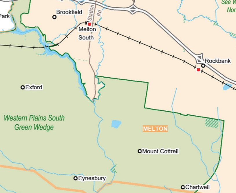
Strathtulloh is with the City of Melton located 40 kilometres west of Melbourne and named after a heritage-listed property located on Greigs Road. Strathtulloh is approximately 1,093 ha, which is bounded by Mount Cottrell Road to the west, Toolern Creek natural waterway corridor to the east, Alfred Road, Ferris Road and Bridge Road to the north and Greigs Road West to the south.
Strathtulloh was gazetted by the Office of Geographic Names on 9 February 2017 under the direction of the Victorian State Government, following a proposal for 11 new suburbs by the City of Melton. The new suburbs have strict density changes to ensure density does not exceed 20,000 residents, ensure vibrant community neighbourhood hubs, provide affordable housing and maintain the geographic characteristics.
The suburb is made up of two parts (northern and southern), as listed below:
- The northern area is set to be redeveloped under the Toolern Precinct Structure Plan which will provide schools, parks and new residential dwellings with an increased density; and
- The southern area known as ‘Strathtulloh Estate’ is a low/semi-rural density area with agriculture surrounded by bushland which will remain undeveloped
.jpg)
Strathtulloh contains zones that maintain the development intentions of the planning scheme. The Green Wedge Zone (GWZ) is found in the southern portion of the area, the Public Park / Recreation Zone (PPRZ) and Rural Conservation Zone (RCZ) are both located along the western boundary and adjoins the Toolern Creek Park corridor.
The Toolern Precinct Structure Plan includes the Urban Growth Zone (UGZ) located in the northern area of Strathtulloh and enables Melton Shire Council to provide a range of physical and social infrastructure as part of the development of the area, with further infrastructure to be provided by the redevelopment of the new suburb.

The Toolern Precinct Structure Plan (PSP) provides recreation and residential infrastructure necessary to support the long-term strategic planning direction for a more sustainable growth area. The new growth area of Cobblebank-Strathtulloh is expected to provide for over 35,000 people by 2051.
The Toolern PSP was prepared by Victorian Planning Authority (VPA) in consultation with the City of Milton and was approved by the Minister for Planning in October 2010. The decision was officially gazetted in November 2011 under Amendment CO84 (Part 1) to the Milton Planning Scheme. The Toolern Precinct Structure Plan was later amended in December 2015 under amendment C161.
Green Wedge
Strathtulloh is within the northern portion of the Western Plains South Green Wedge, which refers to a non-urban land that surrounds the Urban Growth Boundary of Melbourne and was put in place by the Victorian Government in 2002. The city of Melton is preparing a management plan with other surrounding council areas to provide a framework to support sustainable development, land use and management.
- Provide opportunities for agricultural uses, such as market gardening, viticulture, aquaculture, farm forestry and broadacre farming
- Preserve rural and scenic landscapes
- Preserve renewable and non-renewable resources and natural areas (such as water catchments)
- Providing and safeguarding sites for infrastructure that supports urban areas, and
- Provide opportunities for tourism and recreation.
The southern area will be controlled by a management plan for the Western Plains South Green Wedge (WPSGW) that is being prepared and until such time the planning principles of the prepared background report will guide future development. The report can be found here.
Benefits of Strathtulloh
The amendment to the Melton Planning Scheme provides suburb urban structure and redevelopment density direction within the existing Urban Growth Zone (UGZ). The Toolern PSP provides the planning framework to facilitate the new residential community, new schools, sports and recreation areas for future development.
The protection of the open space, parkland and Toolern Creek corridor will be controlled by the existing Public Park / Recreation Zone (PPRZ) and Rural Conservation Zone (RCZ). The existing zoning allows for a series of linear public parklands that can be enjoyed by all future residents.
The envisaged school, sports fields and parks are strategically located within the northern portion of the suburb experiencing urban redevelopment. The future neighbourhood activity centre and surrounding suburbs provide areas that provide social, retail, employment and community infrastructure, with the largest located on Bridge Road adjacent to the northern boundary of Strathtulloh.
Transportation in Strathtulloh
Strathtulloh will be connected to public passenger transport, with Melton train station and Toolner Train Station located in adjacent suburbs north of Strathtulloh. Both stations provide passenger train service to Melbourne CBD.
A shared pathway connects local parks, adjacent suburbs and residential areas in Strathtulloh. A road network is envisaged to connect the large rural residential lots with the approved and proposed residential subdivisions to facilitate vehicle access to the surrounding growth areas. Access to Ferris Road to the north will provide a direct connection to the Melton Highway/ Western Freeway interchange providing access to Melbourne CBD or western Victoria.

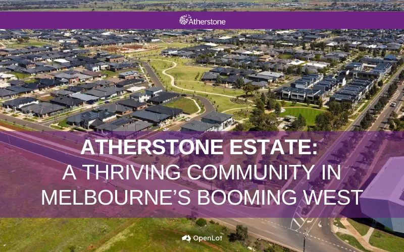
Atherstone Residential Community
Property developer Lendlease has begun to establish a large residential community over the Cobblebank and Strathtulloh suburbs, in accordance with the Toolern PSP. The new master planned community is named ‘Atherstone’ and provides a variety of residential allotments, types of dwellings, parks and a local road network. The redevelopment has announced that future stages of development will be released. The redevelopment has protected the Public Park / Recreation Zone (PPRZ) and Rural Conservation Zone (RCZ) and facilitated the intended redevelopment of the Urban Growth Zone (UGZ).
.jpg)
Strathtulloh Suburb Summary
References
City of Milton – Strathtulloh Map
City of Milton – C122 Draft Planning Scheme Amendment
2019—2020 Federal Government Budget Submission
Western Plains South Green Wedge – Background Report
Western Plains South Green Wedge - Map
Victoria Planning Authority – Toolern PSP
Atherstone Master planned Community
Updates for Stockland Atherstone - Strathtulloh


Land Price Trend in Strathtulloh VIC 3338
Below shows the price trend from vacant land sales recorded in Strathtulloh VIC 3338.
The data and information provided by Terralytics (Aust) Pty Ltd (Terralytics Data) is general in nature and is not intended to constitute professional advice. Read more
It should not be relied upon as a substitute for legal, financial, valuation, or other specialist advice relevant to your specific circumstances.
Terralytics uses commercially reasonable endeavours to ensure the Terralytics Data is current and accurate. However, as the Terralytics Data incorporates information sourced from third parties, Terralytics makes no representation or warranty — express or implied — as to its accuracy, completeness, or currency. To the maximum extent permitted by applicable law, Terralytics excludes all liability for any loss or damage (including consequential loss) arising out of or in connection with reliance on the Terralytics Data, whether arising in contract, tort (including negligence), statute, or otherwise.
Popular Estates near Stockland Atherstone - Strathtulloh


Not exactly what you're looking for? Try surrounding suburbs
Thornhill Park VIC 3335
19 estates | Melton City Council
2.5km east
Mount Cottrell VIC 3024
5 estates | Wyndham City Council
4.5km south-east
Melton South VIC 3338
7 estates | Melton City Council
3.5km north-west
Cobblebank VIC 3338
6 estates | Melton City Council
2.9km north
Weir Views VIC 3338
5 estates | Melton City Council
2.2km west
Brookfield VIC 3338
3 estates | Melton City Council
4.8km north-west
Latest published articles


FAQs about Stockland Atherstone - Strathtulloh
Stockland is the developer behind Stockland Atherstone - Strathtulloh.
Stockland Atherstone - Strathtulloh consists of 4,200 homes.
The total area for Stockland Atherstone - Strathtulloh is 481.00 hectares.
Stockland Atherstone - Strathtulloh falls under Melton City Council.
Stockland Atherstone - Strathtulloh is 34 km west of Melbourne CBD.
Nearby schools for Stockland Atherstone - Strathtulloh:
- Strathtulloh Primary School - 645m north
- St Lawrence of Brindisi Catholic Primary School - 2.1km south-west
- Melton South Primary School - 2.1km north-west
- St Anthony's School - 2.2km north-west
- Staughton College - 2.6km north-west
- Al Iman College - 2.9km north-west