
Property types for sale
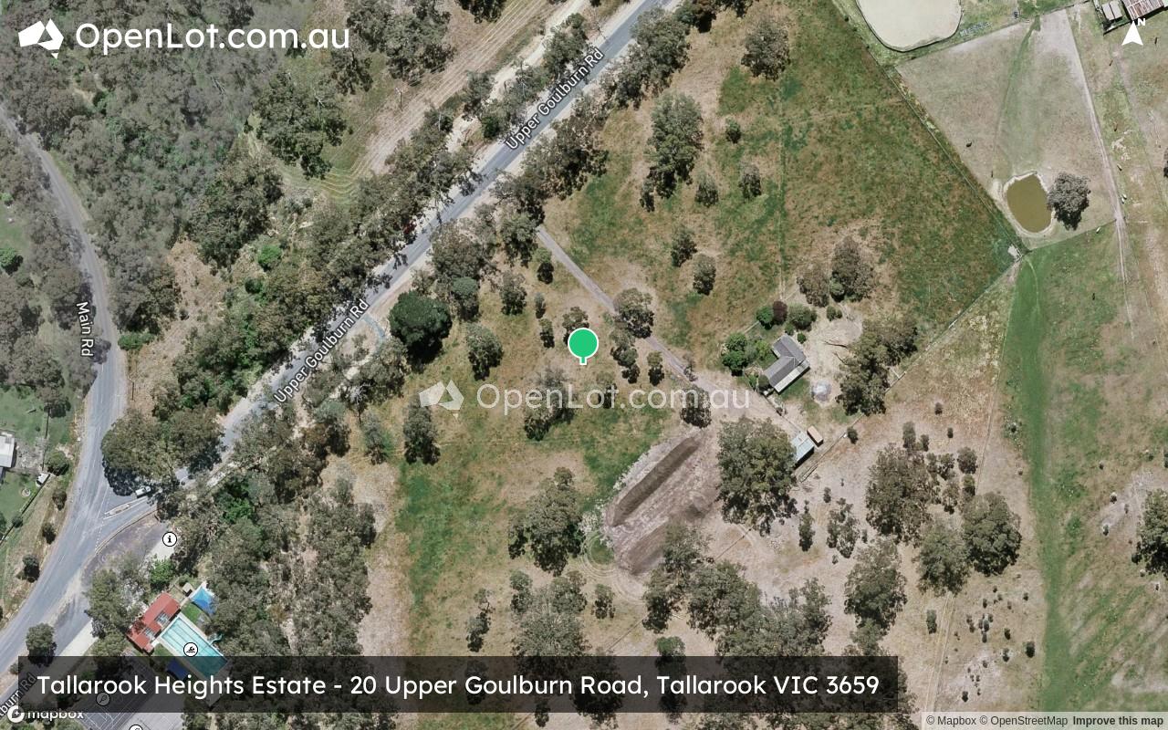
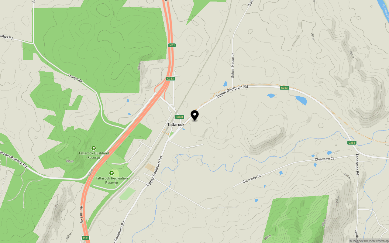
Location & Map for Tallarook Heights Estate - Tallarook
Schools near Tallarook Heights Estate - Tallarook
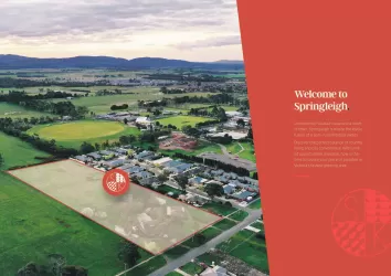
Overview
This information is estimated by the OpenLot research team. Let us know here to provide up-to-date information about this development.
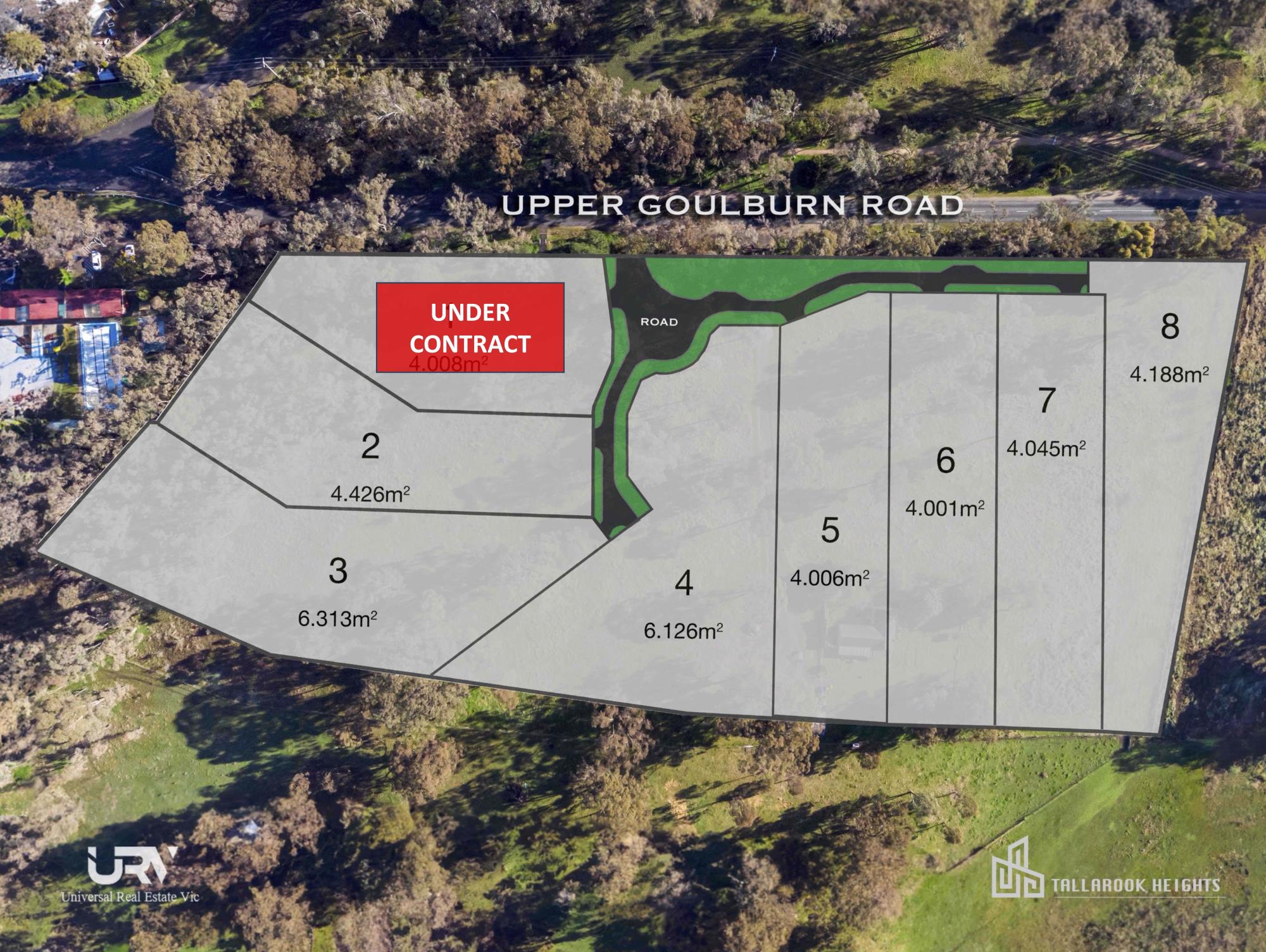
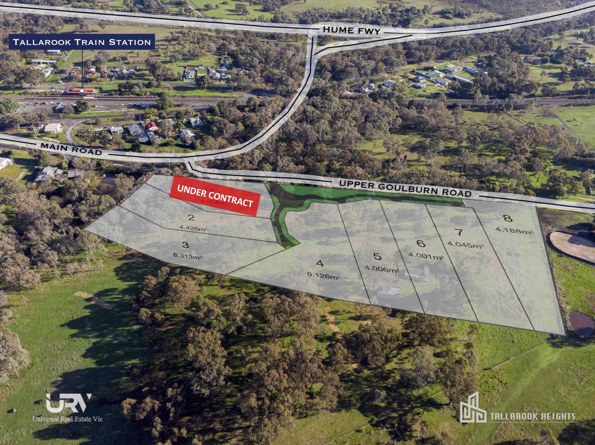
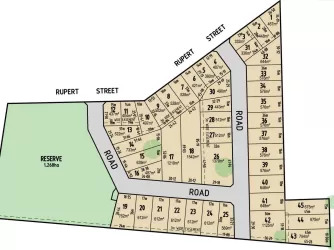
| Total new homes | |
| Area Size | 4.01 hectares |
| Growth Region | Melbourne North Growth Corridor |
| City Council | Mitchell Shire Council |
| Developer | N/A |
| Project Marketer | Universal Real Estate |
| Distance to |
Popular Estates near Tallarook Heights Estate - Tallarook


Not exactly what you're looking for? Try surrounding suburbs
Kilmore VIC 3764
22 estates | Mitchell Shire Council
26.2km south-west
Broadford VIC 3658
7 estates | Mitchell Shire Council
13.0km south
Seymour VIC 3660
9 estates | Mitchell Shire Council
8.1km north
Avenel VIC 3664
5 estates | Strathbogie Shire Council
25.1km north-east
Wandong VIC 3758
2 estates | Mitchell Shire Council
29.9km south
Killingworth VIC 3717
3 estates | Murrindindi Shire Council
29.0km east
Latest published articles


FAQs about Tallarook Heights Estate - Tallarook
Tallarook Heights Estate - Tallarook consists of 8 homes.
The total area for Tallarook Heights Estate - Tallarook is 4.01 hectares.
Tallarook Heights Estate - Tallarook falls under Mitchell Shire Council.
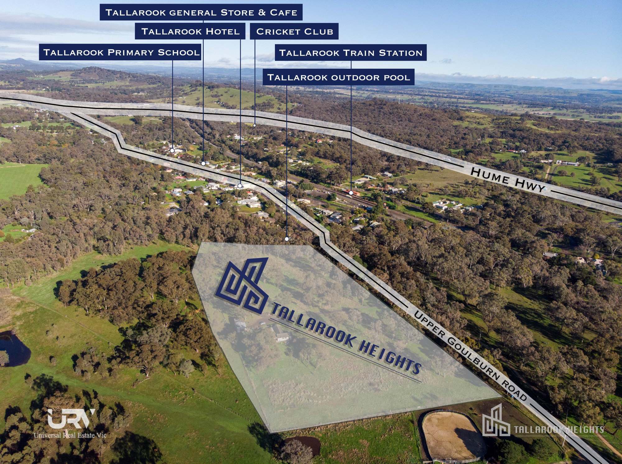
Tallarook Heights Estate - Tallarook is 82 km north of Melbourne CBD.
Universal Real Estate is the project marketer for Tallarook Heights Estate - Tallarook.
Nearby schools for Tallarook Heights Estate - Tallarook:
- Tallarook Primary School - 796m south-west
- Seymour College - 7.5km north-east
- St Mary's College - 8.5km north
- Puckapunyal Primary School - 11.8km north-west
- Broadford Primary School - 13.5km south-west
- Broadford Secondary College - 13.9km south-west