
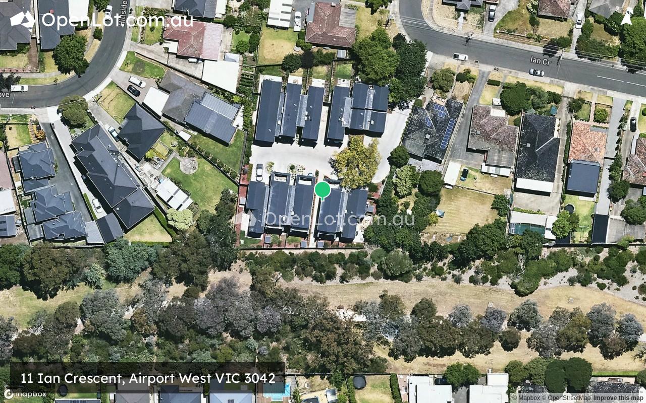
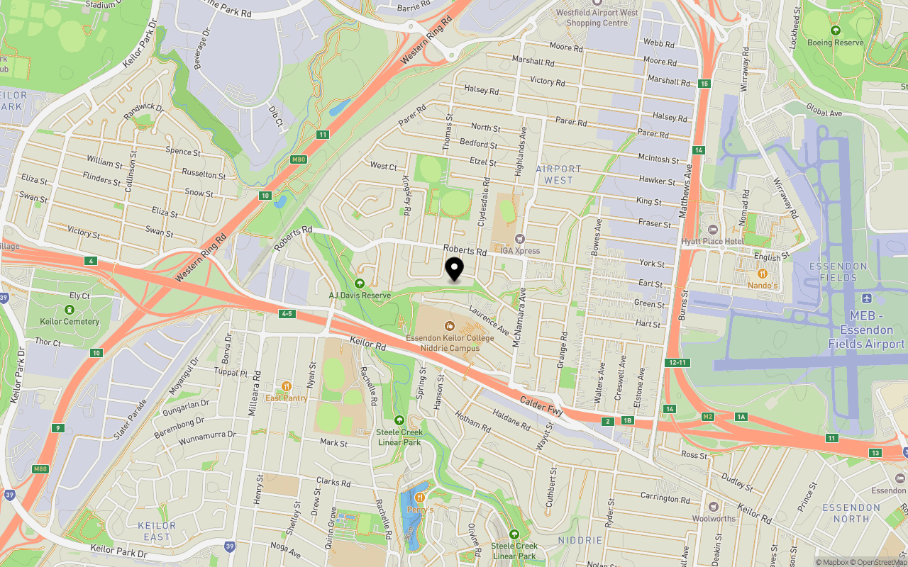
Location & Map for 11 Ian Crescent, Airport West VIC 3042
Schools near 11 Ian Crescent, Airport West VIC 3042
Overview
This information is estimated by the OpenLot research team. Let us know here to provide up-to-date information about this development.
| Total new homes | |
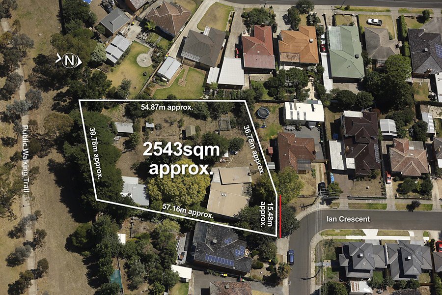
| Area Size | 0.25 hectares |
| Growth Region | Melbourne North Growth Corridor |
| City Council | Moonee Valley City Council |
| Developer | N/A |
| Distance to |
Updates for 11 Ian Crescent, Airport West
Popular Estates near 11 Ian Crescent, Airport West


Not exactly what you're looking for? Try surrounding suburbs
Keilor East VIC 3033
3 estates | Moonee Valley City Council
1.8km south-west
Strathmore VIC 3041
2 estates | Moonee Valley City Council
4.6km east
Essendon VIC 3040
4 estates | Moonee Valley City Council
4.4km south-east
Niddrie VIC 3042
0 estates
3.0km south-east
Essendon West VIC 3040
1 estate | Moonee Valley City Council
4.0km south-east
Tullamarine VIC 3043
1 estate | Merri-bek City Council
3.3km north-east
Latest published articles


FAQs about 11 Ian Crescent, Airport West VIC 3042
11 Ian Crescent, Airport West VIC 3042 consists of 10 homes.
The total area for 11 Ian Crescent, Airport West VIC 3042 is 0.25 hectares.
11 Ian Crescent, Airport West VIC 3042 falls under Moonee Valley City Council.
11 Ian Crescent, Airport West VIC 3042 is 12 km north-west of Melbourne CBD.
Nearby schools for 11 Ian Crescent, Airport West VIC 3042:
- St Christopher's School - 384m north-east
- Niddrie Primary School - 392m south
- Penleigh & Essendon Grammar School - 796m south-west
- Keilor Heights Primary School - 1.5km south-west
- Essendon Keilor College - 2.0km south-west
- Niddrie Autistic School - 2.1km south-east