
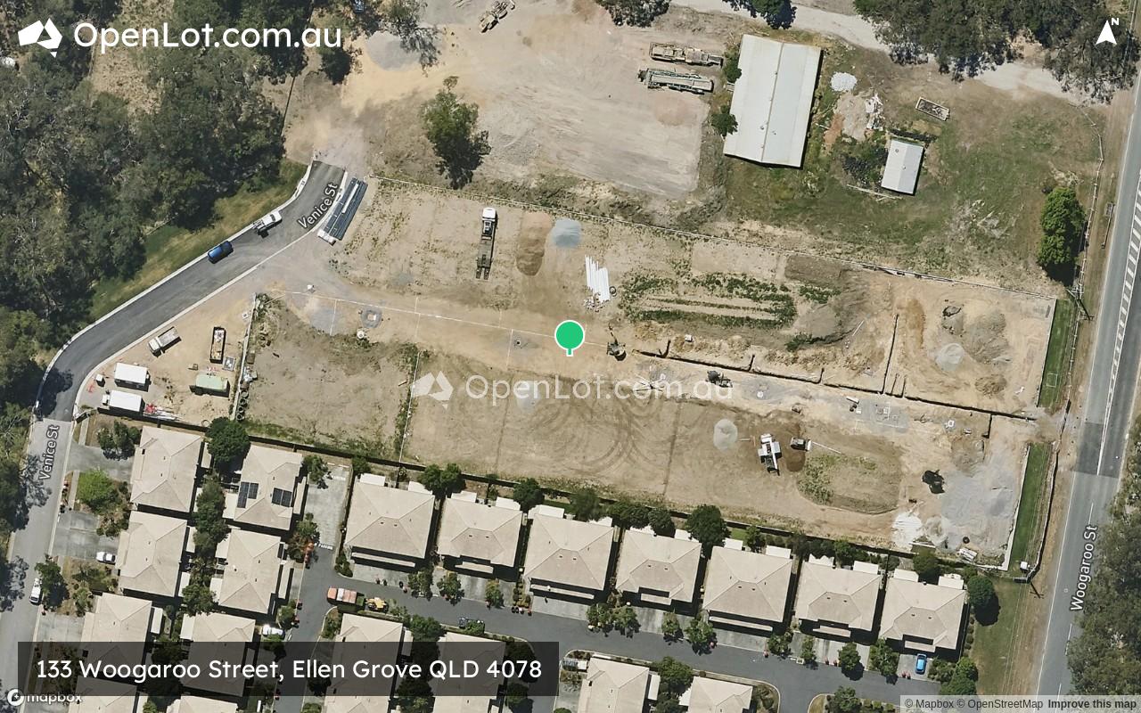
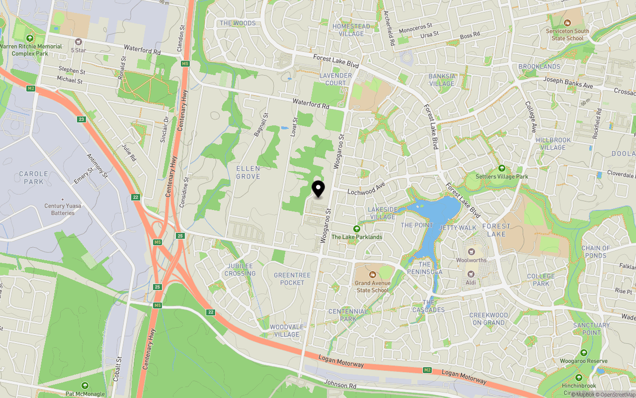
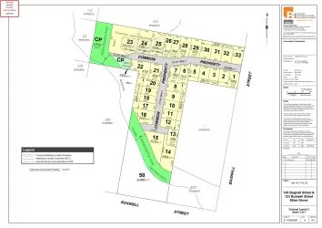
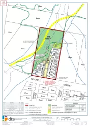
Location & Map for 133 Woogaroo Street, Ellen Grove QLD 4078
Schools near 133 Woogaroo Street, Ellen Grove QLD 4078
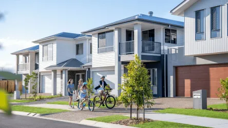
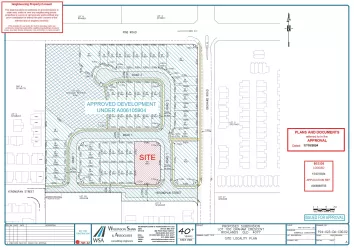
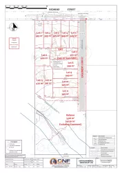
Overview
This information is estimated by the OpenLot research team. Let us know here to provide up-to-date information about this development.
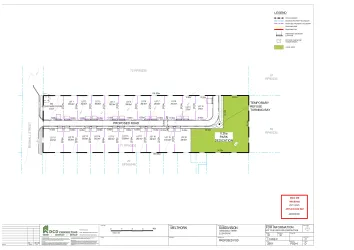
| Total new homes | |
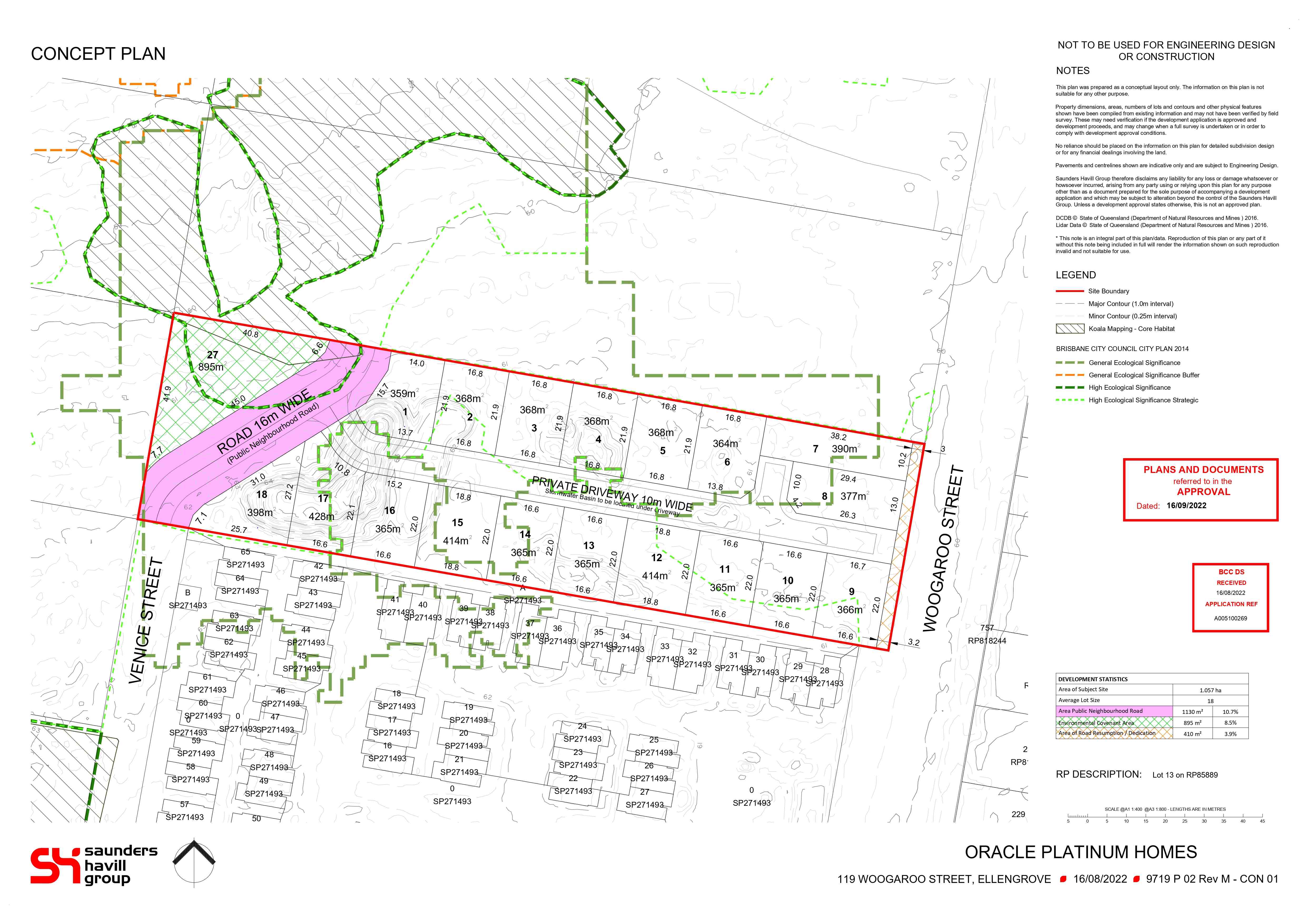
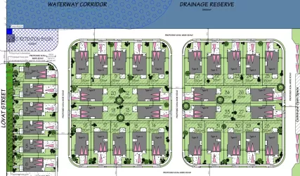
| Area Size | 1.06 hectares |
| Growth Region | Greater Brisbane Growth Areas |
| City Council | Brisbane City Council |
| Developer | N/A |
| Distance to |
Updates for 133 Woogaroo Street, Ellen Grove
Land Price Trend in Ellen Grove QLD 4078
Below shows the price trend from vacant land sales recorded in Ellen Grove QLD 4078.
The data and information provided by Terralytics (Aust) Pty Ltd (Terralytics Data) is general in nature and is not intended to constitute professional advice. Read more
It should not be relied upon as a substitute for legal, financial, valuation, or other specialist advice relevant to your specific circumstances.
Terralytics uses commercially reasonable endeavours to ensure the Terralytics Data is current and accurate. However, as the Terralytics Data incorporates information sourced from third parties, Terralytics makes no representation or warranty — express or implied — as to its accuracy, completeness, or currency. To the maximum extent permitted by applicable law, Terralytics excludes all liability for any loss or damage (including consequential loss) arising out of or in connection with reliance on the Terralytics Data, whether arising in contract, tort (including negligence), statute, or otherwise.
Popular Estates near 133 Woogaroo Street, Ellen Grove

Not exactly what you're looking for? Try surrounding suburbs
Doolandella QLD 4077
23 estates | Brisbane City Council
4.4km east
Richlands QLD 4077
11 estates | Brisbane City Council
3.1km north
Goodna QLD 4300
4 estates | Ipswich City Council
4.8km west
Inala QLD 4077
2 estates | Brisbane City Council
4.1km north-east
Wacol QLD 4076
1 estate | Brisbane City Council
3.4km north
Forest Lake QLD 4078
2 estates | Brisbane City Council
3.2km east
Latest published articles


FAQs about 133 Woogaroo Street, Ellen Grove QLD 4078
133 Woogaroo Street, Ellen Grove QLD 4078 consists of 18 homes.
The total area for 133 Woogaroo Street, Ellen Grove QLD 4078 is 1.06 hectares.
133 Woogaroo Street, Ellen Grove QLD 4078 falls under Brisbane City Council.
133 Woogaroo Street, Ellen Grove QLD 4078 is 18 km south of Brisbane CBD.
Nearby schools for 133 Woogaroo Street, Ellen Grove QLD 4078:
- Grand Avenue State School - 687m south-east
- Forest Lake State School - 898m north-east
- Forest Lake State High School - 1.7km east
- St John's Anglican College - 1.7km east
- Carole Park State School - 2.5km north-west
- Serviceton South State School - 2.7km north-east