
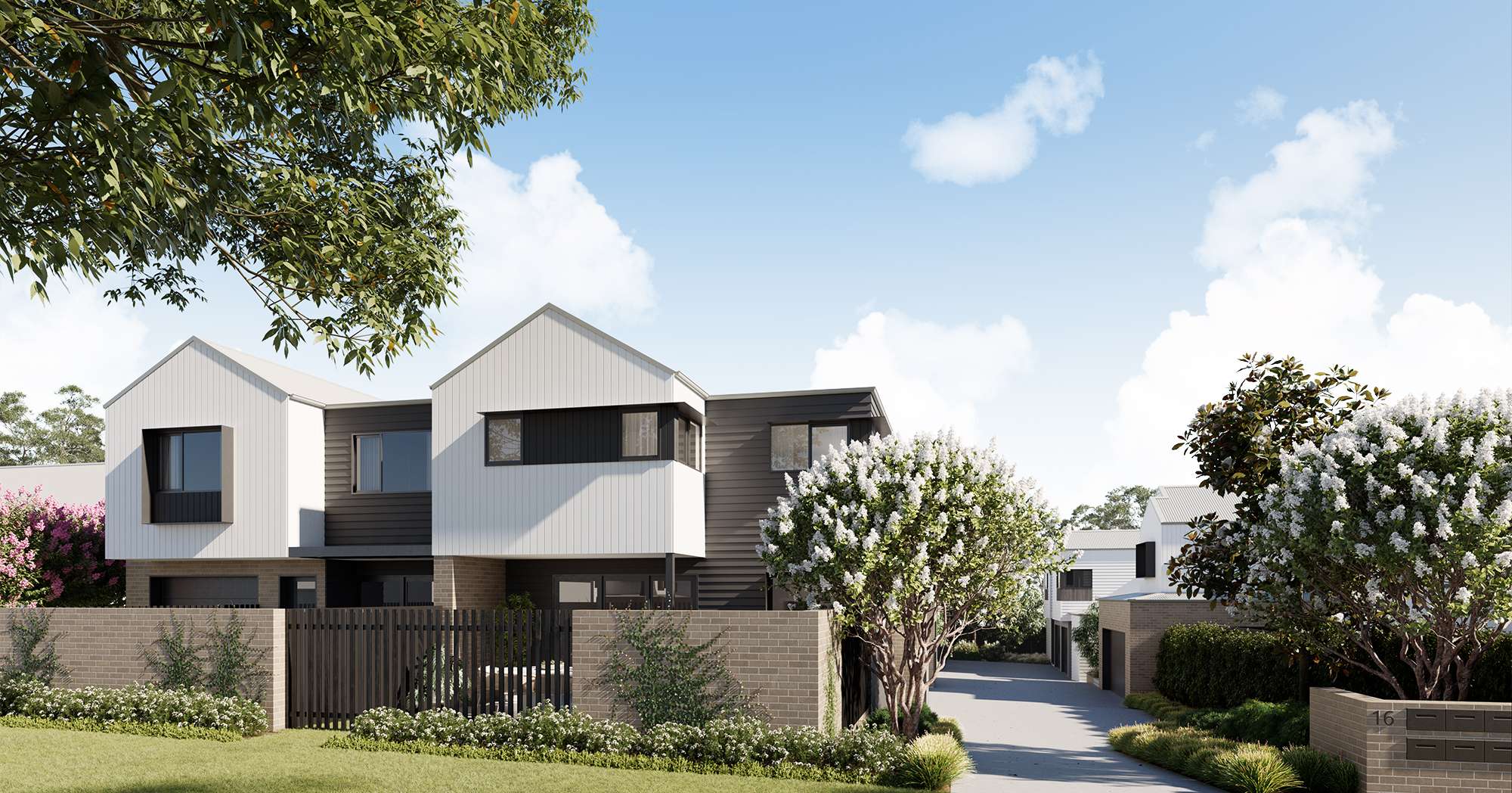
Property types for sale
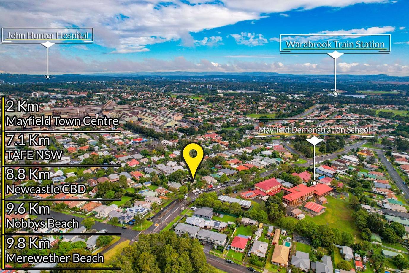
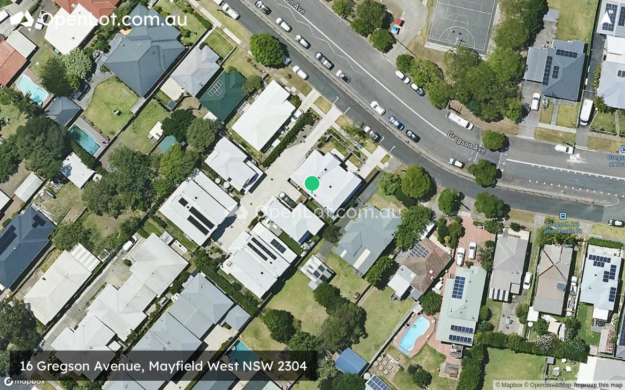
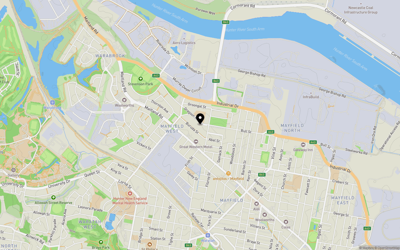
Location & Map for 16 Gregson Avenue, Mayfield West NSW 2304
Schools near 16 Gregson Avenue, Mayfield West NSW 2304
16 Gregson Avenue, Mayfield West NSW 2304 Video
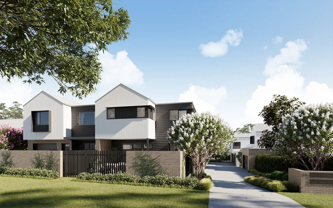
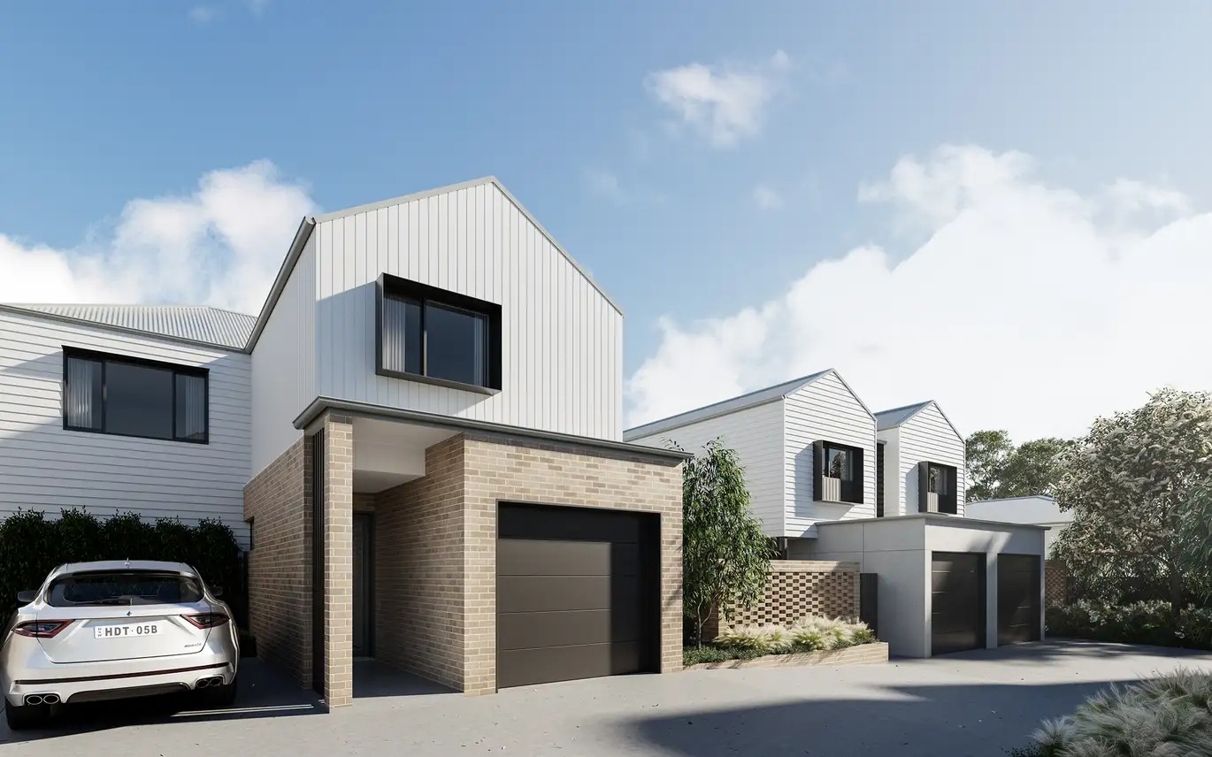
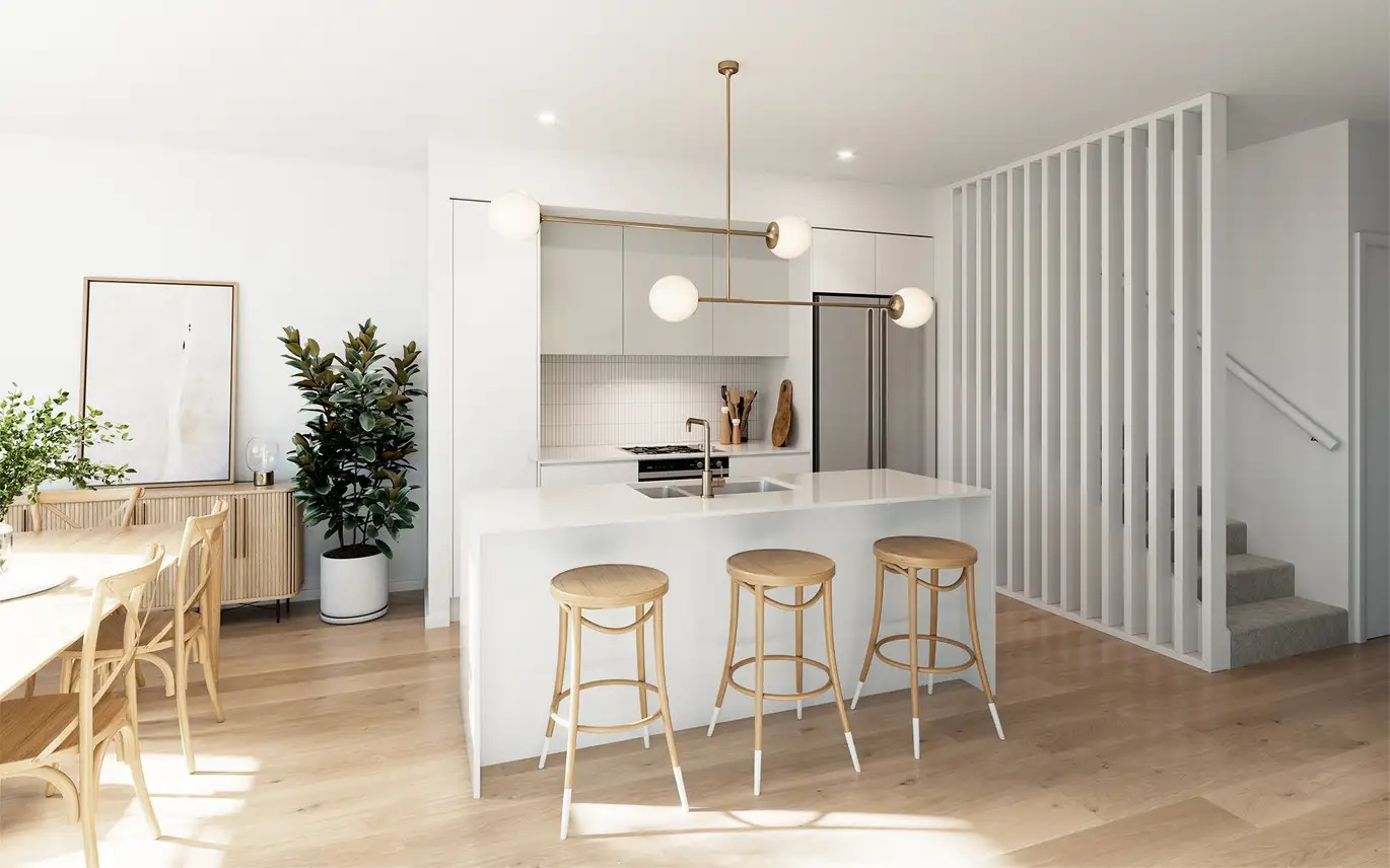
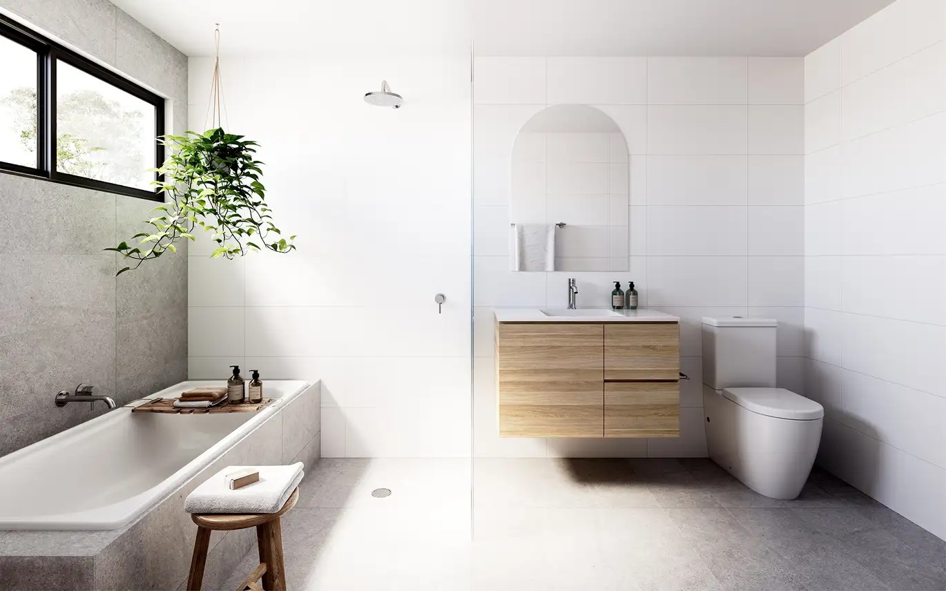
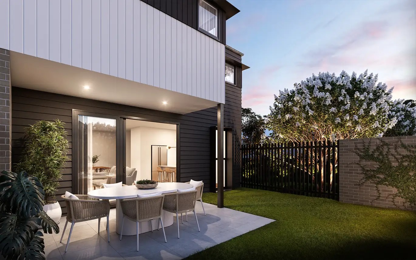
Overview
This information is estimated by the OpenLot research team. Let us know here to provide up-to-date information about this development.
| Total new homes | |
| Area Size | 0.10 hectares |
| Growth Region | Greater Newcastle Growth Areas (The Hunter Region) |
| City Council | Newcastle City Council |
| Developer | SKYY Projects Pty Ltd |
| Project Marketer | Ray White Newcastle |
| Distance to |
Updates for 16 Gregson Avenue, Mayfield West
Popular Estates near 16 Gregson Avenue, Mayfield West
Not exactly what you're looking for? Try surrounding suburbs
Rankin Park NSW 2287
1 estate | Lake Macquarie City Council
6.1km south-west
Mayfield NSW 2304
1 estate | Newcastle City Council
1.6km south-east
Shortland NSW 2307
1 estate | Newcastle City Council
3.7km west
Waratah West NSW 2298
1 estate | Newcastle City Council
2.5km south-west
Wallsend NSW 2287
1 estate | Newcastle City Council
5.7km west
Tighes Hill NSW 2297
1 estate | Newcastle City Council
3.6km south-east
Latest published articles


FAQs about 16 Gregson Avenue, Mayfield West NSW 2304
SKYY Projects Pty Ltd is the developer behind 16 Gregson Avenue, Mayfield West NSW 2304.
16 Gregson Avenue, Mayfield West NSW 2304 consists of 8 homes.
The total area for 16 Gregson Avenue, Mayfield West NSW 2304 is 0.10 hectares.
16 Gregson Avenue, Mayfield West NSW 2304 falls under Newcastle City Council.
16 Gregson Avenue, Mayfield West NSW 2304 is 6 km north-west of Newcastle CBD.
Ray White Newcastle is the project marketer for 16 Gregson Avenue, Mayfield West NSW 2304.
Nearby schools for 16 Gregson Avenue, Mayfield West NSW 2304:
- Mayfield West Public School - 105m north
- Hunter Christian School - 743m east
- St Columban's Primary School - 1.4km south-east
- Corpus Christi Primary School - 1.4km south-west
- San Clemente Catholic College - 1.4km south-east
- St Dominic's Catholic College - 1.5km south-east