
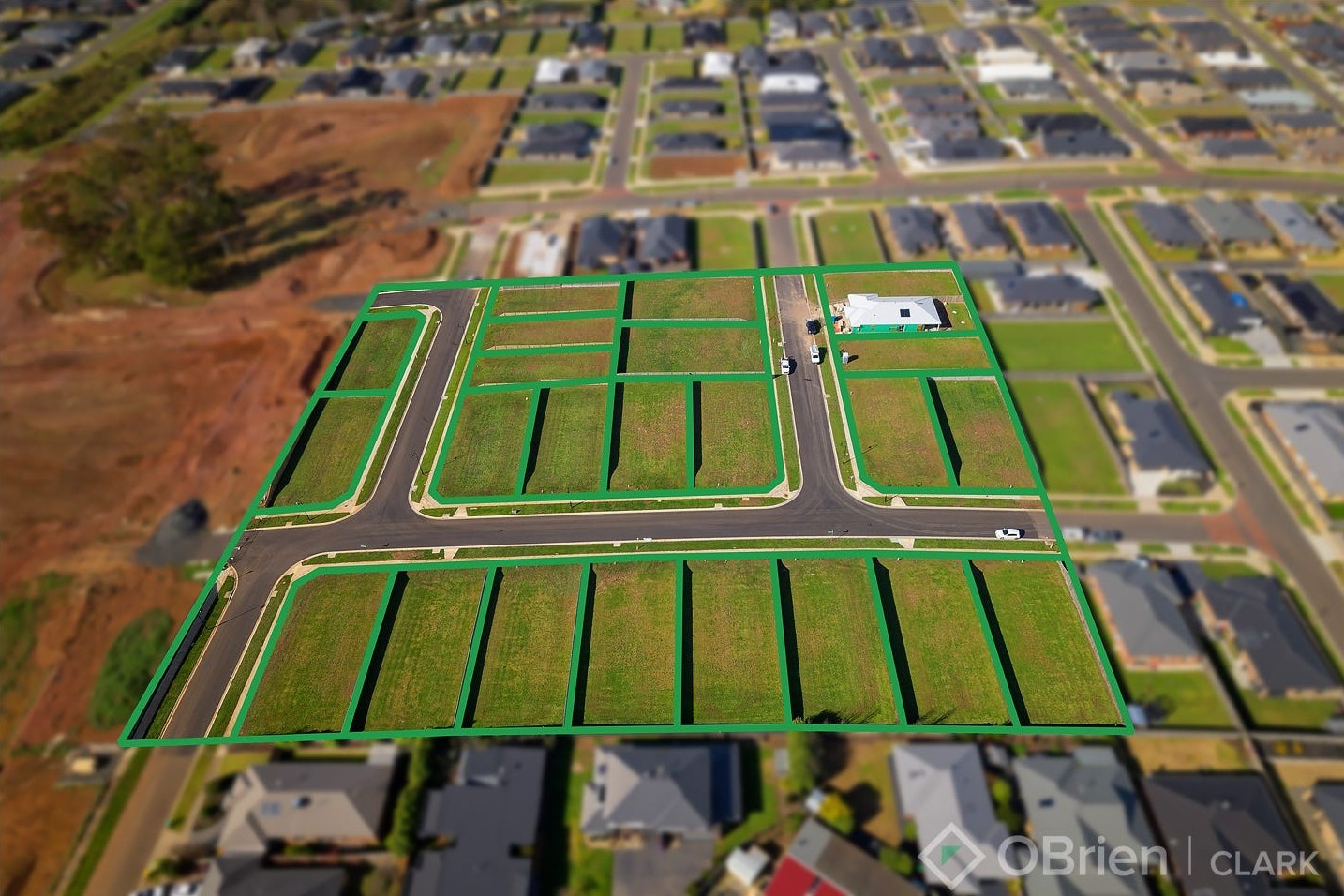
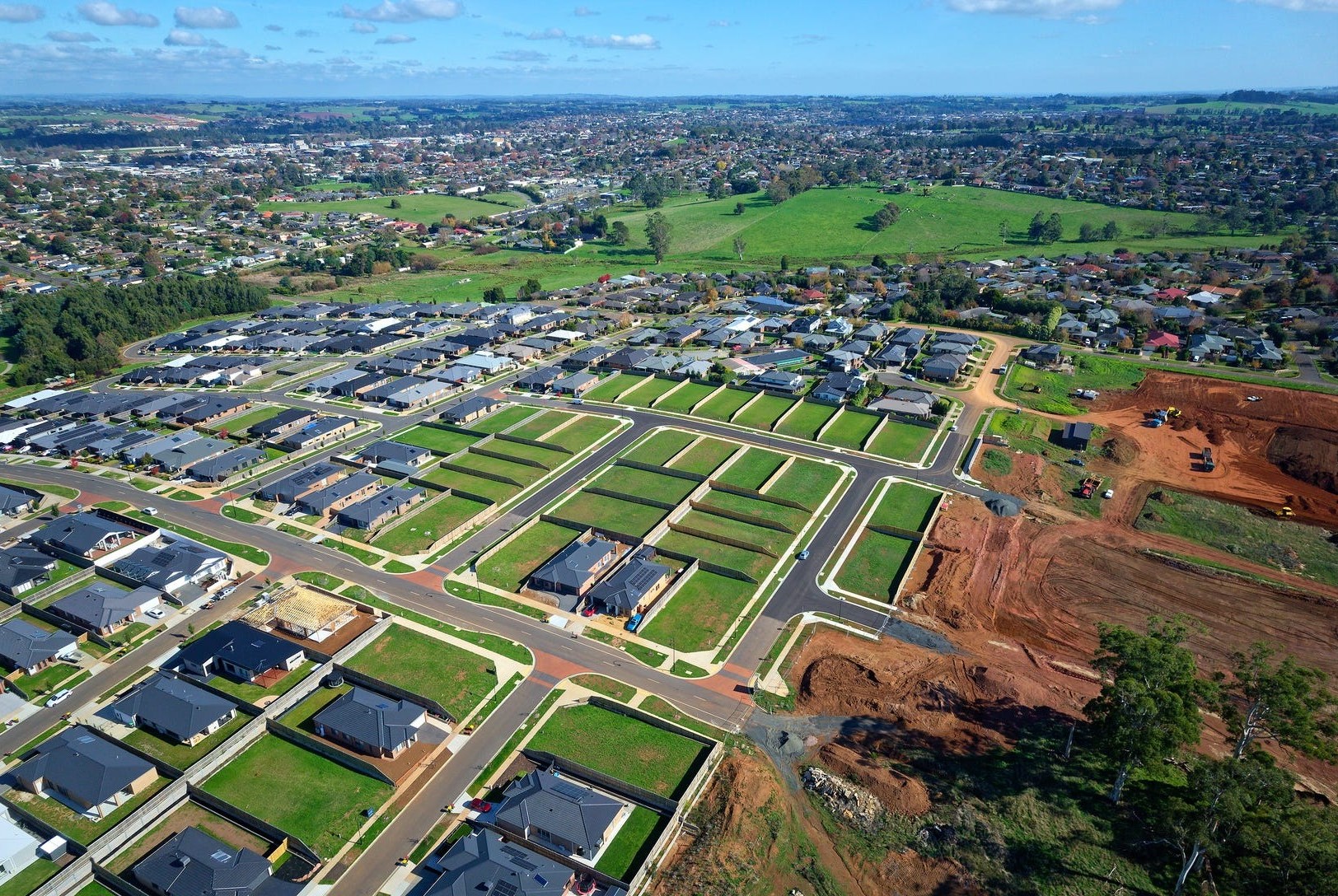
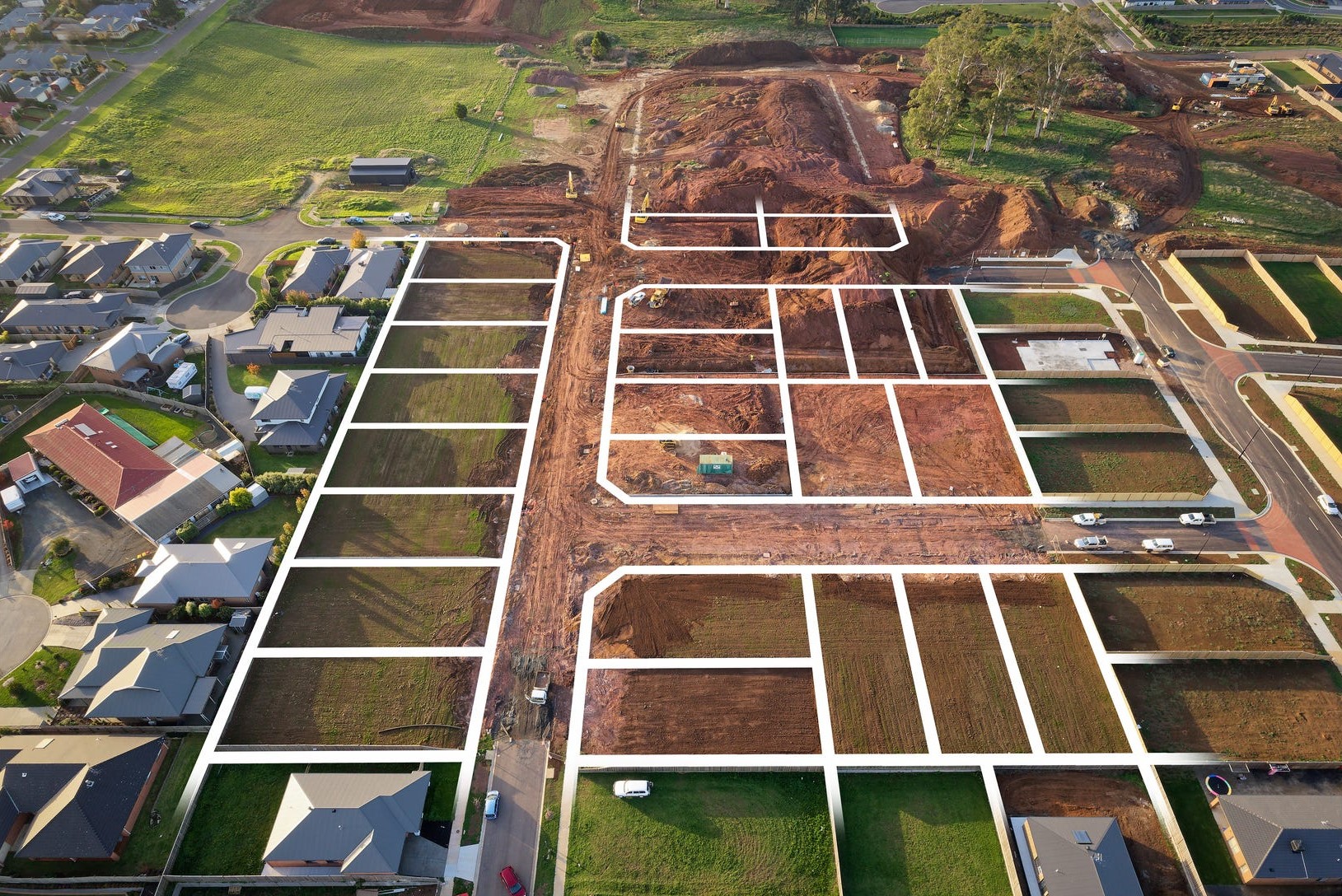
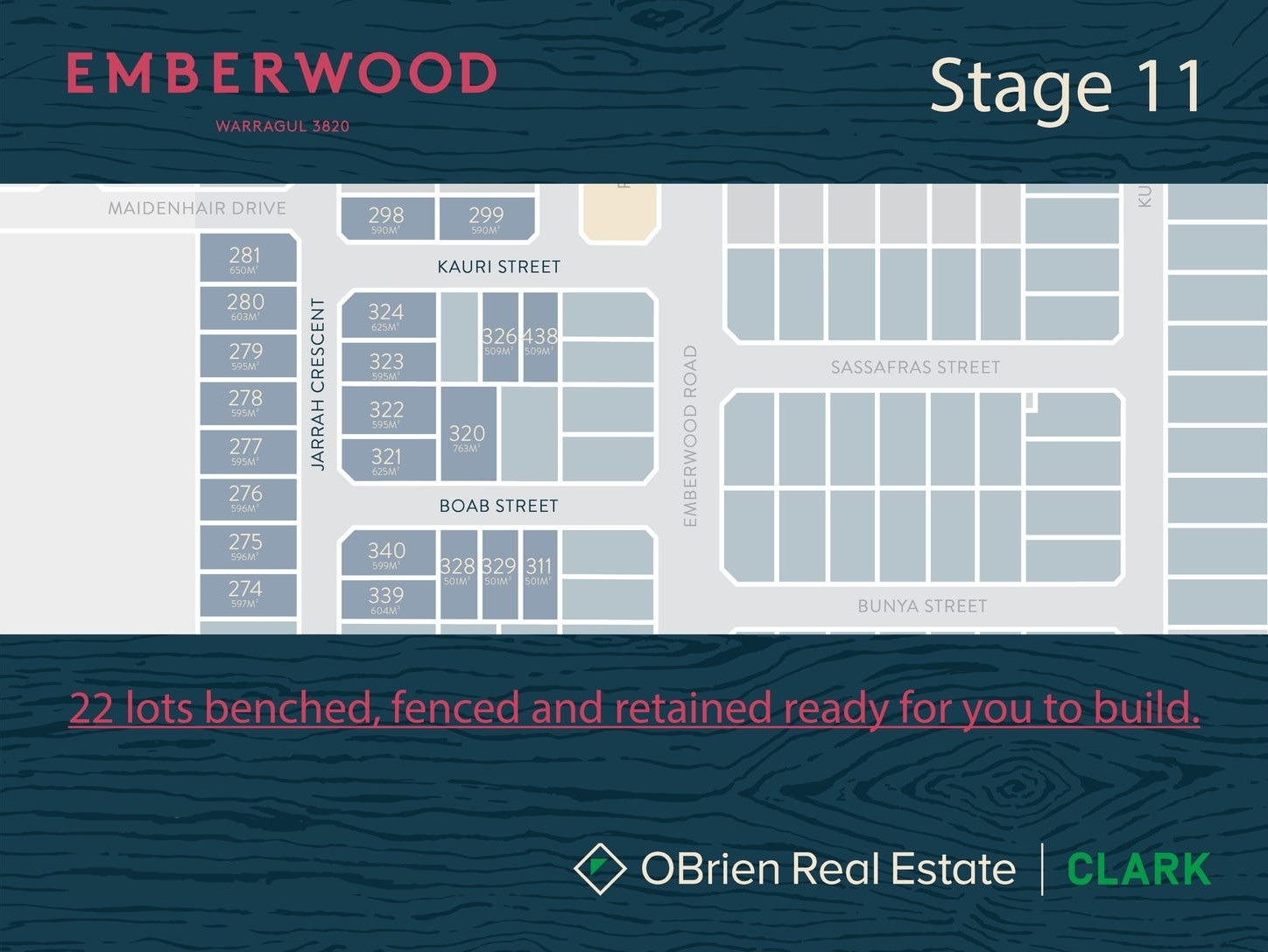
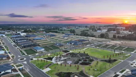
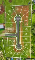
Emberwood Estate - Warragul
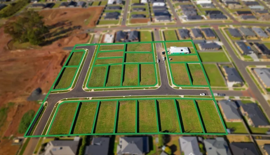


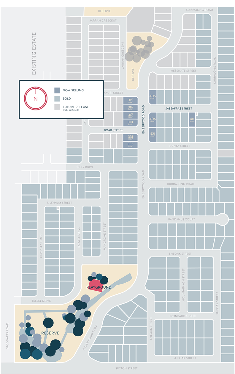
- Stage 11 Now Selling
- Generous parklands
- Brand new playground areas
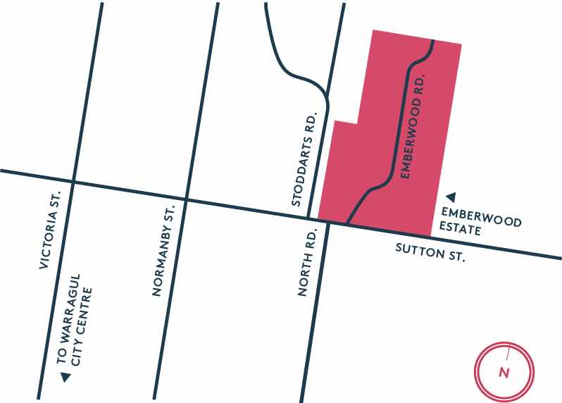
- Access to Warragul's growing town centre
- Just over an hour from Melbourne's CBD
- Sizes from 527-1159m2
- All lots benched, fenced and retained
Property types for sale
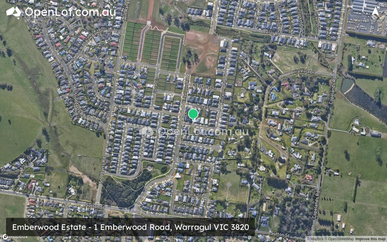
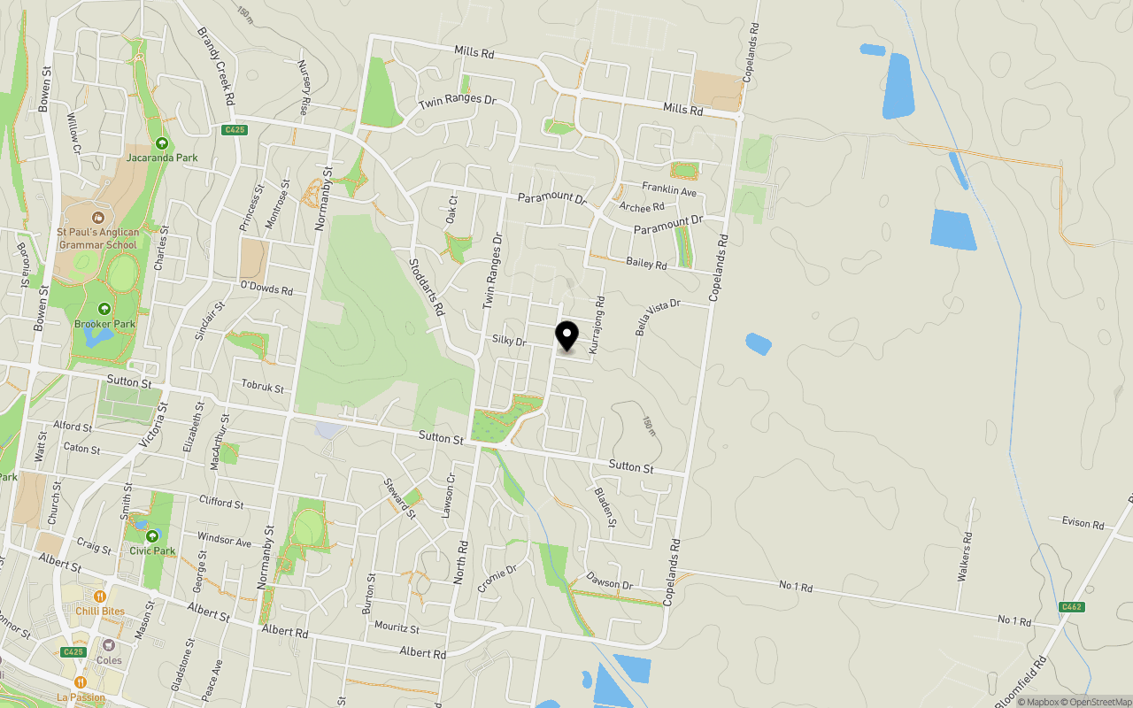
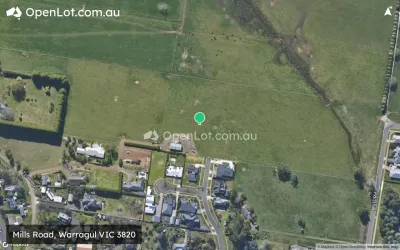
Location & Map for Emberwood Estate - Warragul
Schools near Emberwood Estate - Warragul
Emberwood Warragul Video
Overview
This information is estimated by the OpenLot research team. Let us know here to provide up-to-date information about this development.
| Total new homes | |
| Area Size | 35.17 hectares |
| Growth Region | Gippsland Regional Growth Areas |
| City Council | Baw Baw Shire Council |
| Developer | N/A |
| Project Marketer | OBrien Real Estate Clark |
| Creative Agency | The View From Here |
| Distance to |
Land Price Trend in Warragul VIC 3820
Below shows the price trend from vacant land sales recorded in Warragul VIC 3820.
The data and information provided by Terralytics (Aust) Pty Ltd (Terralytics Data) is general in nature and is not intended to constitute professional advice. Read more
It should not be relied upon as a substitute for legal, financial, valuation, or other specialist advice relevant to your specific circumstances.
Terralytics uses commercially reasonable endeavours to ensure the Terralytics Data is current and accurate. However, as the Terralytics Data incorporates information sourced from third parties, Terralytics makes no representation or warranty — express or implied — as to its accuracy, completeness, or currency. To the maximum extent permitted by applicable law, Terralytics excludes all liability for any loss or damage (including consequential loss) arising out of or in connection with reliance on the Terralytics Data, whether arising in contract, tort (including negligence), statute, or otherwise.
Popular Estates near Emberwood Estate - Warragul


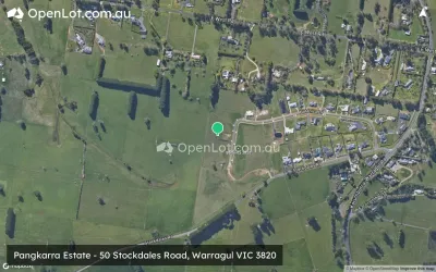
Not exactly what you're looking for? Try surrounding suburbs
Longwarry VIC 3816
8 estates | Baw Baw Shire Council
15.1km west
Drouin VIC 3818
34 estates | Baw Baw Shire Council
6.9km north-west
Yarragon VIC 3823
2 estates | Baw Baw Shire Council
12.9km east
Nilma VIC 3821
1 estate | Baw Baw Shire Council
3.4km east
Warragul South VIC 3821
2 estates | Baw Baw Shire Council
7.3km south-west
Drouin South VIC 3818
1 estate | Baw Baw Shire Council
13.3km west
Latest published articles


FAQs about Emberwood Estate - Warragul
Emberwood Estate - Warragul consists of 330 homes.
The total area for Emberwood Estate - Warragul is 35.17 hectares.
Emberwood Estate - Warragul falls under Baw Baw Shire Council.
Emberwood Estate - Warragul is 95 km south-east of Melbourne CBD.
OBrien Real Estate Clark is the project marketer for Emberwood Estate - Warragul.
Nearby schools for Emberwood Estate - Warragul:
- St Angela of the Cross Primary School - 1.2km north-east
- Warragul North Primary School - 1.3km west
- St Paul's Anglican Grammar School - 2.1km west
- Nilma Primary School - 2.4km south-east
- Warragul Primary School - 2.4km west
- Warragul Regional College - 3.0km south-west