Request pricing
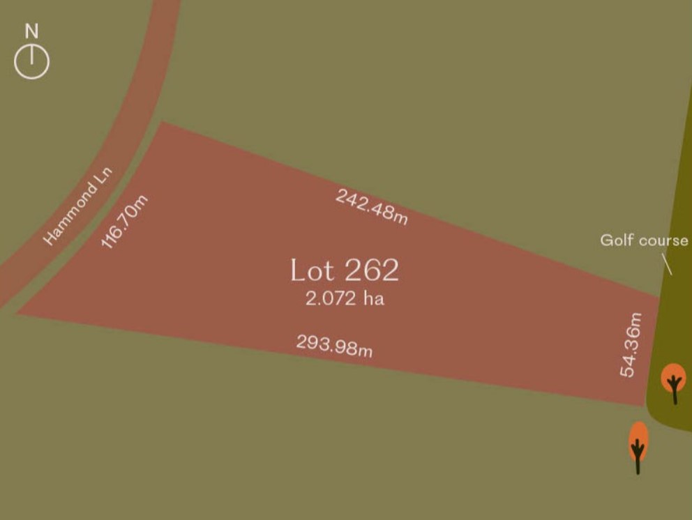
Lot 262 @ Hammond Lane Estate
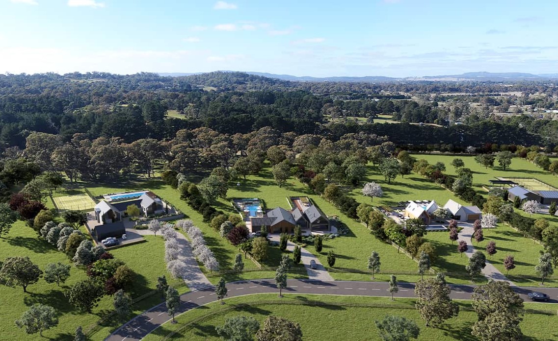
[NEW RELEASE] A small collection of acreage blocks now selling in the heart of Kyneton
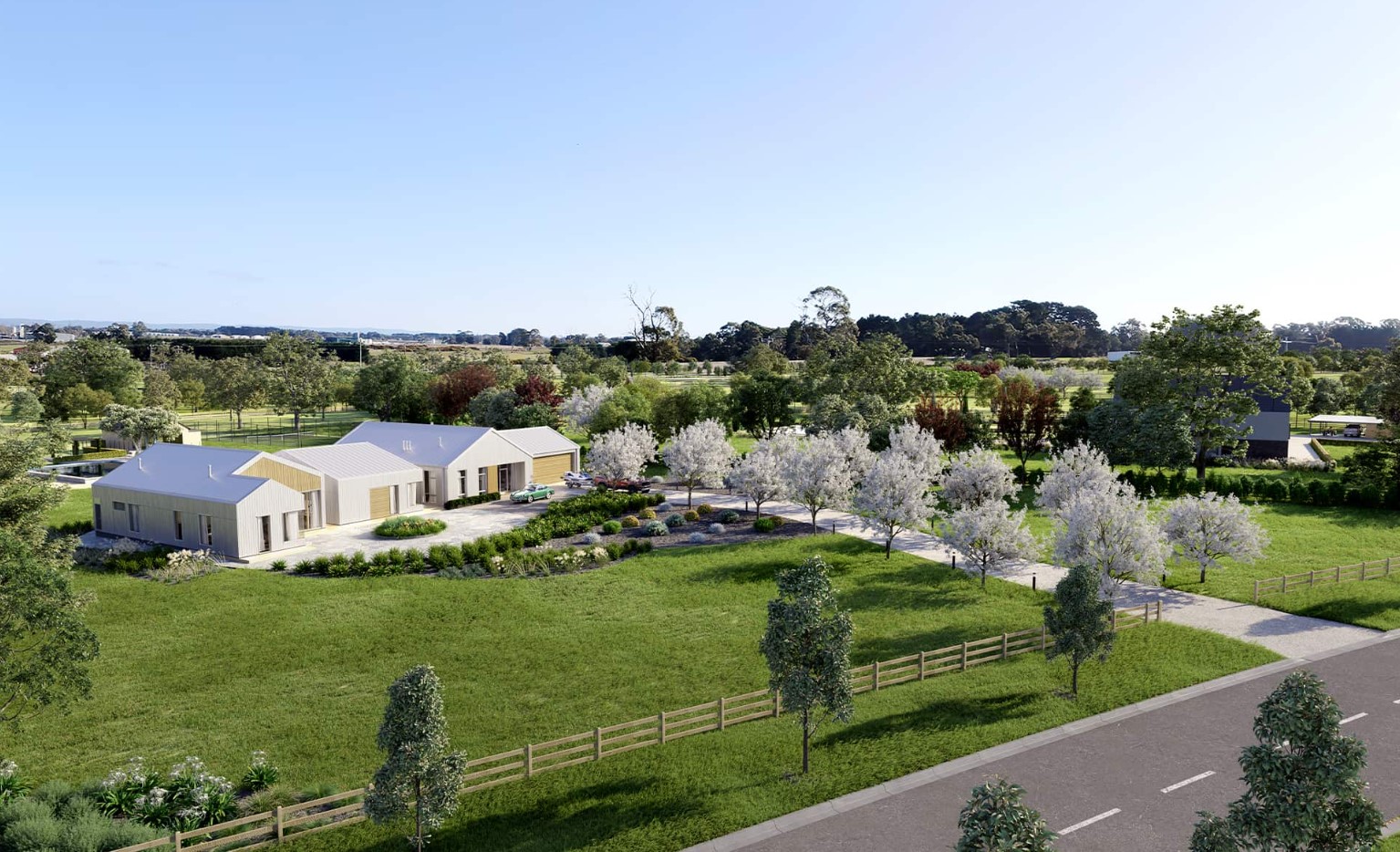
Experience the harmonious blend of nature's beauty and modern design within our vibrant community. Whether you're seeking a change of scenery or require more room for your growing family, Hammond Lane promises a beautiful neighbourhood.
Lot 262 represents a unique parcel of land that seamlessly merges with the lush golf course, effectively extending your backyard. Picture your children or grandchildren playing amidst the trees while you unwind on your veranda.
Whether you're embarking on your homeownership journey, expanding your living space to accommodate your growing family, or seeking an ideal retreat, Hammond Lane is a place where you can relish life's finest moments.
Property overview
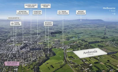
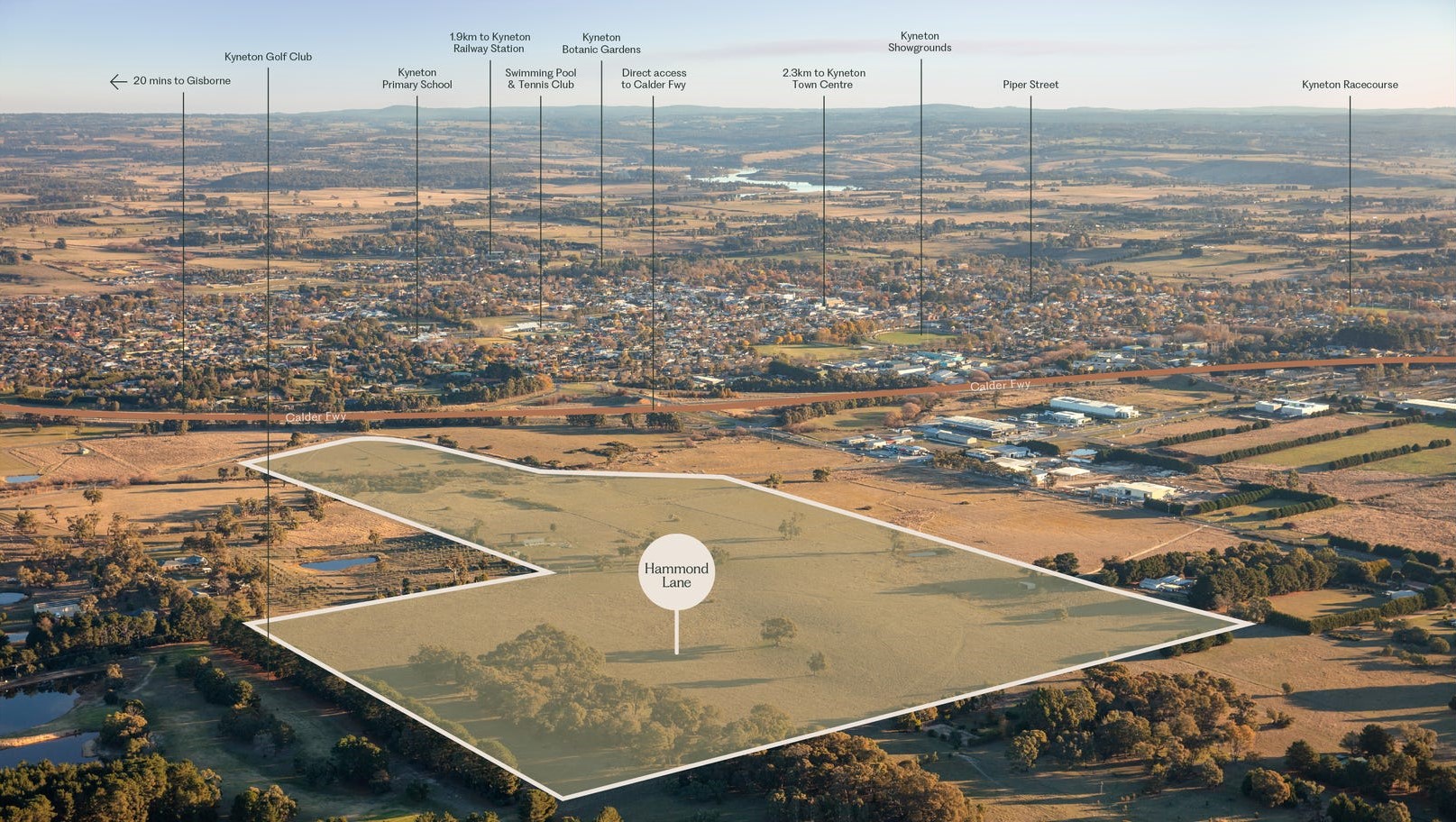
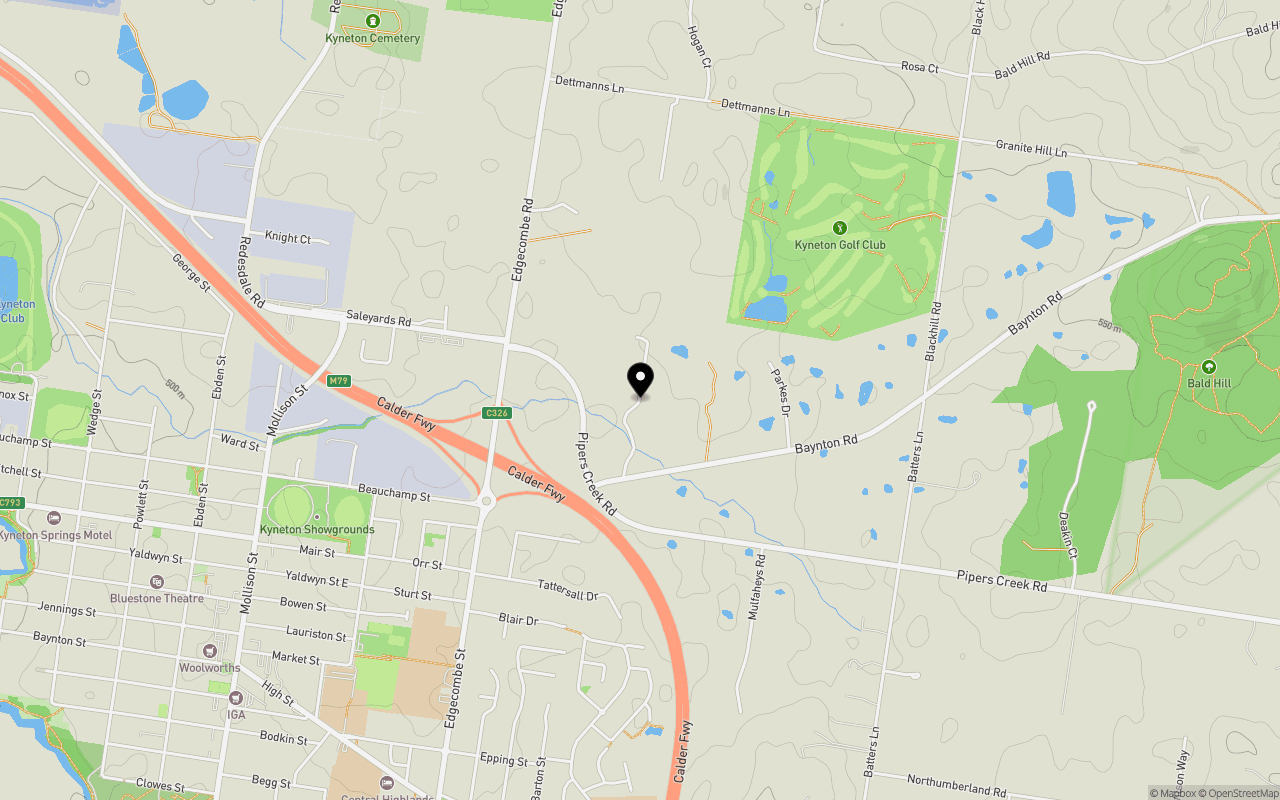
Local Information in Kyneton VIC 3444
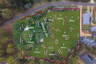
10 Land Lots in Hammond Lane Estate - Kyneton
Hammond Lane Kyneton Video
Estate Overview
This information is estimated by the OpenLot research team. Let us know here to provide up-to-date information about this development.
| Total new homes | |
| Area Size | N/A |
| Growth Region | Melbourne North Growth Corridor |
| City Council | Macedon Ranges Shire Council |
| Developer | Goldfields Group |
| Project Marketer | RT Edgar Macedon Ranges |
| Distance to |
Nearby schools in Hammond Lane Estate - Kyneton
FAQs about Hammond Lane Estate - Kyneton
Goldfields Group is the developer behind Hammond Lane Estate - Kyneton.
Hammond Lane Estate - Kyneton consists of 10 homes.
Hammond Lane Estate - Kyneton falls under Macedon Ranges Shire Council.
Hammond Lane Estate - Kyneton is 77 km north-west of Melbourne CBD.
RT Edgar Macedon Ranges is the project marketer for Hammond Lane Estate - Kyneton.
Nearby schools for Hammond Lane Estate - Kyneton:
- Kyneton Primary School - 1.2km south-west
- Our Lady of the Rosary - 1.4km south-west
- Kyneton High School - 1.7km south-west
- Sacred Heart College - 1.8km south-west
- Langley Primary School - 7.8km north
- Malmsbury Primary School - 9.4km north-west
Land Price Trend in Kyneton VIC 3444
Below shows the price trend from vacant land sales recorded in Kyneton VIC 3444.
The data and information provided by Terralytics (Aust) Pty Ltd (Terralytics Data) is general in nature and is not intended to constitute professional advice. Read more
It should not be relied upon as a substitute for legal, financial, valuation, or other specialist advice relevant to your specific circumstances.
Terralytics uses commercially reasonable endeavours to ensure the Terralytics Data is current and accurate. However, as the Terralytics Data incorporates information sourced from third parties, Terralytics makes no representation or warranty — express or implied — as to its accuracy, completeness, or currency. To the maximum extent permitted by applicable law, Terralytics excludes all liability for any loss or damage (including consequential loss) arising out of or in connection with reliance on the Terralytics Data, whether arising in contract, tort (including negligence), statute, or otherwise.
Vacancy Rate in Kyneton VIC 3444
View full vacancy rate history in Kyneton VIC 3444 via SQM Research
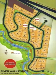
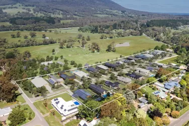
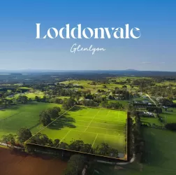
Popular Estates near Hammond Lane Estate - Kyneton