
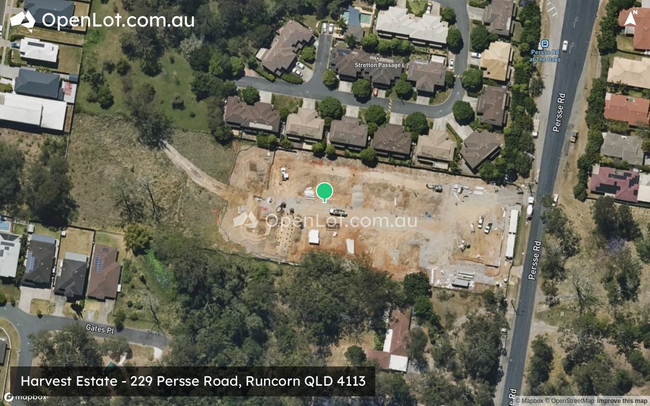
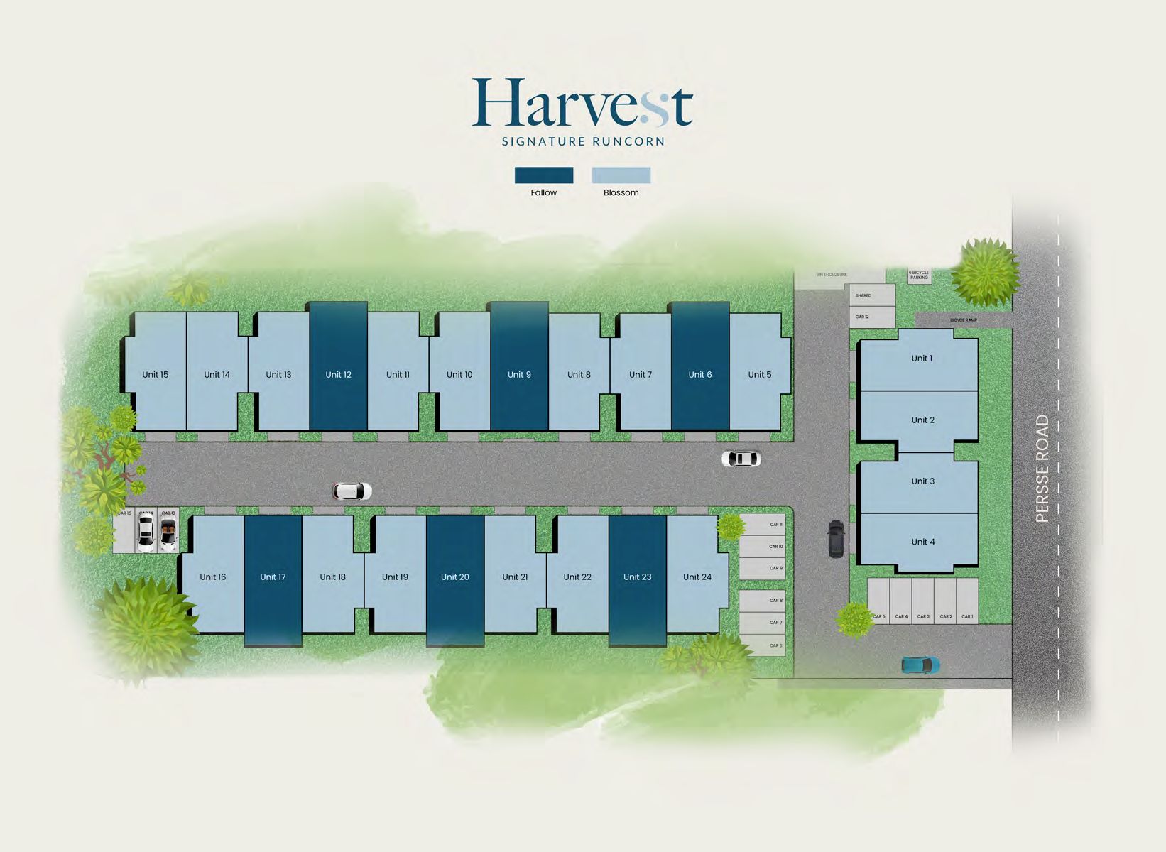
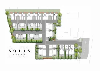
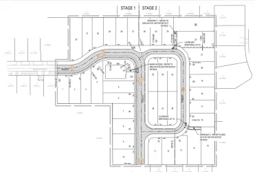
Harvest Estate - Runcorn
[NEW RELEASE] Harvest Signature Runcorn. 24 New Luxury Residences


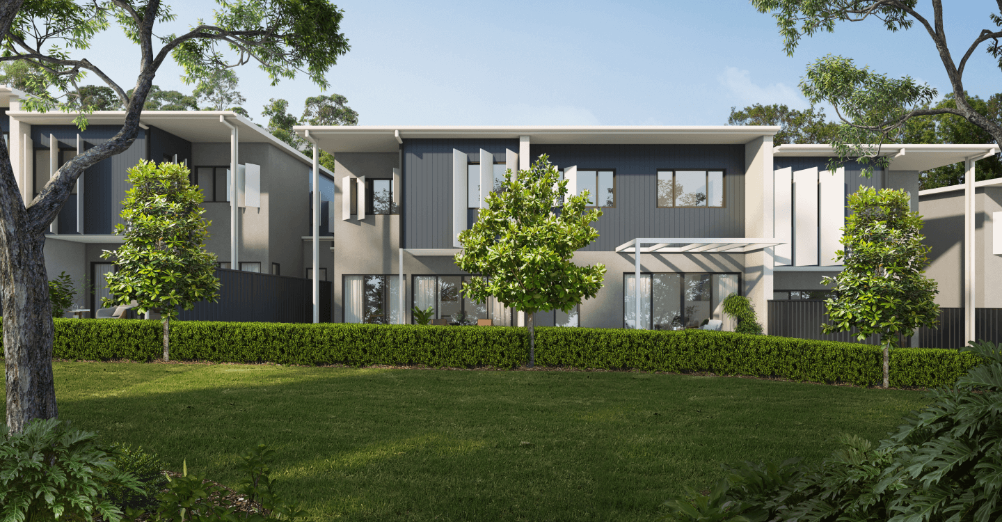
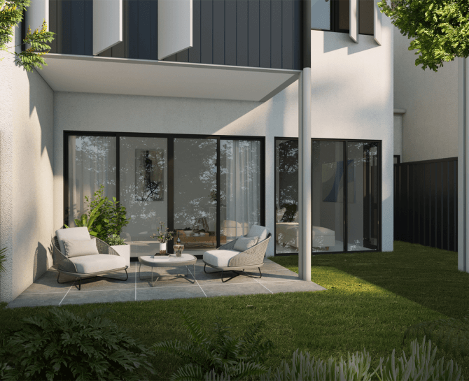
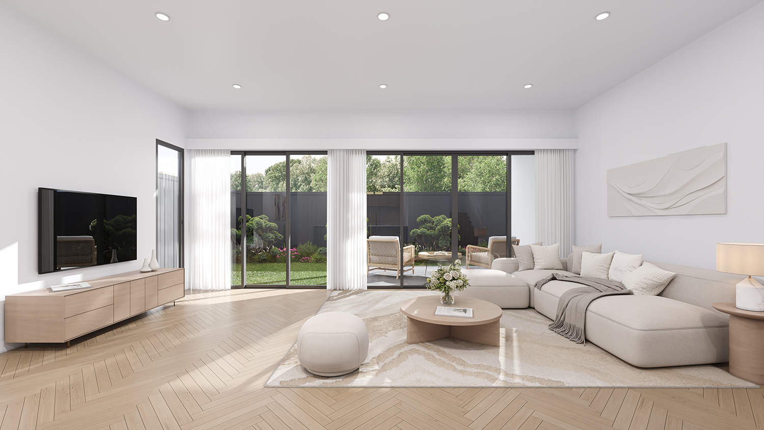
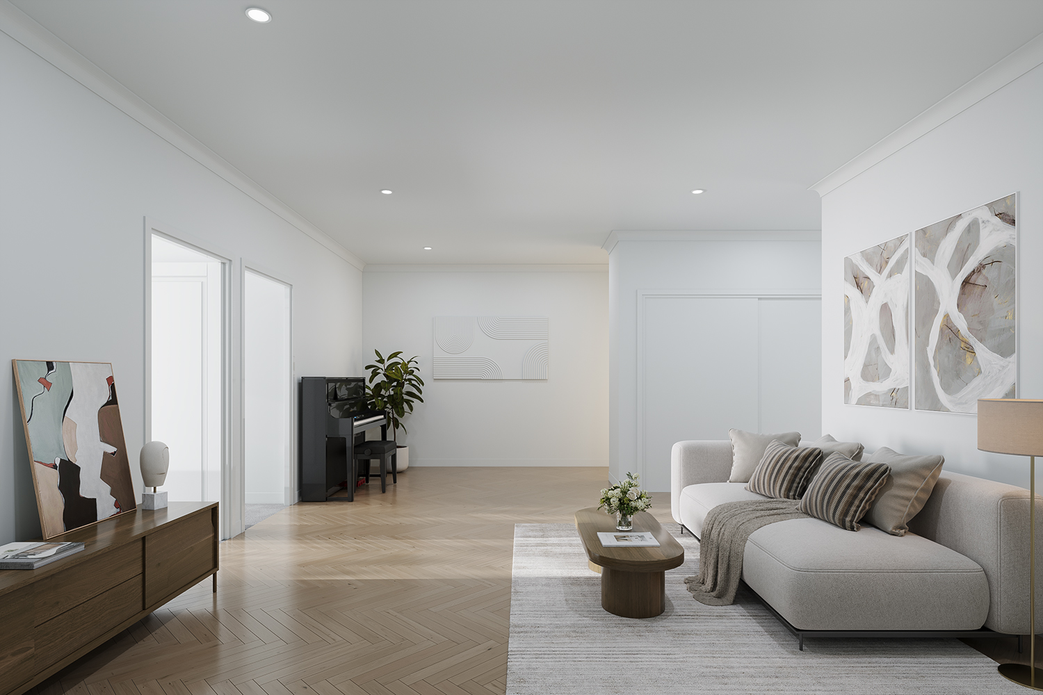
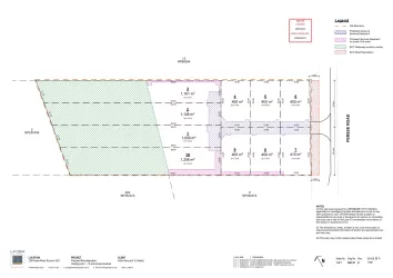
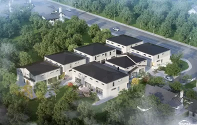
- Welcome to ‘Harvest’ developed by Signature Holdings. An exciting new development in the heart of Runcorn consisting of 24 ultra-high-end townhomes with large open floor plans and completed with high end fittings and finishes throughout.
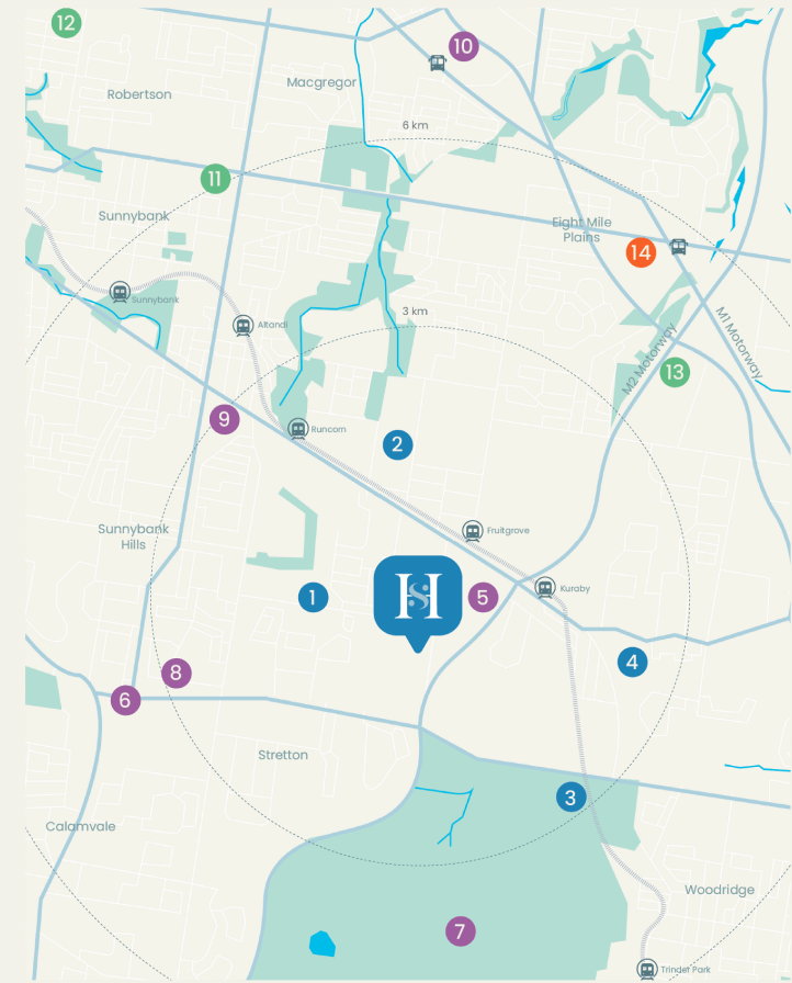
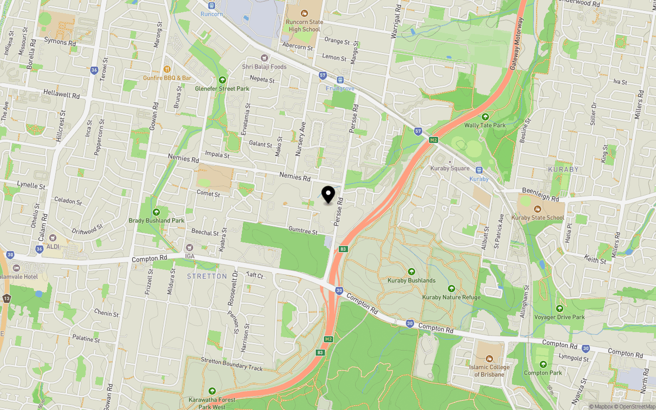
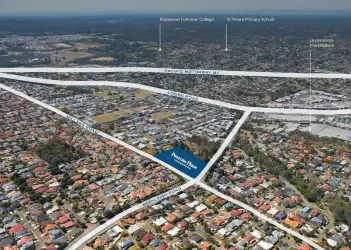
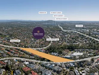
- Well positioned in a booming suburb of Runcorn where you will enjoy the peaceful and yet convenient lifestyle living! You are minutes to all the local amenities including the elite schools, Runcorn train station and city buses, Sunnybank Plaza and Garden City Shopping Centre. You can also easily access to the Pacific Motorway and the Gateway Motorway direct you to the Brisbane CBD, Gold Coast and the Airport.
- A mixture of 3 beds + 2 living areas and 4 bedrooms
- Enjoy the peaceful and yet very convenient lifestyle living
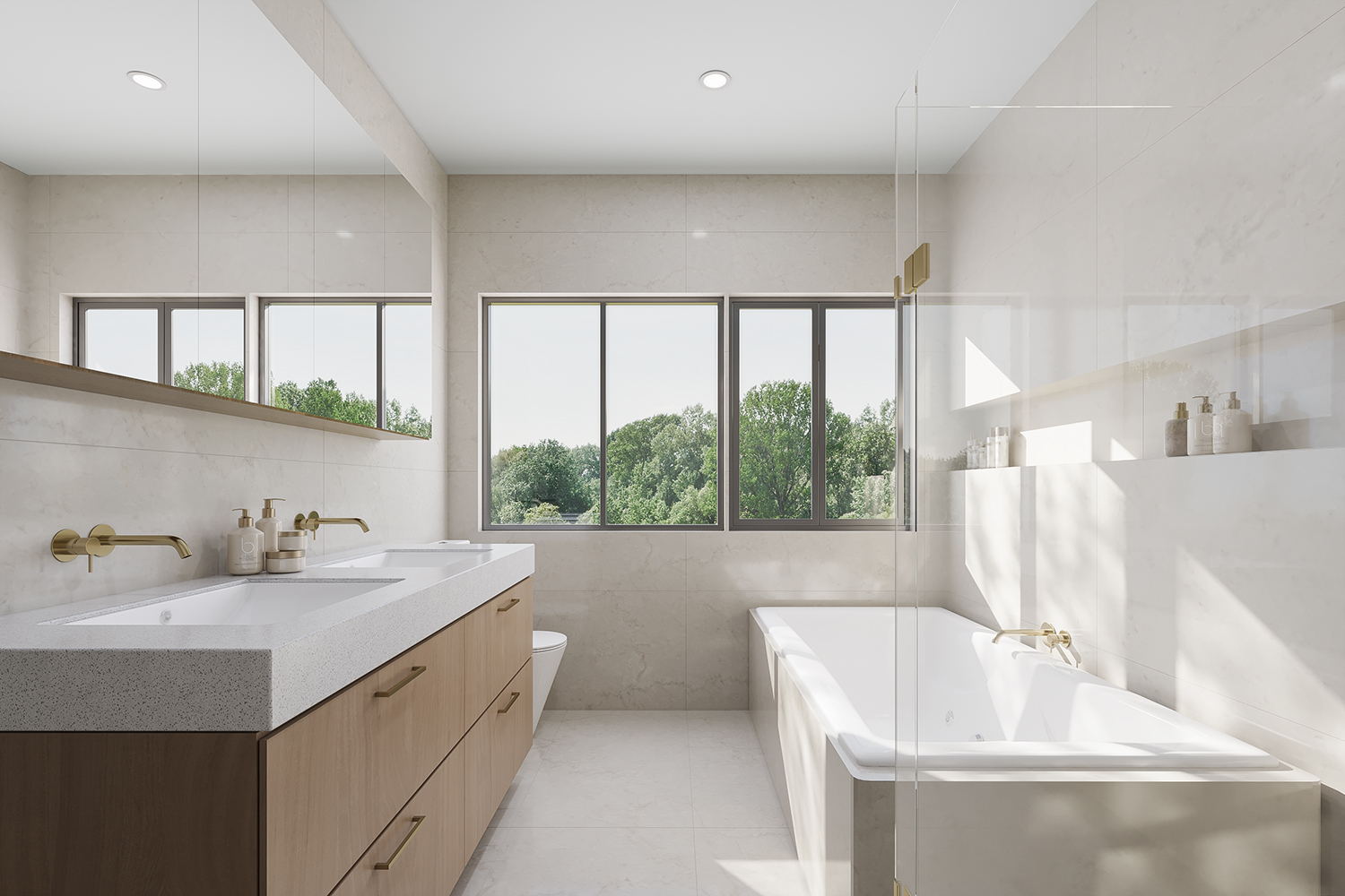
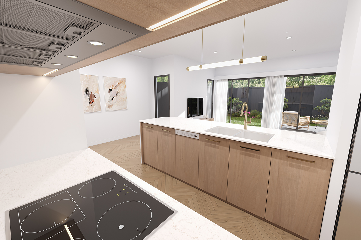
- Beautifully designed with an abundant space and superior finishes
- 2.7m high ceilings on both levels, herringbone flooring and quality carpets
- Reputation builder and developer with a track record
- Low body corporate fee
- Well under construction and due to complete in 2026
Property types for sale
Location & Map for Harvest Estate - Runcorn
Schools near Harvest Estate - Runcorn
Overview
This information is estimated by the OpenLot research team. Let us know here to provide up-to-date information about this development.
| Total new homes | |
| Area Size | 1.02 hectares |
| Growth Region | Greater Brisbane Growth Areas |
| City Council | Brisbane City Council |
| Developer | Signature Holdings |
| Project Marketer | Ray White Sunnybank Hills |
| Creative Agency | Desketing |
| Distance to |
Updates for Harvest Estate - Runcorn
Land Price Trend in Runcorn QLD 4113
Below shows the price trend from vacant land sales recorded in Runcorn QLD 4113.
The data and information provided by Terralytics (Aust) Pty Ltd (Terralytics Data) is general in nature and is not intended to constitute professional advice. Read more
It should not be relied upon as a substitute for legal, financial, valuation, or other specialist advice relevant to your specific circumstances.
Terralytics uses commercially reasonable endeavours to ensure the Terralytics Data is current and accurate. However, as the Terralytics Data incorporates information sourced from third parties, Terralytics makes no representation or warranty — express or implied — as to its accuracy, completeness, or currency. To the maximum extent permitted by applicable law, Terralytics excludes all liability for any loss or damage (including consequential loss) arising out of or in connection with reliance on the Terralytics Data, whether arising in contract, tort (including negligence), statute, or otherwise.
Popular Estates near Harvest Estate - Runcorn


Not exactly what you're looking for? Try surrounding suburbs
Stretton QLD 4116
6 estates | Brisbane City Council
3.3km south
Sunnybank QLD 4109
4 estates | Brisbane City Council
2.7km north-west
Eight Mile Plains QLD 4113
10 estates | Brisbane City Council
2.3km north-east
Underwood QLD 4119
2 estates | Logan City Council
3.5km east
Kuraby QLD 4112
2 estates | Brisbane City Council
1.5km south-east
Sunnybank Hills QLD 4109
5 estates | Brisbane City Council
2.6km west
Latest published articles


FAQs about Harvest Estate - Runcorn
Signature Holdings is the developer behind Harvest Estate - Runcorn.
Harvest Estate - Runcorn consists of 24 homes.
The total area for Harvest Estate - Runcorn is 1.02 hectares.
Harvest Estate - Runcorn falls under Brisbane City Council.
Harvest Estate - Runcorn is 16 km south of Brisbane CBD.
Ray White Sunnybank Hills is the project marketer for Harvest Estate - Runcorn.
Nearby schools for Harvest Estate - Runcorn:
- Runcorn Heights State School - 928m west
- Kuraby Special School - 1.3km east
- Runcorn State High School - 1.6km north
- Kuraby State School - 1.7km east
- Islamic College of Brisbane - 1.8km south-east
- Warrigal Road State School - 2.4km north