
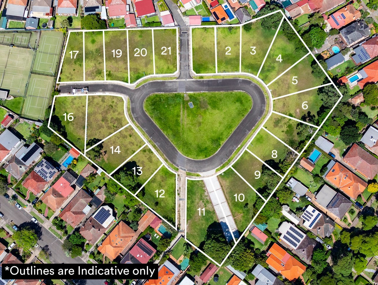
Property types for sale
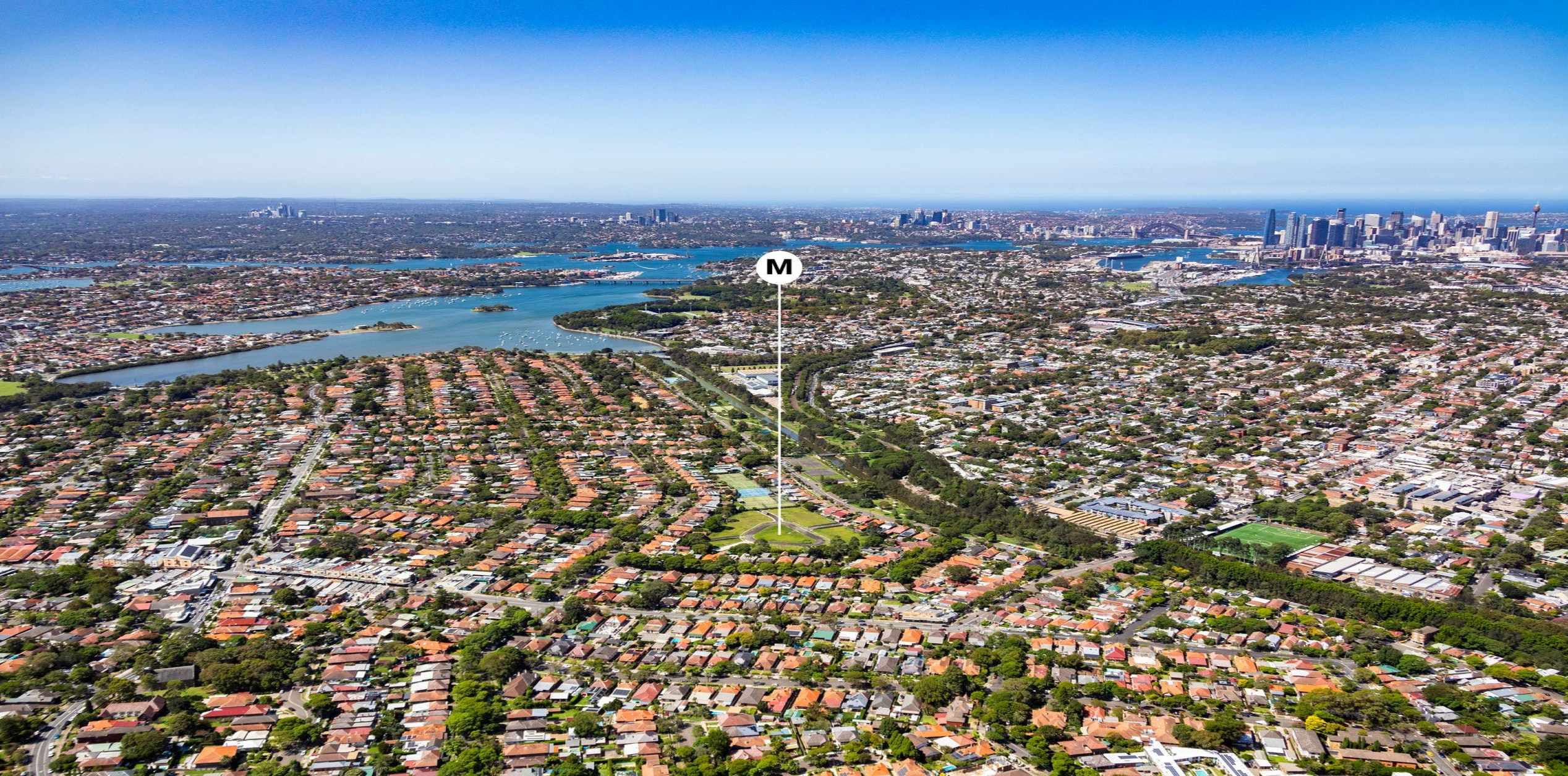
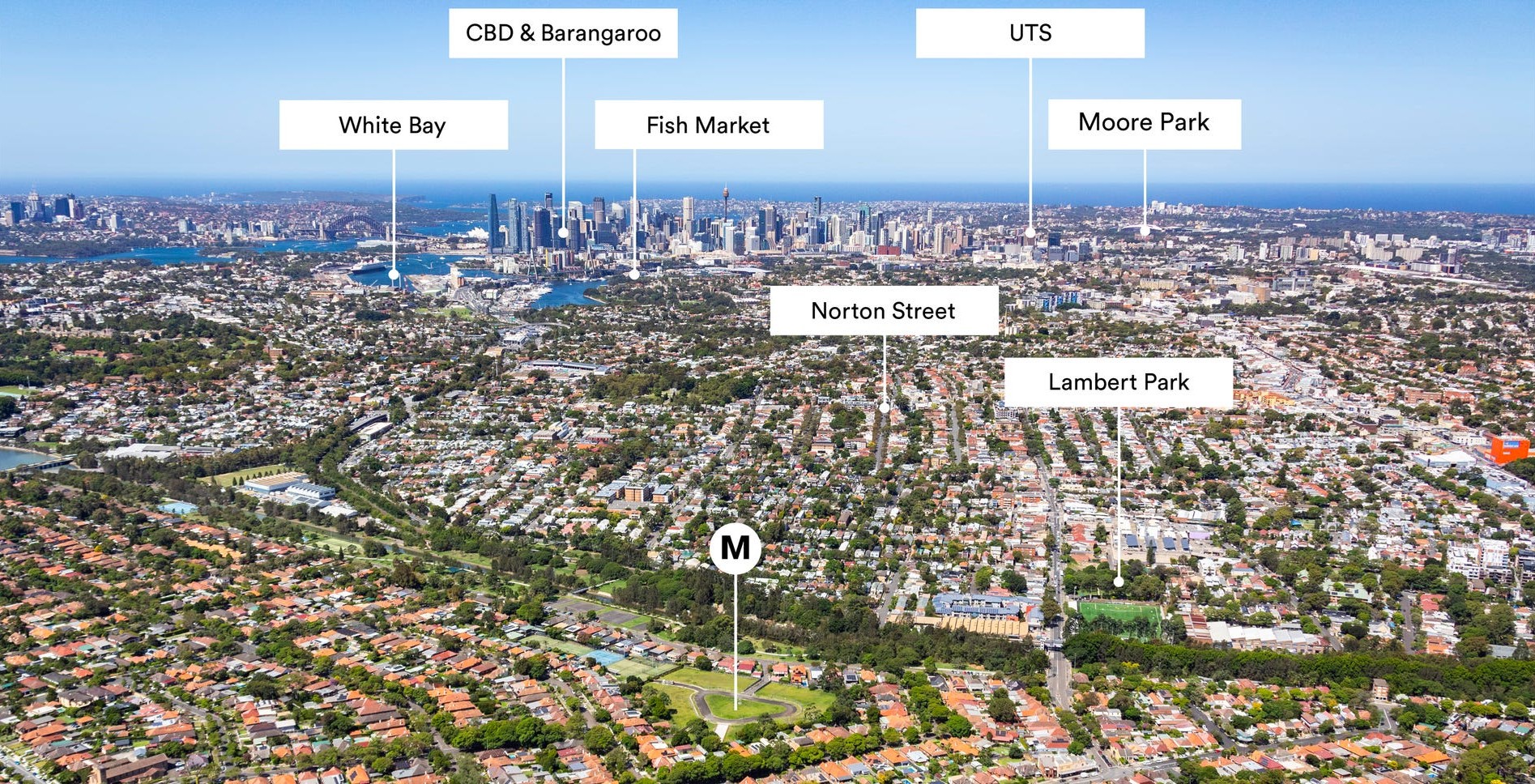
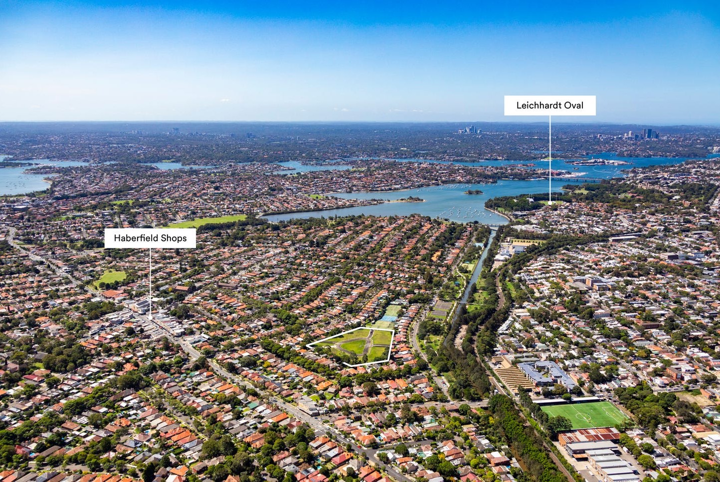
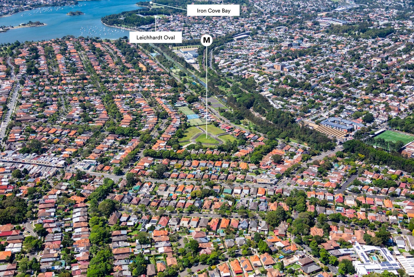
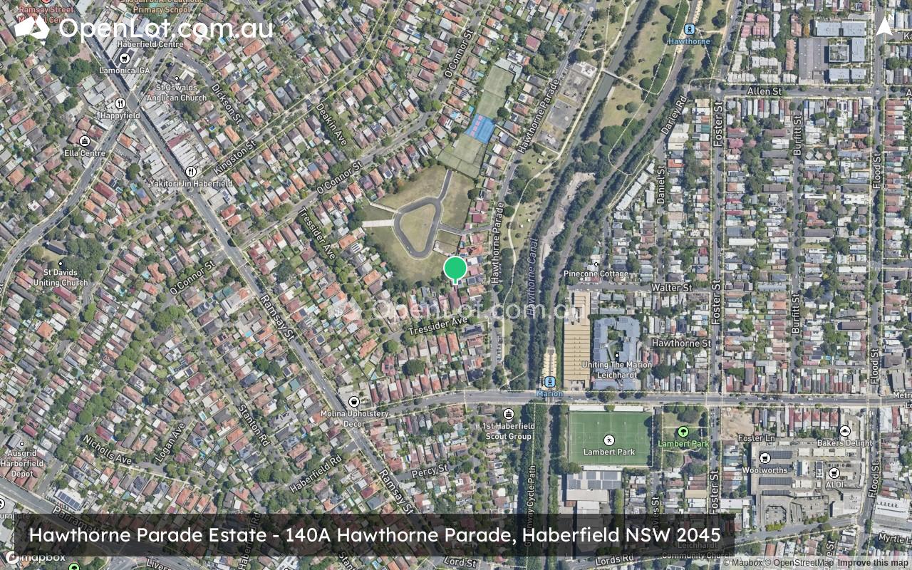
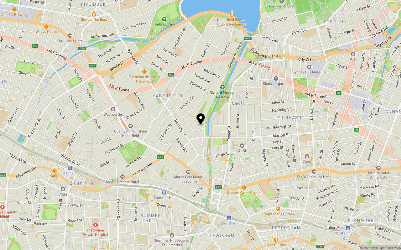
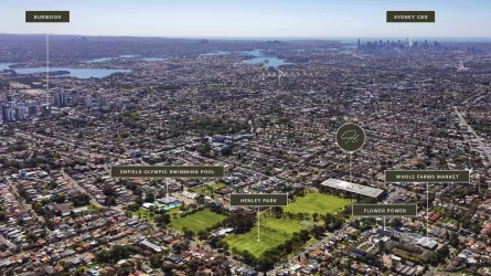
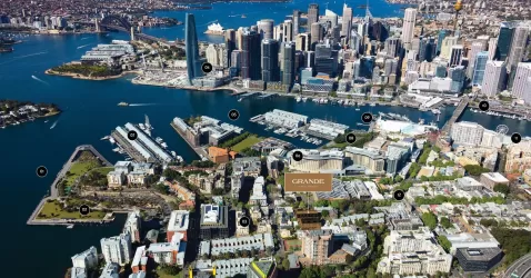
Location & Map for Hawthorne Parade Estate - Haberfield
Schools near Hawthorne Parade Estate - Haberfield
Hawthorne Parade Haberfield Video
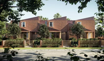
Overview
This information is estimated by the OpenLot research team. Let us know here to provide up-to-date information about this development.
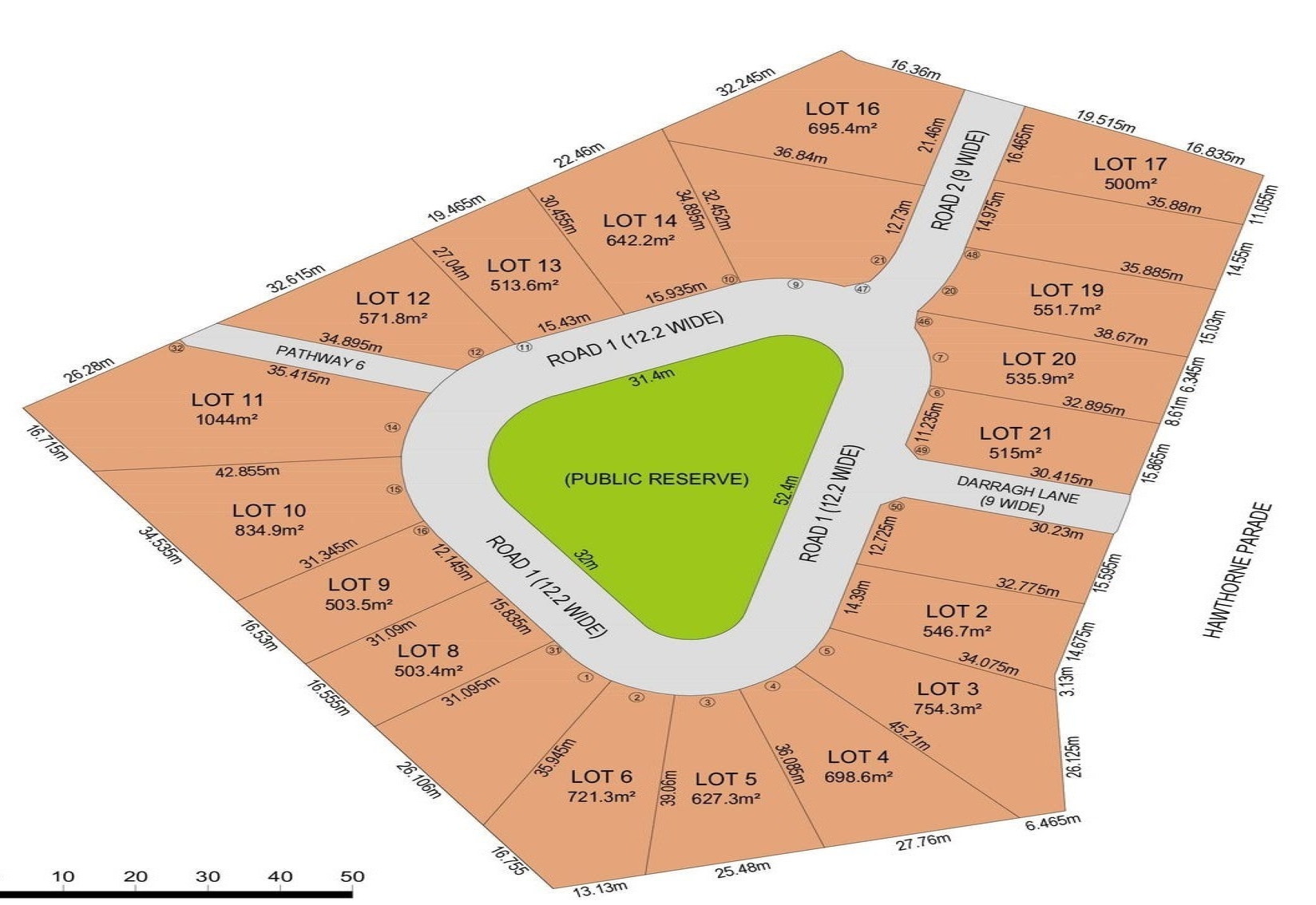
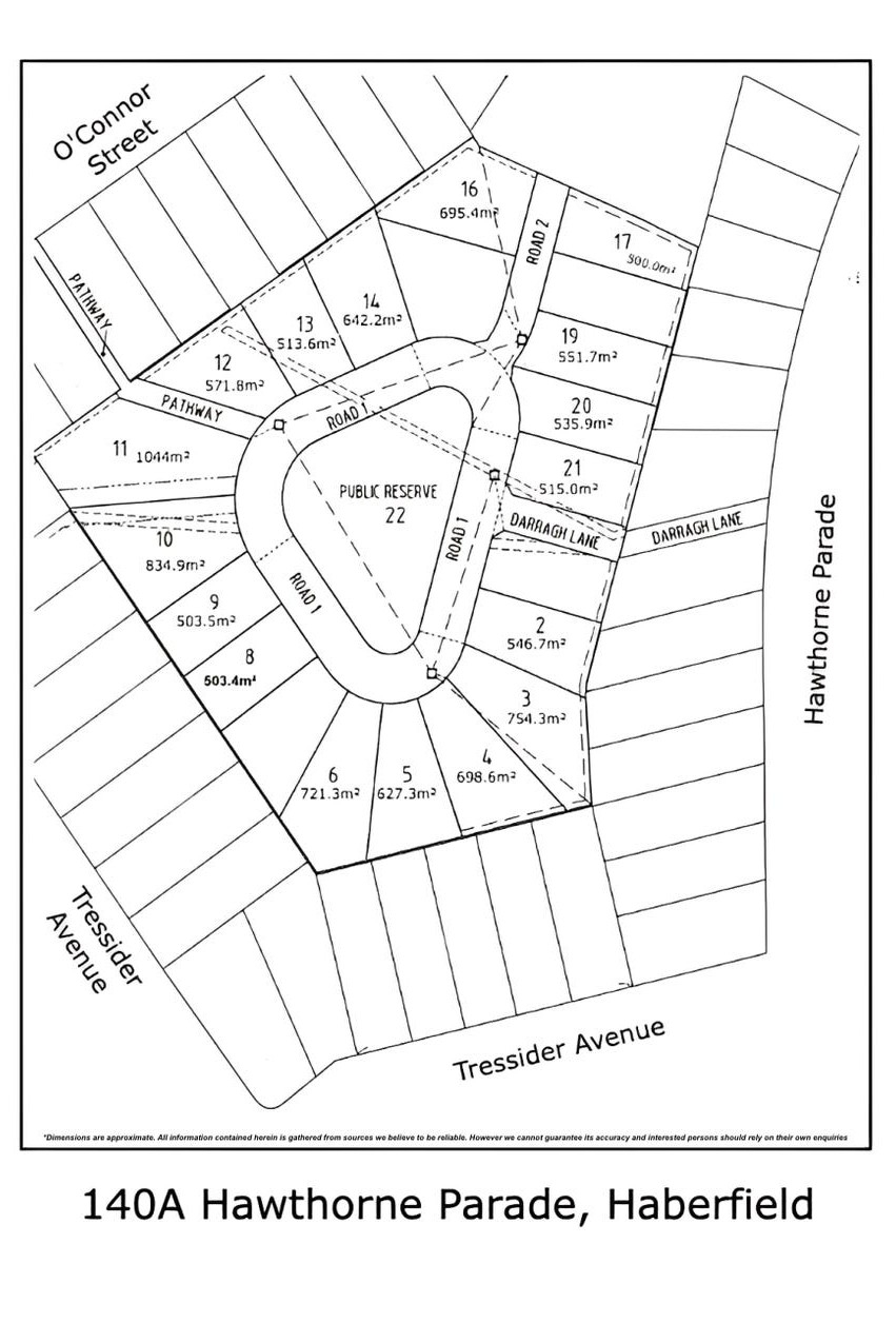
| Total new homes | |
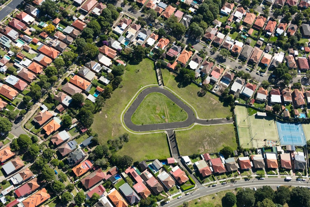
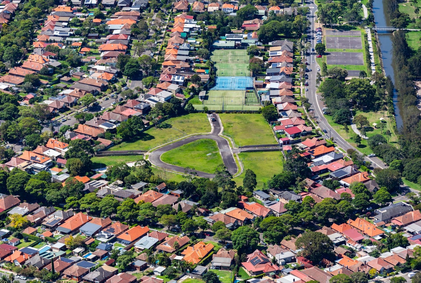
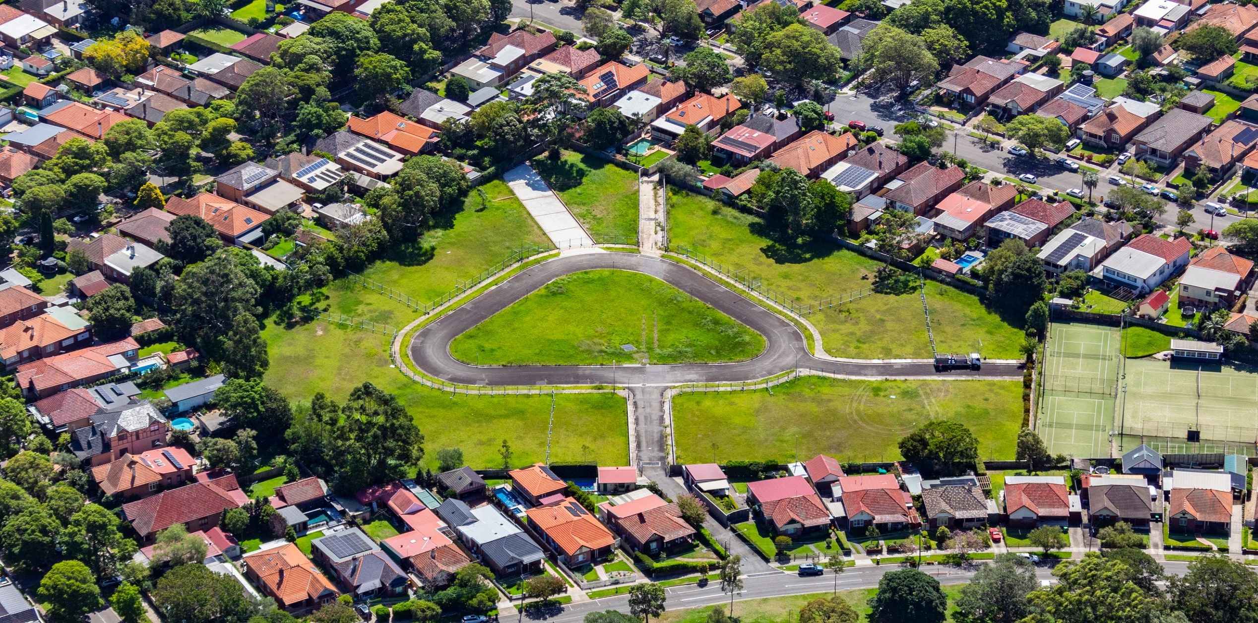
| Area Size | 1.07 hectares |
| City Council | Inner West Council |
| Developer | N/A |
| Project Marketer | McGrath Leichhardt |
| Distance to |
Updates for Hawthorne Parade Estate - Haberfield
Popular Estates near Hawthorne Parade Estate - Haberfield
Not exactly what you're looking for? Try surrounding suburbs
Breakfast Point NSW 2137
1 estate | City of Canada Bay Council
4.8km north-west
Enfield NSW 2136
1 estate | Burwood Council
4.5km west
Annandale NSW 2038
1 estate | Inner West Council
2.3km east
Glebe NSW 2037
1 estate | City of Sydney
3.9km east
Ashbury NSW 2193
1 estate | City of Canterbury Bankstown
3.6km south-west
Pyrmont NSW 2009
2 estates | City of Sydney
4.9km east
Latest published articles


FAQs about Hawthorne Parade Estate - Haberfield
Hawthorne Parade Estate - Haberfield consists of 17 homes.
The total area for Hawthorne Parade Estate - Haberfield is 1.07 hectares.
Hawthorne Parade Estate - Haberfield falls under Inner West Council.
Hawthorne Parade Estate - Haberfield is 4 km west of Sydney CBD.
McGrath Leichhardt is the project marketer for Hawthorne Parade Estate - Haberfield.
Nearby schools for Hawthorne Parade Estate - Haberfield:
- Kegworth Public School - 512m south-east
- St Joan of Arc Catholic Primary School - 568m north-west
- St Columba's Catholic Primary School - 855m north-east
- Haberfield Public School - 968m west
- Dobroyd Point Public School - 969m north
- The John Berne School - 1.1km south