
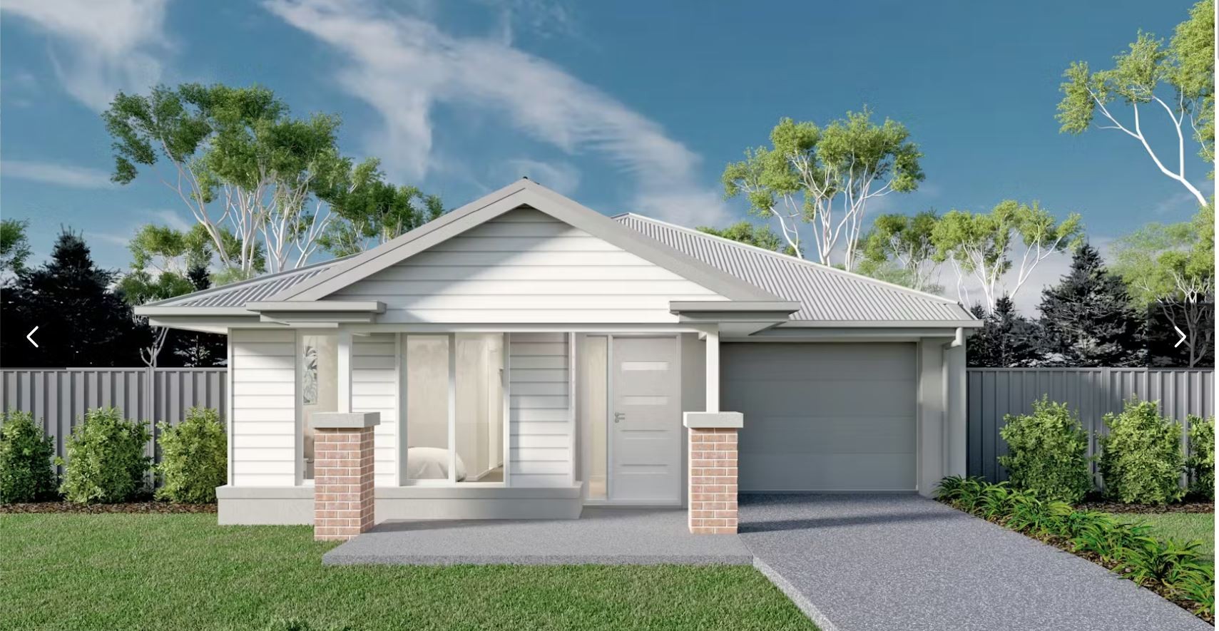


$607,160
Lot 3402 @ Peppercorn Hill Estate


- $20k HomeSolution build savings applied!^
- $10K First Home Owners Grant for eligible First Home Buyers^
- A roof made from COLORBOND® steel
- Fixed site costs (no more to pay!)
- 7 star energy rating
- Flooring to the entire home
- Double glazed aluminium windows
- Ducted gas heating
- All developer requirements
- Lifetime Structural Guarantee#
- Bushfire Upgrades
- PLUS so much more!
Property overview
- Beds
- 3
- Baths
- 2
- Car Spaces
- 1
- House area
- 14m²
- Land area
- 308m²
- Home Design
- Malin 14
- Price Guide
- View Statement of Information
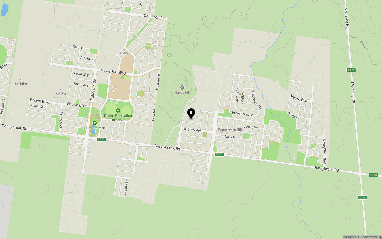
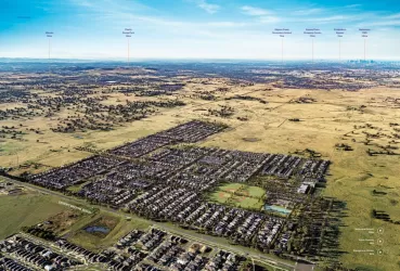
Local information in Donnybrook VIC 3064
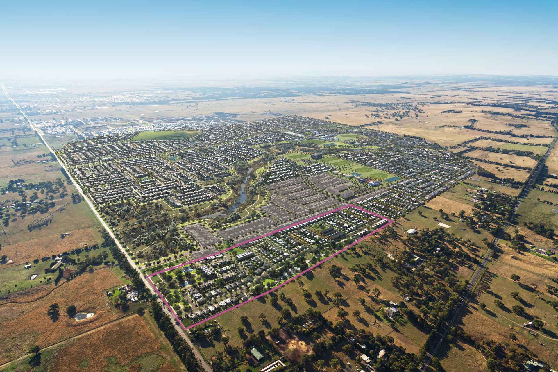
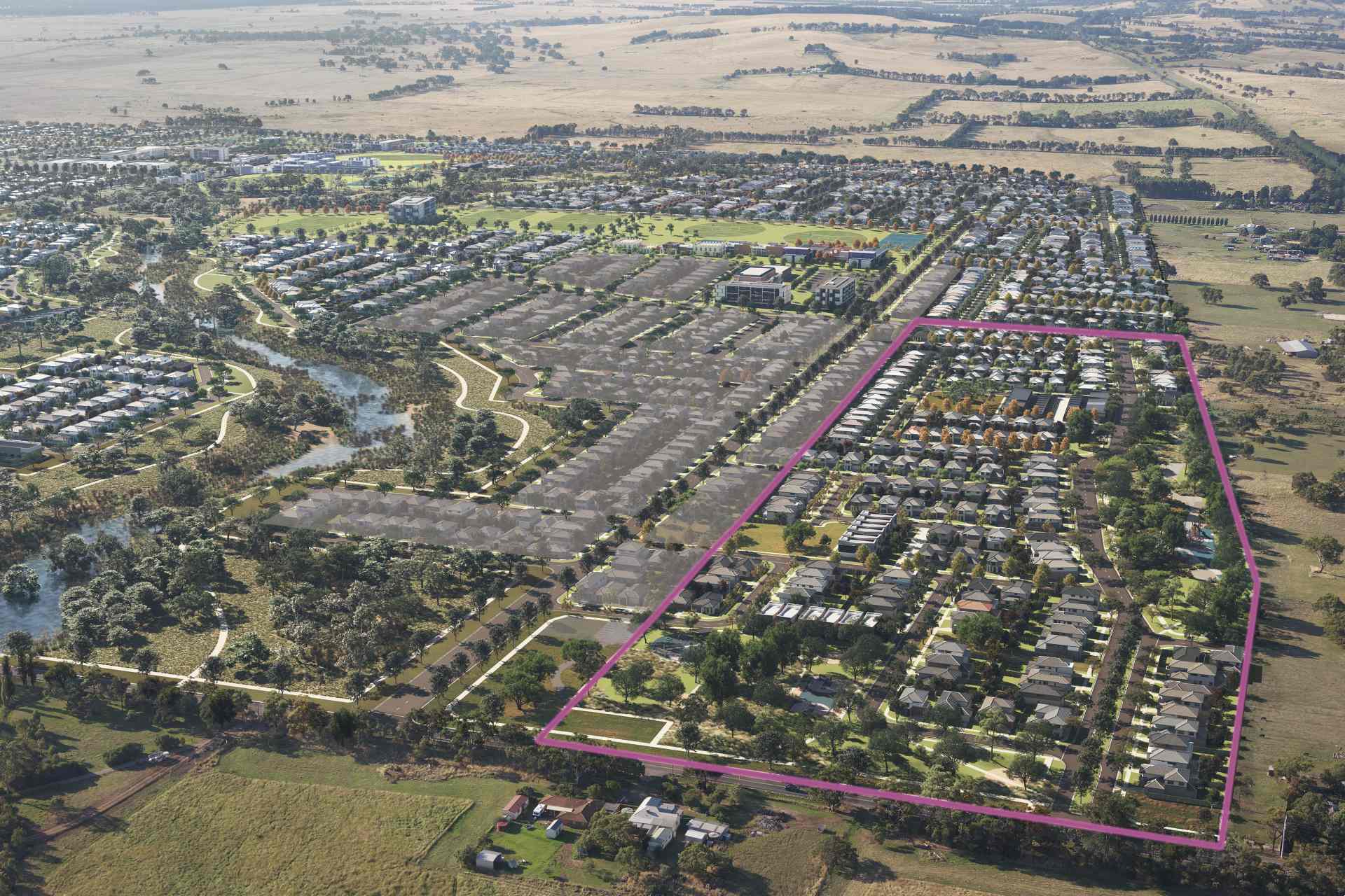
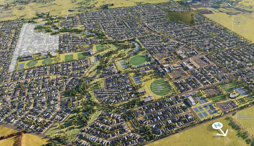
78 Land Lots in Peppercorn Hill Estate - Donnybrook
71 House and Land Packages in Peppercorn Hill Estate - Donnybrook
4 Townhouses in Peppercorn Hill Estate - Donnybrook
3D Tour of Peppercorn Hill Estate - Donnybrook
31 available display homes
Suburb Planning Review in Donnybrook VIC 3064
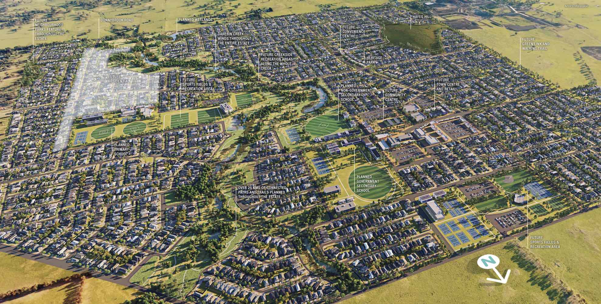
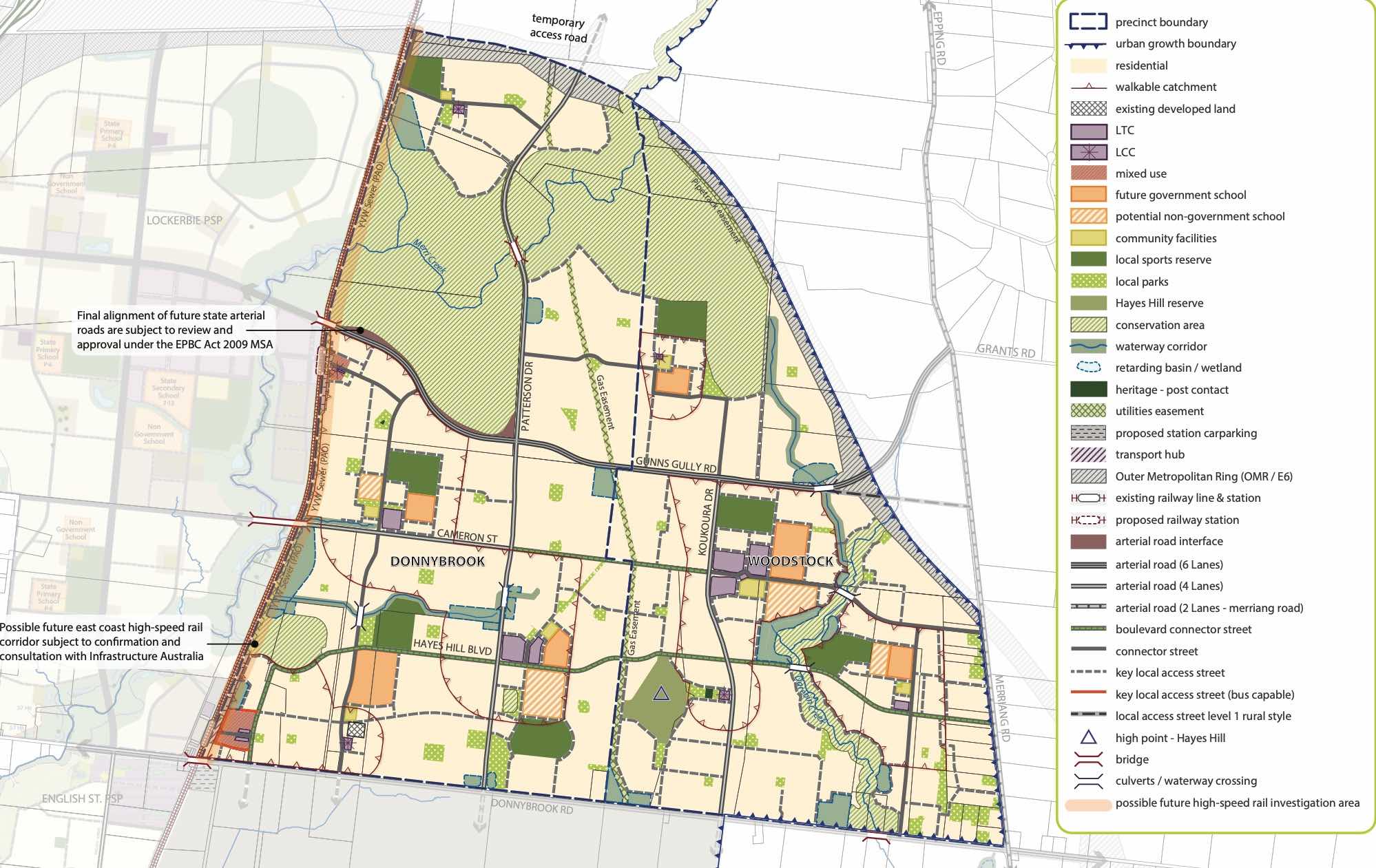
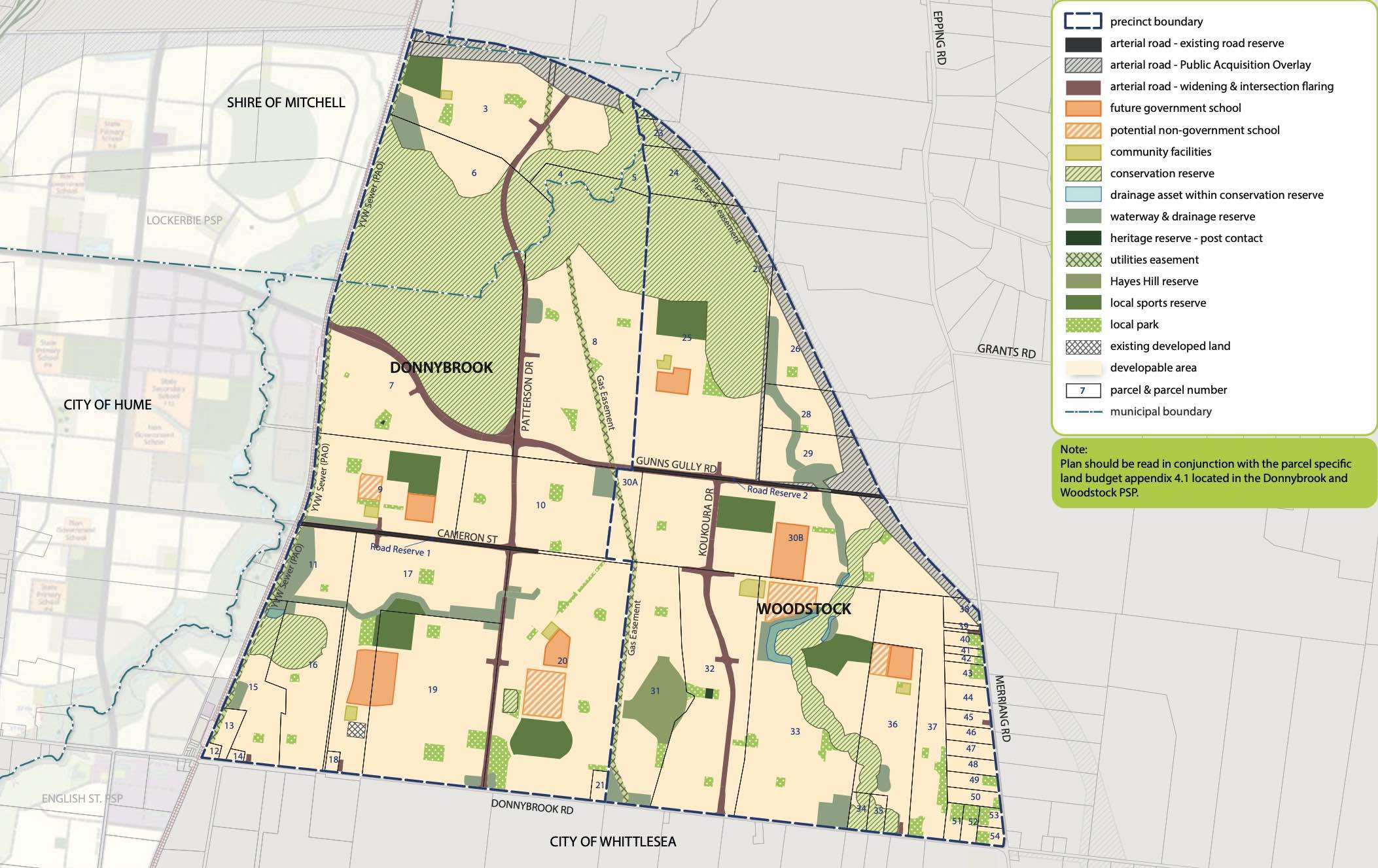
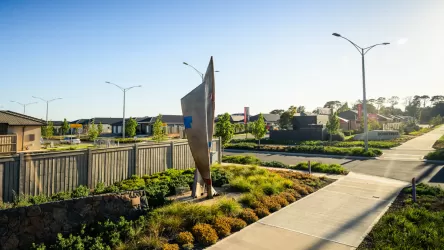
Donnybrook is located in the Shire of Mitchell, a semi-rural location to the north of Melbourne’s outer suburbs of the Urban Growth Boundary and logical expansion of the former Donnybrook township. Donnybrook growth area is 1,026ha and forms part of the new 1,786ha suburb area (Woodstock and Donnybrook) that is located on either side of Cameron Street.
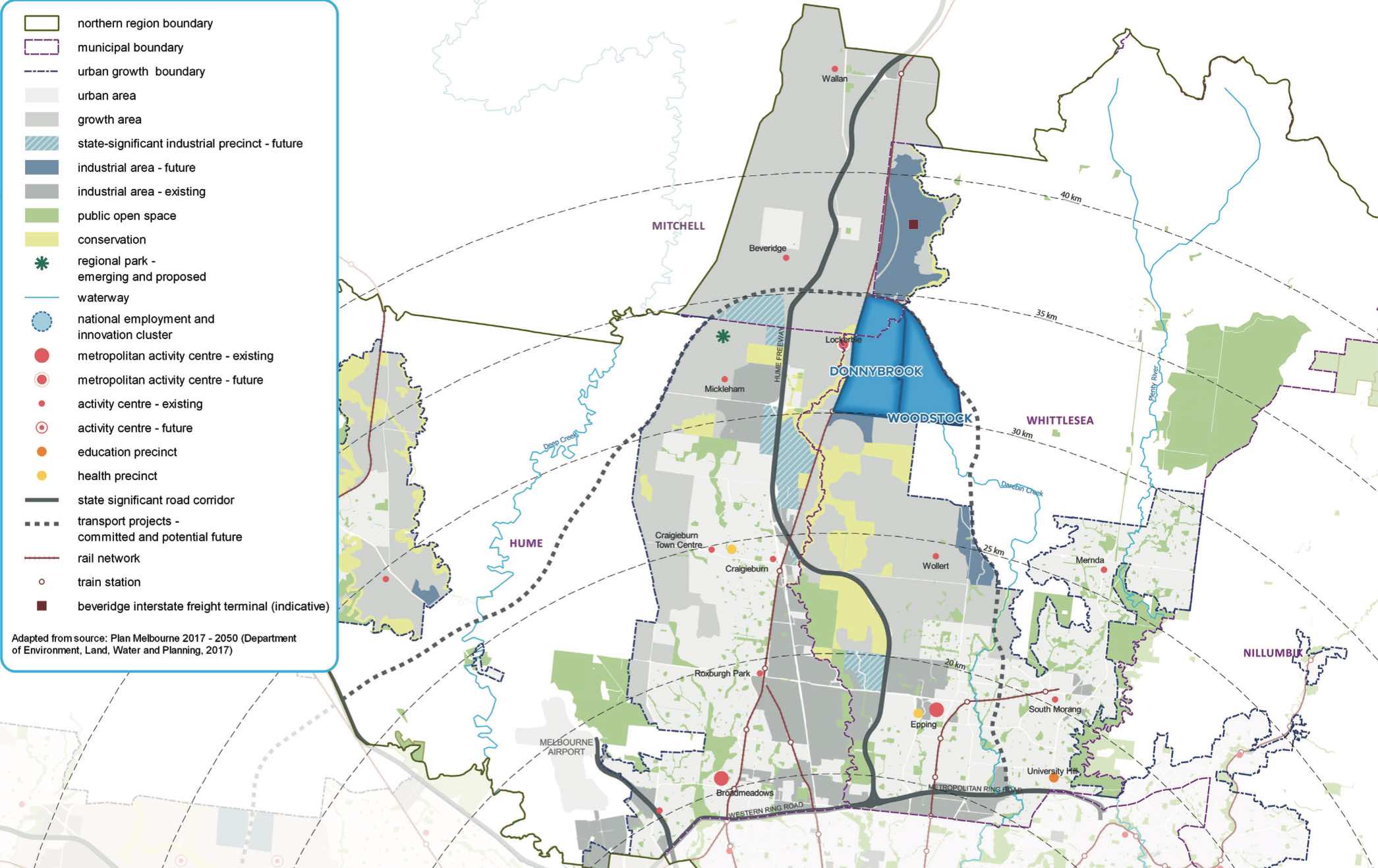
The new suburb is bounded by a possible future high-speed rail investigation area and Outer Metropolitan Ring Reservation (OMR / E6) for future road and rail transport links.
The Donnybrook-Woodstock Precinct Structure Plan (PSP) was prepared to guide the redevelopment of the released land for a mix of residential neighbourhoods linked by a variety of local town centres, schools and other community facilities. Protection of natural assets along the creek corridor and conservation area are provided to protect the Growling Grass Frog habitat from the planned suburb.
The Donnybrook-Woodstock PSP was prepared by Victorian Planning Authority (VPA) in consultation with the Whittlesea City Council and was approved by the Minister for Planning in November 2017. The decision was officially gazetted on 3 November 2017 under Amendment GC28 of the Whittlesea Planning Scheme.
The Vision of Donnybrook
“Development will have a strong emphasis on the retention of natural features and high quality landscaping in an urban environment supported by strong connections to transport and community facilities. Development of the precinct will create a diverse mix of residential neighbourhoods linked by a variety of local town centres, schools and other community facilities.
The distribution of local centres which serve a variety of roles and functions will promote self-sufficiency for residents of the precinct in meeting daily retail and convenience shopping needs. Residential and business development will capitalise on the precinct’s proximity to the existing Donnybrook train station, as well as the future Lockerbie Principal Town Centre and potential future Lockerbie Train Station. The development of the existing Donnybrook Cheese Farm into an agricultural, historical and cultural learning hub will provide new residents with connections to the history of the area”.
Benefits of Donnybrook
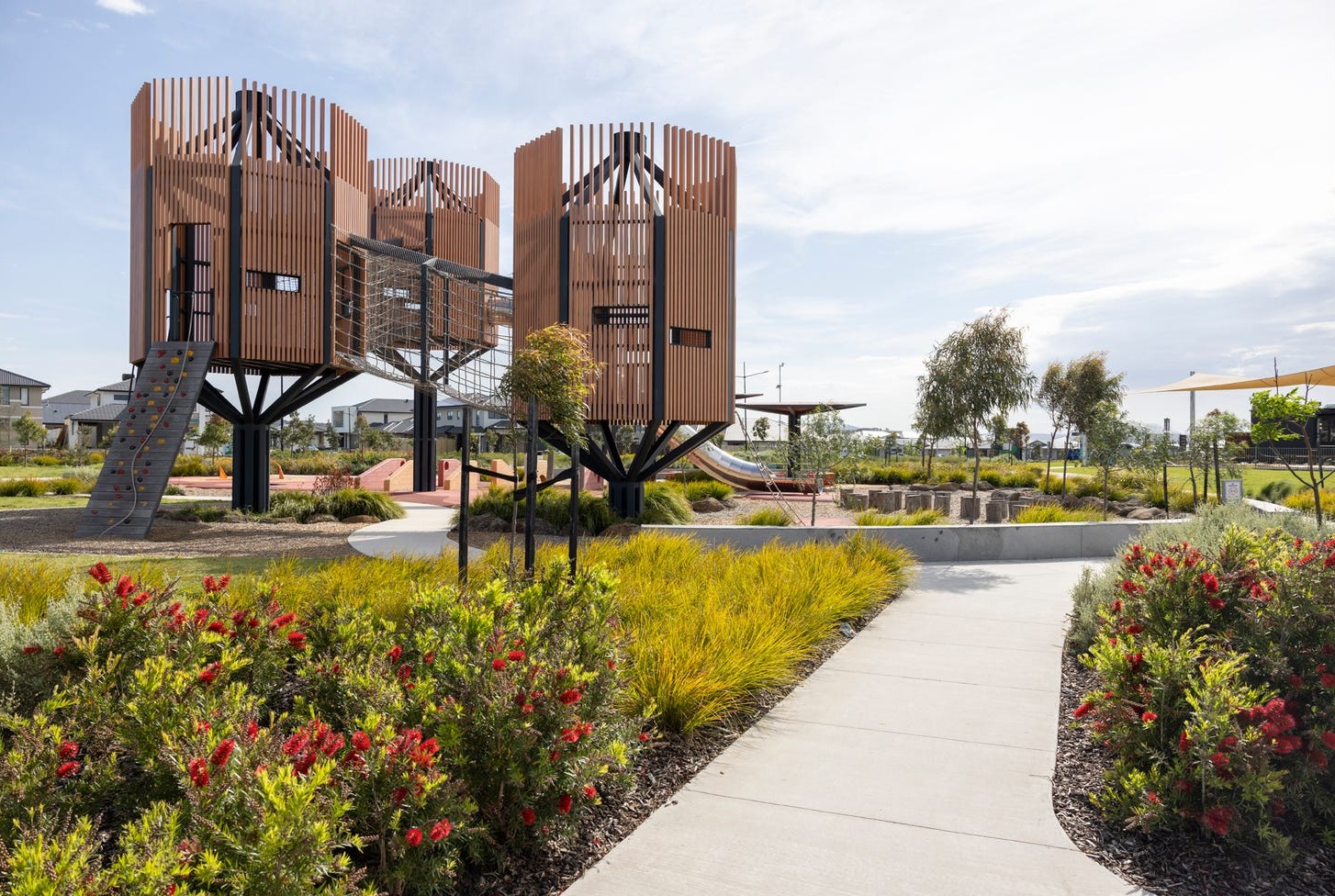
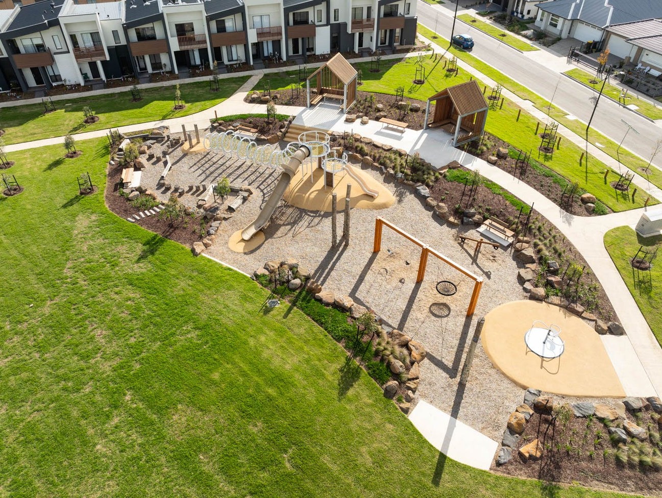
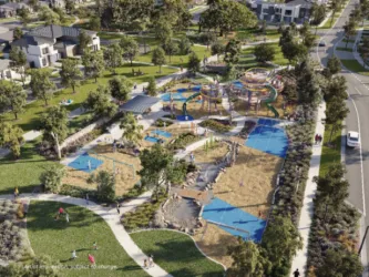
The Structure Plan also supports new schools, local community hubs, local centres to provide employment and services to the new suburb. The amendments provide a new residential community, protection of natural features, parks, and sports and recreation areas. The existing zoning will be amended to provide for Rural Conservation and Urban Growth Zones, providing a series of greenfield sites in proximity to natural water corridors and reserves.
Transportation in Donnybrook
Donnybrook is well connected to public passenger transport, with a future train station to be in Lockerbie and an existing train station located in Donnybrook train station outside the new suburb boundary. The passenger train service connects Melbourne to Sydney and is being considered for a high speed rail project.
The suburb will include a network of shared paths linking the local parks and a new road network. Donnybrook Road and a new future state arterial road will provide access to the Hume Freeway, providing a direct connection to Melbourne CBD or northern Victoria.
Donnybrook Suburb Summary
References
City of Whittlesea - Donnybrook
Victoria Planning Authority – Planning Schemes
Victoria Planning Authority – Donnybrook – Woodstock PSP
Peppercorn Hill Donnybrook Video
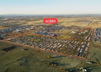
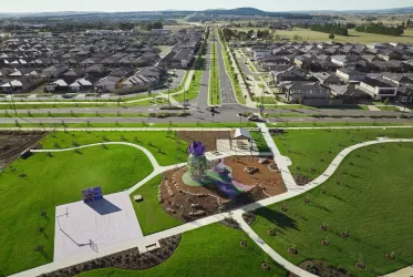
Estate overview
This information is estimated by the OpenLot research team. Let us know here to provide up-to-date information about this development.
| Total new homes | |
| Area Size | 430.00 hectares |
| Growth Region | Melbourne North Growth Corridor |
| City Council | Whittlesea City Council |
| Developer | Dennis Family Corporation, Oreana |
| Project Marketer | RPM Group |
| Creative Agency | Helsinki Agency |
| Other Names | Woodlands |
| Distance to | |
| OpenLot Offer | $200 Cashback |
Updates for Peppercorn Hill Estate - Donnybrook

Nearby schools in Peppercorn Hill Estate - Donnybrook
There are 6 schools registered in this area on ACARA 2024
FAQs about Peppercorn Hill Estate - Donnybrook
Dennis Family Corporation and Oreana is the developer behind Peppercorn Hill Estate - Donnybrook.
Peppercorn Hill Estate - Donnybrook consists of 5,000 homes.
The total area for Peppercorn Hill Estate - Donnybrook is 430.00 hectares.
Peppercorn Hill Estate - Donnybrook falls under Whittlesea City Council.
Peppercorn Hill Estate - Donnybrook is 31 km north of Melbourne CBD.
RPM Group is the project marketer for Peppercorn Hill Estate - Donnybrook.
Nearby schools for Peppercorn Hill Estate - Donnybrook:
- Donnybrook Primary School - 1.0km north-west
- Gilgai Plains Primary School - 4.4km west
- Barrawang Primary School - 6.3km south
- Hume Anglican Grammar - 7.2km south-west
- Edgars Creek Primary School - 7.4km south
- Mother Teresa School - 7.4km south-west
Land Price Trend in Donnybrook VIC 3064
Below shows the price trend from vacant land sales recorded in Donnybrook VIC 3064.
The data and information provided by Terralytics (Aust) Pty Ltd (Terralytics Data) is general in nature and is not intended to constitute professional advice. Read more
It should not be relied upon as a substitute for legal, financial, valuation, or other specialist advice relevant to your specific circumstances.
Terralytics uses commercially reasonable endeavours to ensure the Terralytics Data is current and accurate. However, as the Terralytics Data incorporates information sourced from third parties, Terralytics makes no representation or warranty — express or implied — as to its accuracy, completeness, or currency. To the maximum extent permitted by applicable law, Terralytics excludes all liability for any loss or damage (including consequential loss) arising out of or in connection with reliance on the Terralytics Data, whether arising in contract, tort (including negligence), statute, or otherwise.
Popular Estates near Peppercorn Hill Estate - Donnybrook


Not exactly what you're looking for? Try surrounding suburbs
Kalkallo VIC 3064
7 estates | Hume City Council
2.0km north-west
Woodstock VIC 3751
4 estates | Whittlesea City Council
6.6km east
Wollert VIC 3750
47 estates | Whittlesea City Council
8.5km south-east
Craigieburn VIC 3064
10 estates | Hume City Council
6.6km south
Beveridge VIC 3753
23 estates | Mitchell Shire Council
7.2km north
Mickleham VIC 3064
19 estates | Hume City Council
7.7km west


