
Property types for sale
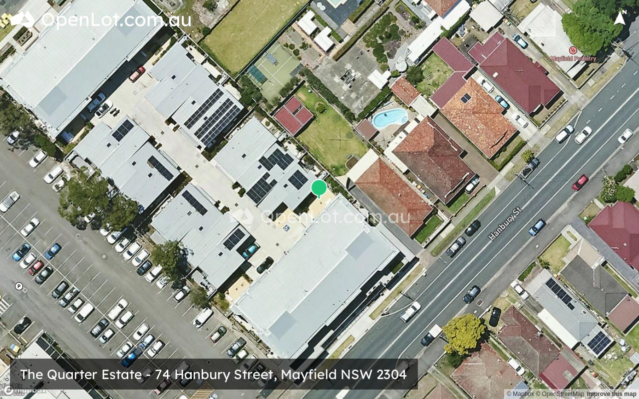
Location & Map for The Quarter Estate - Mayfield
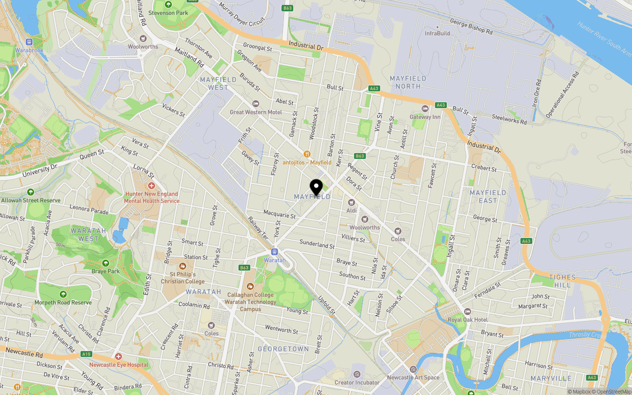
Schools near The Quarter Estate - Mayfield
Overview
This information is estimated by the OpenLot research team. Let us know here to provide up-to-date information about this development.
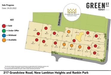
| Total new homes | |
| Area Size | 0.10 hectares |
| Growth Region | Greater Newcastle Growth Areas (The Hunter Region) |
| City Council | Newcastle City Council |
| Developer | N/A |
| Project Marketer | Kapalua |
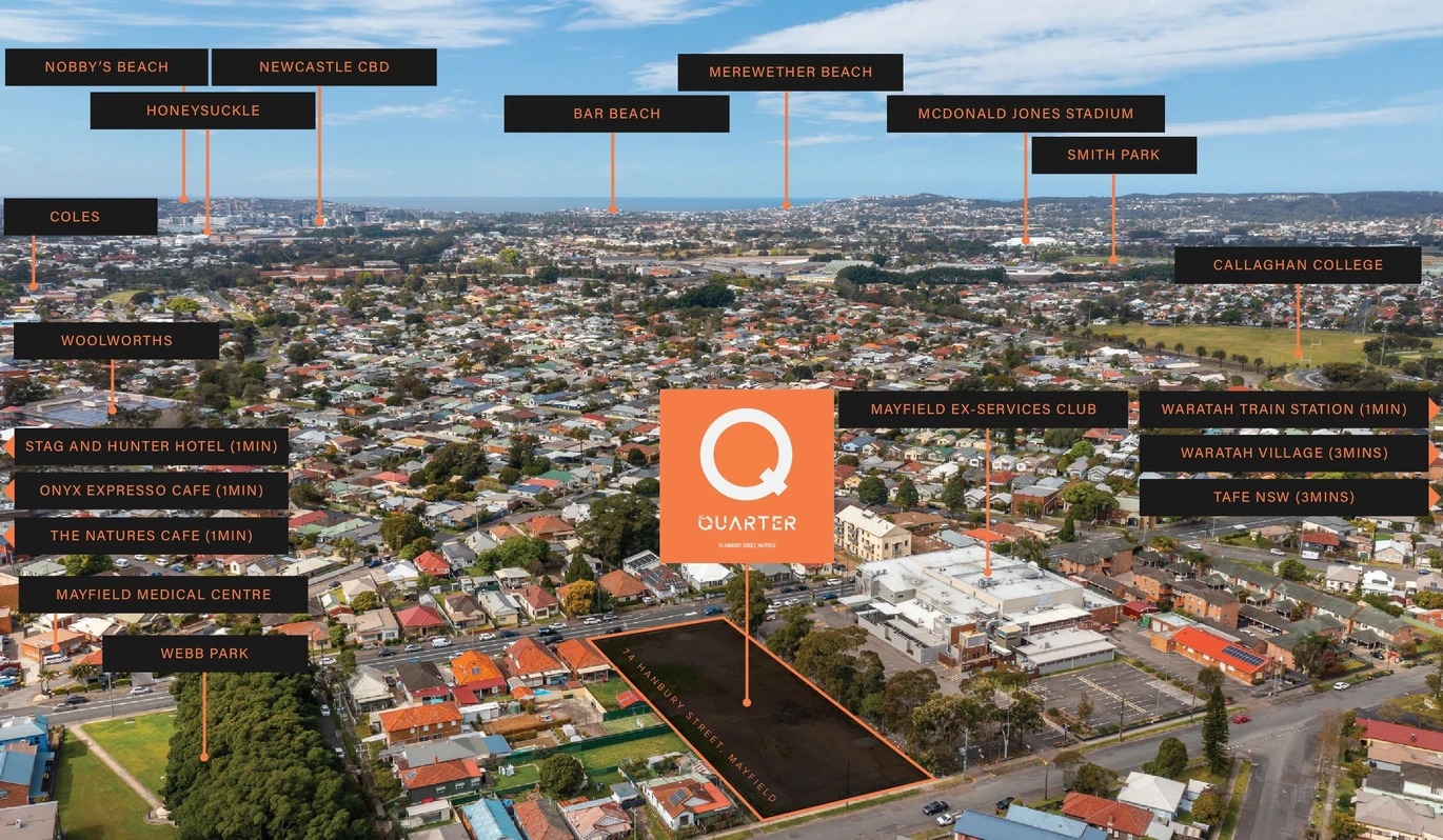
| Distance to |
Updates for The Quarter Estate - Mayfield

Popular Estates near The Quarter Estate - Mayfield
Not exactly what you're looking for? Try surrounding suburbs
Rankin Park NSW 2287
1 estate | Lake Macquarie City Council
6.1km south-west
Shortland NSW 2307
1 estate | Newcastle City Council
5.1km north-west
The Hill NSW 2300
1 estate | Newcastle City Council
5.4km south-east
Mayfield West NSW 2304
1 estate | Newcastle City Council
1.6km north-west
Waratah West NSW 2298
1 estate | Newcastle City Council
3.0km west
Tighes Hill NSW 2297
1 estate | Newcastle City Council
2.1km south-east
Latest published articles


FAQs about The Quarter Estate - Mayfield
The Quarter Estate - Mayfield consists of 12 homes.
The total area for The Quarter Estate - Mayfield is 0.10 hectares.
The Quarter Estate - Mayfield falls under Newcastle City Council.
The Quarter Estate - Mayfield is 5 km north-west of Newcastle CBD.
Kapalua is the project marketer for The Quarter Estate - Mayfield.
Nearby schools for The Quarter Estate - Mayfield:
- St Columban's Primary School - 687m east
- San Clemente Catholic College - 875m east
- Hunter Christian School - 917m north
- Callaghan College Waratah Campus - 920m south-west
- St Dominic's Catholic College - 929m east
- Corpus Christi Primary School - 1.1km west